Jessup (/ˈdʒɛsəp/ JESS-əp) is an unincorporated community and census-designated place in Howard and Anne Arundel counties, about 15 miles (24 km) southwest of Baltimore, Maryland, United States. Per the 2020 census, the population was 10,535.
| Name: | Jessup CDP |
|---|---|
| LSAD Code: | 57 |
| LSAD Description: | CDP (suffix) |
| State: | Maryland |
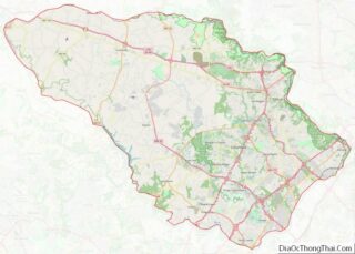
| County: | Anne Arundel County, Howard County |
| Elevation: | 217 ft (66 m) |
| Total Area: | 6.05 sq mi (15.68 km²) |
| Land Area: | 6.05 sq mi (15.66 km²) |
| Water Area: | 0.01 sq mi (0.01 km²) |
| Total Population: | 10,535 |
| Population Density: | 1,741.90/sq mi (672.56/km²) |
| ZIP code: | 20794 |
| Area code: | 240, 301, 410, 443 |
| FIPS code: | 2442550 |
| GNISfeature ID: | 0590560 |
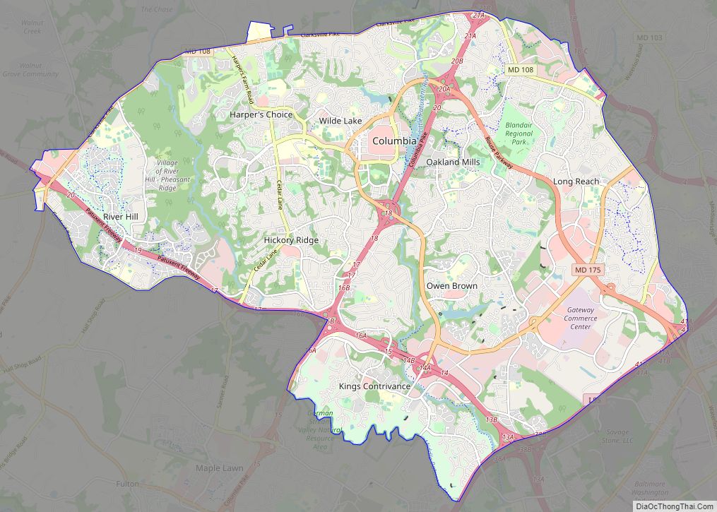
Online Interactive Map
Click on ![]() to view map in "full screen" mode.
to view map in "full screen" mode.
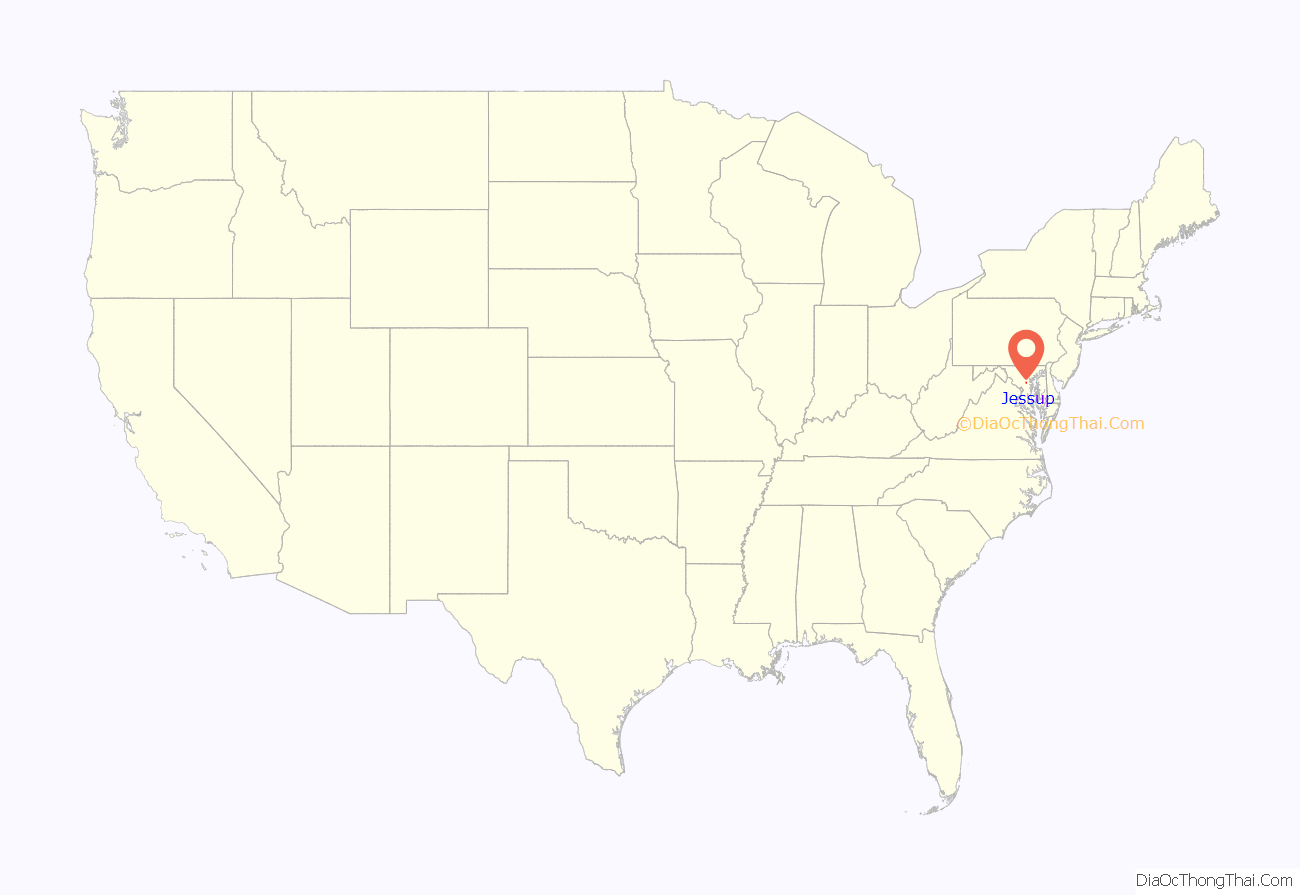
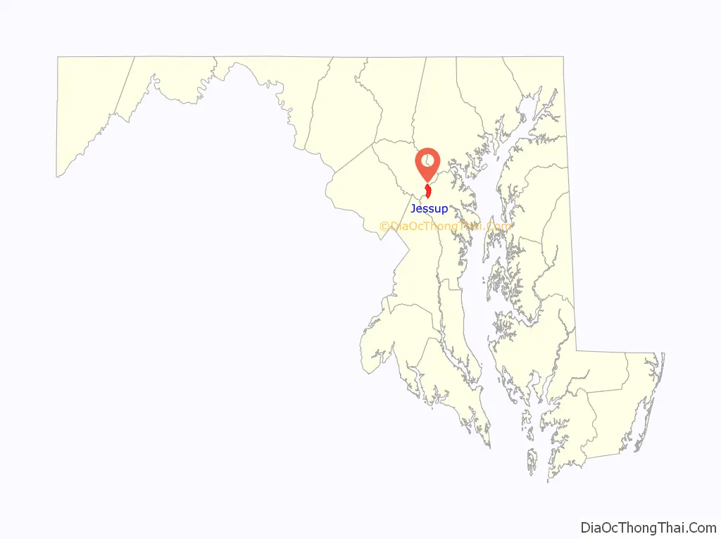
Jessup location map. Where is Jessup CDP?
History
Jessup is located near the site of the historic Spurrier’s Tavern, a farm and tavern located on the post road between Baltimore and Washington (Route One) where George Washington traveled regularly.
The location of the town was named Pierceland on early maps, but the post-civil war name more commonly given was Jessup’s Cut, or Jessop’s Cut, a post village in Howard County on the Baltimore and Ohio Railroad. The name is generally attributed to Jonathan Jessup, a civil engineer who worked on the Baltimore and Ohio Railroad and the hand-dug “cut” though Merrill’s Ridge he managed as a project. The crews took over 200,000 tons of clay from the clay hill that blocked the trains in freezing weather. The clay was turned into bricks by some of the prisoners from the Maryland Penitentiary who also worked on the Maryland House of Corrections when it was being built. Some of those inmates were then transferred to the House of Correction and they knew the walls were made from Jessup’s Cut, hence “the CUT”. The name was shortened to Jessups in 1963. Into the mid 20th century, the town was called “Jessups”, then was shortened to “Jessup”.
Since the mid-19th century, the area has been home to various penal institutions. Inmates today still refer to these jails as “the cut,” probably unaware of the origin of the name. The Maryland House of Correction, operated by the Maryland Department of Corrections, included a large onsite farm manned with prison labor to provide food for prisoners onsite and offsite. Prisoner labor was discouraged by job seekers in the 1970s much as it did 100 years earlier during the construction of the B&O at Jessup’s cut. The State-run Maryland Food Center occupies the land. The prison closed to inmates in 2007. The prison is referred to several times in the NBC television series Homicide: Life on the Street and the HBO original series, The Wire. Even though the maximum security prison is now closed, the town still houses a major minimum security prison, Brockbridge Correctional Facility, for violent offenders who are not deemed a threat to society due to the nature of their crimes.
Jessup contains many warehouse delivery facilities. Due to its geographically central location in the state, Jessup is also home to the Maryland Food Center, which includes the Maryland Produce Market and the Maryland Seafood Market. The largest facility was operated by Giant Food, with a 60-acre (24 ha) 760,000 sq ft (71,000 m) facility until September 2012. The company outsourced distribution to C&S Wholesale Grocers, relocating its operations to Pennsylvania. In 2013, Coastal Sunbelt Produce announced plans to relocate its 900-employee facility out of state claiming the facility was unable expand to adjacent empty parcels. Howard County was unable to relocate the facility to the vacant state-run facility, or the vacant 760,000sqft Giant Food facility with an offer to gift state land intended for a transportation hub to the company. County Executive Ken Ulman brokered a deal with Preston Scheffenacker Properties, rezoning the historic Duvall Farm site in Laurel, for light industrial use and issued county financed low interest loans to relocate the facility out of Jessup.
Kingdon Gould’s Laurel Sand and Gravel company, which includes Savage Stone, Fairfax Materials, Allegany Aggregates, Laurel Asphalt, and S.W. Barrick & Sons, purchased the 625-acre chase property in Eastern Jessup, North of the historic town of Savage, Maryland. The site is home to the Savage Stone quarry, mining Baltimore Gabbro rock for road bed construction. The facility started operations in 2005 after special zoning approval with a 25-year reserve in materials. Ridgley’s Run Community Association directors Kingdon Gould and his son provided community approval of the project in exchange for the construction of the Ridgley’s Run Community Center.
To the north of the quarry, Orson Adams built two nineteenth-century Victorian Manor Houses named Oak Hill on a 235-acre estate that anchored the community. The homes burned down after the Rouse Company purchased the land, and have been redeveloped into apartments.
Resident film maker Wayne Shipley used Jessup as the production location for One-Eyed Horse (2008) and Day of the Gun (2013). Portions of Cry-Baby (1990) and Die Hard with a Vengeance (1995) were filmed in Jessup, with TA Travel Center standing in for Nord des Ligne Truck Stop in the latter film.
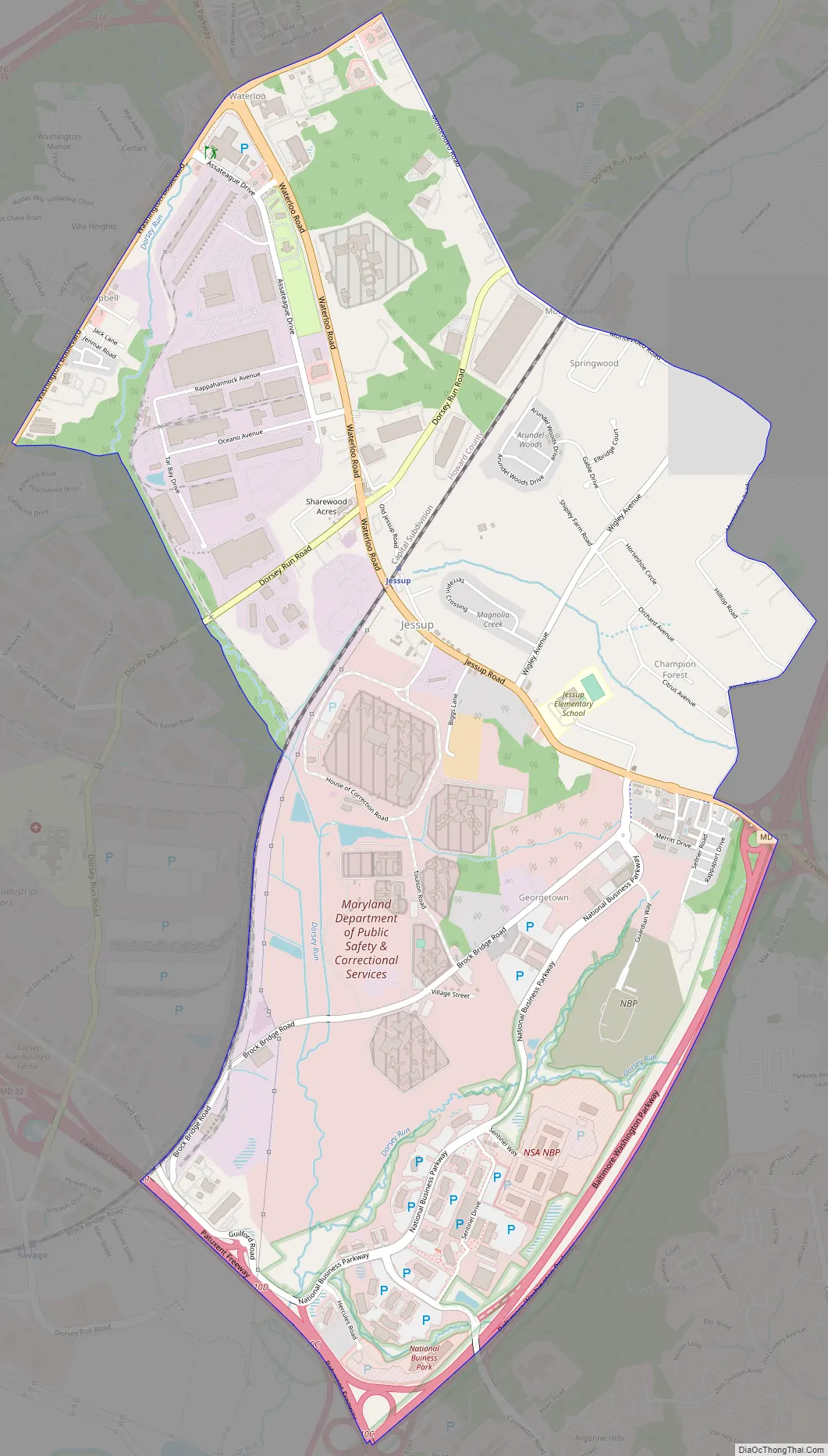
Jessup Road Map
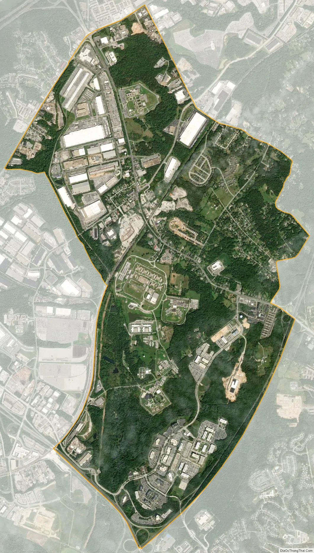
Jessup city Satellite Map
Geography
Jessup is located at 39°08′18″N 76°46′30″W / 39.138374°N 76.774929°W / 39.138374; -76.774929 (39.138374, −76.774929). According to the United States Census Bureau, the CDP has a total area of 5.3 square miles (13.6 km), all land. As of the 2010 census, the center of population for the state of Maryland is located on the grounds of the Clifton T. Perkins Hospital Center in Jessup.
See also
Map of Maryland State and its subdivision: Map of other states:- Alabama
- Alaska
- Arizona
- Arkansas
- California
- Colorado
- Connecticut
- Delaware
- District of Columbia
- Florida
- Georgia
- Hawaii
- Idaho
- Illinois
- Indiana
- Iowa
- Kansas
- Kentucky
- Louisiana
- Maine
- Maryland
- Massachusetts
- Michigan
- Minnesota
- Mississippi
- Missouri
- Montana
- Nebraska
- Nevada
- New Hampshire
- New Jersey
- New Mexico
- New York
- North Carolina
- North Dakota
- Ohio
- Oklahoma
- Oregon
- Pennsylvania
- Rhode Island
- South Carolina
- South Dakota
- Tennessee
- Texas
- Utah
- Vermont
- Virginia
- Washington
- West Virginia
- Wisconsin
- Wyoming