Map of Kingsville CDP, Maryland
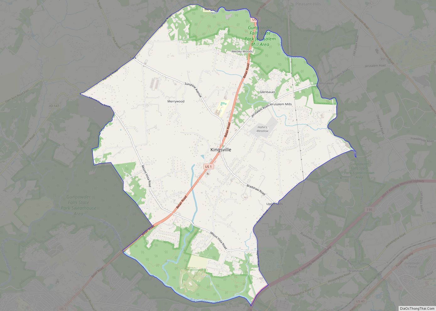
Kingsville is a semi-rural, unincorporated community and census-designated place in Baltimore County, Maryland, United States. It is a close-knit and rustic community bounded by the Little Gunpowder Falls river (to the northeast) and the Big Gunpowder Falls river (to the southwest) which join to form the Gunpowder River. The population of Kingsville was 4,318 at ... Read more
Map of Kingsville CDP, Maryland
Map of La Vale CDP
LaVale is a census-designated place (CDP) in Allegany County, Maryland, United States. It is part of the Cumberland, MD-WV Metropolitan Statistical Area. The population was 3,551 at the 2010 census. La Vale CDP overview: Name: La Vale CDP LSAD Code: 57 LSAD Description: CDP (suffix) State: Maryland County: Allegany County Elevation: 784 ft (239 m) Total Area: ... Read more
Map of La Vale CDP
Map of La Plata town, Maryland
La Plata /ləˈpleɪtə/ lə-PLAY-tə) is a town in Charles County, Maryland, United States. The population was 10,159 at the 2020 census. It is the county seat of Charles County. La Plata town overview: Name: La Plata town LSAD Code: 43 LSAD Description: town (suffix) State: Maryland County: Charles County Incorporated: 1888 Elevation: 190 ft (58 m) Total ... Read more
Map of La Plata town, Maryland
Map of Konterra CDP
Konterra is an unincorporated area and census-designated place (CDP) in Prince George’s County, Maryland, United States. The population was 3,158 at the 2020 census. Parts of Konterra were previously defined by the U.S. Census Bureau as being in the West Laurel census-designated place. Konterra CDP overview: Name: Konterra CDP LSAD Code: 57 LSAD Description: CDP ... Read more
Map of Konterra CDP
Map of Landover Hills town
Landover Hills is a town in Prince George’s County, Maryland, United States. Per the 2020 census, the population was 1,815. The town has a neighborhood named Defense Heights. Landover Hills town overview: Name: Landover Hills town LSAD Code: 43 LSAD Description: town (suffix) State: Maryland County: Prince George’s County Incorporated: 1945 Elevation: 164 ft (50 m) Total ... Read more
Map of Landover Hills town
Map of Lake Shore CDP, Maryland
Lake Shore is a census-designated place and unincorporated community in Anne Arundel County, Maryland, United States, located east of Pasadena. The population of Lake Shore was 19,477 at the 2010 census. Lake Shore CDP overview: Name: Lake Shore CDP LSAD Code: 57 LSAD Description: CDP (suffix) State: Maryland County: Anne Arundel County Elevation: 59 ft (18 m) ... Read more
Map of Lake Shore CDP, Maryland
Map of Lake Arbor CDP
Lake Arbor is an unincorporated area and census-designated place (CDP) in Prince George’s County, Maryland, United States. The population was 14,541 at the 2020 census. It is one of the nation’s most affluent African-American communities. The ZIP Codes encompassing the CDP area are 20721 and 20774. In the 1990s, the U.S. Census Bureau defined the ... Read more
Map of Lake Arbor CDP
Map of Landover CDP
Landover is an unincorporated community and census-designated place in Prince George’s County, Maryland, United States. As of the 2020 census, it had a population of 25,998. Landover is contained between Sheriff Road and Central Avenue to the south, Hill Road, Cabin Branch Drive, and the Washington Metropolitan Area Transit Authority (Metro) Orange Line tracks to ... Read more
Map of Landover CDP
Map of Lanham CDP
Lanham is an unincorporated community and census-designated place in Prince George’s County, Maryland. As of the 2020 United States Census it had a population of 11,282. The New Carrollton station (the terminus of the Washington Metro’s Orange Line) as well as an Amtrak station are across the Capital Beltway in New Carrollton, Maryland. Doctors Community ... Read more
Map of Lanham CDP
Map of Langley Park CDP
Langley Park is an unincorporated area and census-designated place (CDP) in Prince George’s County, Maryland, United States. It is located inside the Capital Beltway, on the northwest edge of Prince George’s County, bordering Montgomery County. Per the 2020 census, the population was 20,126. Langley Park CDP overview: Name: Langley Park CDP LSAD Code: 57 LSAD ... Read more
Map of Langley Park CDP
Map of Laurel city, Maryland
Laurel is a city in Maryland, United States, located midway between Washington, D.C. and Baltimore on the banks of the Patuxent River. While the city limits are entirely in northern Prince George’s County, outlying developments extend into Anne Arundel, Montgomery and Howard counties. Founded as a mill town in the early 19th century, Laurel expanded ... Read more
Map of Laurel city, Maryland
Map of Largo CDP, Maryland
Largo, located within greater Upper Marlboro, Maryland, is an unincorporated area and census-designated place in Prince George’s County, Maryland, United States. The population was 11,605 at the 2020 census. Largo is located just east of the Capital Beltway (I-95/495) and is home to Prince George’s Community College and Largo High School. Six Flags America amusement ... Read more
Map of Largo CDP, Maryland