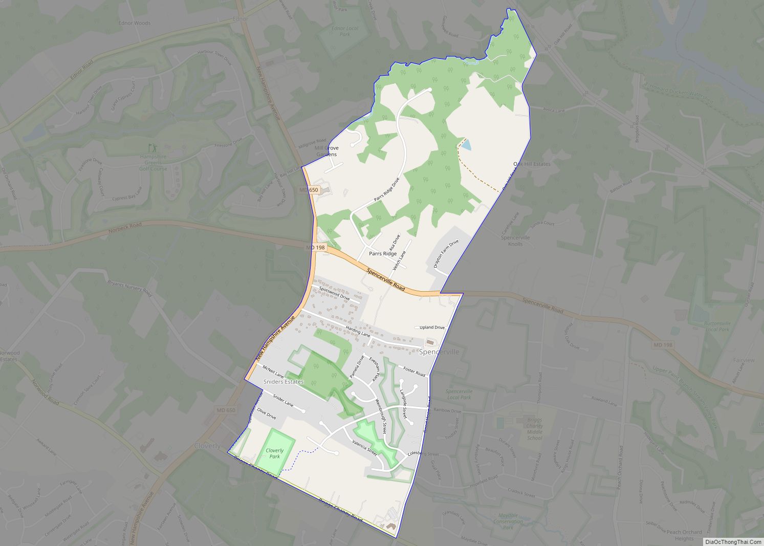
Spencerville is an unincorporated community and census-designated place in Montgomery County, Maryland, United States. Spencerville is 1 mile (1.6 km) north of Cloverly. Spencerville has a post office with ZIP code 20868. Spencerville CDP overview: Name: Spencerville CDP LSAD Code: 57 LSAD Description: CDP (suffix) State: Maryland County: Montgomery County Elevation: 499 ft (152 m) Total Area: 1.56 sq mi ... Read more
Map of US Cities and Places
St. James CDP overview: Name: St. James CDP LSAD Code: 57 LSAD Description: CDP (suffix) State: Maryland County: Washington County FIPS code: 2469550 Online Interactive Map St. James online map. Source: Basemap layers from Google Map, Open Street Map (OSM), Arcgisonline, Wmflabs. Boundary Data from Database of Global Administrative Areas. St. James location map. Where ... Read more
St. George Island CDP overview: Name: St. George Island CDP LSAD Code: 57 LSAD Description: CDP (suffix) State: Maryland County: St. Mary’s County FIPS code: 2469425 Online Interactive Map St. George Island online map. Source: Basemap layers from Google Map, Open Street Map (OSM), Arcgisonline, Wmflabs. Boundary Data from Database of Global Administrative Areas. St. ... Read more
Springdale is an unincorporated area and census-designated place (CDP) in Prince George’s County, Maryland, United States. Per the 2020 census, the population was 5,301. Springdale CDP overview: Name: Springdale CDP LSAD Code: 57 LSAD Description: CDP (suffix) State: Maryland County: Prince George’s County Elevation: 115 ft (35 m) Total Area: 1.33 sq mi (3.46 km²) Land Area: 1.33 sq mi (3.45 km²) Water ... Read more
Stevensville is a census-designated place (CDP) in Queen Anne’s County, Maryland, United States, and is the county’s most populous place among both CDPs and municipalities. The community is the eastern terminus of the Chesapeake Bay Bridge. The Stevensville Historic District is one of two registered historic districts in the county, the other being the Centreville ... Read more
Saint Michaels, also known as St. Michaels, is a town in Talbot County, Maryland, United States. The population was 1,029 at the 2010 census. Saint Michaels derives its name from the Episcopal Parish established there in 1677. The church attracted settlers who engaged in tobacco growing and ship building. St. Michaels town overview: Name: St. ... Read more
St. Leonard CDP overview: Name: St. Leonard CDP LSAD Code: 57 LSAD Description: CDP (suffix) State: Maryland County: Calvert County FIPS code: 2469675 Online Interactive Map St. Leonard online map. Source: Basemap layers from Google Map, Open Street Map (OSM), Arcgisonline, Wmflabs. Boundary Data from Database of Global Administrative Areas. St. Leonard location map. Where ... Read more
Sudlersville is a town in the far northeastern corner of Queen Anne’s County, Maryland, United States. The ZIP code is 21668 and the area code is 410. The population was 497 at the 2010 census. It is perhaps best known as the hometown of Baseball Hall Of Fame slugger Jimmie Foxx. Other famous residents include ... Read more
Stockton is a census-designated place (CDP) in Worcester County, Maryland, United States. The population was 92 at the 2010 census. It is part of the Salisbury, Maryland-Delaware Metropolitan Statistical Area. Stockton CDP overview: Name: Stockton CDP LSAD Code: 57 LSAD Description: CDP (suffix) State: Maryland County: Worcester County Elevation: 33 ft (10 m) Total Area: 1.71 sq mi (4.42 km²) ... Read more
Suitland is an unincorporated community and census designated place (CDP) in Prince George’s County, Maryland, approximately one mile (1.6 km) southeast of Washington, D.C. As of the 2020 census, its population was 25,839. Prior to 2010, it was part of the Suitland-Silver Hill census-designated place. Suitland CDP overview: Name: Suitland CDP LSAD Code: 57 LSAD Description: ... Read more
Sykesville is a small town in Carroll County, Maryland, United States. The town lies 20 miles (32 km) west of Baltimore and 40 miles (64 km) north of Washington D.C. The population was 4,436 at the 2010 census. BudgetTravel.com named Sykesville ‘Coolest Small Town in America’ in June 2016. Sykesville town overview: Name: Sykesville town LSAD Code: ... Read more
Swanton is an unincorporated area and census-designated place (CDP) in Garrett County, Maryland, United States. Swanton is close to several recreation areas, such as Deep Creek Lake State Park and Jennings Randolph Lake. A church and a post office are located in the downtown area. The population was 58 at the 2010 census. Anderson Chapel ... Read more