Stevensville is a census-designated place (CDP) in Queen Anne’s County, Maryland, United States, and is the county’s most populous place among both CDPs and municipalities. The community is the eastern terminus of the Chesapeake Bay Bridge. The Stevensville Historic District is one of two registered historic districts in the county, the other being the Centreville Historic District.
| Name: | Stevensville CDP |
|---|---|
| LSAD Code: | 57 |
| LSAD Description: | CDP (suffix) |
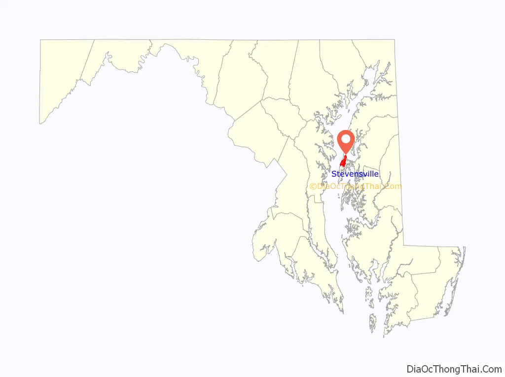
| State: | Maryland |
| County: | Queen Anne’s County |
| Elevation: | 7 ft (2 m) |
| Total Area: | 6.44 sq mi (16.68 km²) |
| Land Area: | 6.44 sq mi (16.68 km²) |
| Water Area: | 0.00 sq mi (0.00 km²) |
| Total Population: | 7,442 |
| Population Density: | 1,155.23/sq mi (446.06/km²) |
| ZIP code: | 21666 |
| Area code: | 410 |
| FIPS code: | 2475025 |
| GNISfeature ID: | 0598122 |
Online Interactive Map
Click on ![]() to view map in "full screen" mode.
to view map in "full screen" mode.
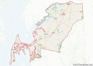
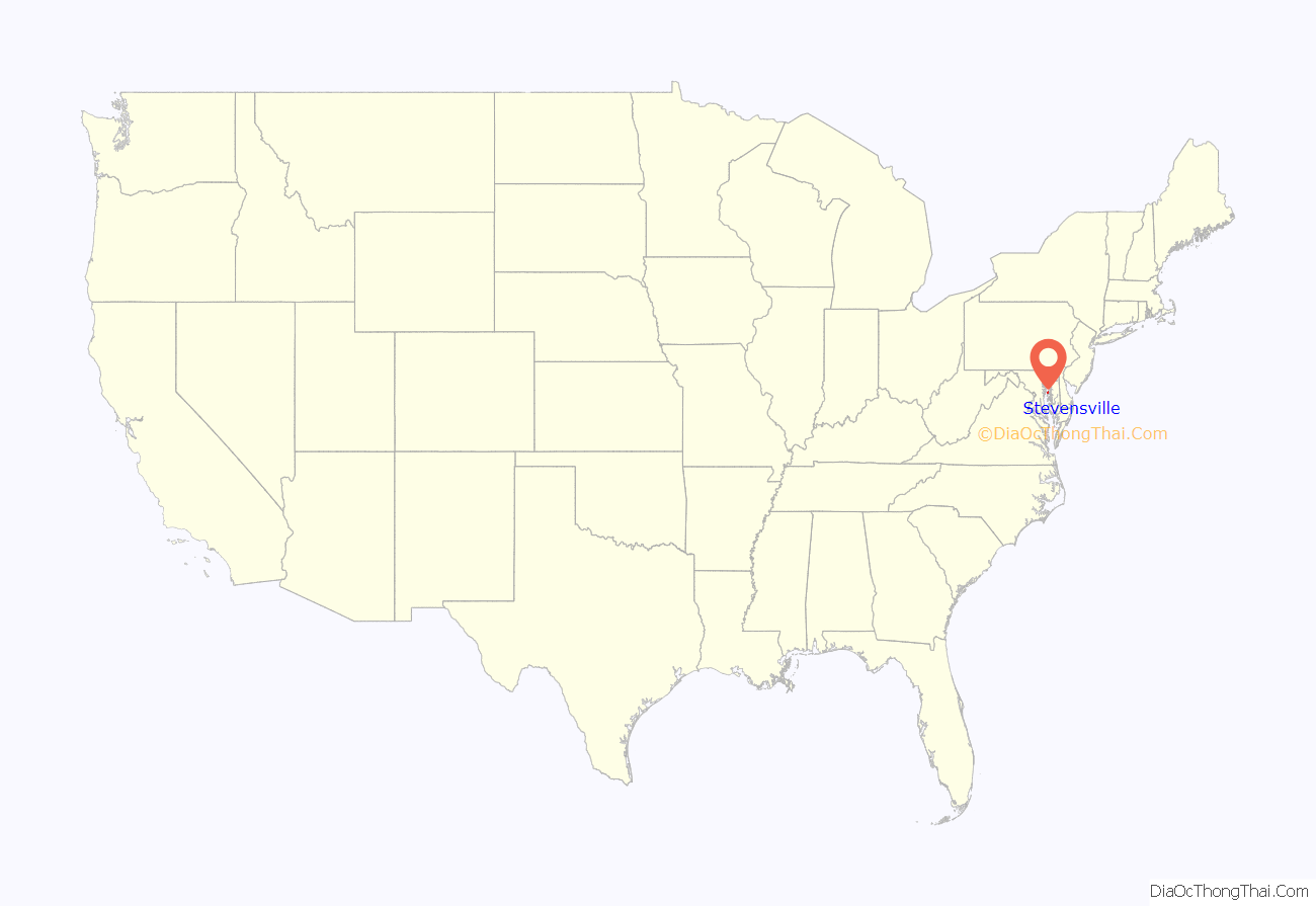
Stevensville location map. Where is Stevensville CDP?
History
Stevensville was founded in 1850 as a steamboat terminal. Today, the Stevensville Historic District contains roughly 100 historic structures dating back to the town’s early days.
In addition to the Stevensville Historic District, the Christ Church, Cray House, Friendship, Legg’s Dependence, Mattapax, and Stevensville Bank are listed on the National Register of Historic Places.
On July 24, 2017, an EF2 tornado hit Stevensville, causing damage to homes, trees, and power lines and injuring one person.
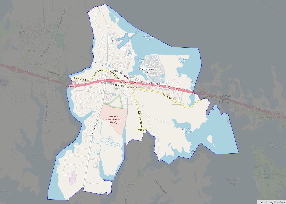
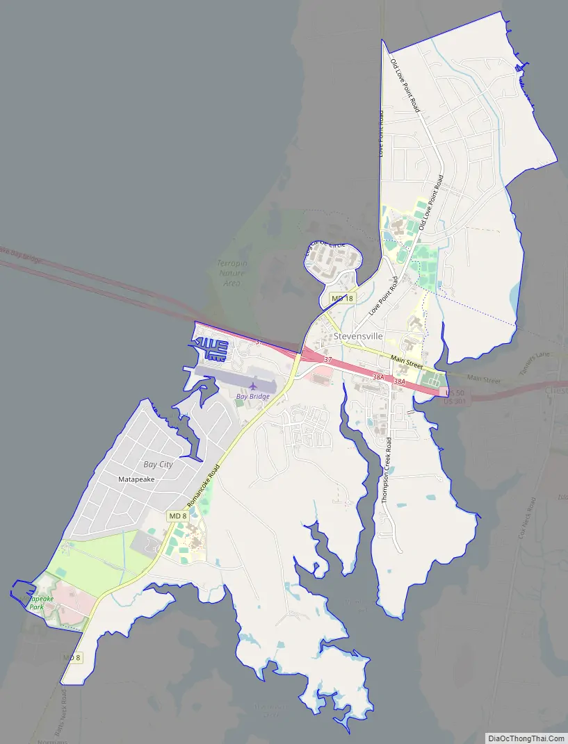
Stevensville Road Map
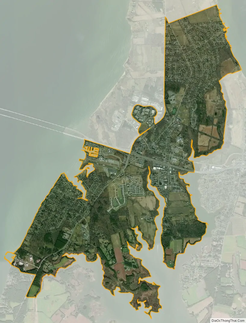
Stevensville city Satellite Map
Geography
Stevensville is located at 38°58′52″N 76°19′8″W / 38.98111°N 76.31889°W / 38.98111; -76.31889 (38.981128, −76.318757). According to the U.S. Census Bureau, it has a total area of 6.1 square miles (16 km), all land.
Climate
The climate in this area is characterized by hot, humid summers and generally mild to cool winters. According to the Köppen Climate Classification system, Stevensville has a humid subtropical climate, abbreviated “Cfa” on climate maps.
See also
Map of Maryland State and its subdivision: Map of other states:- Alabama
- Alaska
- Arizona
- Arkansas
- California
- Colorado
- Connecticut
- Delaware
- District of Columbia
- Florida
- Georgia
- Hawaii
- Idaho
- Illinois
- Indiana
- Iowa
- Kansas
- Kentucky
- Louisiana
- Maine
- Maryland
- Massachusetts
- Michigan
- Minnesota
- Mississippi
- Missouri
- Montana
- Nebraska
- Nevada
- New Hampshire
- New Jersey
- New Mexico
- New York
- North Carolina
- North Dakota
- Ohio
- Oklahoma
- Oregon
- Pennsylvania
- Rhode Island
- South Carolina
- South Dakota
- Tennessee
- Texas
- Utah
- Vermont
- Virginia
- Washington
- West Virginia
- Wisconsin
- Wyoming