Map of Sunrise Lake CDP
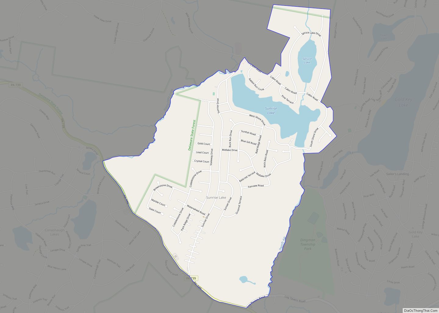
Sunrise Lake is a census-designated place and private lake community located in Dingman Township, Pike County in the state of Pennsylvania. The community is located along Pennsylvania Route 739 in eastern Pike County, about eight miles west of the New Jersey state line at the Delaware River. Sunrise Lake is between, and shares borders with, ... Read more
Map of Sunrise Lake CDP
Map of Sunbury city, Pennsylvania
Sunbury (/ˈsʌnbɛri/ SUN-berr-ee) is a city and county seat of Northumberland County, Pennsylvania, United States. The principal city in the Sunbury, PA Micropolitan Statistical Area, it is also one of three principal cities in the Bloomsburg-Berwick-Sunbury, PA Combined Statistical Area. Located in Central Pennsylvania’s Susquehanna Valley on the east bank of the Susquehanna River, just ... Read more
Map of Sunbury city, Pennsylvania
Map of Sun Valley CDP, Pennsylvania
Sun Valley is a census-designated place in NW Chestnuthill Township, Monroe County, Pennsylvania on the west side of Route 115 and the south flank of Pohopoco Mountain. The Pohopoco Creek starts in Sun Valley and flows south to Gilbert then west to Beltzville Lake and the Lehigh River. New Jersey Camp Jaycee for people with ... Read more
Map of Sun Valley CDP, Pennsylvania
Map of Summit Station CDP
Summit Station is a census-designated place (CDP) in Schuylkill County, Pennsylvania, United States. The population is 174 as of the 2010 census. Summit Station CDP overview: Name: Summit Station CDP LSAD Code: 57 LSAD Description: CDP (suffix) State: Pennsylvania County: Schuylkill County Total Area: 1.1 sq mi (2.8 km²) Land Area: 1.1 sq mi (2.8 km²) Total Population: 208 Population Density: ... Read more
Map of Summit Station CDP
Map of Tamaqua borough
Tamaqua (/təˈmɑːkwə/, Delaware: tëmakwe) is a borough in eastern Schuylkill County in the Coal Region of Pennsylvania, United States. It had a population of 6,934 as of the 2020 U.S. census. Tamaqua was established from territory from West Penn and Schuylkill Townships. The borough is part of the micropolitan statistical area of Pottsville. Tamaqua is ... Read more
Map of Tamaqua borough
Map of Table Rock CDP, Pennsylvania
Table Rock is a populated place and census-designated place (CDP) north of Gettysburg, Pennsylvania, United States, in Adams County, that was the site of an 1885 Gettysburg and Harrisburg Railroad station. As of the 2020 census the population was 133. Table Rock CDP overview: Name: Table Rock CDP LSAD Code: 57 LSAD Description: CDP (suffix) ... Read more
Map of Table Rock CDP, Pennsylvania
Map of Sylvania borough, Pennsylvania
Sylvania is a borough in Bradford County, Pennsylvania, United States. It is part of Northeastern Pennsylvania. The population was 216 at the 2020 census. Children residing in the borough are assigned to attend the Troy Area School District. Sylvania borough overview: Name: Sylvania borough LSAD Code: 21 LSAD Description: borough (suffix) State: Pennsylvania County: Bradford ... Read more
Map of Sylvania borough, Pennsylvania
Map of Sykesville borough, Pennsylvania
Sykesville is a borough in Jefferson County, Pennsylvania, United States. The population was 1,157 at the time of the 2010 census. Named for Jacob B. Sykes, an early resident, Sykesville was the birthplace of Olga Madar (1915–1996), the first woman to become a vice-president in the United Auto Workers (1970) and founder of the Coalition ... Read more
Map of Sykesville borough, Pennsylvania
Map of Swoyersville borough
Swoyersville borough overview: Name: Swoyersville borough LSAD Code: 21 LSAD Description: borough (suffix) State: Pennsylvania County: Luzerne County FIPS code: 4275832 Online Interactive Map Swoyersville online map. Source: Basemap layers from Google Map, Open Street Map (OSM), Arcgisonline, Wmflabs. Boundary Data from Database of Global Administrative Areas. Swoyersville location map. Where is Swoyersville borough? Swoyersville ... Read more
Map of Swoyersville borough
Map of Swissvale borough
Swissvale is a borough in Allegheny County, Pennsylvania, United States, 9 miles (14 km) east of downtown Pittsburgh. Named for a farmstead owned by James Swisshelm, during the industrial age it was the site of the Union Switch and Signal Company of George Westinghouse. The population was 8,624 at the 2020 census. In 1940, 15,919 people ... Read more
Map of Swissvale borough
Map of Sweden Valley CDP
Sweden Valley is a census-designated place located in Sweden Township in central Potter County in the state of Pennsylvania, United States. It is located along the famous U.S. Route 6, a few miles east of Coudersport. As of the 2010 census the population was 223 residents. Sweden Valley CDP overview: Name: Sweden Valley CDP LSAD ... Read more
Map of Sweden Valley CDP
Map of Taylor borough, Pennsylvania
Taylor is a borough in Lackawanna County, Pennsylvania, United States, 3 miles (5 km) southwest of Scranton on the Lackawanna River. It was founded in 1790 by Cornelius Atherton. Silk manufacturing and coal mining were once practiced in the borough. Most of Taylor is built over abandoned mines. The Pennsylvania Turnpike Northeast Extension (I-476), accessible via ... Read more
Map of Taylor borough, Pennsylvania