Tamaqua (/təˈmɑːkwə/, Delaware: tëmakwe) is a borough in eastern Schuylkill County in the Coal Region of Pennsylvania, United States. It had a population of 6,934 as of the 2020 U.S. census.
Tamaqua was established from territory from West Penn and Schuylkill Townships. The borough is part of the micropolitan statistical area of Pottsville. Tamaqua is located 37.8 miles (60.8 km) northwest of Allentown, 87 miles (140 km) northwest of Philadelphia, and 125.5 miles (202.0 km) west of New York City.
| Name: | Tamaqua borough |
|---|---|
| LSAD Code: | 21 |
| LSAD Description: | borough (suffix) |
| State: | Pennsylvania |
| County: | Schuylkill County |
| Incorporated: | 1832 |
| Elevation: | 870 ft (270 m) |
| Total Area: | 9.72 sq mi (25.17 km²) |
| Land Area: | 9.56 sq mi (24.77 km²) |
| Water Area: | 0.16 sq mi (0.40 km²) |
| Total Population: | 6,934 |
| Population Density: | 696.93/sq mi (269.07/km²) |
| ZIP code: | 18252 |
| Area code: | 570 and 272 |
| FIPS code: | 4276032 |
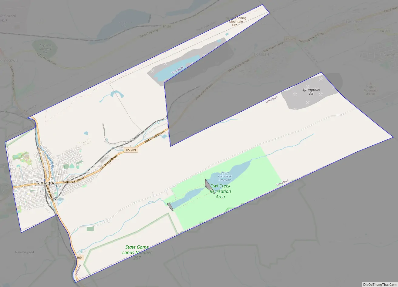
Online Interactive Map
Click on ![]() to view map in "full screen" mode.
to view map in "full screen" mode.
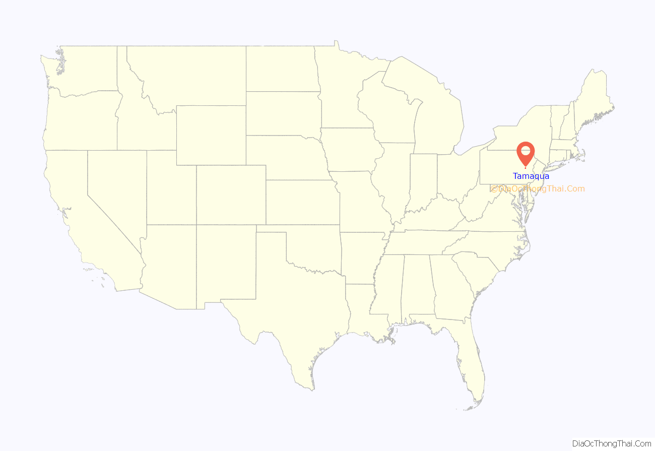
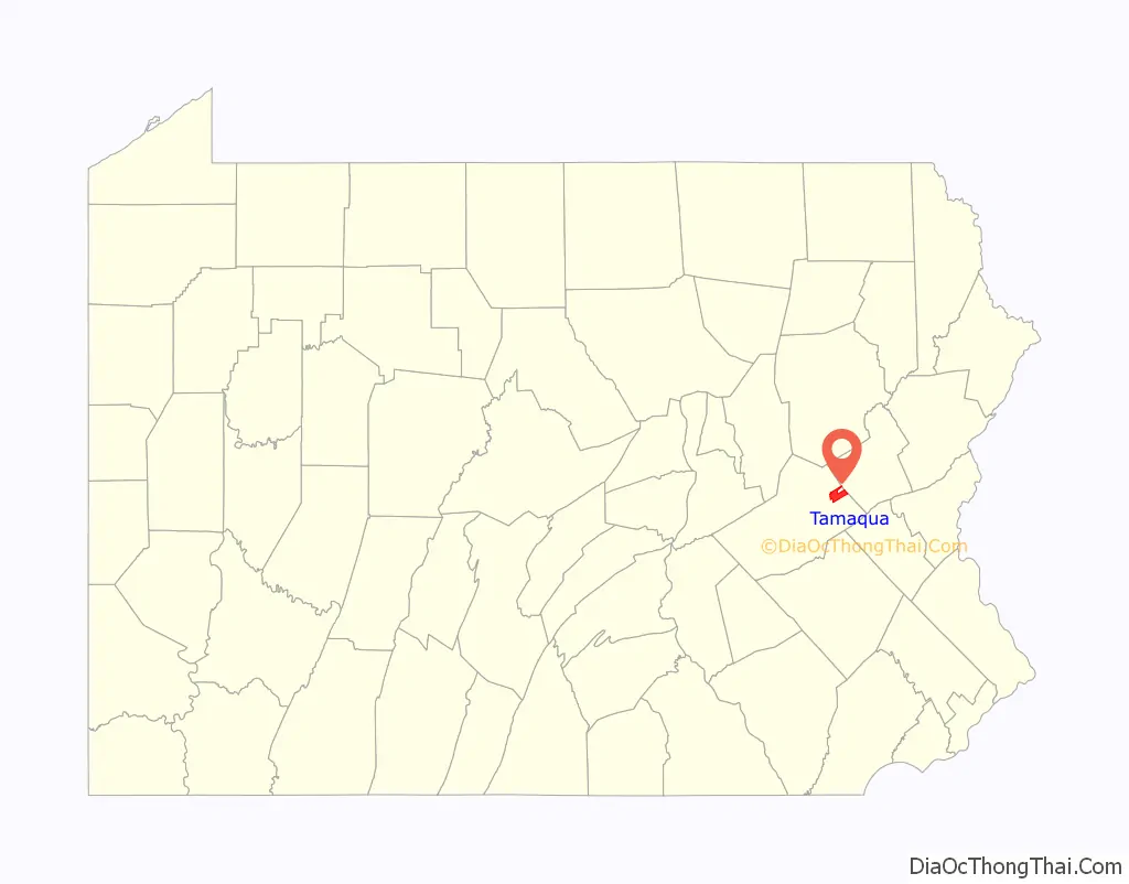
Tamaqua location map. Where is Tamaqua borough?
History
18th century
Tamaqua was settled in 1799 by Burkhardt (alternatively Berkhard) Moser, his son Jacob (born 1790) and John Kershner, who built shelters and a sawmill at the confluence of the Little Schuylkill River and Panther Creek, which is downtown Tamaqua today. According to property records, Moser had a partner named Houser, and together they owned 2,000 acres which Moser homesteaded. Moser built a log house at the base of Dutch Hill in 1801 for Mrs. Catherine Moser, who was the first adult to die and receive burial there on February 15, 1822 followed later in April that year by John Kershner.
19th century
The borough was originally to be named Tuscarora, but the name Tamaqua was chosen after it was realized that there already was a community named Tuscarora about four miles (6 km) to the west. The editor of The History of Schuylkill County wrote in 1881:
The editor writes about the founding:
Roughly half of Moser’s original log cabin is still intact and visible behind a house on the north side of East Broad Street. The discovery of anthracite coal in the region in the early 19th century led to Tamaqua’s rise as a coal-producing community. The town was incorporated as a borough in 1832. The first coal breaker, called “The Greenwood” was built as noted in the quotation, at the site of the first mine at the lower end of the Panther Creek Valley. However, details about construction and development in Rahn Township and Coaldale on the county-line with sister-town Lansford from the same source history illustrate it was definitely not the first breaker in the valley. Lehigh Coal & Navigation Company, with 10,000 acres located between Mauch Chunk and Tamaqua, was known to have mine tailings in their lands in Coaldale. The Greenwood breaker in 1874, as noted in the above quote, was burned by the Molly Maguires in the labor troubles of that era.
Irish, Welsh, and German immigrants came to the borough in the 1840s and 1850s followed by a large influx of Italians, Lithuanians, Russians, Ukrainians, Slovaks, and Poles in the 1890s and early 20th century. During the 1860s and 1870s, Tamaqua also was the geographic center hub for the Molly Maguires. One murder commonly attributed to the Mollies was that of town policeman Benjamin Yost, who was shot to death early one morning while extinguishing a gas lamp at the corner of West Broad and Lehigh Streets.
The Tamaqua Railroad Station was constructed in 1874. It stood idle from the mid 1980s through the late 1990s after passenger railroad service to the town was discontinued. Initially planned to be demolished in the late 1980s, the non-profit group Save Our Station (S.O.S.) eventually managed to raise enough money to have it refurbished at a cost of $1.5 million. The station reopened in August 2004 and is now home to a full-service restaurant and gift shop. Rail excursions leave from there during the Tamaqua Historical Society’s annual Heritage Festival on the second Sunday in October.
The first tavern in Tamaqua was opened around 1807 in Berkhard Moser’s house by the widow of John Kershner and her son-in-law, Isaac Bennett. In 1827, the Little Schuylkill Company, aspiring to draw the center of population to Dutch Hill, built the first stone building and hotel in Tamaqua. The house was converted into a dwelling thirty years afterward.
In 1832, James Taggart, one of the pioneers in Panther Creek Valley, came to Tamaqua and opened a hotel. Michael Beard took possession in 1846. Between 1845 and 1847, the United States Hotel was built by the Little Schuylkill Company and was first kept by Joseph Haughawout. In 1850, the Washington House, on Pine Street, was built, and the American and Mansion on Centre Street at a later period.
In 1853, Tamaqua had a public library and debating clubs discussed current events in the first town hall or schoolhouse as early as 1845. About 1856 the Tamaqua Lyceum was organized; it held weekly sessions in the south ward school building. To this lyceum Matthew Newkirk, of Philadelphia, made a gift of 1,500 books, which passed into the hands of the Perseverance Fire Company when the society disbanded. No records of the first organization remain. The principal citizens were members.
On November 26, 1876, a group of men formed the Presbyterian Social and Literary Institute.
The first graveyard was laid out in 1831 on Dutch Hill. The Catholic and Methodist burying grounds were laid out about 1837. The 30-acre Odd Fellows’ cemetery is located at the western end of Broad Street. It is one of only two elaborate Victorian garden cemeteries in Schuylkill County. It is overseen by trustees appointed by Harmony Lodge of Odd Fellows, and it was first opened in 1865. Zion’s cemetery was opened in 1876.
20th century
Tamaqua remained a thriving community throughout the heyday of coal production in the United States through the early 20th century. Certain sections of the borough, such as Dutch Hill and the South Ward, had a reputation for “toughness.” Those sections were also densely populated by immigrants from southern and eastern Europe. However, in the 1950s, as coal mines began tapering off, Tamaqua began declining, along with many other anthracite communities. Hurricane Diane in 1955 caused tremendous damage to Tamaqua’s railroad yards, and they never fully recovered. In 1971, the borough annexed neighboring Rahn Township and its Owl Creek section, home to the world’s first fish hatchery.
In 1945, John E. Morgan established a knitwear manufacturing industry in Hometown, two miles north of Tamaqua. The company, Morgan Knitting Mills, Inc., grew into one of the largest employers in the area, second only to the Atlas Powder Company. In the mid 1950s, Morgan, working from a design developed by his wife (Anna Hoban Morgan), patented the widely known thermal underwear product lines. Since Morgan’s death in 2000, the Morgan Trust has donated money to various causes in the Tamaqua area and established the John & Dorothy Morgan Cancer Center at Lehigh Valley Hospital–Cedar Crest in Allentown.
Dial telephone service arrived in Tamaqua on August 6, 1961. The new exchange (668) still exists. Operators who worked the 12-position switchboard on the top floor of the Tamaqua National Bank at West Broad and Berwick Streets were transferred to Bell Telephone’s Hazleton and Pottsville Toll Centers. The 55-block Tamaqua Historic District, Anthracite Bank Building, George Ormrod House, and Tamaqua Railroad Station are listed on the National Register of Historic Places.
21st century
In 2007, the borough of Tamaqua passed an unprecedented law giving ecosystems legal rights. The ordinance establishes that the municipal government or any Tamaqua resident can file a lawsuit on behalf of the local ecosystem. Other townships, such as Rush, followed suit and passed their own laws.
Tamaqua Road Map
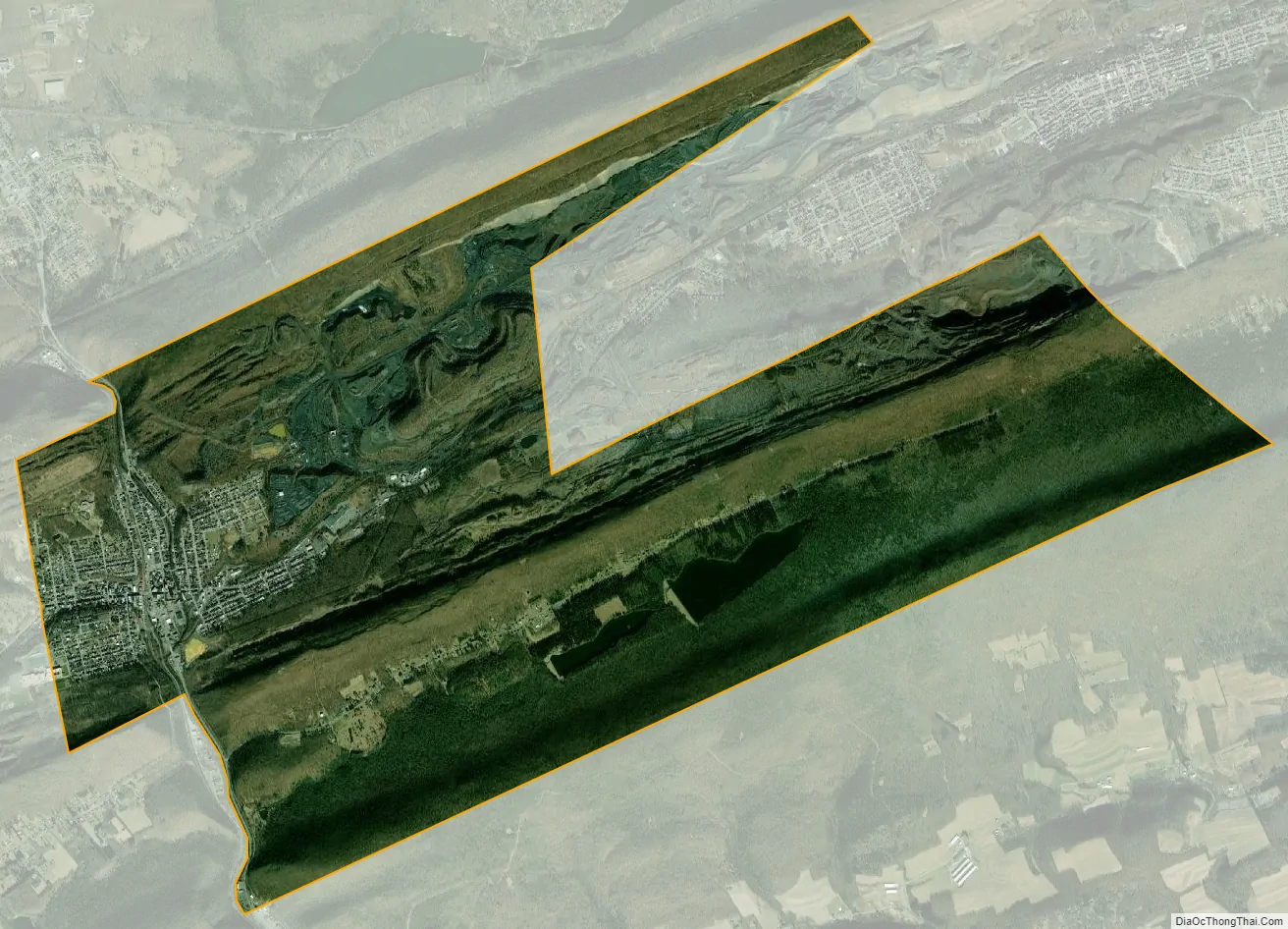
Tamaqua city Satellite Map
Geography
Tamaqua is located in a valley basin at 40°47′55″N 75°57′59″W / 40.79861°N 75.96639°W / 40.79861; -75.96639 (40.798600, −75.966498) within Pennsylvania’s southern Coal Region section of the Appalachian Mountains in the Schuylkill River drainage basin. Tamaqua’s valley is located at the western end of the Pocono Mountains on the edge of the neighboring Lehigh River watershed. Because of the dominant terrain, the town is typical of many mid-size Ridge-and-Valley Appalachians—low lands and flats towns with business, rail transport, and industries in its lower valley locations and residential dwellings on the higher elevated slopes above.
According to the U.S. Census Bureau, the borough has a total area of 10.0 square miles (26 km), of which 9.8 square miles (25 km) is land and 0.1 square miles (0.26 km) (1.31%) is water. Three streams pass through Tamaqua: The Little Schuylkill River runs through Tamaqua from the north through the gap separating the folds of Sharp Mountain on the west and Nesquehoning Mountain. Panther Creek flows southwest from Lansford, five miles away, and joins the Little Schuylkill River in Tamaqua. Wabash Creek joins the Little Schuylkill from the west.
In the Tamaqua area, coal mining was a vital economic activity throughout the 20th century, but more recent diminished use of coal as a power plant fuel and the demise of steam powered traction, coal has since experienced a decline. Tamaqua also gained recognition as a railroad center. In addition, the 1885 Edison Electric Illuminating Co. of Tamaqua once furnished the town with the nation’s second incandescent municipal lighting system, a feat accomplished through the involvement of Thomas Edison.
The nearest city to Tamaqua is Hazleton, which is 12.5 miles north. Tamaqua is 15 miles (24 km) east of Pottsville, 14 miles (23 km) southwest of Jim Thorpe, approximately 60 miles (97 km) south of Scranton, approximately 95 miles (153 km) northwest of Philadelphia, and approximately 100 miles (160 km) southwest of New York City.
Tamaqua’s average elevation is 870 feet (270 m) above sea level, but elevations can reach up to 1,000 feet (300 m) above sea level.
The borough has a warm-summer humid continental climate (Dfb) and the hardiness zone is 6a. Average monthly temperatures range from 26.0 °F in January to 71.0 °F in July.
See also
Map of Pennsylvania State and its subdivision:- Adams
- Allegheny
- Armstrong
- Beaver
- Bedford
- Berks
- Blair
- Bradford
- Bucks
- Butler
- Cambria
- Cameron
- Carbon
- Centre
- Chester
- Clarion
- Clearfield
- Clinton
- Columbia
- Crawford
- Cumberland
- Dauphin
- Delaware
- Elk
- Erie
- Fayette
- Forest
- Franklin
- Fulton
- Greene
- Huntingdon
- Indiana
- Jefferson
- Juniata
- Lackawanna
- Lancaster
- Lawrence
- Lebanon
- Lehigh
- Luzerne
- Lycoming
- Mc Kean
- Mercer
- Mifflin
- Monroe
- Montgomery
- Montour
- Northampton
- Northumberland
- Perry
- Philadelphia
- Pike
- Potter
- Schuylkill
- Snyder
- Somerset
- Sullivan
- Susquehanna
- Tioga
- Union
- Venango
- Warren
- Washington
- Wayne
- Westmoreland
- Wyoming
- York
- Alabama
- Alaska
- Arizona
- Arkansas
- California
- Colorado
- Connecticut
- Delaware
- District of Columbia
- Florida
- Georgia
- Hawaii
- Idaho
- Illinois
- Indiana
- Iowa
- Kansas
- Kentucky
- Louisiana
- Maine
- Maryland
- Massachusetts
- Michigan
- Minnesota
- Mississippi
- Missouri
- Montana
- Nebraska
- Nevada
- New Hampshire
- New Jersey
- New Mexico
- New York
- North Carolina
- North Dakota
- Ohio
- Oklahoma
- Oregon
- Pennsylvania
- Rhode Island
- South Carolina
- South Dakota
- Tennessee
- Texas
- Utah
- Vermont
- Virginia
- Washington
- West Virginia
- Wisconsin
- Wyoming


