Map of Warren city, Pennsylvania
Warren is a city in Warren County, Pennsylvania, United States, located along the Allegheny River. The population was 9,404 at the 2020 census. It is the county seat of Warren County. It is home to the headquarters of the Allegheny National Forest and the Cornplanter State Forest. It is also the headquarters for the Chief ... Read more
Map of Warren city, Pennsylvania
Map of Warminster Heights CDP
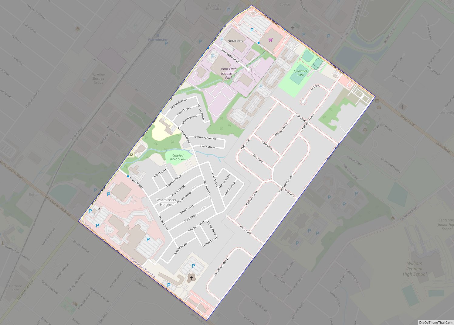
Warminster Heights is a census-designated place and part of Warminster Township in Bucks County, Pennsylvania, United States. It is located near the eastern border of Hatboro in Montgomery County. The population was 4,124 at the 2010 census. Warminster Heights CDP overview: Name: Warminster Heights CDP LSAD Code: 57 LSAD Description: CDP (suffix) State: Pennsylvania County: ... Read more
Map of Warminster Heights CDP
Map of Wanamie CDP
Wanamie is an unincorporated community and census-designated place in Newport Township, Luzerne County, Pennsylvania. It is located in the southwestern end of the Wyoming Valley and uses the Nanticoke zip code of 18634. The South Branch Newport Creek forms the natural eastern boundary of Wanamie and drains it northeastward via the Newport Creek into the ... Read more
Map of Wanamie CDP
Map of Wampum borough
Wampum is a borough in Lawrence County, Pennsylvania. The population was 557 at the 2020 census. It is part of the New Castle micropolitan area. Wampum borough overview: Name: Wampum borough LSAD Code: 21 LSAD Description: borough (suffix) State: Pennsylvania County: Lawrence County Total Area: 1.03 sq mi (2.67 km²) Land Area: 0.98 sq mi (2.55 km²) Water Area: 0.05 sq mi (0.12 km²) ... Read more
Map of Wampum borough
Map of Walnuttown CDP
Walnuttown is a census-designated place in Berks County, Pennsylvania, United States. It is mainly in Richmond Township but also in Maidencreek Township. It is a short distance west of Fleetwood and south of U.S. Route 222. Willow Creek flows west through the CDP into Maiden Creek, just east of the latter’s mouth into the Schuylkill ... Read more
Map of Walnuttown CDP
Map of Walnutport borough
Walnutport is a borough in Northampton County, Pennsylvania. It was first incorporated in 1909. The population of Walnutport was 2,067 at the 2020 census. Walnutport is located along the Lehigh River and is part of the Lehigh Valley metropolitan area, which had a population of 861,899 and was the 68th-most populous metropolitan area in the ... Read more
Map of Walnutport borough
Map of Wayne Heights CDP
Wayne Heights is a census-designated place (CDP) in Franklin County, Pennsylvania, United States. The population was 2,606 at the 2020 census. Wayne Heights CDP overview: Name: Wayne Heights CDP LSAD Code: 57 LSAD Description: CDP (suffix) State: Pennsylvania County: Franklin County Elevation: 640 ft (200 m) Total Area: 2.1 sq mi (5.5 km²) Land Area: 2.1 sq mi (5.5 km²) Water Area: 0.0 sq mi ... Read more
Map of Wayne Heights CDP
Map of Waymart borough
Waymart is a borough in Wayne County, Pennsylvania, United States. The borough’s population was 1,341 at the time of the 2010 United States Census. Waymart borough overview: Name: Waymart borough LSAD Code: 21 LSAD Description: borough (suffix) State: Pennsylvania County: Wayne County Elevation: 1,873 ft (571 m) Total Area: 2.76 sq mi (7.14 km²) Land Area: 2.69 sq mi (6.97 km²) Water Area: ... Read more
Map of Waymart borough
Map of Waverly CDP, Pennsylvania
Waverly is a census-designated place (CDP) comprising the central community within Waverly Township in Lackawanna County, Pennsylvania, United States. Originally called Abington Center, it was founded in the late 18th century by settlers from Connecticut, along the Warriors’ Path. The population of the CDP at the 2010 census was 604. Waverly CDP overview: Name: Waverly ... Read more
Map of Waverly CDP, Pennsylvania
Map of Wattsburg borough
Wattsburg is a borough in Erie County, Pennsylvania, United States. The population was 352 at the 2020 census. It is part of the Erie Metropolitan Statistical Area. Wattsburg borough overview: Name: Wattsburg borough LSAD Code: 21 LSAD Description: borough (suffix) State: Pennsylvania County: Erie County Total Area: 0.31 sq mi (0.80 km²) Land Area: 0.30 sq mi (0.77 km²) Water Area: ... Read more
Map of Wattsburg borough
Map of Watsontown borough
Watsontown is a borough in Northumberland County, Pennsylvania, United States. The population was 2,351 at the 2010 census. It was named for John Watson, an early settler. Watsontown borough overview: Name: Watsontown borough LSAD Code: 21 LSAD Description: borough (suffix) State: Pennsylvania County: Northumberland County Total Area: 0.93 sq mi (2.42 km²) Land Area: 0.71 sq mi (1.84 km²) Water Area: ... Read more
Map of Watsontown borough
Map of Waterford borough, Pennsylvania
Waterford is a borough in Erie County, Pennsylvania, United States. The population was 1,475 at the 2020 census. It is part of the Erie Metropolitan Statistical Area. Waterford is an independent municipality located entirely within (and surrounded by) Waterford Township and is located near the geographic center of the township. Waterford borough overview: Name: Waterford ... Read more
Map of Waterford borough, Pennsylvania