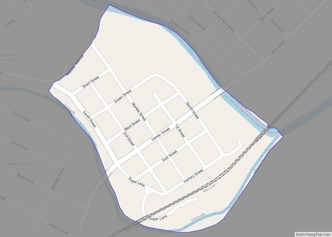
Waynesburg is a borough in and the county seat of Greene County, Pennsylvania, United States, located about 50 miles (80 km) south of Pittsburgh. Its population was 3,987 at the 2020 census.
The region around Waynesburg is underlaid with several layers of coking coal, including the Pittsburgh No. 8 seam, the Waynesburg seam, and the Sewickley (Mapletown) seam. The area is also rich with coalbed methane, which is being developed from the underlying Marcellus Shale, the largest domestic natural gas reserve. Early in the 20th century, four large gas compressing stations and a steam shovel factory were located in Waynesburg.
Waynesburg is named for General “Mad” Anthony Wayne, one of the top lieutenants of George Washington during the Revolutionary War (1776–81). The borough is the location of Waynesburg University, and it is served by the Greene County Airport.
| Name: | Waynesburg borough |
|---|---|
| LSAD Code: | 21 |
| LSAD Description: | borough (suffix) |
| State: | Pennsylvania |
| County: | Greene County |
| Elevation: | 1,034 ft (315 m) |
| Total Area: | 0.81 sq mi (2.09 km²) |
| Land Area: | 0.81 sq mi (2.09 km²) |
| Water Area: | 0.00 sq mi (0.00 km²) |
| Total Population: | 3,987 |
| Population Density: | 4,925.47/sq mi (1,901.04/km²) |
| ZIP code: | 15370 |
| Area code: | 724, 878 |
| FIPS code: | 4281832 |
| Website: | waynesburgboro.com |
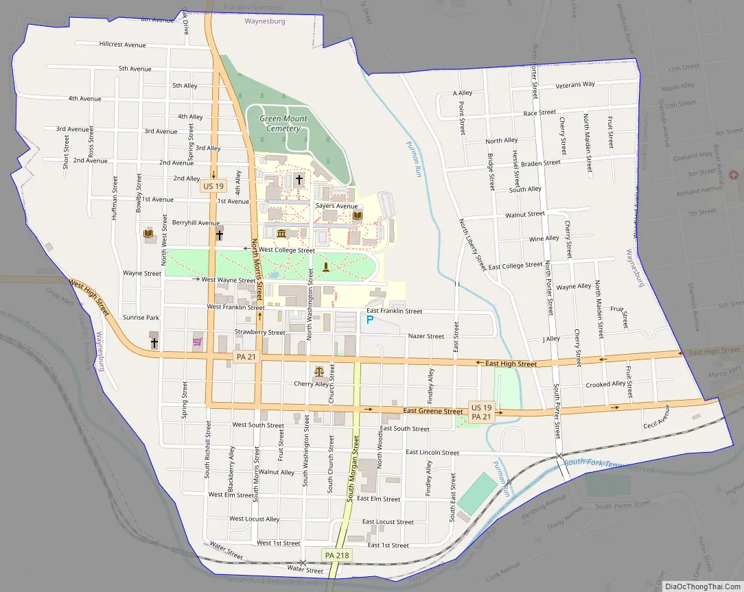
Online Interactive Map
Click on ![]() to view map in "full screen" mode.
to view map in "full screen" mode.
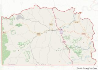
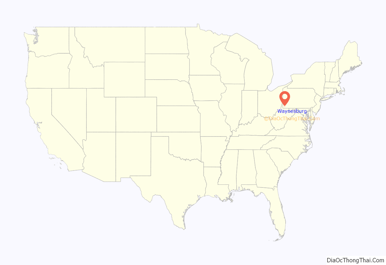
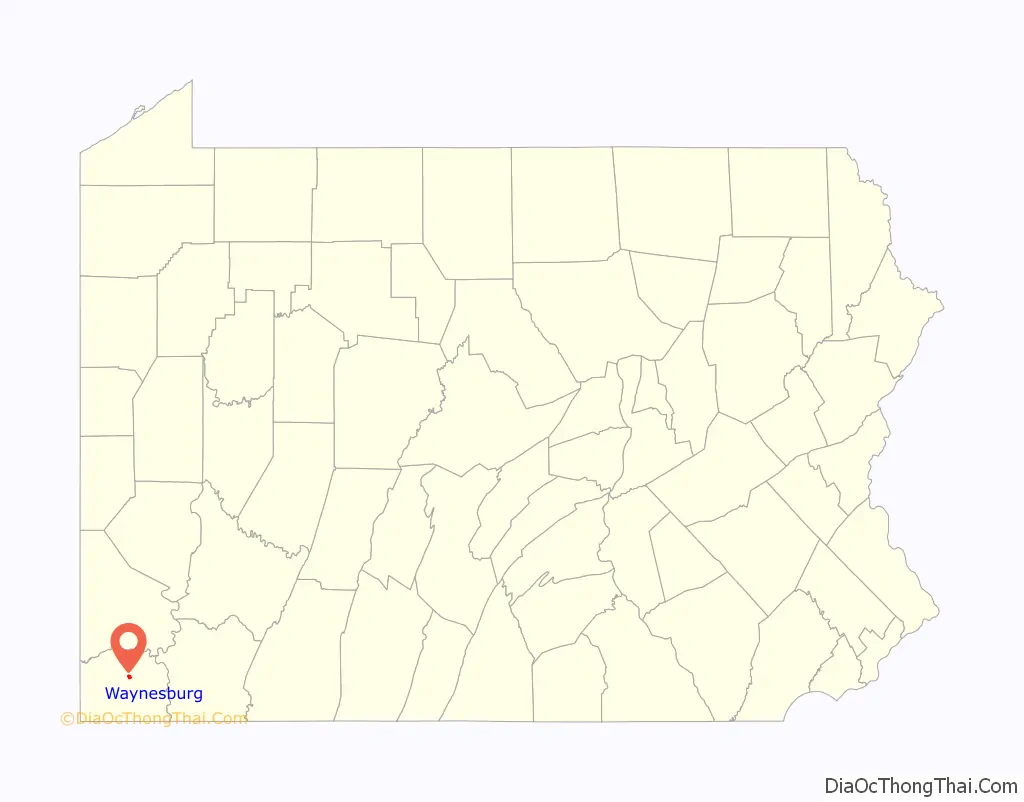
Waynesburg location map. Where is Waynesburg borough?
History
In 1796, the Pennsylvania General Assembly passed legislation to create Greene County, dividing Washington County into two parts with the lower part becoming Greene County. Part of the legislation required a city to take the county seat for the section of land. They chose Waynesburg as the place for the county seat because it was in the center of the county. Thomas Slater owned the land which is now Waynesburg. According to the Living Places website, Slater purchased the land from a Native American for a two-year-old heifer and a flint-lock rifle. In that time, land development required a patent from William Penn. The town at that time was referred to as Eden, named after his wife Elanor’s maiden name, according to the Angel Fire website. County commissioners bought the 158 acres of land from Slater for $2,376 for the purpose of building a jail, courthouse and other public buildings. The commissioners changed the name to Waynesburg, after Revolutionary War General Anthony Wayne. Despite selling the land, though, Slater remained in the area. He lived next to the Waynesburg VFW where two trailers now sit. Slater lived in his house until his death in 1815 at the age of 76. In August 1875 construction began of the 3 ft (914 mm) narrow gauge Waynesburg and Washington Railroad, conceived by John Day in 1874 and chartered in 1875. Its passenger service ended in 1929, and conversion to 4 ft 8+1⁄2 in (1,435 mm) standard gauge followed in 1944 as a wartime measure. Then the railroad was renamed the Waynesburg Secondary Railroad. Regular freight service ended on this line in 1976, though part of it still serves (irregularly) for railroad access to a coal mine.
The Waynesburg Historic District, Hanna Hall at the university, and Miller Hall are listed on the National Register of Historic Places.
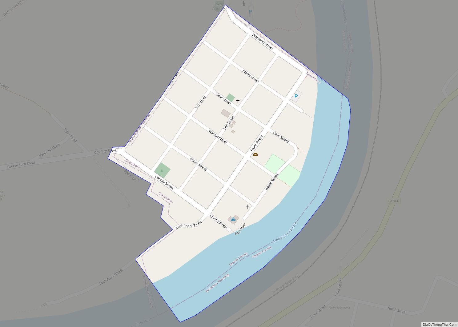
Waynesburg Road Map
Waynesburg city Satellite Map

Geography
Waynesburg is located northeast of the center of Greene County at 39°53′51″N 80°11′8″W / 39.89750°N 80.18556°W / 39.89750; -80.18556 (39.897403, -80.185597). Its southern boundary follows the South Fork of Tenmile Creek, an east-flowing tributary of the Monongahela River. The borough is surrounded by Franklin Township, a separate municipality.
U.S. Route 19 passes through the center of the borough as High Street (westbound) and Greene Street (eastbound), turning on the north side of town to follow Morris Street (northbound) and Richhill Street (southbound). Pennsylvania Route 21 joins US 19 through downtown Waynesburg on High and Greene streets. PA 21 leads east 2 miles (3 km) to Interstate 79 at Exit 14 and continues east another 25 miles (40 km) to Uniontown. To the west PA 21 leads 6 miles (9.7 km) to Rogersville and 24 miles (39 km) to the West Virginia border. I-79 leads north from Exit 14 21 miles (34 km) to Washington and 53 miles (85 km) to Pittsburgh, while Morgantown, West Virginia, is 24 miles (39 km) to the south.
According to the United States Census Bureau, Waynesburg has a total area of 0.80 square miles (2.07 km), all land.
Climate
See also
Map of Pennsylvania State and its subdivision:- Adams
- Allegheny
- Armstrong
- Beaver
- Bedford
- Berks
- Blair
- Bradford
- Bucks
- Butler
- Cambria
- Cameron
- Carbon
- Centre
- Chester
- Clarion
- Clearfield
- Clinton
- Columbia
- Crawford
- Cumberland
- Dauphin
- Delaware
- Elk
- Erie
- Fayette
- Forest
- Franklin
- Fulton
- Greene
- Huntingdon
- Indiana
- Jefferson
- Juniata
- Lackawanna
- Lancaster
- Lawrence
- Lebanon
- Lehigh
- Luzerne
- Lycoming
- Mc Kean
- Mercer
- Mifflin
- Monroe
- Montgomery
- Montour
- Northampton
- Northumberland
- Perry
- Philadelphia
- Pike
- Potter
- Schuylkill
- Snyder
- Somerset
- Sullivan
- Susquehanna
- Tioga
- Union
- Venango
- Warren
- Washington
- Wayne
- Westmoreland
- Wyoming
- York
- Alabama
- Alaska
- Arizona
- Arkansas
- California
- Colorado
- Connecticut
- Delaware
- District of Columbia
- Florida
- Georgia
- Hawaii
- Idaho
- Illinois
- Indiana
- Iowa
- Kansas
- Kentucky
- Louisiana
- Maine
- Maryland
- Massachusetts
- Michigan
- Minnesota
- Mississippi
- Missouri
- Montana
- Nebraska
- Nevada
- New Hampshire
- New Jersey
- New Mexico
- New York
- North Carolina
- North Dakota
- Ohio
- Oklahoma
- Oregon
- Pennsylvania
- Rhode Island
- South Carolina
- South Dakota
- Tennessee
- Texas
- Utah
- Vermont
- Virginia
- Washington
- West Virginia
- Wisconsin
- Wyoming