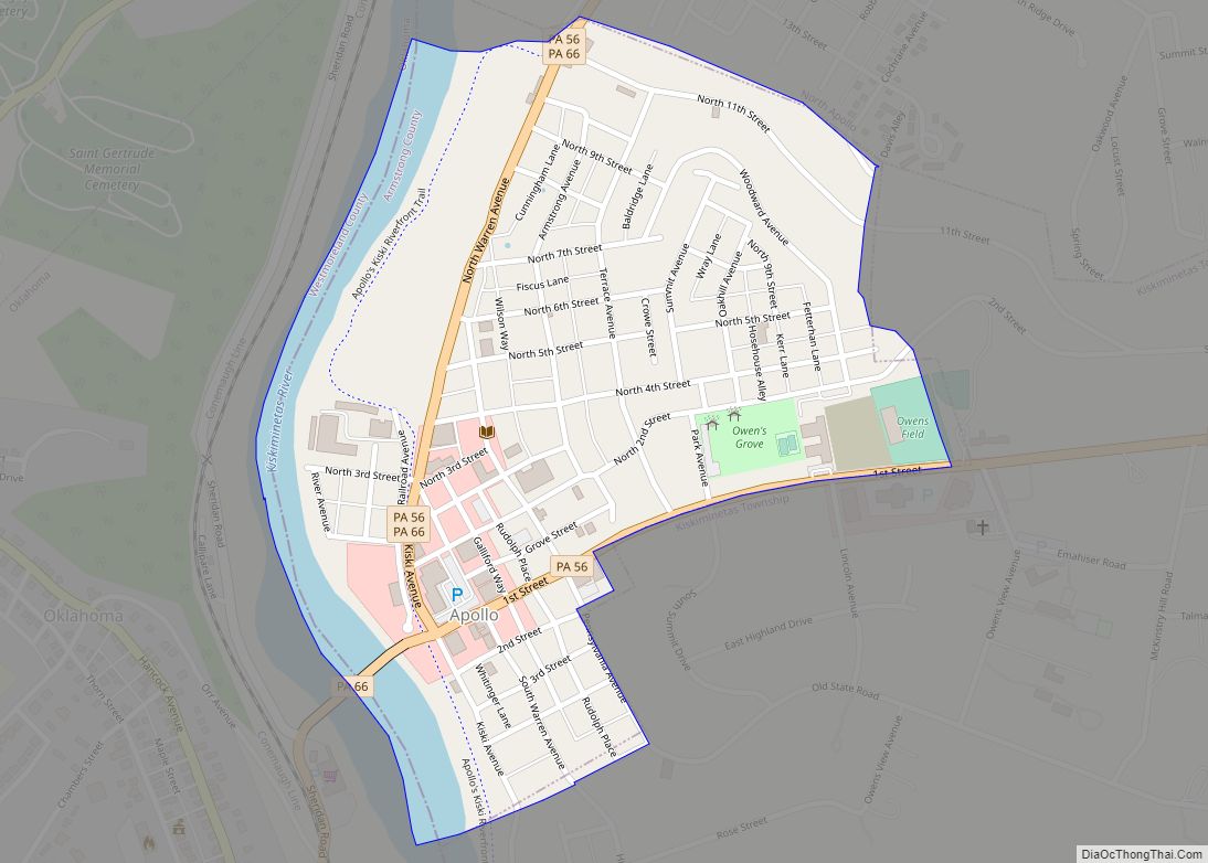
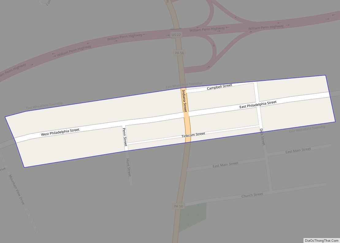
Map of Ambridge borough
Ambridge is a borough in Beaver County, Pennsylvania, United States. Incorporated in 1905 as a company town by the American Bridge Company, Ambridge is located 16 miles (25 km) northwest of Pittsburgh, along the Ohio River. The population was 6,972 at the 2020 census. Ambridge borough overview: Name: Ambridge borough LSAD Code: 21 LSAD Description: borough ... Read more
Map of Ambridge borough
Map of Ambler borough, Pennsylvania
Ambler is a borough in Montgomery County, Pennsylvania. It is located approximately 16 miles (26 km) north of the Center City Philadelphia. Ambler borough overview: Name: Ambler borough LSAD Code: 21 LSAD Description: borough (suffix) State: Pennsylvania County: Montgomery County Elevation: 220 ft (70 m) Total Area: 0.85 sq mi (2.21 km²) Land Area: 0.85 sq mi (2.21 km²) Water Area: 0.00 sq mi (0.00 km²) Total ... Read more
Map of Ambler borough, Pennsylvania
Map of Altoona city, Pennsylvania
Altoona is a city in Blair County, Pennsylvania, United States. The population was 43,963 at the time of the 2020 census, making it the 18th-most populous city in Pennsylvania. It is the principal city of the Altoona metropolitan area, which includes all of Blair County and was recorded as having a population of 122,822 at ... Read more
Map of Altoona city, Pennsylvania
Map of Archbald borough
Archbald is a borough in Lackawanna County, Pennsylvania, United States. It is part of Northeastern Pennsylvania and is named for James Archbald, the first mayor of Carbondale, Pennsylvania. Before being renamed in Archbald’s honor, the name of the settlement was White Oak Run. Most of the original settlers were Irish Catholics, fleeing the Great Famine. ... Read more
Map of Archbald borough
Map of Arcadia University CDP
Arcadia University is a census-designated place located in Cheltenham Township, Montgomery County, Pennsylvania. It is located just off campus at Arcadia University and off Pennsylvania Route 309. As of the 2010 census the population was 595 residents. With 10,438 people per square mile, Arcadia University is the most densely populated census-designated place in Montgomery County ... Read more
Map of Arcadia University CDP
Map of Applewold borough
Applewold is a borough in Armstrong County, Pennsylvania, United States. The population was 334 at the 2020 census. Applewold borough overview: Name: Applewold borough LSAD Code: 21 LSAD Description: borough (suffix) State: Pennsylvania County: Armstrong County Incorporated: 1899 Elevation: 790 ft (240 m) Total Area: 0.05 sq mi (0.12 km²) Land Area: 0.05 sq mi (0.12 km²) Water Area: 0.00 sq mi (0.00 km²) Total Population: ... Read more
Map of Applewold borough
Map of Ashland borough, Pennsylvania
Ashland is a borough in Schuylkill County in the U.S. state of Pennsylvania, 15 miles (24 km) northwest of Pottsville. It is part of Northeastern Pennsylvania. A small part of the borough also lies in Columbia County, although all of the population resided in the Schuylkill County portion as of the 2020 census. The borough lies ... Read more
Map of Ashland borough, Pennsylvania
Map of Arona borough
Arona is a borough in Westmoreland County, Pennsylvania, United States. The population was 253 at the 2020 census. Arona borough overview: Name: Arona borough LSAD Code: 21 LSAD Description: borough (suffix) State: Pennsylvania County: Westmoreland County Incorporated: November 11, 1895 Elevation: 1,017 ft (310 m) Total Area: 0.53 sq mi (1.36 km²) Land Area: 0.52 sq mi (1.35 km²) Water Area: 0.00 sq mi (0.01 km²) ... Read more
Map of Arona borough
Map of Arnot CDP
Arnot is a census-designated place located in Bloss Township, Tioga County in the state of Pennsylvania, United States. It is located off US Route 15 near the borough of Blossburg. As of the 2010 census, the population was 332 residents. Arnot CDP overview: Name: Arnot CDP LSAD Code: 57 LSAD Description: CDP (suffix) State: Pennsylvania ... Read more
Map of Arnot CDP
Map of Arnold city, Pennsylvania
Arnold is a city in Westmoreland County, Pennsylvania, United States. It is part of the Greater Pittsburgh metropolitan area. The population was 5,157 at the 2010 census. Arnold city overview: Name: Arnold city LSAD Code: 25 LSAD Description: city (suffix) State: Pennsylvania County: Westmoreland County Total Area: 0.85 sq mi (2.21 km²) Land Area: 0.73 sq mi (1.90 km²) Water Area: ... Read more
Map of Arnold city, Pennsylvania
Map of Arnold City CDP
Arnold City is an unincorporated community and census-designated place in Washington Township, Fayette County, Pennsylvania, United States. It is located approximately 3 miles (5 km) east of the borough of Belle Vernon, in far northwestern Fayette County. As of the 2010 census, the population of Arnold City was 498. Arnold City CDP overview: Name: Arnold City ... Read more
Map of Arnold City CDP
Map of Armagh borough
Armagh is a borough in Indiana County in the U.S. state of Pennsylvania. The population was 103 at the 2020 census. Armagh borough overview: Name: Armagh borough LSAD Code: 21 LSAD Description: borough (suffix) State: Pennsylvania County: Indiana County Incorporated: 1824 Total Area: 0.06 sq mi (0.15 km²) Land Area: 0.06 sq mi (0.15 km²) Water Area: 0.00 sq mi (0.00 km²) Total Population: ... Read more
Map of Armagh borough