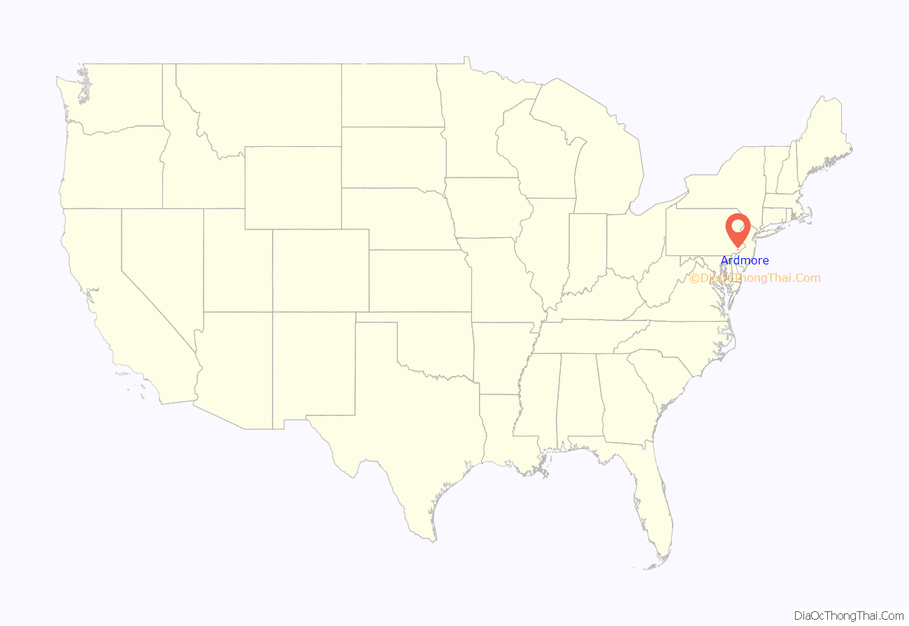
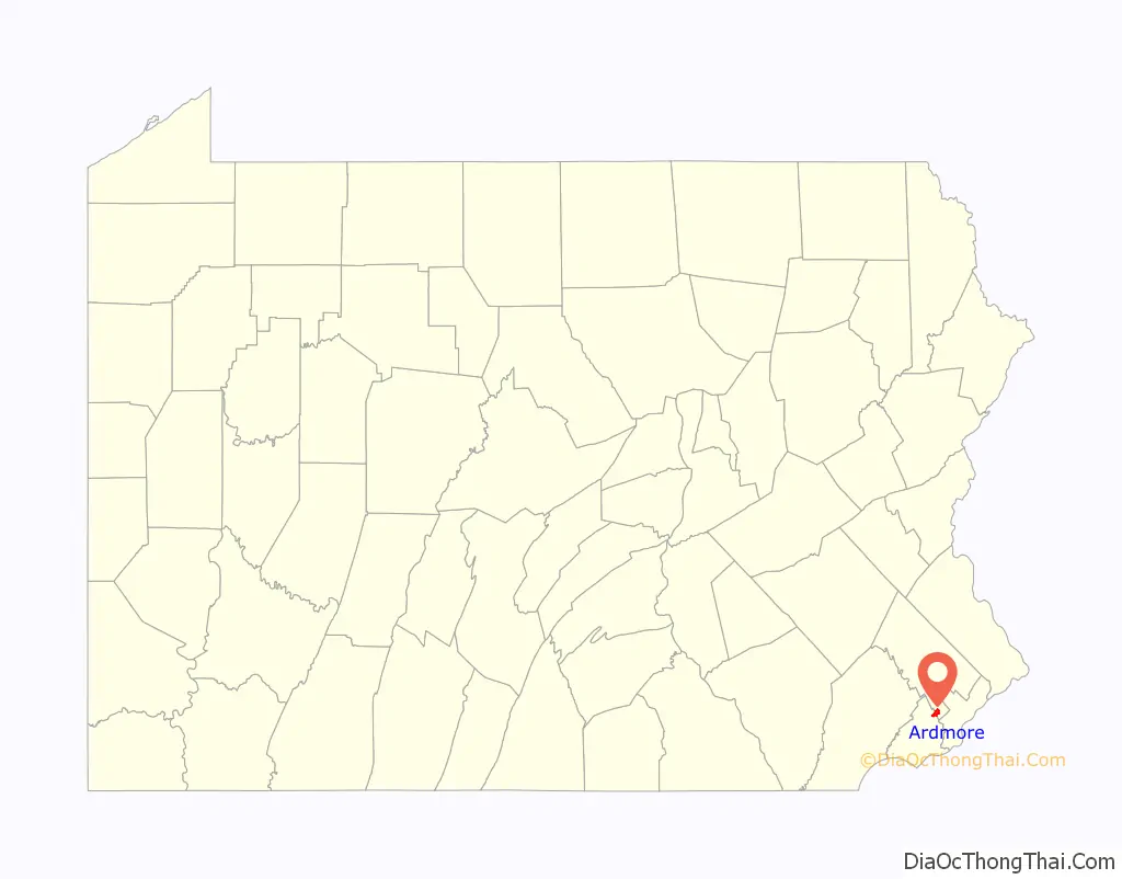
Ardmore is an unincorporated community and census-designated place (CDP) spanning the border between Delaware and Montgomery counties in the U.S. state of Pennsylvania. The population was 12,455 at the time of the 2010 census and had risen to 13,566 in the 2020 census.
Ardmore is a suburb on the west side of Philadelphia within Lower Merion Township in Montgomery County and Haverford Township in Delaware County.
| Name: | Ardmore CDP |
|---|---|
| LSAD Code: | 57 |
| LSAD Description: | CDP (suffix) |
| State: | Pennsylvania |
| County: | Delaware County, Montgomery County |
| Elevation: | 282 ft (86 m) |
| Total Area: | 1.97 sq mi (5.09 km²) |
| Land Area: | 1.97 sq mi (5.09 km²) |
| Water Area: | 0.00 sq mi (0.00 km²) |
| Total Population: | 13,566 |
| Population Density: | 6,900.31/sq mi (2,664.01/km²) |
| ZIP code: | 19003 |
| FIPS code: | 4202896 |
Online Interactive Map
Click on ![]() to view map in "full screen" mode.
to view map in "full screen" mode.
Ardmore location map. Where is Ardmore CDP?
History
Originally named “Athensville” in 1853, the community and its railroad station were renamed Ardmore in 1873 by the Pennsylvania Railroad, on whose Main Line, west out of Philadelphia, Ardmore sits at Milepost 8.5. The Autocar Company moved its headquarters to Ardmore in 1899 and constructed a factory on the edge of the downtown area. The factory closed in 1954; during demolition in 1956, a major fire broke out that threatened the downtown area before it was extinguished. Today, Ardmore consistently ranks among the most desirable suburbs of Philadelphia.
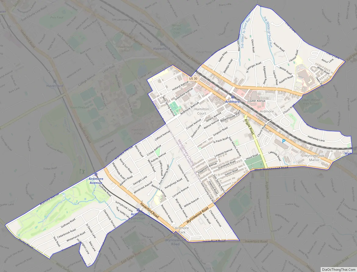
Ardmore Road Map
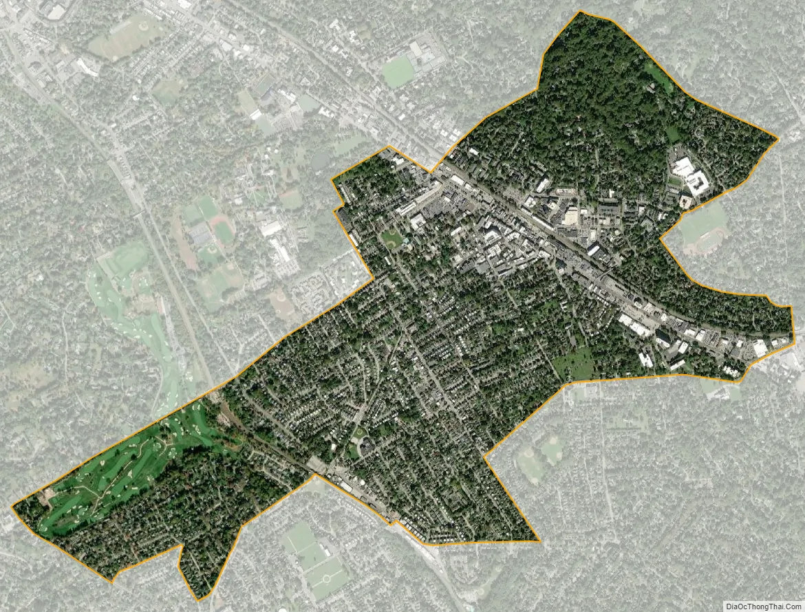
Ardmore city Satellite Map
Geography
According to the U.S. Census Bureau, Ardmore has a total area of 2.0 square miles (5.1 km), all land. Ardmore is adjacent to Wynnewood (east), Haverford (west), Gladwyne (north), and Havertown (southwest).
Ardmore’s downtown, primarily centered around Lancaster Ave, Rittenhouse Place, and Cricket Ave, is home to many shops, restaurants, and small businesses. The western end of downtown features more traditional retail establishments, including the Ardmore West and Ardmore Plaza Shopping Centers. Similarly, the eastern portion of Ardmore along Lancaster Ave is home to several car dealerships, offices, and apartments, as well as the Wynnewood Plaza Shopping Center. Suburban Square, opened in 1928 as one of the earliest shopping centers in the United States, is located just north of the Ardmore train station. Ardmore contained the nation’s first suburban branch of a major department store, the former Strawbridge & Clothier which opened there in 1930; the former Suburban movie theater—now Not Your Average Joe’s Restaurant; the newly relocated Ardmore Farmer’s Market; an Apple Store, and the usual selection of mall shops.
The Merion Golf Manor neighborhood, named for the adjacent Merion Golf Club, is roughly bounded by Ardmore Avenue to the north, Darby Road to the West, Hathaway Lane to the South, and the Norristown High Speed Line to the East. Another neighborhood in the Haverford Township portion of town is Ardmore Park, roughly bounded by Haverford Road to the South, Ardmore Avenue to the west, and County Line Road to the North. While originally developed and marketed as Ardmore Park, today it is more commonly referred to today as South Ardmore (not to be confused with a separate housing development of the same name located in nearby Havertown). This neighborhood is home to Normandy Park, Chestnutwold Elementary, and businesses along Haverford Road and County Line Road.
Residents from portions of southeastern Ardmore and Wynnewood cooperate as the ArdWood Civic Association. The Ardmore Progressive Civic Association serves the historically black section of Ardmore bordered by ArdWood Civic Association, Haverford College, Montgomery Avenue, and the Montgomery/Delaware County line. The North Ardmore Civic Association represents residents of North Ardmore and Wynnewood north of Montgomery Avenue. The South Ardmore Betterment Alliance is a community group in the Haverford Township portion of Ardmore which organizes various community activities.
There are several recreation areas, including Linwood Park, Normandy Park, the Ardmore Ice Skating Club, and Vernon V. Young Memorial Park (home to the Ardmore Ave Pool and the community center known as “The Shack”). South Ardmore Park is located in neighboring Wynnewood, and Merwood Park and Elwell Field are both adjacent to Ardmore. The Ardmore Post Office and Ardmore Public Library (part of the Lower Merion Library System) are both found on Ardmore Ave, and the Merion Fire Company of Ardmore is located nearby on Greenfield Ave.
Two sites, located in the Haverford Township section of Ardmore, the Merion Golf Club East Course and Pont Reading are listed on the National Register of Historic Places.
See also
Map of Pennsylvania State and its subdivision:- Adams
- Allegheny
- Armstrong
- Beaver
- Bedford
- Berks
- Blair
- Bradford
- Bucks
- Butler
- Cambria
- Cameron
- Carbon
- Centre
- Chester
- Clarion
- Clearfield
- Clinton
- Columbia
- Crawford
- Cumberland
- Dauphin
- Delaware
- Elk
- Erie
- Fayette
- Forest
- Franklin
- Fulton
- Greene
- Huntingdon
- Indiana
- Jefferson
- Juniata
- Lackawanna
- Lancaster
- Lawrence
- Lebanon
- Lehigh
- Luzerne
- Lycoming
- Mc Kean
- Mercer
- Mifflin
- Monroe
- Montgomery
- Montour
- Northampton
- Northumberland
- Perry
- Philadelphia
- Pike
- Potter
- Schuylkill
- Snyder
- Somerset
- Sullivan
- Susquehanna
- Tioga
- Union
- Venango
- Warren
- Washington
- Wayne
- Westmoreland
- Wyoming
- York
- Alabama
- Alaska
- Arizona
- Arkansas
- California
- Colorado
- Connecticut
- Delaware
- District of Columbia
- Florida
- Georgia
- Hawaii
- Idaho
- Illinois
- Indiana
- Iowa
- Kansas
- Kentucky
- Louisiana
- Maine
- Maryland
- Massachusetts
- Michigan
- Minnesota
- Mississippi
- Missouri
- Montana
- Nebraska
- Nevada
- New Hampshire
- New Jersey
- New Mexico
- New York
- North Carolina
- North Dakota
- Ohio
- Oklahoma
- Oregon
- Pennsylvania
- Rhode Island
- South Carolina
- South Dakota
- Tennessee
- Texas
- Utah
- Vermont
- Virginia
- Washington
- West Virginia
- Wisconsin
- Wyoming


