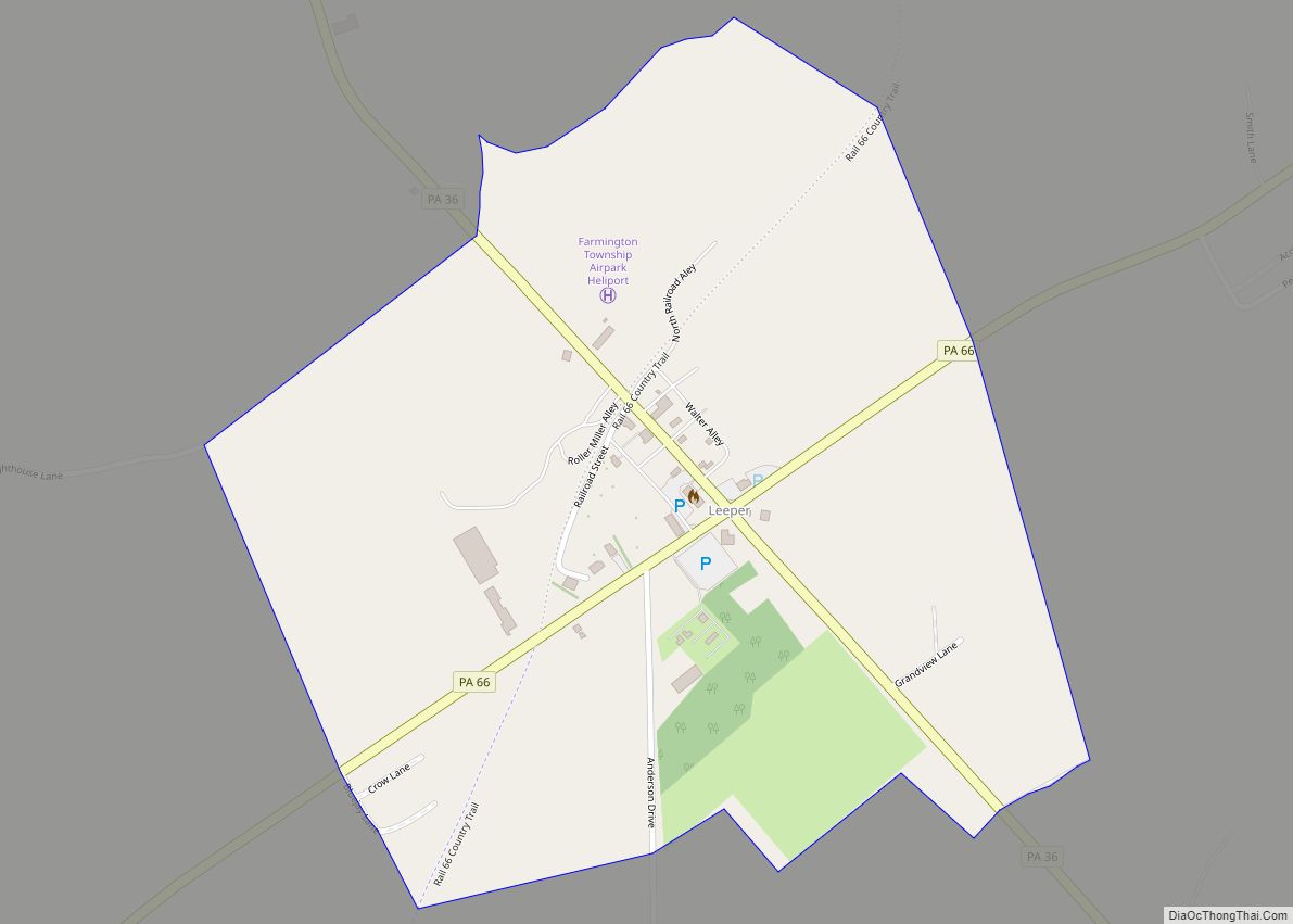
Leeper is a census-designated place (CDP) located in Farmington Township, Clarion County, in the U.S. state of Pennsylvania. The community is located at the intersections of Pennsylvania Routes 66 and 36 in northern Clarion County. As of the 2010 census the population was 158. Leeper CDP overview: Name: Leeper CDP LSAD Code: 57 LSAD Description: ... Read more
Pennsylvania Cities and Places
Leechburg is a borough in southern Armstrong County in the U.S. state of Pennsylvania, 35 miles (56 km) northeast of Pittsburgh. A population of 2,149 residents live within the borough limits as of the 2020 census, according to US Census Bureau. Leechburg was founded by David Leech, for whom it was named, and was incorporated as ... Read more
Lebanon (/ˈlɛbənən/) is a city in and the county seat of Lebanon County, Pennsylvania, United States. The population was 26,814 at the 2020 census. Lebanon was founded by George Steitz in 1740 and was originally named Steitztown. Lebanon is located 61 miles (98 km) southwest of Allentown, 26 miles (42 km) east of Harrisburg, and 88 miles ... Read more
Lebanon South is an unincorporated area and census-designated place (CDP) in Lebanon County, Pennsylvania, United States. The population was 2,270 at the 2010 census. Lebanon South CDP overview: Name: Lebanon South CDP LSAD Code: 57 LSAD Description: CDP (suffix) State: Pennsylvania County: Lebanon County Elevation: 510 ft (160 m) Total Area: 0.79 sq mi (2.04 km²) Land Area: 0.79 sq mi (2.04 km²) ... Read more
Le Raysville is a borough in Bradford County, Pennsylvania, United States. It is part of Northeastern Pennsylvania. The population was 290 at the 2020 census. Le Raysville borough overview: Name: Le Raysville borough LSAD Code: 21 LSAD Description: borough (suffix) State: Pennsylvania County: Bradford County Incorporated: 1863 Elevation: 1,572 ft (479 m) Total Area: 1.04 sq mi (2.71 km²) Land ... Read more
Lawson Heights is a census-designated place (CDP) in Unity Township, Westmoreland County, Pennsylvania, United States. The population was 2,339 at the 2000 census. Lawson Heights CDP overview: Name: Lawson Heights CDP LSAD Code: 57 LSAD Description: CDP (suffix) State: Pennsylvania County: Westmoreland County Total Area: 1.53 sq mi (3.96 km²) Land Area: 1.53 sq mi (3.96 km²) Water Area: 0.00 sq mi (0.00 km²) ... Read more
Lawrenceville is a borough in Tioga County, Pennsylvania. The population was 690 at the 2020 census. Lawrenceville borough overview: Name: Lawrenceville borough LSAD Code: 21 LSAD Description: borough (suffix) State: Pennsylvania County: Tioga County Elevation: 997 ft (304 m) Total Area: 0.61 sq mi (1.59 km²) Land Area: 0.61 sq mi (1.59 km²) Water Area: 0.00 sq mi (0.00 km²) Total Population: 691 Population Density: 1,123.58/sq mi ... Read more
Lawrence is a census-designated place located in Cecil Township, Washington County in the state of Pennsylvania. The community is a Pittsburgh suburb located in northern Washington County near the Allegheny County line. As of the 2010 census the population was 540 residents. Lawrence CDP overview: Name: Lawrence CDP LSAD Code: 57 LSAD Description: CDP (suffix) ... Read more
Lenape Heights is a census-designated place (CDP) in Armstrong County, Pennsylvania, United States. The population was 1,167 at the 2010 census. Lenape Heights CDP overview: Name: Lenape Heights CDP LSAD Code: 57 LSAD Description: CDP (suffix) State: Pennsylvania County: Armstrong County Total Area: 0.76 sq mi (1.98 km²) Land Area: 0.76 sq mi (1.98 km²) Water Area: 0.00 sq mi (0.00 km²) Total Population: ... Read more
Lemoyne is a borough in Cumberland County, Pennsylvania, United States, which lies across the Susquehanna River from Harrisburg, Pennsylvania’s capital. It is part of the Harrisburg–Carlisle metropolitan statistical area. Lemoyne was incorporated as a borough on May 23, 1905. As of the 2010 census, the borough population was 4,553. Lemoyne is served by Interstate 83 ... Read more
Lemont is an unincorporated community and census-designated place (CDP) in Centre County, Pennsylvania, United States, and is the location of the only remaining granary in Pennsylvania. It is part of the State College, Pennsylvania Metropolitan Statistical Area. The population was 2,270 at the 2010 census. Lemont CDP overview: Name: Lemont CDP LSAD Code: 57 LSAD ... Read more
Lemont Furnace is an unincorporated community and census-designated place in North Union Township, Fayette County, Pennsylvania, United States. It is located 3 miles (5 km) northeast of the city of Uniontown and approximately 60 miles (97 km) southeast of Pittsburgh. The community is part of the Pittsburgh metropolitan area. At the 2010 census, the population of Lemont ... Read more