Map of Marianna borough, Pennsylvania
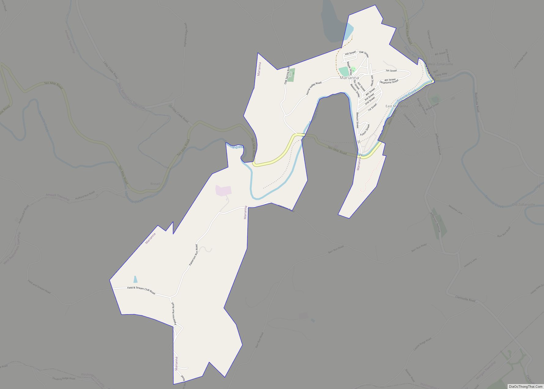
Marianna is a borough in Washington County, Pennsylvania, United States. The population was 396 at the 2020 census. Marianna borough overview: Name: Marianna borough LSAD Code: 21 LSAD Description: borough (suffix) State: Pennsylvania County: Washington County Total Area: 1.96 sq mi (5.07 km²) Land Area: 1.96 sq mi (5.07 km²) Water Area: 0.00 sq mi (0.00 km²) Total Population: 399 Population Density: 203.99/sq mi (78.74/km²) ... Read more
Map of Marianna borough, Pennsylvania
Map of Marcus Hook borough
Marcus Hook is a borough in Delaware County, Pennsylvania, United States. The population was 2,397 at the 2010 census. The current mayor is Gene Taylor. The borough calls itself “The Cornerstone of Pennsylvania”. The 2005 film One Last Thing… was set and partially filmed in Marcus Hook. Marcus Hook borough overview: Name: Marcus Hook borough ... Read more
Map of Marcus Hook borough
Map of Mapletown CDP
Mapletown is an unincorporated community and census-designated place in Monongahela Township, Greene County, Pennsylvania, United States. It is located 1 mile (1.6 km) west of the Monongahela River in southeastern Greene County. As of the 2010 census, the population was 130. Mapletown CDP overview: Name: Mapletown CDP LSAD Code: 57 LSAD Description: CDP (suffix) State: Pennsylvania ... Read more
Map of Mapletown CDP
Map of Mapleton borough, Pennsylvania
Mapleton is a borough in Huntingdon County, Pennsylvania, United States. The population was 441 at the 2010 census. It is located on the Juniata River, which is a tributary of the Susquehanna River. Mapleton borough overview: Name: Mapleton borough LSAD Code: 21 LSAD Description: borough (suffix) State: Pennsylvania County: Huntingdon County Elevation: 604 ft (184 m) Total ... Read more
Map of Mapleton borough, Pennsylvania
Map of Marklesburg borough
Marklesburg is a borough in Huntingdon County, Pennsylvania, United States. The population was 204 at the 2010 census. Marklesburg borough overview: Name: Marklesburg borough LSAD Code: 21 LSAD Description: borough (suffix) State: Pennsylvania County: Huntingdon County Elevation: 899 ft (274 m) Total Area: 1.05 sq mi (2.72 km²) Land Area: 1.04 sq mi (2.68 km²) Water Area: 0.01 sq mi (0.04 km²) Total Population: 200 Population ... Read more
Map of Marklesburg borough
Map of Masthope CDP
Masthope Mountain Community is a census-designated place located in Lackawaxen Township, Pike County in the state of Pennsylvania. The community is located in far northeastern Pike County near the New York border. As of the 2010 census the population was 685. Masthope is a name derived from a Native American language purported to mean “beads ... Read more
Map of Masthope CDP
Map of Masontown borough, Pennsylvania
Masontown is a borough in Fayette County, Pennsylvania, United States. It is part of the Pittsburgh Metro Area. The population of the borough was 3,274 at the 2020 census. It is served by the Albert Gallatin Area School District. Masontown is a small crossroads for the rural portions of western Fayette County, and it contains ... Read more
Map of Masontown borough, Pennsylvania
Map of Marysville borough, Pennsylvania
Marysville is a borough in Perry County, Pennsylvania, United States. The population was 2,652 at the 2020 census. It is part of the Harrisburg–Carlisle Metropolitan Statistical Area. The borough was settled in 1755, incorporated as the Borough of Haley in 1866, and re-incorporated as the Borough of Marysville in 1867. Marysville borough overview: Name: Marysville ... Read more
Map of Marysville borough, Pennsylvania
Map of Martinsburg borough, Pennsylvania
Martinsburg is a borough in the Morrisons Cove section of Blair County, Pennsylvania, United States. The population was 1,874 at the 2020 census. It is part of the Altoona, PA Metropolitan Statistical Area. Martinsburg borough overview: Name: Martinsburg borough LSAD Code: 21 LSAD Description: borough (suffix) State: Pennsylvania County: Blair County Incorporated: 1832 Elevation: 1,404 ft ... Read more
Map of Martinsburg borough, Pennsylvania
Map of Martins Creek CDP
Martins Creek is a census-designated place in Lower Mt. Bethel Township, Pennsylvania. It is located along Martins Creek. Its population was 664 as of the 2020 U.S. census. Martins Creek is part of the Lehigh Valley metropolitan area, which had a population of 861,899 and was the 68th-most populous metropolitan area in the U.S. as ... Read more
Map of Martins Creek CDP
Map of Marshallton CDP
Marshallton is a census-designated place (CDP), located in Coal Township, in Northumberland County, Pennsylvania, United States. The population was 1,441 at the 2010 census. Marshallton CDP overview: Name: Marshallton CDP LSAD Code: 57 LSAD Description: CDP (suffix) State: Pennsylvania County: Northumberland County Total Area: 0.9 sq mi (2.3 km²) Land Area: 0.9 sq mi (2.3 km²) Total Population: 1,441 Population Density: ... Read more
Map of Marshallton CDP
Map of Mars borough
Mars is a borough in southern Butler County, Pennsylvania, United States. The population was 1,458 at the 2020 census. It is part of the Pittsburgh metropolitan area. Mars borough overview: Name: Mars borough LSAD Code: 21 LSAD Description: borough (suffix) State: Pennsylvania County: Butler County Incorporated: 1882; 141 years ago (1882) Total Area: 0.47 sq mi (1.22 km²) Land Area: ... Read more
Map of Mars borough