Marcus Hook is a borough in Delaware County, Pennsylvania, United States. The population was 2,397 at the 2010 census. The current mayor is Gene Taylor. The borough calls itself “The Cornerstone of Pennsylvania”. The 2005 film One Last Thing… was set and partially filmed in Marcus Hook.
| Name: | Marcus Hook borough |
|---|---|
| LSAD Code: | 21 |
| LSAD Description: | borough (suffix) |
| State: | Pennsylvania |
| County: | Delaware County |
| Elevation: | 30 ft (9 m) |
| Total Area: | 1.62 sq mi (4.21 km²) |
| Land Area: | 1.11 sq mi (2.87 km²) |
| Water Area: | 0.52 sq mi (1.34 km²) |
| Total Population: | 2,454 |
| Population Density: | 2,214.80/sq mi (854.89/km²) |
| ZIP code: | 19061 |
| FIPS code: | 4247344 |
| Website: | www.marcushookboro.org |
Online Interactive Map
Click on ![]() to view map in "full screen" mode.
to view map in "full screen" mode.
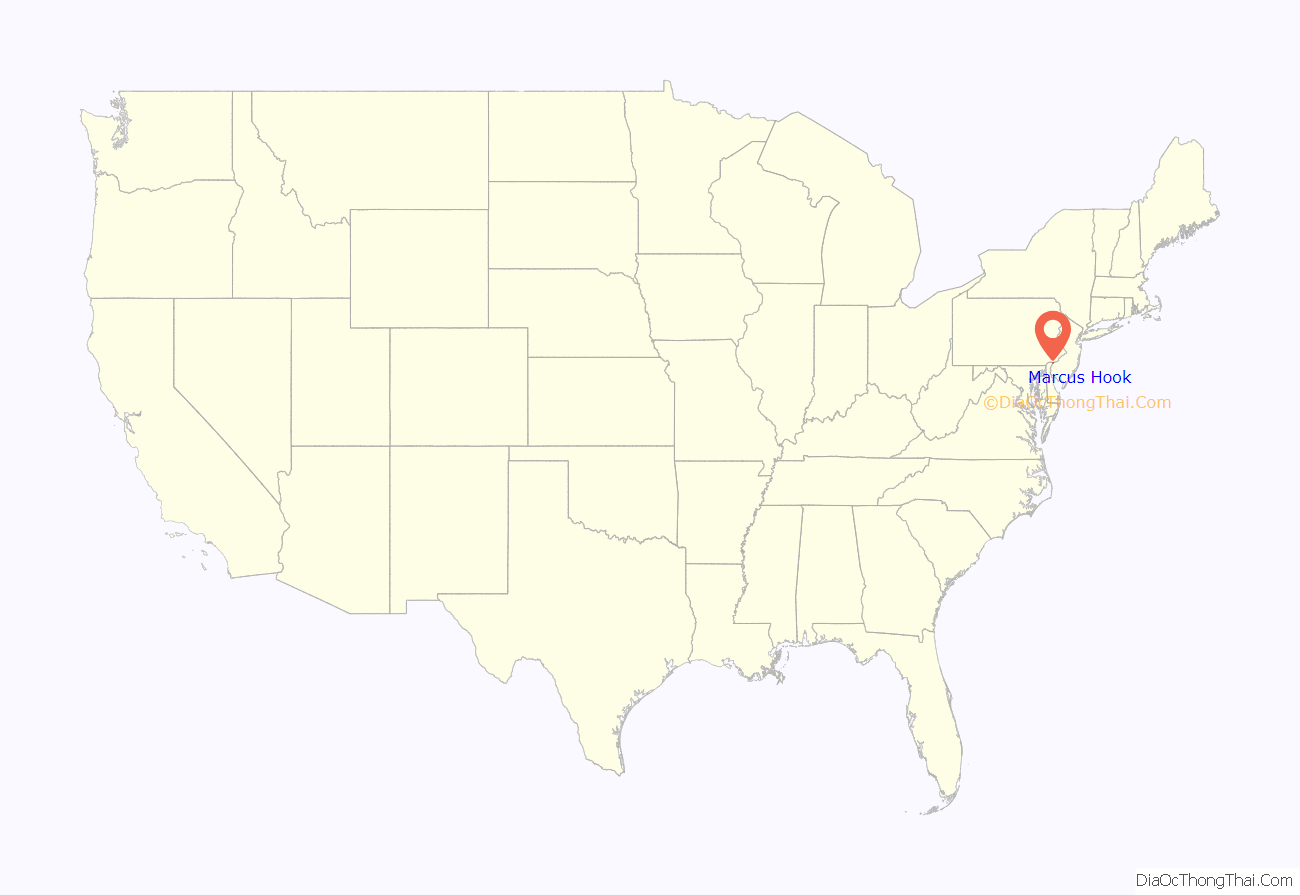
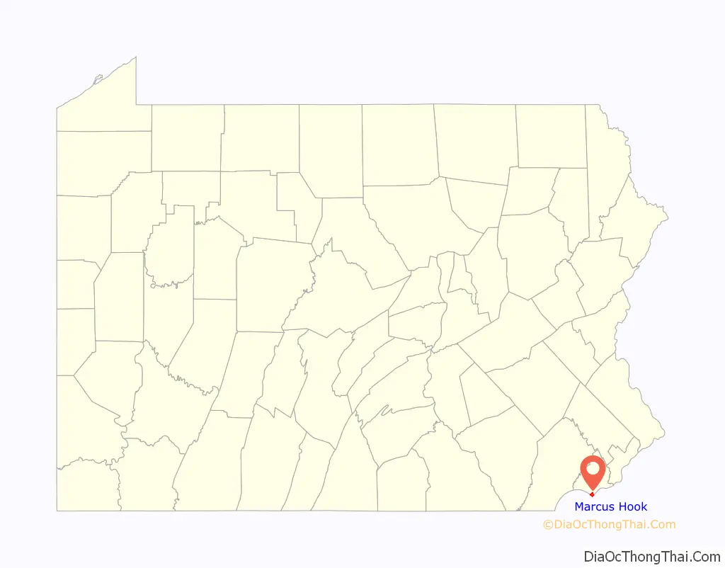
Marcus Hook location map. Where is Marcus Hook borough?
History
Pre-settlement
The earliest inhabitants of Marcus Hook were the Lenape Indians and their indigenous ancestors, whose succeeding cultures had occupied this area for thousands of years.
17th century
The Lenape had a major settlement in Marcus Hook; New Sweden colonists established a trading post here in the 1640s. The village was called Chammassungh, or “Finland” by the Swedes. It was located on the west side of the Delaware River, between Marcus Hook Creek and Naamans Creek. Dutch colonists renamed the settlement as “Marrites Hoeck” after they conquered the area in 1655. The name is derived from the word Hook, meaning promontory, or point of land projecting into the water and Marcus, a corruption of the name of the Indian chief, called Maarte by the Dutch, who lived at the Hook.
English colonists gained control of the Dutch colonies and founded St. Martin’s Church in 1699; the new church opened for worship in 1702. Walter Martin of Upper Chichester founded this church as an alternative place of worship and burial for Christian non-Quakers.
18th century
Marcus Hook became a prosperous community and market town and in 1708 was of equal prominence to nearby Chester, Pennsylvania, with each location having approximately 100 houses.
In the early 1700s, Marcus Hook was a haven for pirates who plagued the lower Delaware River. The market at Marcus Hook provided the pirates a place to sell plundered goods and re-supply away from the authorities and custom officials in Philadelphia. Early maps of Marcus Hook show the current Second Street was originally named “Discord Lane”, since it was the location of the pirates’ revelry when they were in town.
According to a local oral tradition, Marcus Hook Plank House was once the home of the mistress of the pirate Blackbeard.
By the mid-1700s, Marcus Hook became a major regional center for the building of wooden sailing ships and remained so until the late 19th century. By that time, larger tonnage ships became more popular than the sloops and schooners built in Marcus Hook.
During the American Revolutionary War, two tiers of underwater chevaux-de-frise obstacles were placed across the Delaware River at Marcus Hook to provide a first line of defense of Philadelphia against British naval forces. Marcus Hook also served as a training center for the Pennsylvania militia. The Continental Army was stationed at Marcus Hook during the fall of 1777. As the town was bombarded by British warships, there are very few pre-Revolutionary houses in Marcus Hook.
19th century
Marcus Hook served as a defensive post along the Delaware River during the War of 1812, with over 5,000 United States troops placed there.
The borough was officially incorporated on March 7, 1892. The convergence of rail, roads, a deep water port, and the nation’s growing thirst for petroleum gave rise to the refineries that became the borough’s dominant industry.
20th century
The Sun Oil Company opened the Marcus Hook refinery in 1901 to refine crude oil brought by ship from Texas. It was the first of seven major refineries that made up the largest fuel-manufacturing center in the Northeast. The refinery was closed in 2011 due to deteriorating market conditions. The refinery was reopened as the Trainer Refinery by Monroe Energy in 2012, a subsidiary of Delta Air Lines, and was optimized to produce mainly jet fuel for Delta.
In 1910, the American Viscose Corporation opened a plant in Marcus Hook for the production of rayon and other synthetic fibers.
On February 4, 1932, the MS Bidwell, a motor tanker belonging to Sun Oil, exploded and burned at the Sinclair Dock while tanks were being cleaned of residual crude oil in preparation for loading of gasoline. The first explosion occurred at 12:20 am and was followed by three more explosions within 25 minutes, resulting in 17 or 18 dead, including the entire crew and captain, and four were injured. The disaster induced Sun Oil to develop cargo tank inerting and install it on all their ships beginning the following year, in 1933.
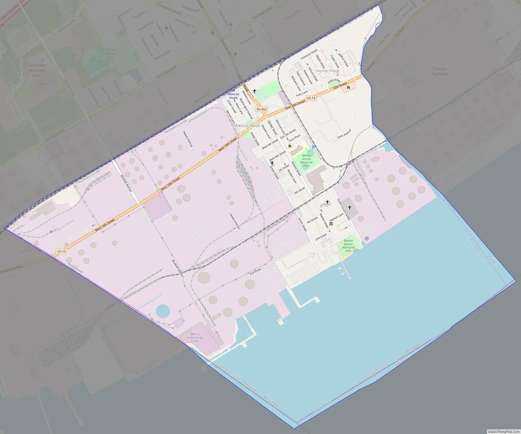
Marcus Hook Road Map
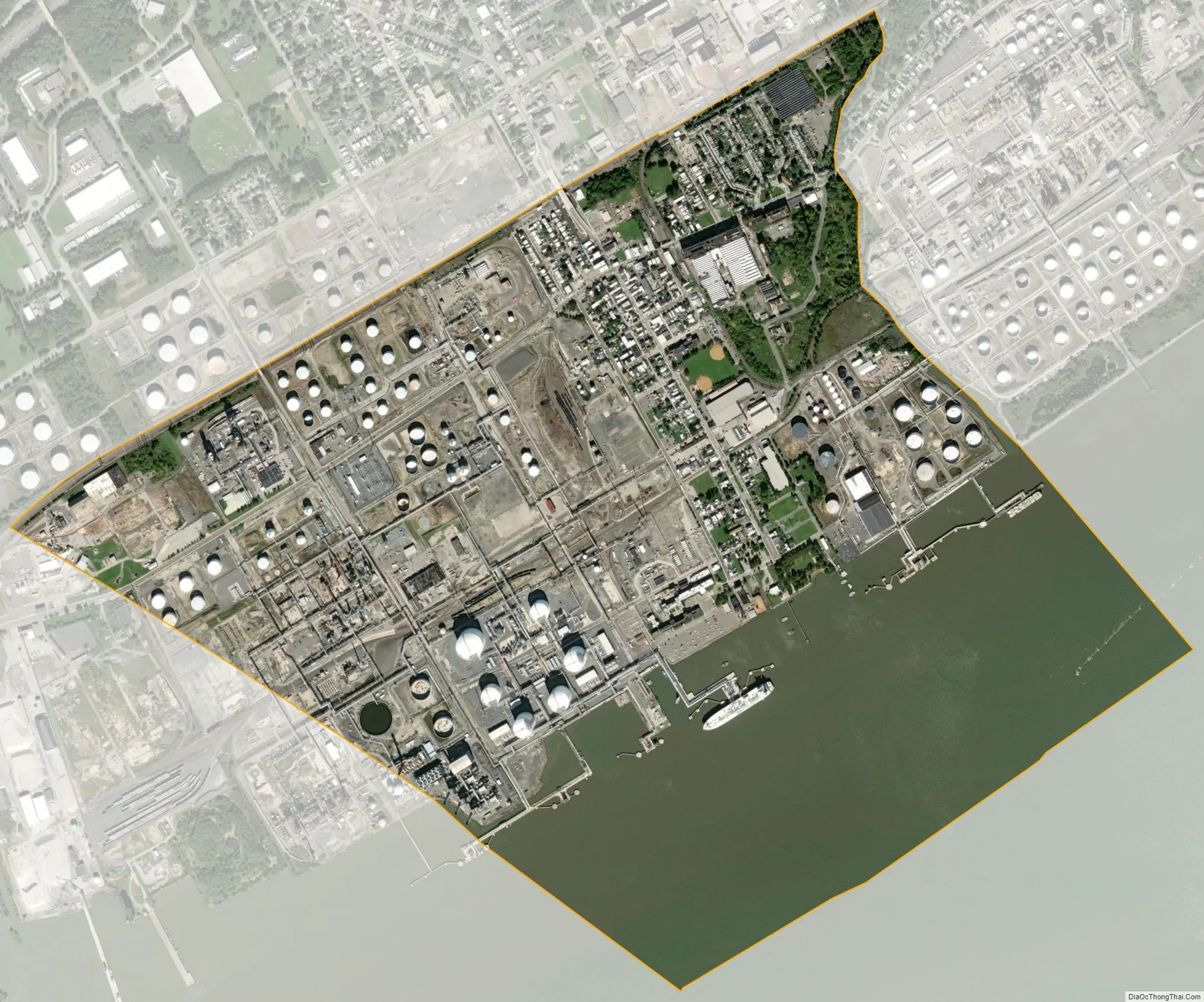
Marcus Hook city Satellite Map
Geography
Marcus Hook is located along the southern border of Delaware County (and Pennsylvania) at 39°49′N 75°25′W / 39.817°N 75.417°W / 39.817; -75.417 (39.8182, -75.4155). It is bordered to the northwest by Lower Chichester Township, including the community of Linwood, to the northeast by the borough of Trainer, to the southeast across the Delaware River by Gloucester County, New Jersey, and to the southwest by New Castle County, Delaware. The southern border of Marcus Hook is part of the Twelve-Mile Circle border between Pennsylvania and Delaware.
According to the U.S, Census Bureau, Marcus Hook has a total area of 1.6 square miles (4.2 km), of which 1.1 square miles (2.9 km) is land and 0.50 square miles (1.3 km), or 31.63%, is water. The lowest point in the state of Pennsylvania is located on the Delaware River in Marcus Hook, where it flows out of Pennsylvania and into Delaware. The borough has a humid subtropical climate (Cfa) and average monthly temperatures range from 33.1° F in January to 77.9° F in July. The hardiness zone is 7b.
See also
Map of Pennsylvania State and its subdivision:- Adams
- Allegheny
- Armstrong
- Beaver
- Bedford
- Berks
- Blair
- Bradford
- Bucks
- Butler
- Cambria
- Cameron
- Carbon
- Centre
- Chester
- Clarion
- Clearfield
- Clinton
- Columbia
- Crawford
- Cumberland
- Dauphin
- Delaware
- Elk
- Erie
- Fayette
- Forest
- Franklin
- Fulton
- Greene
- Huntingdon
- Indiana
- Jefferson
- Juniata
- Lackawanna
- Lancaster
- Lawrence
- Lebanon
- Lehigh
- Luzerne
- Lycoming
- Mc Kean
- Mercer
- Mifflin
- Monroe
- Montgomery
- Montour
- Northampton
- Northumberland
- Perry
- Philadelphia
- Pike
- Potter
- Schuylkill
- Snyder
- Somerset
- Sullivan
- Susquehanna
- Tioga
- Union
- Venango
- Warren
- Washington
- Wayne
- Westmoreland
- Wyoming
- York
- Alabama
- Alaska
- Arizona
- Arkansas
- California
- Colorado
- Connecticut
- Delaware
- District of Columbia
- Florida
- Georgia
- Hawaii
- Idaho
- Illinois
- Indiana
- Iowa
- Kansas
- Kentucky
- Louisiana
- Maine
- Maryland
- Massachusetts
- Michigan
- Minnesota
- Mississippi
- Missouri
- Montana
- Nebraska
- Nevada
- New Hampshire
- New Jersey
- New Mexico
- New York
- North Carolina
- North Dakota
- Ohio
- Oklahoma
- Oregon
- Pennsylvania
- Rhode Island
- South Carolina
- South Dakota
- Tennessee
- Texas
- Utah
- Vermont
- Virginia
- Washington
- West Virginia
- Wisconsin
- Wyoming


