Map of Homeland Park CDP
Homeland Park is a census-designated place (CDP) in Anderson County, South Carolina, United States. The population was 6,296 at the 2010 census. Homeland Park CDP overview: Name: Homeland Park CDP LSAD Code: 57 LSAD Description: CDP (suffix) State: South Carolina County: Anderson County Elevation: 787 ft (240 m) Total Area: 4.72 sq mi (12.22 km²) Land Area: 4.71 sq mi (12.20 km²) Water ... Read more
Map of Homeland Park CDP
Map of Isle of Palms city
Isle of Palms is a city in Charleston County, South Carolina, United States. At the 2010 census, the population was 4,133. Isle of Palms is a barrier island on the South Carolina coast. The city is included within the Charleston-North Charleston-Summerville metropolitan area and the Charleston-North Charleston Urbanized Area. The town lies along a narrow ... Read more
Map of Isle of Palms city
Map of Islandton CDP
Islandton is an unincorporated community and census-designated place in Colleton County, South Carolina, United States. As of the 2010 census, its population was 70. South Carolina Highway 63 passes through the community, leading east 17 miles (27 km) to Walterboro, the county seat, and southwest 10 miles (16 km) to Varnville. Islandton has a post office with ... Read more
Map of Islandton CDP
Map of Irwin CDP, South Carolina
Irwin is an unincorporated community and census-designated place (CDP) in Lancaster County, South Carolina, United States. The population was 1,405 at the 2010 census. Irwin is known for its small mill homes. This was a thriving community in Lancaster County when the Springs Industries was a thriving business from 1950 to 2002. Irwin CDP overview: ... Read more
Map of Irwin CDP, South Carolina
Map of Irmo town
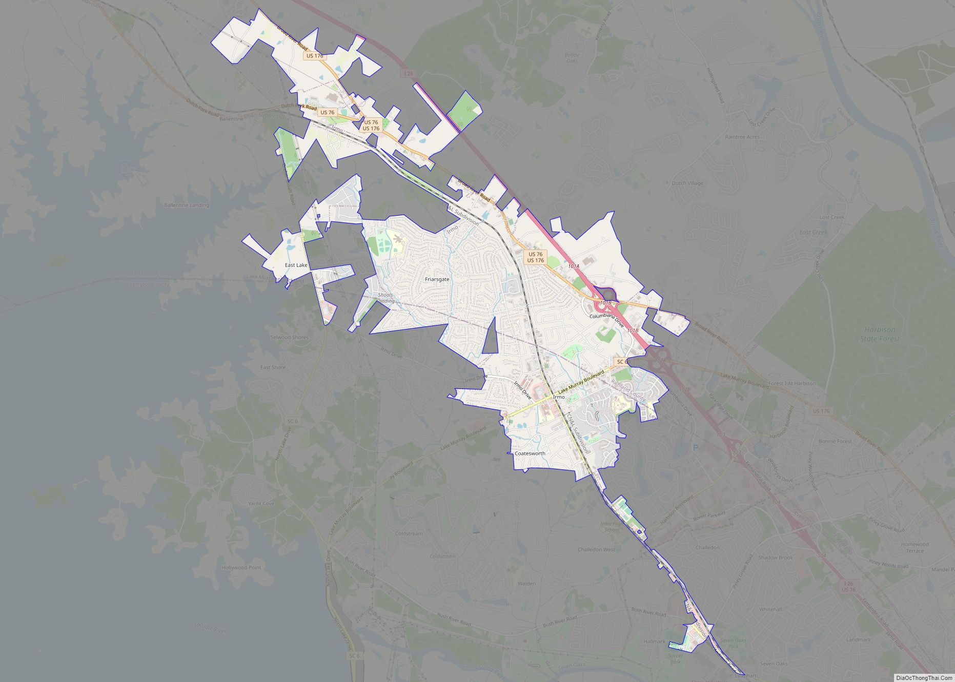
Irmo (/ˈərmoʊ/) is a town in Lexington and Richland counties, South Carolina, United States and a suburb of Columbia. It is part of the Columbia Metropolitan Statistical Area and is located 12 miles (19 km) northwest of the city center. The population of Irmo was 11,097 at the 2010 census. Irmo town overview: Name: Irmo town ... Read more
Map of Irmo town
Map of Inman city, South Carolina
Inman is a city in Spartanburg County, South Carolina, United States. The population was 3,665 at the 2020 census, and 2,321 at the 2010 census. Greater Inman is close to the Spartanburg–Greenville–Anderson metroplex. Inman residents have access to nearby Lake Bowen that affords water recreational sports and fishing, and Inman is accessible by Interstate 26 ... Read more
Map of Inman city, South Carolina
Map of Inman Mills CDP
Inman Mills is a census-designated place (CDP) in Spartanburg County, South Carolina, United States. The population was 1,050 at the 2010 census. Inman Mills CDP overview: Name: Inman Mills CDP LSAD Code: 57 LSAD Description: CDP (suffix) State: South Carolina County: Spartanburg County Elevation: 919 ft (280 m) Total Area: 1.08 sq mi (2.80 km²) Land Area: 1.08 sq mi (2.80 km²) Water ... Read more
Map of Inman Mills CDP
Map of India Hook CDP
India Hook is a census-designated place (CDP) in York County, South Carolina, United States. The majority of India Hook is annexed into the city of Rock Hill, but as of 2010 India Hook is still considered to be a CDP. It is one of the three communities located on Lake Wylie. The population was 2,051 ... Read more
Map of India Hook CDP
Map of Hopkins CDP, South Carolina
Hopkins is a census-designated place (CDP) in Richland County, South Carolina, United States, that was founded circa 1836 and named after John Hopkins(1739-1775). It is located 11 miles (18 km) southeast of downtown Columbia and is part of the Columbia Metropolitan Statistical Area. As of the 2010 census, the population of the Hopkins CDP was 2,882. ... Read more
Map of Hopkins CDP, South Carolina
Map of Joanna CDP
Joanna is an unincorporated community and census-designated place (CDP) in Laurens County, South Carolina, United States. The population was 1,539 at the 2010 census, down from 1,609 at the 2000 census. It is part of the Greenville–Mauldin–Easley Metropolitan Statistical Area. Joanna CDP overview: Name: Joanna CDP LSAD Code: 57 LSAD Description: CDP (suffix) State: South ... Read more
Map of Joanna CDP
Map of Jenkinsville town
Jenkinsville is an incorporated town in western Fairfield County, South Carolina, United States, between the Broad and the Little rivers. It is located east of Monticello Reservoir and is near the Virgil C. Summer Nuclear Generating Station. Also in the area is the Kincaid-Anderson House and quarry. The town was incorporated in 2008. Jenkinsville’s population ... Read more
Map of Jenkinsville town
Map of Jefferson town, South Carolina
Jefferson is a town in western Chesterfield County, South Carolina, United States at the junction of SC routes 265 and 151. Jefferson is located in the Piedmont region of South Carolina just in the edge meeting the Sandhills region. Jefferson is located 16 miles northwest of McBee, 8 miles south of Pageland, 50 miles southeast ... Read more
Map of Jefferson town, South Carolina