Map of Jonesville town, South Carolina

Map of Jonesville town, South Carolina

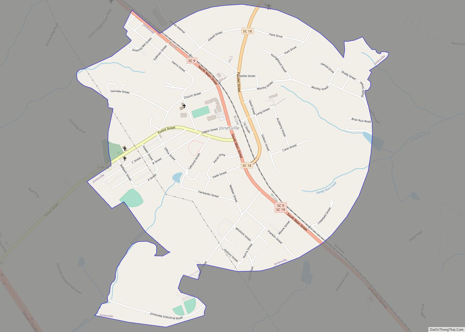
Jonesville is a town in Union County, South Carolina, United States. The population was 911 at the 2010 United States Census. Jonesville town overview: Name: Jonesville town LSAD Code: 43 LSAD Description: town (suffix) State: South Carolina County: Union County Elevation: 686 ft (209 m) Total Area: 1.02 sq mi (2.65 km²) Land Area: 1.01 sq mi (2.63 km²) Water Area: 0.01 sq mi (0.02 km²) … Read more

Map of Lake Secession CDP

Map of Lake Secession CDP

Lake Secession is a census-designated place (CDP) in Abbeville County, South Carolina, United States located near a lake by the same name. The population was 1,083 at the 2010 census. Lake Secession CDP overview: Name: Lake Secession CDP LSAD Code: 57 LSAD Description: CDP (suffix) State: South Carolina County: Abbeville County Elevation: 558 ft (170 m) Total … Read more

Map of Lake Murray of Richland CDP

Map of Lake Murray of Richland CDP

Lake Murray of Richland is a census-designated place (CDP) in Richland County, South Carolina, United States. The population was 5,484 at the 2010 census. It is part of the Columbia, South Carolina Metropolitan Statistical Area. Lake Murray of Richland CDP overview: Name: Lake Murray of Richland CDP LSAD Code: 57 LSAD Description: CDP (suffix) State: … Read more

Map of Lake City, South Carolina

Map of Lake City, South Carolina

Lake City is a city in Florence County, South Carolina, United States. The population was 6,675 at the 2010 census. Located in central South Carolina, it is south of Florence and included as part of the Florence Metropolitan Statistical Area. Lake City overview: Name: Lake City LSAD Code: 25 LSAD Description: city (suffix) State: South … Read more

Map of Ladson CDP

Map of Ladson CDP

Ladson is a census-designated place (CDP) in Berkeley, Charleston and Dorchester counties in the U.S. state of South Carolina. The population was 13,790 at the 2010 census. It is named in honor of the Ladson family, one of the oldest planter and merchant families in the Charleston area; one of its members was lieutenant governor … Read more

Map of Laurel Bay CDP

Map of Laurel Bay CDP

Laurel Bay is a census-designated place and military housing complex in Beaufort County, South Carolina, United States. The population was 5,891 at the 2010 census. As defined by the U.S. Census Bureau, Laurel Bay is included within the Hilton Head Island-Bluffton-Beaufort, SC Metropolitan Statistical Area. The base primarily houses military personnel with families that are … Read more

Map of Latta town, South Carolina

Map of Latta town, South Carolina

Latta is a town in Dillon County, South Carolina, United States. Latta is the second largest town in Dillon County. As of the 2010 census, it had a population of 1,379. Latta town overview: Name: Latta town LSAD Code: 43 LSAD Description: town (suffix) State: South Carolina County: Dillon County Incorporated: March 1890 Elevation: 105 ft … Read more

Map of Langley CDP, South Carolina

Map of Langley CDP, South Carolina

Langley is a census-designated place (CDP) in Aiken County, South Carolina, United States. The population was 1,447 at the 2010 census. It is bordered by Gloverville to the northeast and Burnettown to the west. Langley is part of the Augusta, Georgia metropolitan area. Langley is located in historic Horse Creek Valley. It sits next to … Read more

Map of Lane town, South Carolina

Map of Lane town, South Carolina

Lane is a town in Williamsburg County, South Carolina, United States. The population was 508 at the 2010 census. Lane is a predominately black town. Lane town overview: Name: Lane town LSAD Code: 43 LSAD Description: town (suffix) State: South Carolina County: Williamsburg County Elevation: 69 ft (21 m) Total Area: 3.95 sq mi (10.23 km²) Land Area: 3.95 sq mi (10.23 km²) … Read more

Map of Landrum city

Map of Landrum city

Landrum is a city in Spartanburg County, South Carolina, United States. The population was 2,376 at the 2010 census. Landrum was founded in 1880 and incorporated in 1912. It is located just west of Interstate 26 between Spartanburg and Asheville, North Carolina. Landrum city overview: Name: Landrum city LSAD Code: 25 LSAD Description: city (suffix) … Read more

Map of Lancaster city, South Carolina

Map of Lancaster city, South Carolina

The city of Lancaster (/ˈleɪŋkəstər/) is the county seat of Lancaster County, South Carolina, United States, located in the Charlotte Metropolitan Area. As of the United States Census of 2010, the city population was 8,526. The city was named after the famous House of Lancaster. Lancaster city overview: Name: Lancaster city LSAD Code: 25 LSAD … Read more

Map of Lamar town, South Carolina

Map of Lamar town, South Carolina

Lamar is a town in Darlington County, South Carolina, United States. The population was 989 at the 2010 census. It is part of the Florence, SC Metropolitan Statistical Area. Lamar town overview: Name: Lamar town LSAD Code: 43 LSAD Description: town (suffix) State: South Carolina County: Darlington County Elevation: 171 ft (52 m) Total Area: 1.21 sq mi (3.14 km²) … Read more