Latta is a town in Dillon County, South Carolina, United States. Latta is the second largest town in Dillon County. As of the 2010 census, it had a population of 1,379.
| Name: | Latta town |
|---|---|
| LSAD Code: | 43 |
| LSAD Description: | town (suffix) |
| State: | South Carolina |
| County: | Dillon County |
| Incorporated: | March 1890 |
| Elevation: | 105 ft (32 m) |
| Total Area: | 1.10 sq mi (2.84 km²) |
| Land Area: | 1.10 sq mi (2.84 km²) |
| Water Area: | 0.00 sq mi (0.00 km²) |
| Total Population: | 1,296 |
| Population Density: | 1,182.48/sq mi (456.66/km²) |
| ZIP code: | 29565 |
| Area code: | 843, 854 |
| FIPS code: | 4540480 |
| GNISfeature ID: | 1246298 |
| Website: | www.townoflatta.sc.gov |
Online Interactive Map
Click on ![]() to view map in "full screen" mode.
to view map in "full screen" mode.
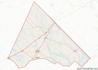
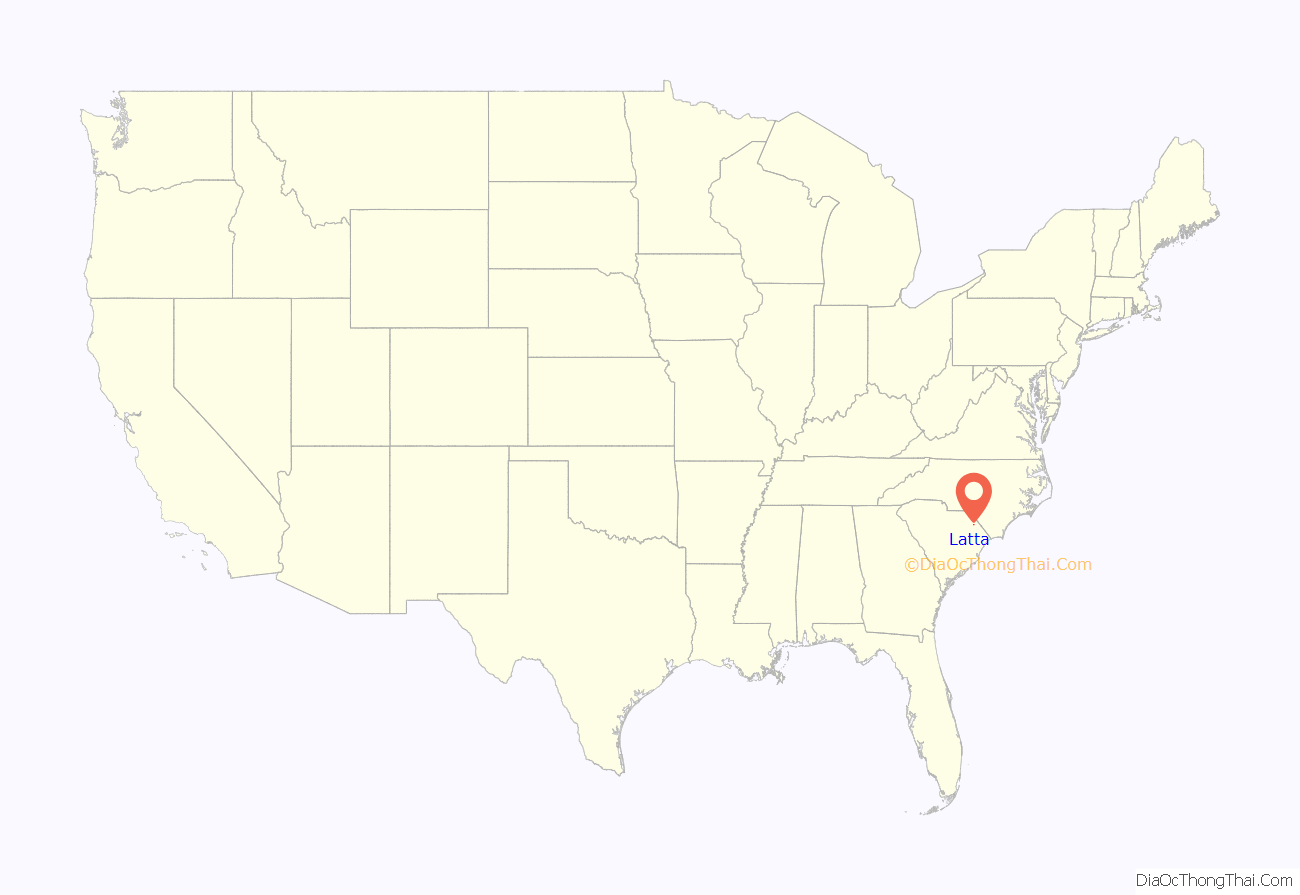
Latta location map. Where is Latta town?
History
Latta was established in 1887. The town arose from a need for a railroad, which helped to eliminate “the need to travel to Wilmington, North Carolina, in order to reach many points in South Carolina.” Thus, the Atlantic Coast Line Railroad built two depots; one in the city of Dillon and the other 7 miles (11 km) to the south in Latta. The depots were completed in 1888. Many families were drawn to this area, and in March 1890, “the town of Latta was incorporated by the state legislature and received its charter.”
The town was named for the Latta family of settlers. More specifically, it was named after Captain Robert Latta, who was from York County, South Carolina; he orchestrated the engineering for the Atlantic Coast Line Railroad. Captain Latta not only surveyed the area for the railroad, but he also constructed the original plans for the town of Latta. Because of Latta’s railroad facilities, the town grew rapidly, especially from 1900 to 1910.
Latta has an established historic district, mostly located on Main Street, and many of these structures are listed in the National Register of Historic Places. Latta has about 55 properties, constructed between ca. 1890 and ca. 1930, that are a part of the historic district. Furthermore, Latta is home to one of the 13 Carnegie public library buildings in South Carolina. The Latta library opened in 1914 and is “one of five of South Carolina’s original 14 Carnegie libraries still in use as a library.” The post office in Latta has been in operation since 1888.
In April 2014, Mayor Earl Bullard fired Police Chief Crystal Moore, allegedly because Moore is lesbian. Bullard said on the telephone, “I would much rather have — and I will say this to anybody’s face — somebody who drank and drank too much taking care of my child than I had somebody whose lifestyle is questionable around children. … I’m not going to let two women stand up there and hold hands and let my child be aware of it. And I’m not going to see them do it with two men neither.”
In June 2014, Latta residents voted in favor of changing from a “strong mayor” government to a “strong council” government, which allowed the town council to reinstate Crystal Moore as Latta’s police chief, which they did unanimously on June 28, 2014.
Registered historic sites
The following are listed on the National Register of Historic Places: Joel Allen House, Catfish Creek Baptist Church, Early Cotton Press, John Hayes Farmstead, Latta Downtown Historic District, Latta Historic District No. 1, Latta Historic District No. 2, McMillan House, and Old Ebenezer Church.
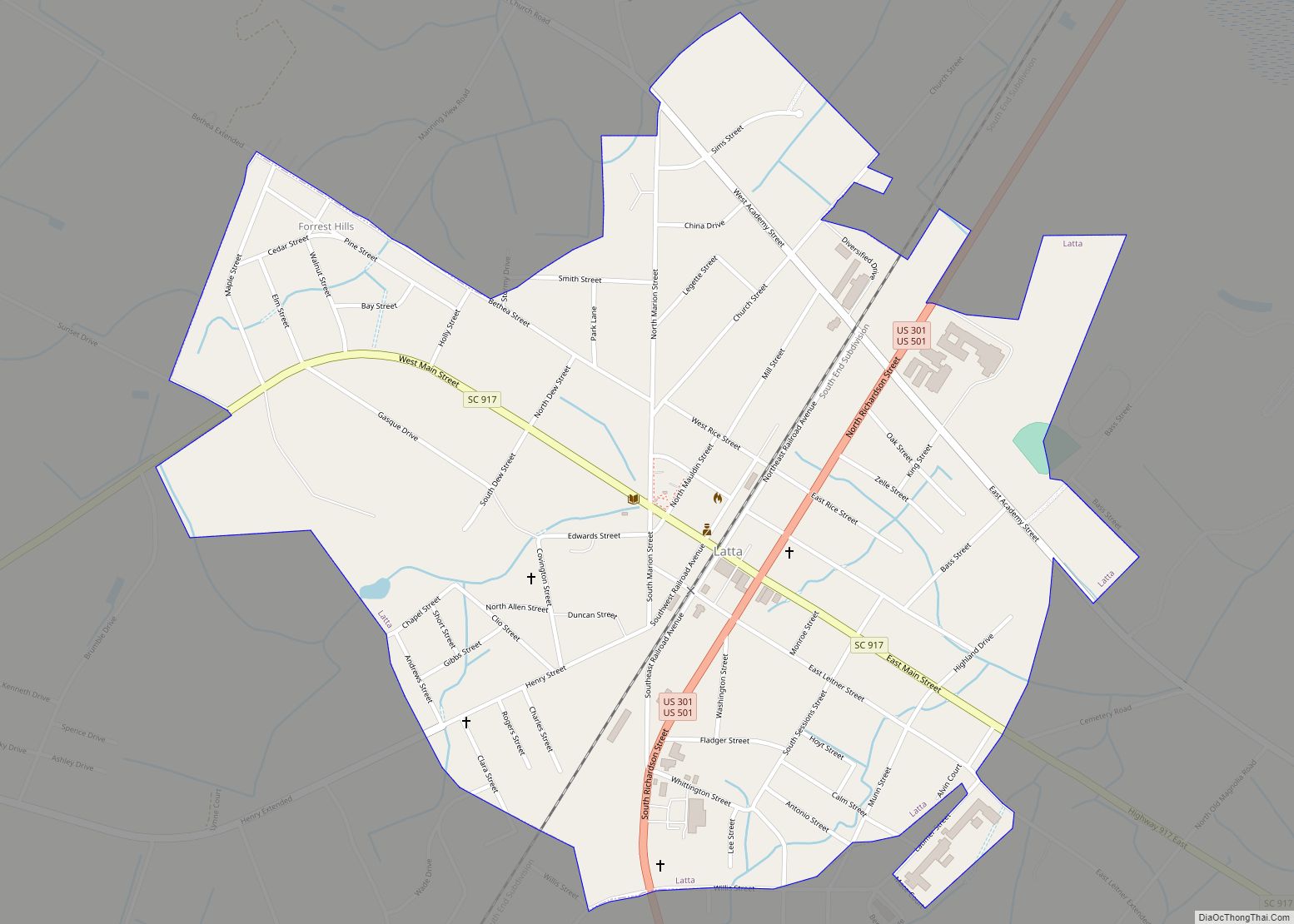
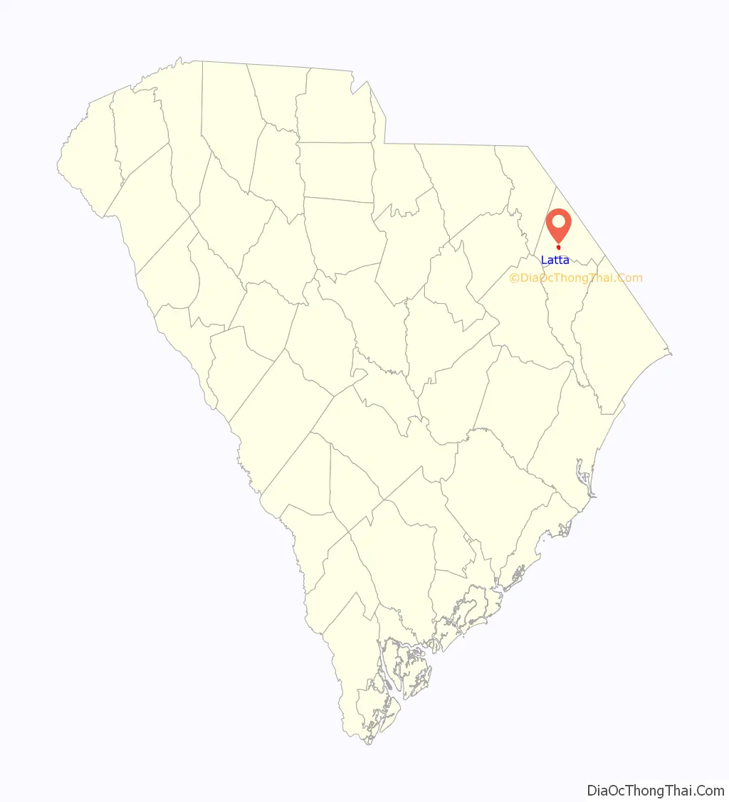
Latta Road Map
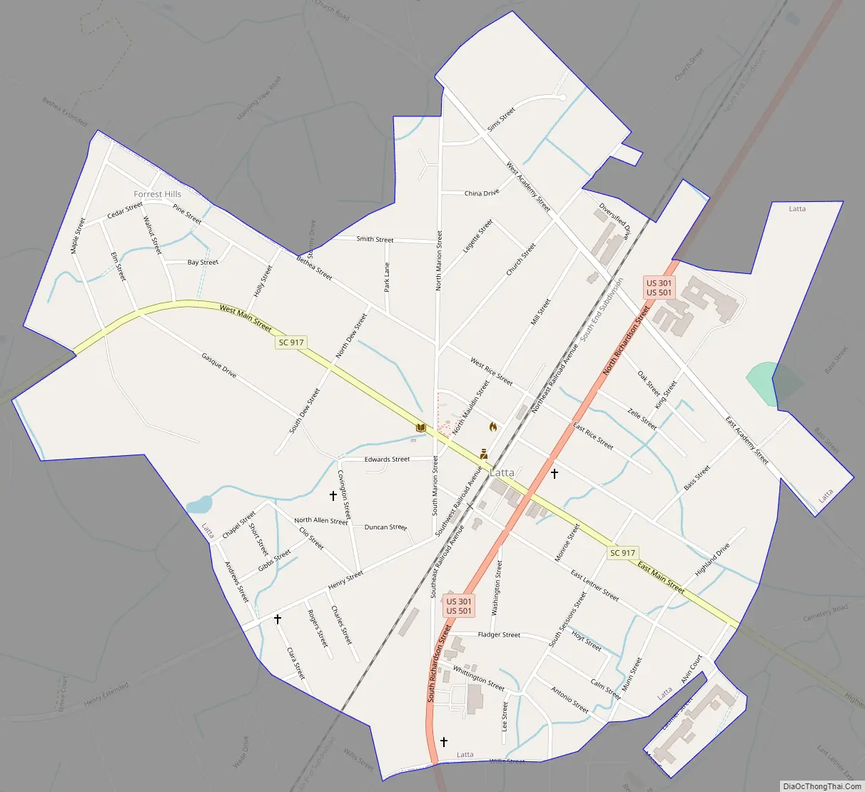
Latta city Satellite Map

Geography
Latta is located in southern Dillon County at 34°20′18″N 79°25′59″W / 34.33833°N 79.43306°W / 34.33833; -79.43306 (34.338459, -79.432997). U.S. Routes 301 and 501 pass through the center of town as Second Avenue, leading northeast 6 miles (10 km) to Dillon, the county seat. US 501 leads south 12 miles (19 km) to Marion, while US 301 diverges from US 501 south of town and leads southwest 24 miles (39 km) to Florence. South Carolina Highway 917 is Main Street in Latta, leading west 6 miles (10 km) to Interstate 95 at Exit 181, and southeast 15 miles (24 km) to Mullins.
According to the United States Census Bureau, the town has a total area of 1.1 square miles (2.8 km), all land.
See also
Map of South Carolina State and its subdivision:- Abbeville
- Aiken
- Allendale
- Anderson
- Bamberg
- Barnwell
- Beaufort
- Berkeley
- Calhoun
- Charleston
- Cherokee
- Chester
- Chesterfield
- Clarendon
- Colleton
- Darlington
- Dillon
- Dorchester
- Edgefield
- Fairfield
- Florence
- Georgetown
- Greenville
- Greenwood
- Hampton
- Horry
- Jasper
- Kershaw
- Lancaster
- Laurens
- Lee
- Lexington
- Marion
- Marlboro
- McCormick
- Newberry
- Oconee
- Orangeburg
- Pickens
- Richland
- Saluda
- Spartanburg
- Sumter
- Union
- Williamsburg
- York
- Alabama
- Alaska
- Arizona
- Arkansas
- California
- Colorado
- Connecticut
- Delaware
- District of Columbia
- Florida
- Georgia
- Hawaii
- Idaho
- Illinois
- Indiana
- Iowa
- Kansas
- Kentucky
- Louisiana
- Maine
- Maryland
- Massachusetts
- Michigan
- Minnesota
- Mississippi
- Missouri
- Montana
- Nebraska
- Nevada
- New Hampshire
- New Jersey
- New Mexico
- New York
- North Carolina
- North Dakota
- Ohio
- Oklahoma
- Oregon
- Pennsylvania
- Rhode Island
- South Carolina
- South Dakota
- Tennessee
- Texas
- Utah
- Vermont
- Virginia
- Washington
- West Virginia
- Wisconsin
- Wyoming