Kingstree is a city and the county seat of Williamsburg County, South Carolina, United States. The population was 3,328 at the 2010 census.
| Name: | Kingstree town |
|---|---|
| LSAD Code: | 43 |
| LSAD Description: | town (suffix) |
| State: | South Carolina |
| County: | Williamsburg County |
| Elevation: | 62 ft (19 m) |
| Total Area: | 3.20 sq mi (8.30 km²) |
| Land Area: | 3.18 sq mi (8.24 km²) |
| Water Area: | 0.02 sq mi (0.06 km²) |
| Total Population: | 3,244 |
| Population Density: | 1,020.13/sq mi (393.85/km²) |
| ZIP code: | 29556 |
| Area code: | 843, 854 |
| FIPS code: | 4538590 |
| GNISfeature ID: | 1246255 |
| Website: | www.kingstree.org |
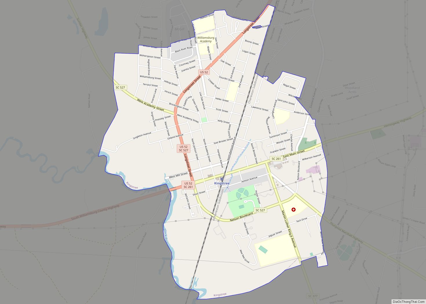
Online Interactive Map
Click on ![]() to view map in "full screen" mode.
to view map in "full screen" mode.
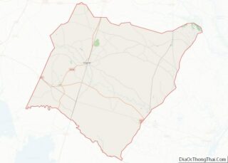
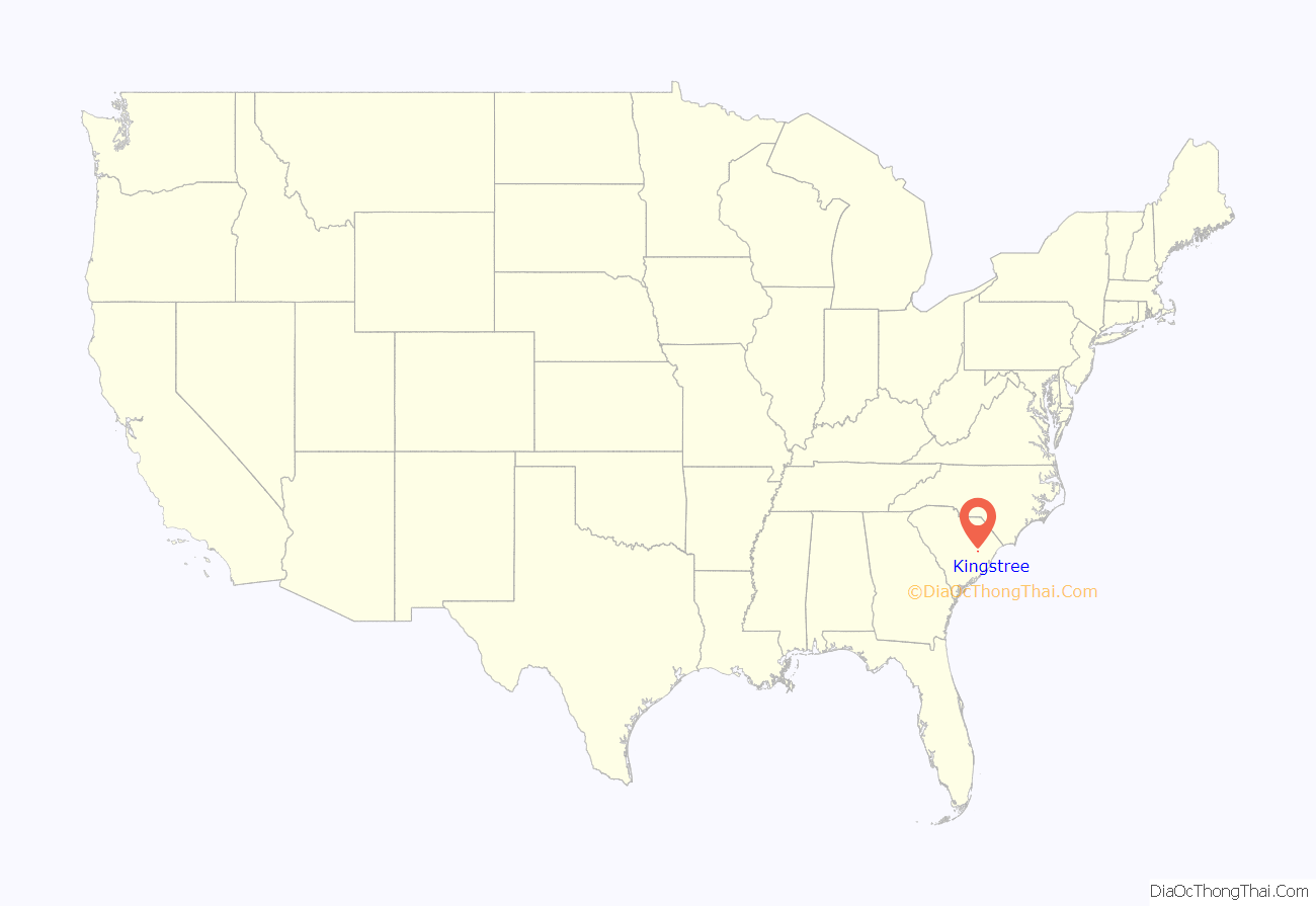
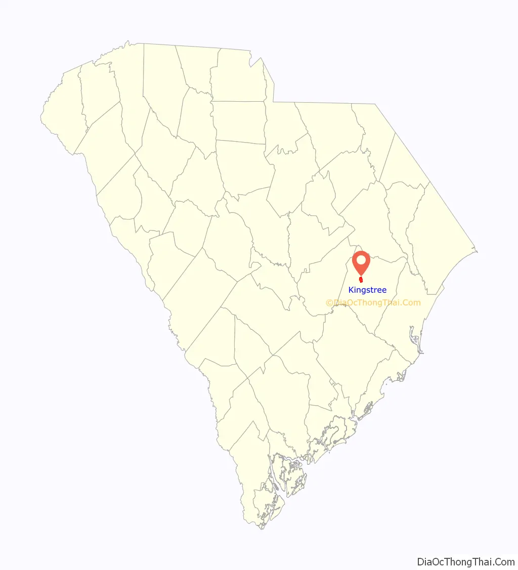
Kingstree location map. Where is Kingstree town?
History
The original town was laid out as Williamsburg by the Lords Proprietors in colonial times, but a lone, unusually large white pine was found along the Black River. Since tall white pines were ideal for use as masts for ships, it was claimed by the Crown on behalf of the king. The broad arrow mark was carved into the tree to prevent any colonists from cutting it. Though white pines are native to the Appalachians as far south as Georgia, it is the only tree of King George’s ever found in the South. Over time, the county kept the name Williamsburg, but the county seat became known as the King’s Tree.
Battles
General Francis Marion, known as the Swamp Fox, defeated the British at the Battle of the Lower Bridge in March 1781. A historical marker between US Highway 521 and the Black River denotes the battle.
After the British had captured Charles Town during the revolution, General Marion gained supporters from Major John James. The Battle of King’s Tree took place on August 27, 1780. The city sustained losses, including Indiantown Presbyterian Church being burned to the ground.
Historical homes and buildings
The Kingstree Historic District, M.F. Heller House, Colonel John Gotea Pressley House, Scott House, and Thorntree are listed on the National Register of Historic Places.
Williamsburg Presbyterian Church was founded in August 1736. The church consisted of three structures. Its founders built the first church in 1738 across from the Williamsburg Cemetery in town; the second building was constructed in 1828 and was across from the Williamsburg Cemetery as well. The third, the current structure of the church located on North Academy Street was built in 1914. The stained glass windows on the roof of the church today were imported from Austria. One of the stained glass windows on the roof was removed in 1989 during a renovation and was placed behind the pulpit of the sanctuary. The first person to be buried in the church cemetery was John Witherspoon(1670–1737), the father of James Witherspoon, builder of Thorntree.
Williamsburg Presbyterian Church celebrated its 275th Birthday in October 2011. The church held a service to share Kingstree’s history. The church is the oldest church that still exists today between the Santee and Cape Fear Rivers in North and South Carolina. Williamsburg Presbyterian is the mother church to 33 other Presbyterian churches. Two daughter churches include nearby Union Presbyterian church in Salters, South Carolina, and Indiantown Presbyterian Church in Williamsburg County.
The Kingstree company formed at Williamsburg Presbyterian Church’s original churchyard in July 1780. The company was led by Captain Henry Mouzon and later turned into the battalion and then formed a brigade led by Francis Marion against the British.
The Arnette House is one of the three oldest homes in the town and was built in 1840. The home holds significance in the town because the dining room was used as a school for two periods of history during the early years of the home.
Thorntree House is the oldest home in the lowcountry area of South Carolina. The early plantation home was constructed from native materials of South Carolina. James Witherspoon built the home in 1749 when the house was located six miles outside of town near where the Battle of the Lower Bridge took place. Witherspoon was a part of Francis Marion’s brigade. After Witherspoon’s death, Witherspoon’s son inherited the plantation home. The British occupied the home during the revolution when it was at its original location, on the Black River. Gavin Witherspoon was the owner at the time. The house was later moved to its current location in 1969 when it was being restored by the Williamsburg Historical Society and is currently registered by the National Historic Register. The Williamsburg Historical Society moved the house into Kingstree city limits to provide protection by the city’s police and fire department.
The Williamsburg County Courthouse is located in the business district of Kingstree on Main Street. The original grounds of where the courthouse stands were the original parade grounds in the town of Kingstree and were used by the militia during the revolution. The courthouse was built in 1823 by Robert Mills, a nationally known architect that hailed from South Carolina. The second level of the courthouse suffered a fire in 1883 but because the walls were 30 inches thick and fireproof, the building was restored. Other changes and additions were added to the courthouse including in parking for horses in 1901, and a third floor in 1954.
Kingstree Road Map

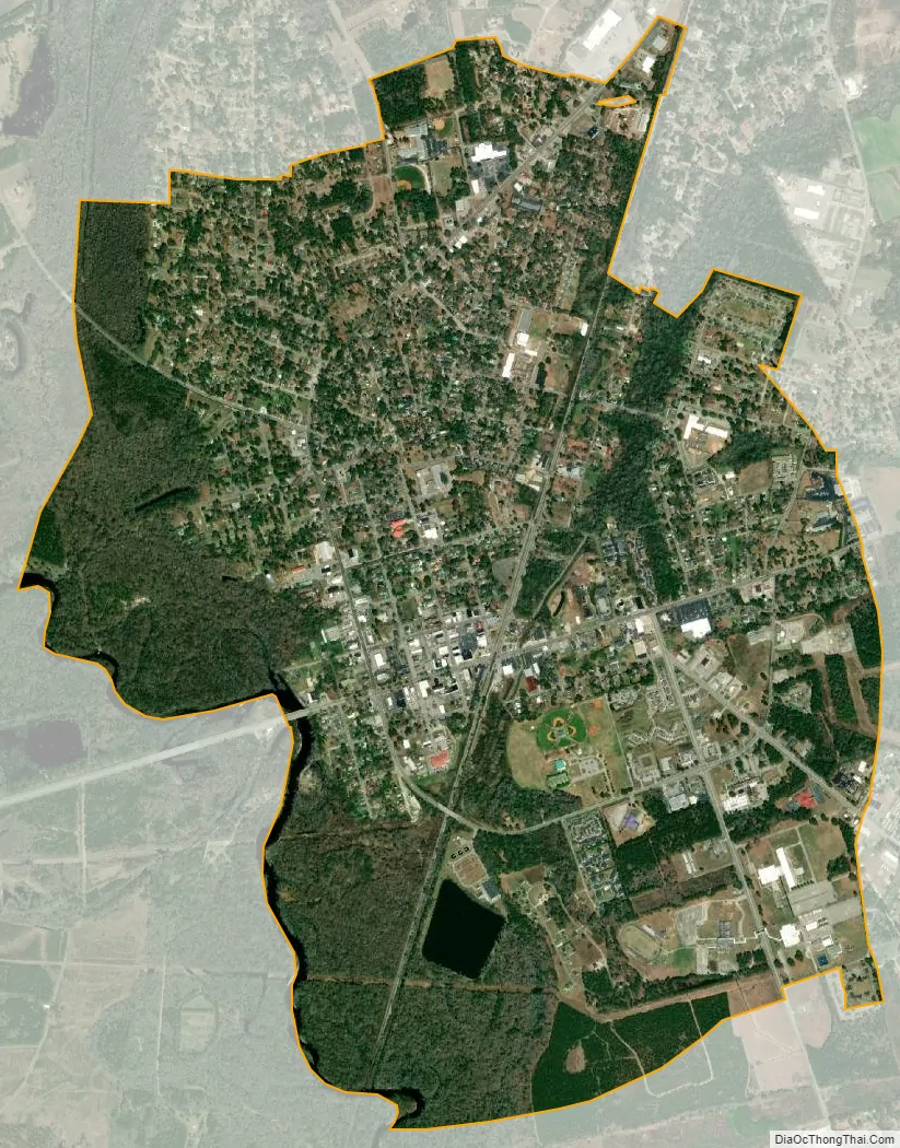
Kingstree city Satellite Map
Geography
Kingstree is located at 33°40′16″N 79°49′43″W / 33.67111°N 79.82861°W / 33.67111; -79.82861 (33.671243, −79.828635).
According to the United States Census Bureau, the town has a total area of 3.2 square miles (8.3 km), of which 3.1 square miles (8.0 km) are land and 0.04 square miles (0.10 km) (0.63%) is covered by water.
Rivers
The Black River is a free-flowing river surrounded by banks of undisturbed land. The river has habitats suitable for endangered species, including the American chaffseed and the swallow-tailed kite. The black color of the river comes from tannins from cypress trees. The river draws sportsmen because of the variety of fish, including bream, red-breasted sunfish, largemouth bass, and catfish.
The Williamsburg County Hometown Chamber Quality of Place Committee was able to get the South Carolina Department of Natural Resources to include a 75-mile stretch of the Black River in the Scenic River Program in 2001. The Black River is one South Carolina’s longest rivers and was the seventh addition to the Scenic Rivers. The river is 150 miles long and goes through Williamsburg, Clarendon, Sumter, and Georgetown Counties in South Carolina.
See also
Map of South Carolina State and its subdivision:- Abbeville
- Aiken
- Allendale
- Anderson
- Bamberg
- Barnwell
- Beaufort
- Berkeley
- Calhoun
- Charleston
- Cherokee
- Chester
- Chesterfield
- Clarendon
- Colleton
- Darlington
- Dillon
- Dorchester
- Edgefield
- Fairfield
- Florence
- Georgetown
- Greenville
- Greenwood
- Hampton
- Horry
- Jasper
- Kershaw
- Lancaster
- Laurens
- Lee
- Lexington
- Marion
- Marlboro
- McCormick
- Newberry
- Oconee
- Orangeburg
- Pickens
- Richland
- Saluda
- Spartanburg
- Sumter
- Union
- Williamsburg
- York
- Alabama
- Alaska
- Arizona
- Arkansas
- California
- Colorado
- Connecticut
- Delaware
- District of Columbia
- Florida
- Georgia
- Hawaii
- Idaho
- Illinois
- Indiana
- Iowa
- Kansas
- Kentucky
- Louisiana
- Maine
- Maryland
- Massachusetts
- Michigan
- Minnesota
- Mississippi
- Missouri
- Montana
- Nebraska
- Nevada
- New Hampshire
- New Jersey
- New Mexico
- New York
- North Carolina
- North Dakota
- Ohio
- Oklahoma
- Oregon
- Pennsylvania
- Rhode Island
- South Carolina
- South Dakota
- Tennessee
- Texas
- Utah
- Vermont
- Virginia
- Washington
- West Virginia
- Wisconsin
- Wyoming