Map of Lakewood CDP, South Carolina

Map of Lakewood CDP, South Carolina

Lakewood is a census-designated place (CDP) in Sumter County, South Carolina, United States. The population was 2,603 at the 2000 census. It is included in the Sumter, South Carolina Metropolitan Statistical Area. Lakewood CDP overview: Name: Lakewood CDP LSAD Code: 57 LSAD Description: CDP (suffix) State: South Carolina County: Sumter County Elevation: 174 ft (53 m) Total … Read more

Map of Lake Wylie CDP

Map of Lake Wylie CDP

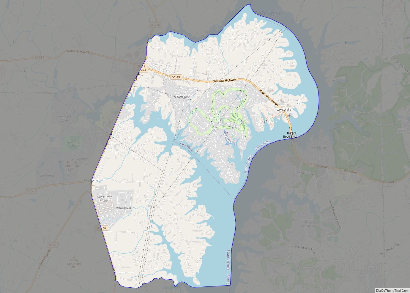
Lake Wylie is a census-designated place (CDP) in York County, South Carolina, United States. The population was 8,841 at the 2010 census. Lake Wylie is located on a peninsula along the shore of Lake Wylie, a reservoir that was named for Dr. W. Gil Wylie in 1960. It is a suburb of Charlotte, North Carolina. … Read more

Map of Lake View town, South Carolina

Map of Lake View town, South Carolina

Lake View is a town in Dillon County, South Carolina, United States. The population was 807 at the 2010 census. Lake View town overview: Name: Lake View town LSAD Code: 43 LSAD Description: town (suffix) State: South Carolina County: Dillon County Elevation: 89 ft (27 m) Total Area: 1.71 sq mi (4.42 km²) Land Area: 1.71 sq mi (4.42 km²) Water Area: 0.00 sq mi … Read more

Map of Lincolnville town, South Carolina

Map of Lincolnville town, South Carolina

Lincolnville is a town in Charleston County, South Carolina, United States. A very small portion of the town extends into Dorchester County. The population was 1,139 at the 2010 census, up from 904 in 2000. Lincolnville is part of the Charleston-North Charleston-Summerville metropolitan area. Lincolnville town overview: Name: Lincolnville town LSAD Code: 43 LSAD Description: … Read more

Map of Liberty city, South Carolina

Map of Liberty city, South Carolina

Liberty is a city in Pickens County, South Carolina, United States. It is part of the Greenville–Mauldin–Easley Metropolitan Statistical Area. The city was chartered on March 2, 1876. Liberty city overview: Name: Liberty city LSAD Code: 25 LSAD Description: city (suffix) State: South Carolina County: Pickens County Elevation: 984 ft (300 m) Total Area: 4.54 sq mi (11.76 km²) Land … Read more

Map of Lexington town, South Carolina

Map of Lexington town, South Carolina

Lexington is the largest town in and the county seat of Lexington County, South Carolina, United States. It is a suburb of the state capital, Columbia. The population was 23,568 at the 2020 Census, and it is the second-largest municipality in the greater Columbia area. The 2021 estimated population is 24,208. According to the Central … Read more

Map of Lesslie CDP

Map of Lesslie CDP

Lesslie is a census-designated place located in York County, South Carolina, United States, southeast of the city of Rock Hill. In 2010, Lesslie had a total population of 2,882 people. While Lesslie is sometimes considered to be a town, it is not incorporated and does not have a town council or mayor. Lesslie is a … Read more

Map of Laurens city, South Carolina

Map of Laurens city, South Carolina

Laurens is a city in Laurens County, South Carolina, United States. The population was 9,139 at the 2010 census. It is the county seat of Laurens County. Laurens city overview: Name: Laurens city LSAD Code: 25 LSAD Description: city (suffix) State: South Carolina County: Laurens County Elevation: 614 ft (187 m) Land Area: 9.84 sq mi (25.49 km²) Water Area: … Read more

Map of Lodge town

Map of Lodge town

Lodge is a town in Colleton County, South Carolina, United States. The population was 120 at the 2010 census. Lodge town overview: Name: Lodge town LSAD Code: 43 LSAD Description: town (suffix) State: South Carolina County: Colleton County Elevation: 108 ft (33 m) Total Area: 3.14 sq mi (8.14 km²) Land Area: 3.14 sq mi (8.14 km²) Water Area: 0.00 sq mi (0.00 km²) Total Population: … Read more

Map of Lockhart town, South Carolina

Map of Lockhart town, South Carolina

Lockhart is a town in Union County, South Carolina, United States. The population was 488 at the 2010 United States Census. Lockhart town overview: Name: Lockhart town LSAD Code: 43 LSAD Description: town (suffix) State: South Carolina County: Union County Elevation: 453 ft (138 m) Total Area: 0.41 sq mi (1.06 km²) Land Area: 0.30 sq mi (0.79 km²) Water Area: 0.10 sq mi (0.27 km²) … Read more

Map of Livingston town, South Carolina

Map of Livingston town, South Carolina

Livingston is a town in Orangeburg County, South Carolina, United States. The population was 136 at the 2010 census. Livingston town overview: Name: Livingston town LSAD Code: 43 LSAD Description: town (suffix) State: South Carolina County: Orangeburg County Elevation: 331 ft (101 m) Total Area: 0.79 sq mi (2.04 km²) Land Area: 0.79 sq mi (2.04 km²) Water Area: 0.00 sq mi (0.00 km²) Total Population: … Read more

Map of Little River CDP, South Carolina

Map of Little River CDP, South Carolina

Little River is a census-designated place (CDP) in Horry County, South Carolina, United States. The population was 11,711 at the 2020 census. Little River is named for the Little River, which flows into the Atlantic Ocean at the state line between North Carolina and South Carolina. The Little River inlet has long been a breakpoint … Read more