Map of Trenton town, South Carolina
Trenton is a town in Edgefield County, South Carolina, United States. The population was 196 at the 2010 census, down from 226 in 2000. Trenton town overview: Name: Trenton town LSAD Code: 43 LSAD Description: town (suffix) State: South Carolina County: Edgefield County Elevation: 620 ft (189 m) Total Area: 1.28 sq mi (3.30 km²) Land Area: 1.26 sq mi (3.27 km²) Water ... Read more
Map of Trenton town, South Carolina
Map of Travelers Rest city
Travelers Rest is a city in Greenville County, South Carolina, United States. The population was 4,576 at the 2010 census, a small increase from 4,099 in 2000. By 2018 the population had jumped to 5,253. It is part of the Greenville–Mauldin–Easley Metropolitan Statistical Area. Travelers Rest, the northernmost city in Greenville County, is located 10 ... Read more
Map of Travelers Rest city
Map of Timmonsville town
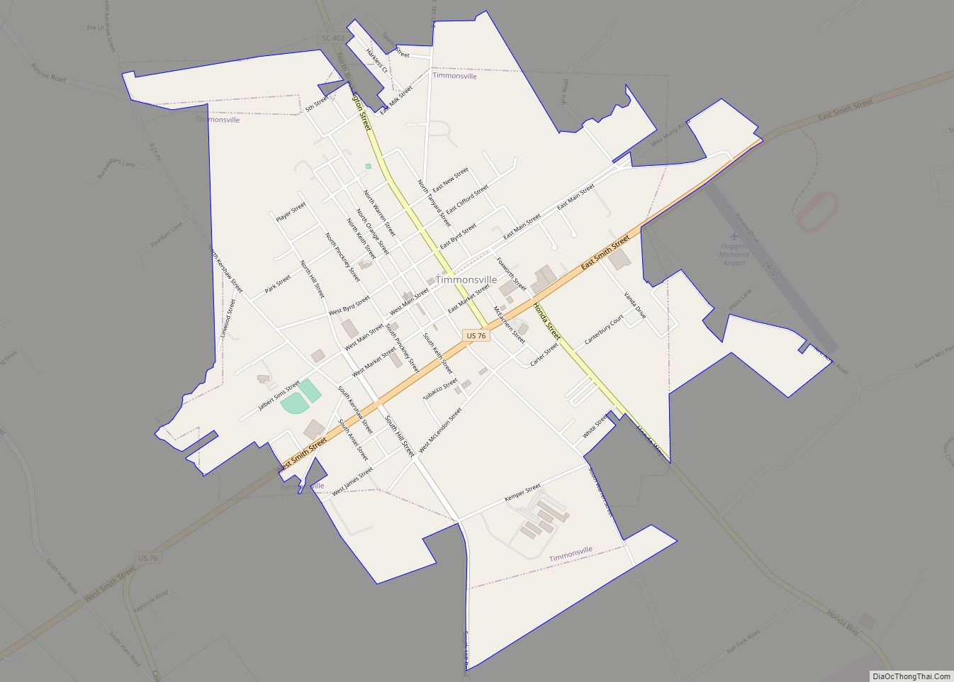
Timmonsville is a town in Florence County, South Carolina, United States. The population was 2,320 at the 2010 census, an increase of five persons from 2000. It is part of the Florence Metropolitan Statistical Area. Timmonsville town overview: Name: Timmonsville town LSAD Code: 43 LSAD Description: town (suffix) State: South Carolina County: Florence County Elevation: ... Read more
Map of Timmonsville town
Map of Tigerville CDP
Tigerville is an unincorporated community and census-designated place in Greenville County, South Carolina, United States. As of the 2010 United States Census the population was 1,312. It lies 12 miles (19 km) north of Taylors, 10 miles (16 km) northeast of Travelers Rest, and 14 miles (23 km) northwest of Greer. North Greenville University, a private institution of ... Read more
Map of Tigerville CDP
Map of Tega Cay city
Tega Cay is a planned city in York County, South Carolina, United States, located west of Fort Mill and north of Rock Hill. It is a suburb of Charlotte, North Carolina. The population was recorded at 7,621 as of the 2010 U.S. Census. Tega Cay is located on a peninsula along Lake Wylie, twenty miles ... Read more
Map of Tega Cay city
Map of Taylors CDP
Taylors is a census-designated place (CDP) in Greenville County, South Carolina, United States. The population was 21,617 at the 2010 census. Taylors is the Greenville/Spartanburg area’s largest suburb although it is not incorporated as a city. It is part of the Greenville–Mauldin–Easley Metropolitan Statistical Area. The area serves as the result of urban sprawl in ... Read more
Map of Taylors CDP
Map of Tatum town, South Carolina
Tatum is a town in Marlboro County, South Carolina, United States. The population was 75 at the 2010 census. Tatum town overview: Name: Tatum town LSAD Code: 43 LSAD Description: town (suffix) State: South Carolina County: Marlboro County Elevation: 194 ft (59 m) Total Area: 0.91 sq mi (2.35 km²) Land Area: 0.91 sq mi (2.35 km²) Water Area: 0.00 sq mi (0.00 km²) Total Population: ... Read more
Map of Tatum town, South Carolina
Map of Varnville town
Varnville is a town in Hampton County, South Carolina, United States. The population was 2,162 as of the 2010 census. Varnville forms a twin town with Hampton, the county seat; the two towns often share civic and cultural events. Varnville town overview: Name: Varnville town LSAD Code: 43 LSAD Description: town (suffix) State: South Carolina ... Read more
Map of Varnville town
Map of Vance town, South Carolina
Vance is a town in Orangeburg County, South Carolina, United States. The population was 170 at the 2010 census. Vance town overview: Name: Vance town LSAD Code: 43 LSAD Description: town (suffix) State: South Carolina County: Orangeburg County Elevation: 131 ft (40 m) Total Area: 0.51 sq mi (1.31 km²) Land Area: 0.51 sq mi (1.31 km²) Water Area: 0.00 sq mi (0.00 km²) Total Population: ... Read more
Map of Vance town, South Carolina
Map of Van Wyck town
Van Wyck is a town in the panhandle of Lancaster County, South Carolina, United States. It is part of the Charlotte Metropolitan Area. Van Wyck is 29 miles (47 km) south of Charlotte. Established in the 1880s, it was to be originally named “Cocheecho”, after a young Indian chief, by the Seaboard Air Line Railroad. The ... Read more
Map of Van Wyck town
Map of Valley Falls CDP, South Carolina
Valley Falls is a census-designated place (CDP) in Spartanburg County, South Carolina, United States. The population was 6,299 at the 2010 census. Valley Falls CDP overview: Name: Valley Falls CDP LSAD Code: 57 LSAD Description: CDP (suffix) State: South Carolina County: Spartanburg County Elevation: 797 ft (243 m) Total Area: 5.22 sq mi (13.51 km²) Land Area: 5.19 sq mi (13.43 km²) Water ... Read more
Map of Valley Falls CDP, South Carolina
Map of Utica CDP, South Carolina
Utica is a census-designated place (CDP) in Oconee County, South Carolina, United States. The population was 1,322 at the 2000 census. Utica CDP overview: Name: Utica CDP LSAD Code: 57 LSAD Description: CDP (suffix) State: South Carolina County: Oconee County Elevation: 886 ft (270 m) Total Area: 1.13 sq mi (2.93 km²) Land Area: 1.13 sq mi (2.93 km²) Water Area: 0.00 sq mi (0.00 km²) ... Read more
Map of Utica CDP, South Carolina