Tega Cay is a planned city in York County, South Carolina, United States, located west of Fort Mill and north of Rock Hill. It is a suburb of Charlotte, North Carolina. The population was recorded at 7,621 as of the 2010 U.S. Census.
Tega Cay is located on a peninsula along Lake Wylie, twenty miles south of Charlotte. The name Tega Cay allegedly comes from an unknown Polynesian language and means “Beautiful Peninsula”, however, this is unconfirmed.
| Name: | Tega Cay city |
|---|---|
| LSAD Code: | 25 |
| LSAD Description: | city (suffix) |
| State: | South Carolina |
| County: | York County |
| Elevation: | 627 ft (191 m) |
| Total Area: | 4.50 sq mi (11.64 km²) |
| Land Area: | 4.49 sq mi (11.62 km²) |
| Water Area: | 0.01 sq mi (0.02 km²) |
| Population Density: | 2,859.18/sq mi (1,103.99/km²) |
| ZIP code: | 29708 |
| Area code: | 803, 839 |
| FIPS code: | 4571417 |
| GNISfeature ID: | 1231854 |
| Website: | www.tegacaysc.org |
Online Interactive Map
Click on ![]() to view map in "full screen" mode.
to view map in "full screen" mode.
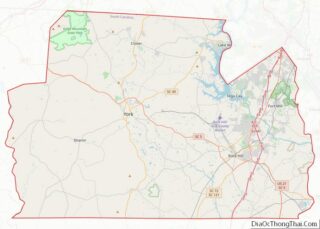
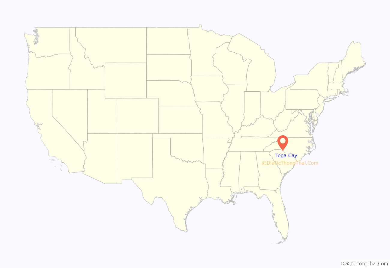
Tega Cay location map. Where is Tega Cay city?
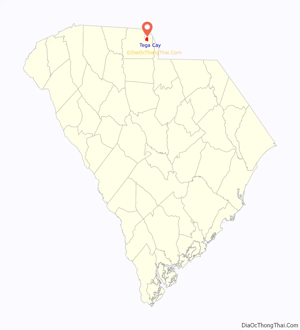
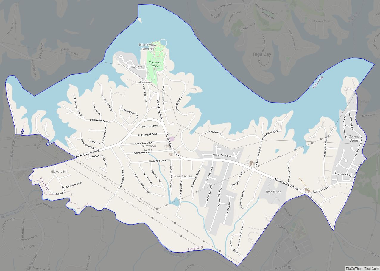
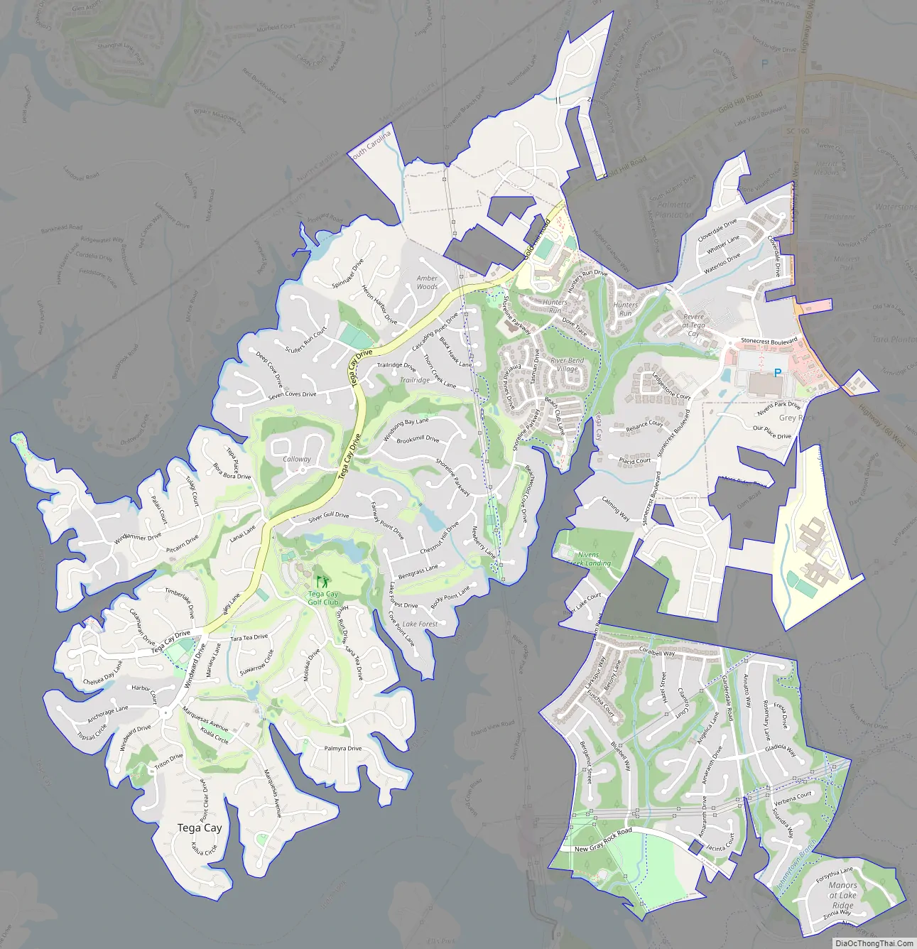
Tega Cay Road Map
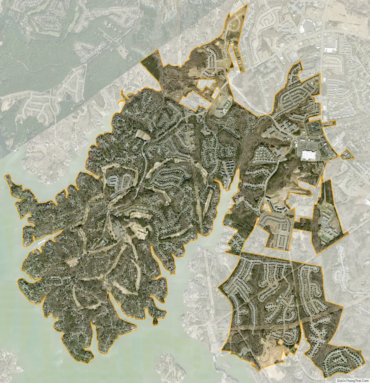
Tega Cay city Satellite Map
Geography
Tega Cay is located at 35°2′14″N 81°1′29″W / 35.03722°N 81.02472°W / 35.03722; -81.02472 (35.037262, -81.024644). According to the United States Census Bureau, the city has a total area of 3.2 square miles (8.2 km), of which 2.5 square miles (6.4 km) is land and 0.7 square mile (1.7 km) (21.27%) is water. The city has 13 mi (21 km) of shoreline. Tega Cay’s ZIP code is 29708 and the area code is 803. The hilly terrain is densely forested, containing many species of hardwoods and pines, and wildlife. Recreational facilities located in Tega Cay include a public 27-hole, award winning golf course with a clubhouse and pavilion, a croquet court, and seven lighted tennis courts, two lighted pickleball courts, several miles of walking trails, and thirteen city owned parks of which three have baseball and/or soccer fields available for public use. Two of the parks are lake side and the City owns swimming pool facility (membership only) that is also adjacent to Lake Wylie. Along with those lakeside amenities, there is a privately owned marina, and three areas to launch boats. The City is currently engineering and fundraising for a 62-acre park for passive and active recreation along the Catawba River. Included at that park will be miles of walking trails, four baseball/softball diamonds, six youth soccer fields, inclusive playgrounds, an amphitheater and a paddle boat launch onto the river just below the Lake Wylie hydro-electric dam. The climate of Tega Cay is that of a Humid subtropical climate, which is characterized by hot, humid summers and cool, dry winters. Snow falls 3-4 times a year on average.
See also
Map of South Carolina State and its subdivision:- Abbeville
- Aiken
- Allendale
- Anderson
- Bamberg
- Barnwell
- Beaufort
- Berkeley
- Calhoun
- Charleston
- Cherokee
- Chester
- Chesterfield
- Clarendon
- Colleton
- Darlington
- Dillon
- Dorchester
- Edgefield
- Fairfield
- Florence
- Georgetown
- Greenville
- Greenwood
- Hampton
- Horry
- Jasper
- Kershaw
- Lancaster
- Laurens
- Lee
- Lexington
- Marion
- Marlboro
- McCormick
- Newberry
- Oconee
- Orangeburg
- Pickens
- Richland
- Saluda
- Spartanburg
- Sumter
- Union
- Williamsburg
- York
- Alabama
- Alaska
- Arizona
- Arkansas
- California
- Colorado
- Connecticut
- Delaware
- District of Columbia
- Florida
- Georgia
- Hawaii
- Idaho
- Illinois
- Indiana
- Iowa
- Kansas
- Kentucky
- Louisiana
- Maine
- Maryland
- Massachusetts
- Michigan
- Minnesota
- Mississippi
- Missouri
- Montana
- Nebraska
- Nevada
- New Hampshire
- New Jersey
- New Mexico
- New York
- North Carolina
- North Dakota
- Ohio
- Oklahoma
- Oregon
- Pennsylvania
- Rhode Island
- South Carolina
- South Dakota
- Tennessee
- Texas
- Utah
- Vermont
- Virginia
- Washington
- West Virginia
- Wisconsin
- Wyoming