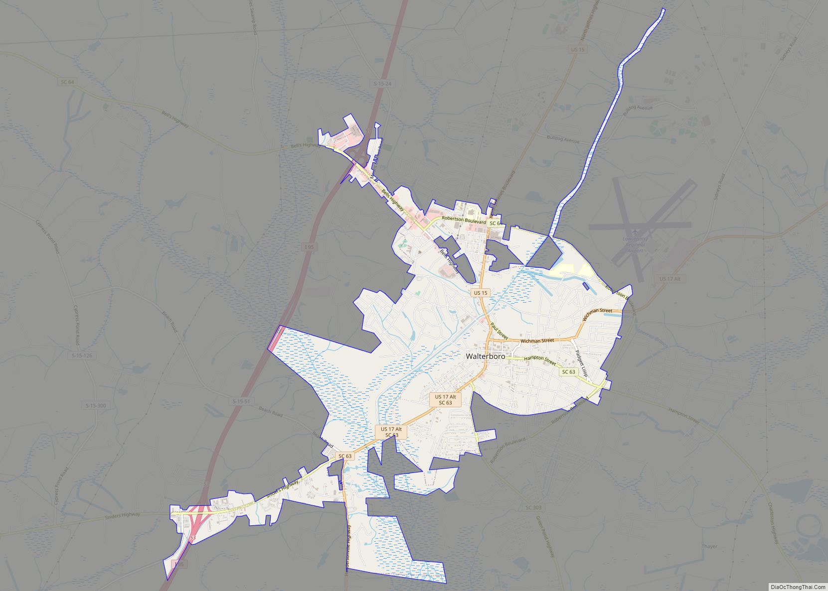
Map of Ware Shoals town
Ware Shoals is a town in Abbeville, Greenwood, and Laurens counties in the U.S. state of South Carolina, along the Saluda River . Ware Shoals has a 2020 population of 1,607. Ware Shoals is currently declining at a rate of -2.84% annually and its population has decreased by -5.53% since the most recent census, which ... Read more
Map of Ware Shoals town
Map of Ware Place CDP
Ware Place is a Census-designated place located in Greenville County in the U.S. State of South Carolina. According to the 2010 United States Census, the population was 228. Ware Place CDP overview: Name: Ware Place CDP LSAD Code: 57 LSAD Description: CDP (suffix) State: South Carolina County: Greenville County Elevation: 876 ft (267 m) Total Area: 0.92 sq mi ... Read more
Map of Ware Place CDP
Map of Ward town, South Carolina
Ward is a town in Saluda County, South Carolina, United States. The population was 91 at the 2010 census. Ward town overview: Name: Ward town LSAD Code: 43 LSAD Description: town (suffix) State: South Carolina County: Saluda County Elevation: 666 ft (203 m) Total Area: 0.78 sq mi (2.01 km²) Land Area: 0.78 sq mi (2.01 km²) Water Area: 0.00 sq mi (0.00 km²) Total Population: ... Read more
Map of Ward town, South Carolina
Map of Williams town, South Carolina
Williams is a town in Colleton County, South Carolina, United States. The population was 117 at the 2010 census. Williams town overview: Name: Williams town LSAD Code: 43 LSAD Description: town (suffix) State: South Carolina County: Colleton County Elevation: 105 ft (32 m) Total Area: 0.85 sq mi (2.19 km²) Land Area: 0.85 sq mi (2.19 km²) Water Area: 0.00 sq mi (0.00 km²) Total Population: ... Read more
Map of Williams town, South Carolina
Map of Wilkinson Heights CDP
Wilkinson Heights is a census-designated place (CDP) in Orangeburg County, South Carolina, United States. The population was 3,068 at the 2000 census. Wilkinson Heights CDP overview: Name: Wilkinson Heights CDP LSAD Code: 57 LSAD Description: CDP (suffix) State: South Carolina County: Orangeburg County Elevation: 223 ft (68 m) Total Area: 2.99 sq mi (7.74 km²) Land Area: 2.99 sq mi (7.74 km²) Water ... Read more
Map of Wilkinson Heights CDP
Map of Whitmire town
Whitmire is a town in Newberry County, South Carolina, United States, along the Enoree River. The population was 1,441 at the 2010 census. The town was named for George Fredrick Whitmire, who came from Stuttgart, Germany. Whitmire town overview: Name: Whitmire town LSAD Code: 43 LSAD Description: town (suffix) State: South Carolina County: Newberry County ... Read more
Map of Whitmire town
Map of Westminster city, South Carolina
Westminster is a city in Oconee County, South Carolina, United States. The population was 2,418 at the 2010 census. Westminster city overview: Name: Westminster city LSAD Code: 25 LSAD Description: city (suffix) State: South Carolina County: Oconee County Elevation: 929 ft (283 m) Total Area: 3.45 sq mi (8.94 km²) Land Area: 3.45 sq mi (8.93 km²) Water Area: 0.00 sq mi (0.01 km²) Total Population: ... Read more
Map of Westminster city, South Carolina
Map of West Union town, South Carolina
West Union is a town in Oconee County, South Carolina, United States. Although its name suggests that it is near Union, they are approximately four counties apart. The population was 291 at the 2010 census. West Union town overview: Name: West Union town LSAD Code: 43 LSAD Description: town (suffix) State: South Carolina County: Oconee ... Read more
Map of West Union town, South Carolina
Map of West Pelzer town
West Pelzer is a town in Anderson County, South Carolina, United States. The population was 880 at the 2010 census. West Pelzer town overview: Name: West Pelzer town LSAD Code: 43 LSAD Description: town (suffix) State: South Carolina County: Anderson County Elevation: 843 ft (257 m) Total Area: 0.53 sq mi (1.36 km²) Land Area: 0.53 sq mi (1.36 km²) Water Area: 0.00 sq mi ... Read more
Map of West Pelzer town
Map of West Columbia city, South Carolina
West Columbia, formerly Brookland, is a city and commuter town in the suburban eastern sections of Lexington County, South Carolina, United States. According to the 2010 census, the population was 14,988, and the 2019 population estimate was 17,998. West Columbia is bordered to the east by Columbia, the state capital, across the Congaree River. It ... Read more
Map of West Columbia city, South Carolina
Map of Wellford city
Wellford is a city in Spartanburg County, South Carolina, United States. The population was 2,378 at the 2010 census, up from 2,030 in 2000. Wellford city overview: Name: Wellford city LSAD Code: 25 LSAD Description: city (suffix) State: South Carolina County: Spartanburg County Elevation: 774 ft (236 m) Total Area: 4.61 sq mi (11.93 km²) Land Area: 4.58 sq mi (11.86 km²) Water ... Read more
Map of Wellford city
Map of Welcome CDP, South Carolina
Welcome is a census-designated place (CDP) in Greenville County, South Carolina, United States. The population was 6,668 at the 2010 census. It is part of the Greenville–Mauldin–Easley Metropolitan Statistical Area. Welcome has been noted for its colorful place name. Welcome CDP overview: Name: Welcome CDP LSAD Code: 57 LSAD Description: CDP (suffix) State: South Carolina ... Read more
Map of Welcome CDP, South Carolina