Map of Cane Savannah CDP
Cane Savannah is a census-designated place (CDP) in Sumter County, South Carolina, United States. The population was 1,452 at the 2000 census. It is included in the Sumter, South Carolina Metropolitan Statistical Area. Cane Savannah CDP overview: Name: Cane Savannah CDP LSAD Code: 57 LSAD Description: CDP (suffix) State: South Carolina County: Sumter County Elevation: ... Read more
Map of Cane Savannah CDP
Map of Campobello town
Campobello is a town in Spartanburg County, South Carolina, United States, along the South Pacolet River. The population was 502 at the 2010 census. Campobello town overview: Name: Campobello town LSAD Code: 43 LSAD Description: town (suffix) State: South Carolina County: Spartanburg County Elevation: 922 ft (281 m) Total Area: 2.78 sq mi (7.21 km²) Land Area: 2.78 sq mi (7.21 km²) Water ... Read more
Map of Campobello town
Map of Cameron town, South Carolina
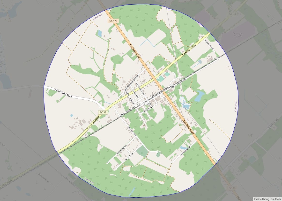
Cameron is a town in Calhoun County, South Carolina, United States. The population was 424 at the 2010 census. It is part of the Columbia, South Carolina Metropolitan Statistical Area. Cameron town overview: Name: Cameron town LSAD Code: 43 LSAD Description: town (suffix) State: South Carolina County: Calhoun County Elevation: 177 ft (54 m) Total Area: 3.13 sq mi ... Read more
Map of Cameron town, South Carolina
Map of Camden city, South Carolina
Camden is the largest city and county seat of Kershaw County, South Carolina. The population was 7,764 in the 2020 census. It is part of the Columbia, South Carolina, Metropolitan Statistical Area. Camden is the oldest inland city in South Carolina, and home to the Carolina Cup and the National Steeplechase Museum. Camden city overview: ... Read more
Map of Camden city, South Carolina
Map of Calhoun Falls town
Calhoun Falls is a town in Abbeville County, South Carolina, United States. The population was 1,724 at the 2020 census, down from 2,004 at the 2010 census. The town derives its name from John E. Colhoun (or Calhoun), a United States Senator from South Carolina. Calhoun Falls town overview: Name: Calhoun Falls town LSAD Code: ... Read more
Map of Calhoun Falls town
Map of Burton CDP, South Carolina
Burton is a census-designated place (CDP) on Port Royal Island in Beaufort County, South Carolina, United States. The population was 6,976 at the 2010 census. As defined by the U.S. Census Bureau, Burton is included within the Hilton Head Island-Bluffton-Beaufort, SC Metropolitan Statistical Area. Burton CDP overview: Name: Burton CDP LSAD Code: 57 LSAD Description: ... Read more
Map of Burton CDP, South Carolina
Map of Burnettown town
Burnettown is a town in Aiken County, South Carolina, United States. The population was 3,105 at the 2020 census. It is part of the Augusta, Georgia metropolitan area. Burnettown is located in historic Horse Creek Valley. Burnettown town overview: Name: Burnettown town LSAD Code: 43 LSAD Description: town (suffix) State: South Carolina County: Aiken County ... Read more
Map of Burnettown town
Map of Chapin town, South Carolina
Chapin, popularly known as the “Capital of Lake Murray”, is a small lake town located at the northern tip of Lexington County, South Carolina, United States. Lake Murray separates Chapin from the rest of Lexington County. The population of Chapin was 1,445 according to the 2010 census, and an estimated 1,633 in 2019. Chapin is ... Read more
Map of Chapin town, South Carolina
Map of Central town, South Carolina
Central is a town in Pickens County, South Carolina, United States. As of the 2010 census, the population was 5,159, roughly 3,000 of whom were considered permanent residents. Contrary to its name, it is not near South Carolina’s center. It received its name from being halfway or the central point between Atlanta and Charlotte along ... Read more
Map of Central town, South Carolina
Map of Central Pacolet town
Central Pacolet is a town in Spartanburg County, South Carolina, United States, along the Pacolet River. The population was 216 at the 2010 census. Central Pacolet town overview: Name: Central Pacolet town LSAD Code: 43 LSAD Description: town (suffix) State: South Carolina County: Spartanburg County Elevation: 686 ft (209 m) Total Area: 0.24 sq mi (0.61 km²) Land Area: 0.24 sq mi ... Read more
Map of Central Pacolet town
Map of Centerville CDP, South Carolina
Centerville is a census-designated place (CDP) in Anderson County, South Carolina, United States. The population was 6,586 at the 2010 census. Centerville CDP overview: Name: Centerville CDP LSAD Code: 57 LSAD Description: CDP (suffix) State: South Carolina County: Anderson County Elevation: 833 ft (254 m) Total Area: 5.94 sq mi (15.37 km²) Land Area: 5.91 sq mi (15.29 km²) Water Area: 0.03 sq mi (0.08 km²) ... Read more
Map of Centerville CDP, South Carolina
Map of City View CDP
City View , a former incorporated city, is now a census-designated place (CDP) in Greenville County, South Carolina, United States. The population was 1,345 at the 2010 census, up from 1,254 in 2000. It is part of the Greenville–Mauldin–Easley Metropolitan Statistical Area. City View CDP overview: Name: City View CDP LSAD Code: 57 LSAD Description: ... Read more
Map of City View CDP