Map of Herreid city

Map of Herreid city

Herreid is a city in Campbell County, South Dakota, United States. The population was 416 at the 2020 census. Herreid was laid out in 1901 when a branch of the Soo Line reached the city, and named after Charles N. Herreid, fourth Governor of South Dakota. Herreid city overview: Name: Herreid city LSAD Code: 25 … Read more

Map of Hermosa town

Map of Hermosa town

Hermosa is a town near the northern edge of Custer County, South Dakota, United States. The population was 382 at the 2020 census. Hermosa town overview: Name: Hermosa town LSAD Code: 43 LSAD Description: town (suffix) State: South Dakota County: Custer County Founded: 1886 Elevation: 3,327 ft (1,014 m) Total Area: 0.48 sq mi (1.24 km²) Land Area: 0.48 sq mi (1.24 km²) … Read more

Map of Henry town, South Dakota

Map of Henry town, South Dakota

Henry is a town in southwestern Codington County, South Dakota, United States. The population was 256 at the 2020 census. It is part of the Watertown, South Dakota Micropolitan Statistical Area. Henry town overview: Name: Henry town LSAD Code: 43 LSAD Description: town (suffix) State: South Dakota County: Codington County Incorporated: 1886 Elevation: 1,821 ft (555 m) … Read more

Map of Hecla city

Map of Hecla city

Hecla is a city in Brown County, South Dakota, United States, located only a few miles south of the North Dakota border. The population was 193 at the 2020 census. State Highway 37 runs along the east side of town. Hecla city overview: Name: Hecla city LSAD Code: 25 LSAD Description: city (suffix) State: South … Read more

Map of Hazel town, South Dakota

Map of Hazel town, South Dakota

Hazel is a town in Hamlin County, South Dakota, United States. It is part of the Watertown, South Dakota Micropolitan Statistical Area. The population was 102 at the 2020 census. The town is named for Hazel Bowley, the daughter of the original owner of the town site. Hazel town overview: Name: Hazel town LSAD Code: … Read more

Map of Hayti town, South Dakota

Map of Hayti town, South Dakota

Hayti (pronounced “HAY-tie”) is a town in and county seat of Hamlin County, South Dakota, United States. The population was 393 at the 2020 census. It is part of the Watertown, South Dakota Micropolitan Statistical Area. It is the county seat of Hamlin County. According to tradition, the name is derived from the practice of … Read more

Map of Hartford city, South Dakota

Map of Hartford city, South Dakota

Hartford is a suburban American city in Minnehaha County, South Dakota, a few miles northwest of Sioux Falls. Its population was 3,354 at the 2020 census. Hartford city overview: Name: Hartford city LSAD Code: 25 LSAD Description: city (suffix) State: South Dakota County: Minnehaha County Elevation: 1,572 ft (479 m) Total Area: 3.05 sq mi (7.91 km²) Land Area: 3.05 sq mi … Read more

Map of Harrold town

Map of Harrold town

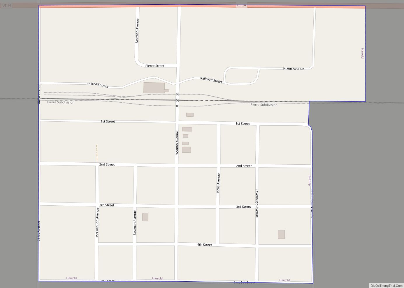
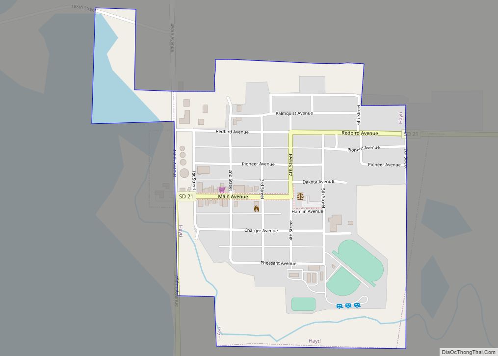
Harrold is a town in Hughes County, South Dakota, United States. It is part of the Pierre, South Dakota Micropolitan Statistical Area. The population was 101 at the 2020 census. Harrold town overview: Name: Harrold town LSAD Code: 43 LSAD Description: town (suffix) State: South Dakota County: Hughes County Incorporated: 1886 Elevation: 1,795 ft (547 m) Total … Read more

Map of Harrison CDP, South Dakota

Map of Harrison CDP, South Dakota

Harrison is an unincorporated community and census-designated place (CDP) in Douglas County, South Dakota, United States. The population was 55 at the 2020 census. The community was named for Benjamin Harrison, a United States Senator from Indiana, and afterward President of the United States. Harrison CDP overview: Name: Harrison CDP LSAD Code: 57 LSAD Description: … Read more

Map of Hosmer city

Map of Hosmer city

Hosmer is a city in northwestern Edmunds County, South Dakota, United States. The population was 164 at the 2020 census. Hosmer city overview: Name: Hosmer city LSAD Code: 25 LSAD Description: city (suffix) State: South Dakota County: Edmunds County Founded: 1887 Elevation: 1,906 ft (581 m) Total Area: 0.99 sq mi (2.56 km²) Land Area: 0.99 sq mi (2.56 km²) Water Area: 0.00 sq mi … Read more

Map of Hitchcock town, South Dakota

Map of Hitchcock town, South Dakota

Hitchcock is a town in Beadle County, South Dakota, United States. The population was 112 at the 2020 census. Hitchcock co-ops with the nearby town of Tulare for sports, making them the Hitchcock/Tulare Patriots. Hitchcock town overview: Name: Hitchcock town LSAD Code: 43 LSAD Description: town (suffix) State: South Dakota County: Beadle County Elevation: 1,339 ft … Read more

Map of Hillsview town

Map of Hillsview town

Hillsview is a town in McPherson County, South Dakota, United States. The population was 2 at the 2020 census. Hillsview is the least-populated municipality in South Dakota. As of 2024, the population is 0 and is scheduled to be unincorporated. The town was named because of its lofty elevation. Hillsview town overview: Name: Hillsview town … Read more