Highmore is a city in and county seat of Hyde County, South Dakota, United States. The population was 682 at the 2020 census.
| Name: | Highmore city |
|---|---|
| LSAD Code: | 25 |
| LSAD Description: | city (suffix) |
| State: | South Dakota |
| County: | Hyde County |
| Incorporated: | 1882 |
| Elevation: | 1,886 ft (575 m) |
| Total Area: | 1.89 sq mi (4.88 km²) |
| Land Area: | 1.89 sq mi (4.88 km²) |
| Water Area: | 0.00 sq mi (0.00 km²) |
| Total Population: | 682 |
| Population Density: | 361.80/sq mi (139.72/km²) |
| ZIP code: | 57345 |
| Area code: | 605 |
| FIPS code: | 4628980 |
| GNISfeature ID: | 1255553 |
| Website: | highmoresd.govoffice3.com |
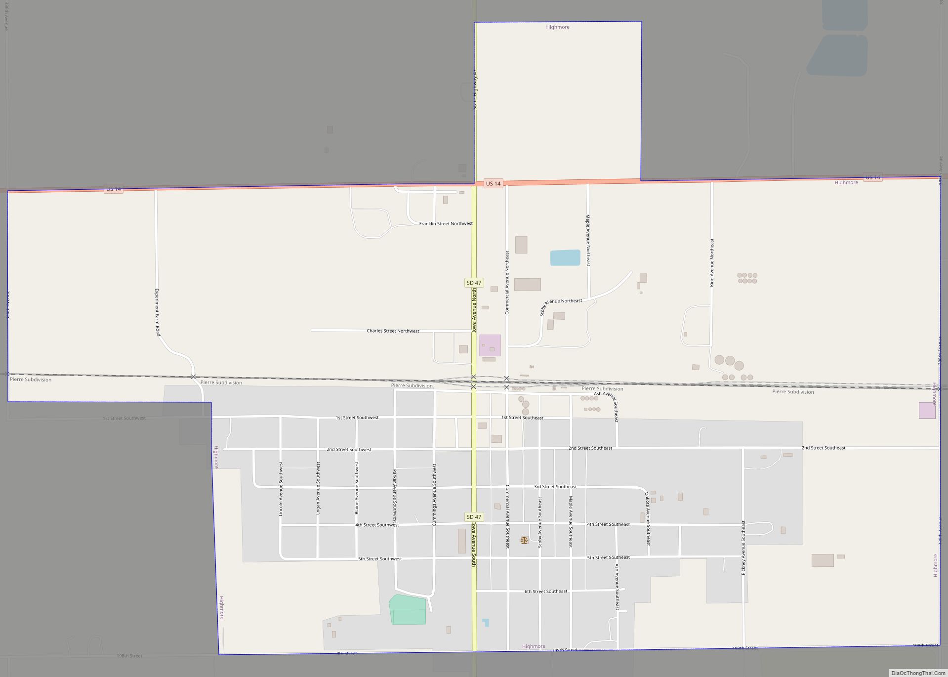
Online Interactive Map
Click on ![]() to view map in "full screen" mode.
to view map in "full screen" mode.
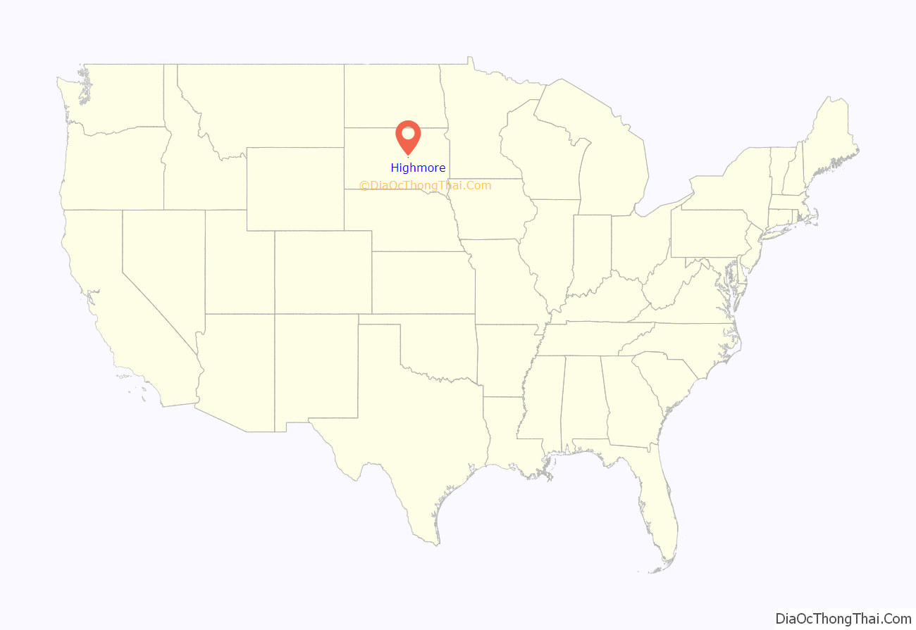
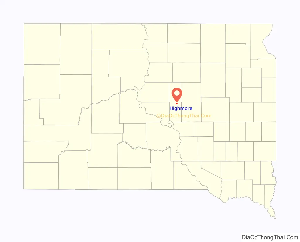
Highmore location map. Where is Highmore city?
History
A post office called Highmore has been in operation since 1882. The city was named from its lofty elevation.
It was near Highmore that South Dakota Attorney General Jason Ravnsborg struck and killed a pedestrian in 2020.
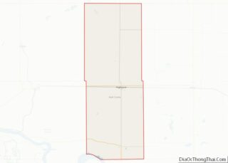
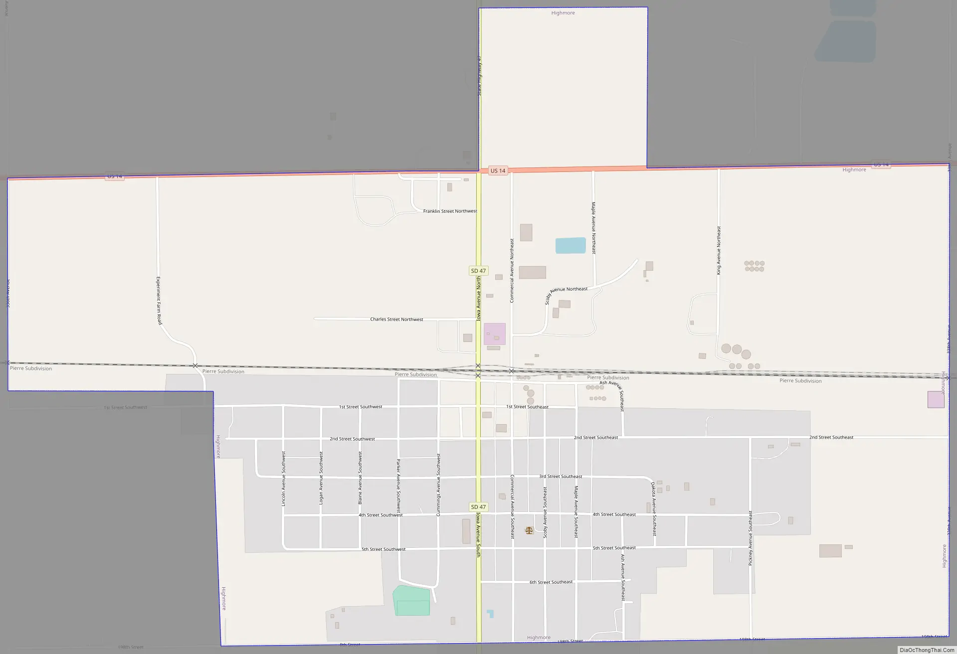
Highmore Road Map
Highmore city Satellite Map
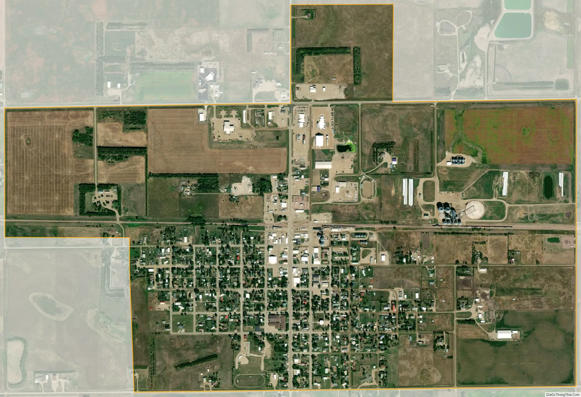
Geography
Highmore is located at 44°31′7″N 99°26′28″W / 44.51861°N 99.44111°W / 44.51861; -99.44111 (44.518700, -99.441106).
According to the United States Census Bureau, the city has a total area of 1.89 square miles (4.90 km), all land.
Highmore has been assigned the ZIP code 57345 and the FIPS place code 28960.
Climate
Highmore has a humid continental climate (Köppen climate classification: Dwa).
See also
Map of South Dakota State and its subdivision:- Aurora
- Beadle
- Bennett
- Bon Homme
- Brookings
- Brown
- Brule
- Buffalo
- Butte
- Campbell
- Charles Mix
- Clark
- Clay
- Codington
- Corson
- Custer
- Davison
- Day
- Deuel
- Dewey
- Douglas
- Edmunds
- Fall River
- Faulk
- Grant
- Gregory
- Haakon
- Hamlin
- Hand
- Hanson
- Harding
- Hughes
- Hutchinson
- Hyde
- Jackson
- Jerauld
- Jones
- Kingsbury
- Lake
- Lawrence
- Lincoln
- Lyman
- Marshall
- McCook
- McPherson
- Meade
- Mellette
- Miner
- Minnehaha
- Moody
- Pennington
- Perkins
- Potter
- Roberts
- Sanborn
- Shannon
- Spink
- Stanley
- Sully
- Todd
- Tripp
- Turner
- Union
- Walworth
- Yankton
- Ziebach
- Alabama
- Alaska
- Arizona
- Arkansas
- California
- Colorado
- Connecticut
- Delaware
- District of Columbia
- Florida
- Georgia
- Hawaii
- Idaho
- Illinois
- Indiana
- Iowa
- Kansas
- Kentucky
- Louisiana
- Maine
- Maryland
- Massachusetts
- Michigan
- Minnesota
- Mississippi
- Missouri
- Montana
- Nebraska
- Nevada
- New Hampshire
- New Jersey
- New Mexico
- New York
- North Carolina
- North Dakota
- Ohio
- Oklahoma
- Oregon
- Pennsylvania
- Rhode Island
- South Carolina
- South Dakota
- Tennessee
- Texas
- Utah
- Vermont
- Virginia
- Washington
- West Virginia
- Wisconsin
- Wyoming