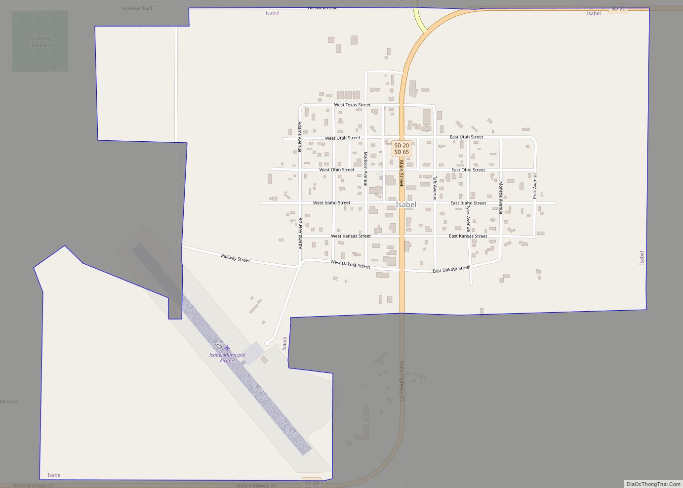
Map of Interior town
Interior (Lakota: makȟóšiča otȟúŋwahe; “Badlands village”) is a town in Jackson County, South Dakota, United States. The population was 65 at the 2020 census. Interior got its start in 1907 when the Milwaukee Railroad was extended to that point. Interior town overview: Name: Interior town LSAD Code: 43 LSAD Description: town (suffix) State: South Dakota ... Read more
Map of Interior town
Map of Huron city, South Dakota
Huron is a city in Beadle County, South Dakota, United States. It is the county seat of Beadle County. The population was 14,263 at the 2020 census, and it is the eighth largest city in South Dakota. The first settlement at Huron was made in 1880. Huron is location of the South Dakota State Fair, ... Read more
Map of Huron city, South Dakota
Map of Hurley city, South Dakota
Hurley is a city in Turner County, South Dakota, United States. The population was 379 at the 2020 census. Hurley city overview: Name: Hurley city LSAD Code: 25 LSAD Description: city (suffix) State: South Dakota County: Turner County Incorporated: 1883 Elevation: 1,283 ft (391 m) Total Area: 0.62 sq mi (1.59 km²) Land Area: 0.62 sq mi (1.59 km²) Water Area: 0.00 sq mi (0.00 km²) ... Read more
Map of Hurley city, South Dakota
Map of Humboldt town, South Dakota
Humboldt is a town in Minnehaha County, South Dakota, United States. The population was 579 at the 2020 census. Humboldt town overview: Name: Humboldt town LSAD Code: 43 LSAD Description: town (suffix) State: South Dakota County: Minnehaha County Incorporated: 1891 Elevation: 1,703 ft (519 m) Total Area: 0.63 sq mi (1.64 km²) Land Area: 0.62 sq mi (1.60 km²) Water Area: 0.01 sq mi (0.04 km²) ... Read more
Map of Humboldt town, South Dakota
Map of Hudson town, South Dakota
Hudson is a town in Lincoln County, South Dakota, United States. The population was 311 at the 2020 census. It is the easternmost community in South Dakota. The town takes its name from Hudson, Iowa, the native home of a large share of the early settlers. Hudson town overview: Name: Hudson town LSAD Code: 43 ... Read more
Map of Hudson town, South Dakota
Map of Kaylor CDP
Kaylor is a census-designated place (CDP) in Hutchinson County, South Dakota, United States. The population was 30 at the 2020 census. The community’s name is a corruption of Taylor, the name of a local rancher. Kaylor CDP overview: Name: Kaylor CDP LSAD Code: 57 LSAD Description: CDP (suffix) State: South Dakota County: Hutchinson County Total ... Read more
Map of Kaylor CDP
Map of Kadoka city
Kadoka is a city in, and the county seat of, Jackson County, South Dakota, United States. The population was 543 at the 2020 census. The town occupies about 2.3 square miles. Kadoka city overview: Name: Kadoka city LSAD Code: 25 LSAD Description: city (suffix) State: South Dakota County: Jackson County Founded: 1906 Elevation: 2,467 ft (752 m) ... Read more
Map of Kadoka city
Map of Johnson Siding CDP
Johnson Siding is an unincorporated community in Pennington County, South Dakota, United States. The population as of the 2020 census was 614. It is located in the Rimrock Area, approximately 10 miles west of Rapid City. Johnson Siding is surrounded by the Black Hills National Forest. It is the only significant business district in the ... Read more
Map of Johnson Siding CDP
Map of Jefferson city, South Dakota
Jefferson is a city in Union County, South Dakota, United States. The population was 475 at the 2020 census. It is part of the Sioux City, IA–NE-SD Metropolitan Statistical Area. Jefferson was founded in 1859. Every year the citizens of Jefferson and surrounding area celebrate the founding of Jefferson during the “Days of ’59”, a ... Read more
Map of Jefferson city, South Dakota
Map of Kyle CDP, South Dakota
Kyle (Lakota: phežúta ȟaká; “Branched Medicine”) is a census-designated place (CDP) in Oglala Lakota County, South Dakota, United States. Its population was 943 at the 2020 census. Located within the Pine Ridge Indian Reservation of the Oglala Lakota, it is one of two settlements which are closest to the North American continental pole of inaccessibility. ... Read more
Map of Kyle CDP, South Dakota
Map of Kranzburg town
Kranzburg is a town in Codington County, South Dakota, United States. The population was 163 at the 2020 census. It is part of the Watertown, South Dakota Micropolitan Statistical Area. Kranzburg town overview: Name: Kranzburg town LSAD Code: 43 LSAD Description: town (suffix) State: South Dakota County: Codington County Founded: May 16, 1879 Elevation: 1,982 ft ... Read more
Map of Kranzburg town
Map of Kimball city, South Dakota
Kimball is a city in Brule County, South Dakota, United States. The population was 572 at the 2020 census. Kimball city overview: Name: Kimball city LSAD Code: 25 LSAD Description: city (suffix) State: South Dakota County: Brule County Incorporated: 1889 Elevation: 1,788 ft (545 m) Total Area: 3.44 sq mi (8.90 km²) Land Area: 3.44 sq mi (8.90 km²) Water Area: 0.00 sq mi (0.00 km²) ... Read more
Map of Kimball city, South Dakota