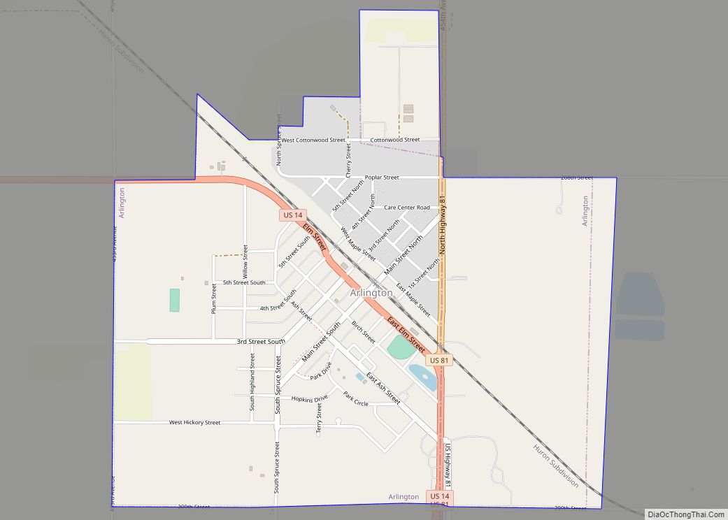
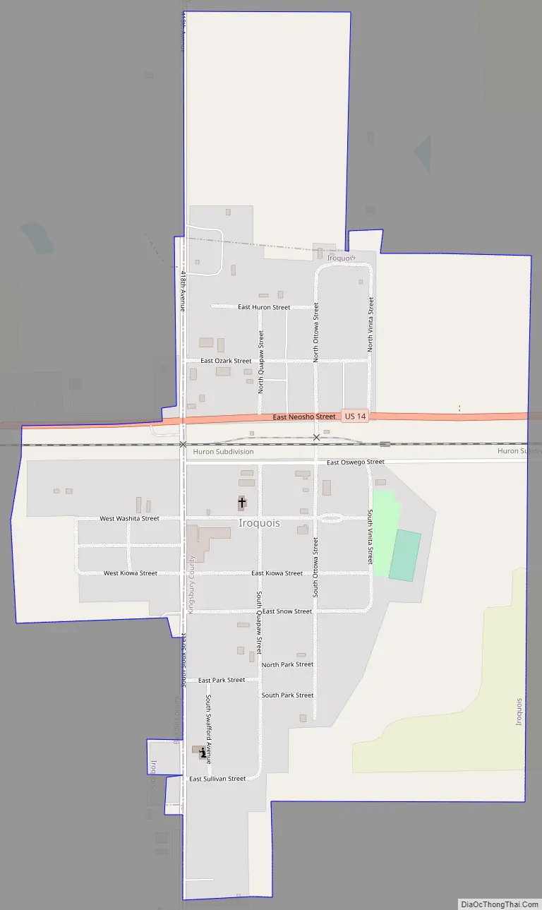
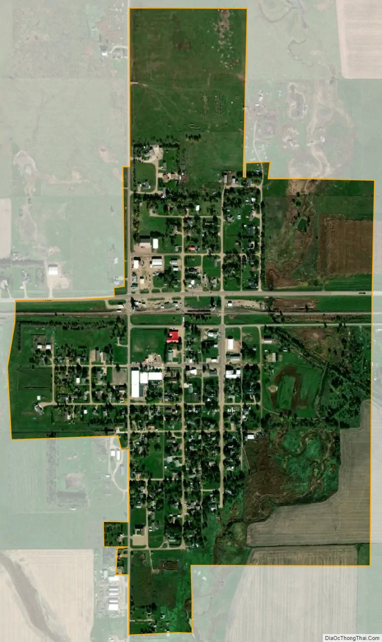
Iroquois is a city on the border of Beadle and Kingsbury counties in South Dakota, United States. The population was 292 at the 2020 census. The school building (kindergarten – twelfth grade) is located in Kingsbury County, while the school parking lot is located in Beadle County. Highway 14 runs directly through Iroquois.
| Name: | Iroquois city |
|---|---|
| LSAD Code: | 25 |
| LSAD Description: | city (suffix) |
| State: | South Dakota |
| County: | Beadle County, Kingsbury County |
| Incorporated: | 1887 |
| Elevation: | 1,401 ft (427 m) |
| Total Area: | 0.62 sq mi (1.61 km²) |
| Land Area: | 0.62 sq mi (1.61 km²) |
| Water Area: | 0.00 sq mi (0.00 km²) |
| Total Population: | 292 |
| Population Density: | 470.97/sq mi (181.70/km²) |
| ZIP code: | 57353 |
| Area code: | 605 |
| FIPS code: | 4632020 |
| GNISfeature ID: | 1255781 |
| Website: | www.iroquoissd.com |
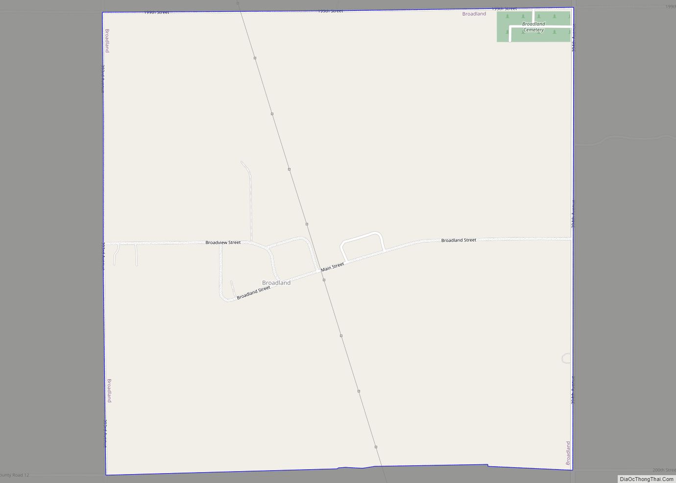
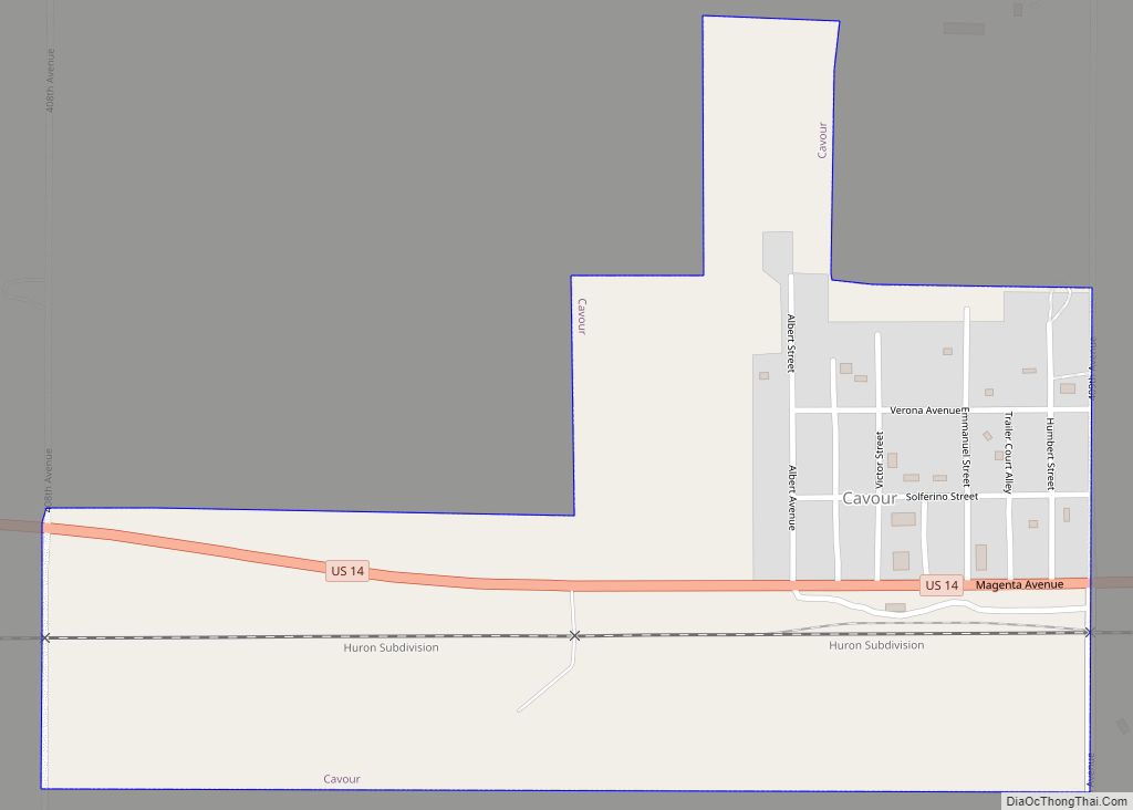
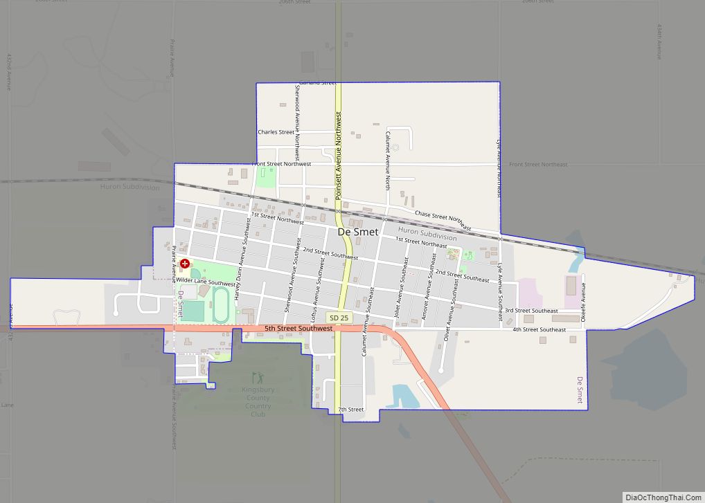
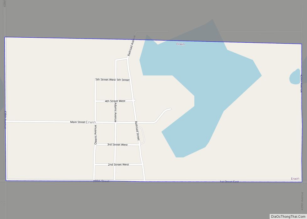
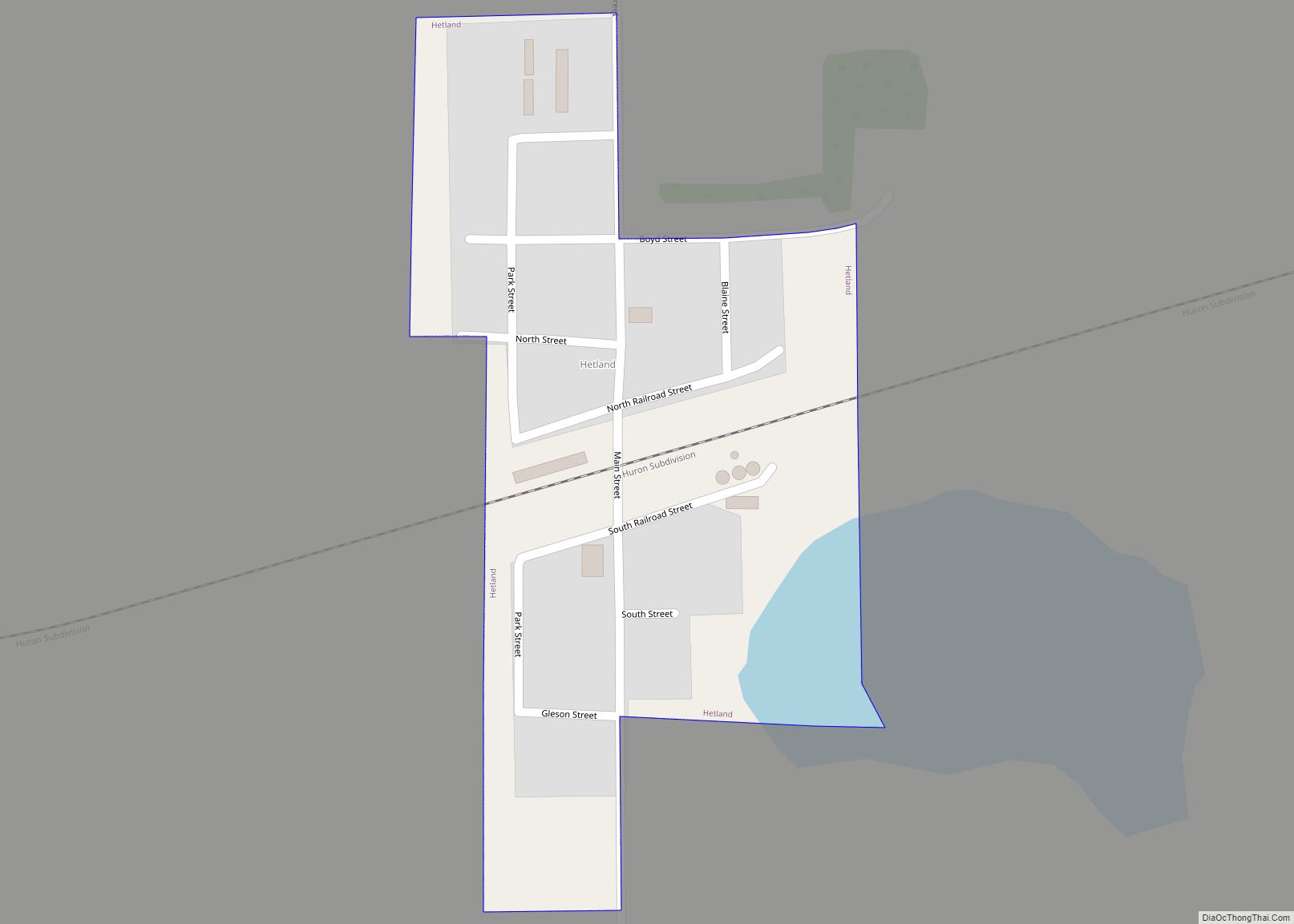
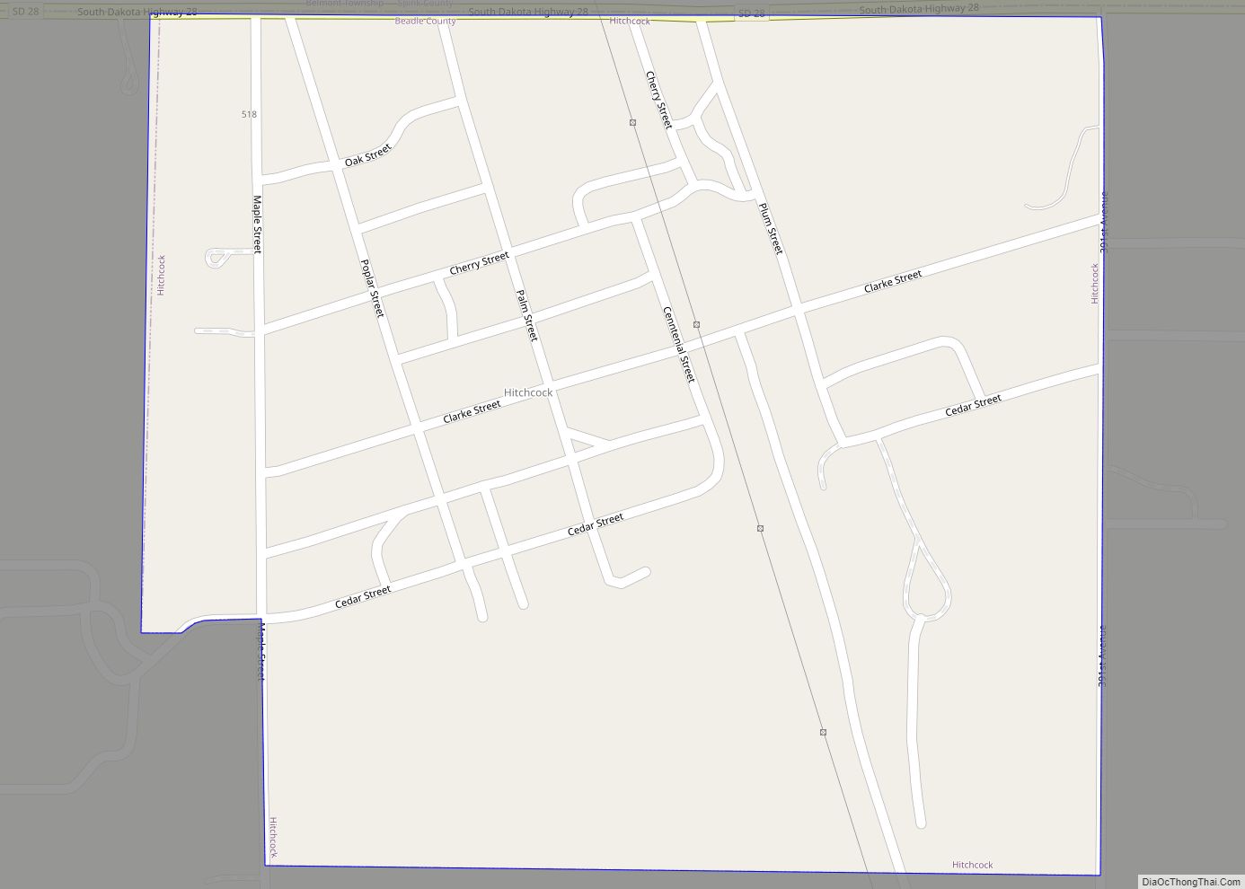
Online Interactive Map
Click on ![]() to view map in "full screen" mode.
to view map in "full screen" mode.
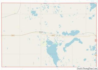
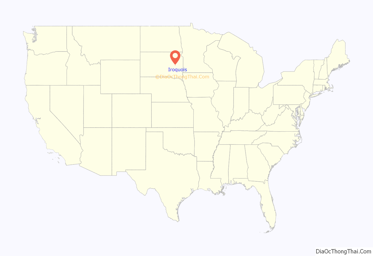
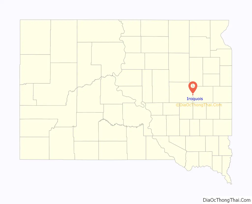
Iroquois location map. Where is Iroquois city?
History
Iroquois was laid out in 1880. The city was named after the Iroquois people. A post office called Iroquois has been in operation since 1880.
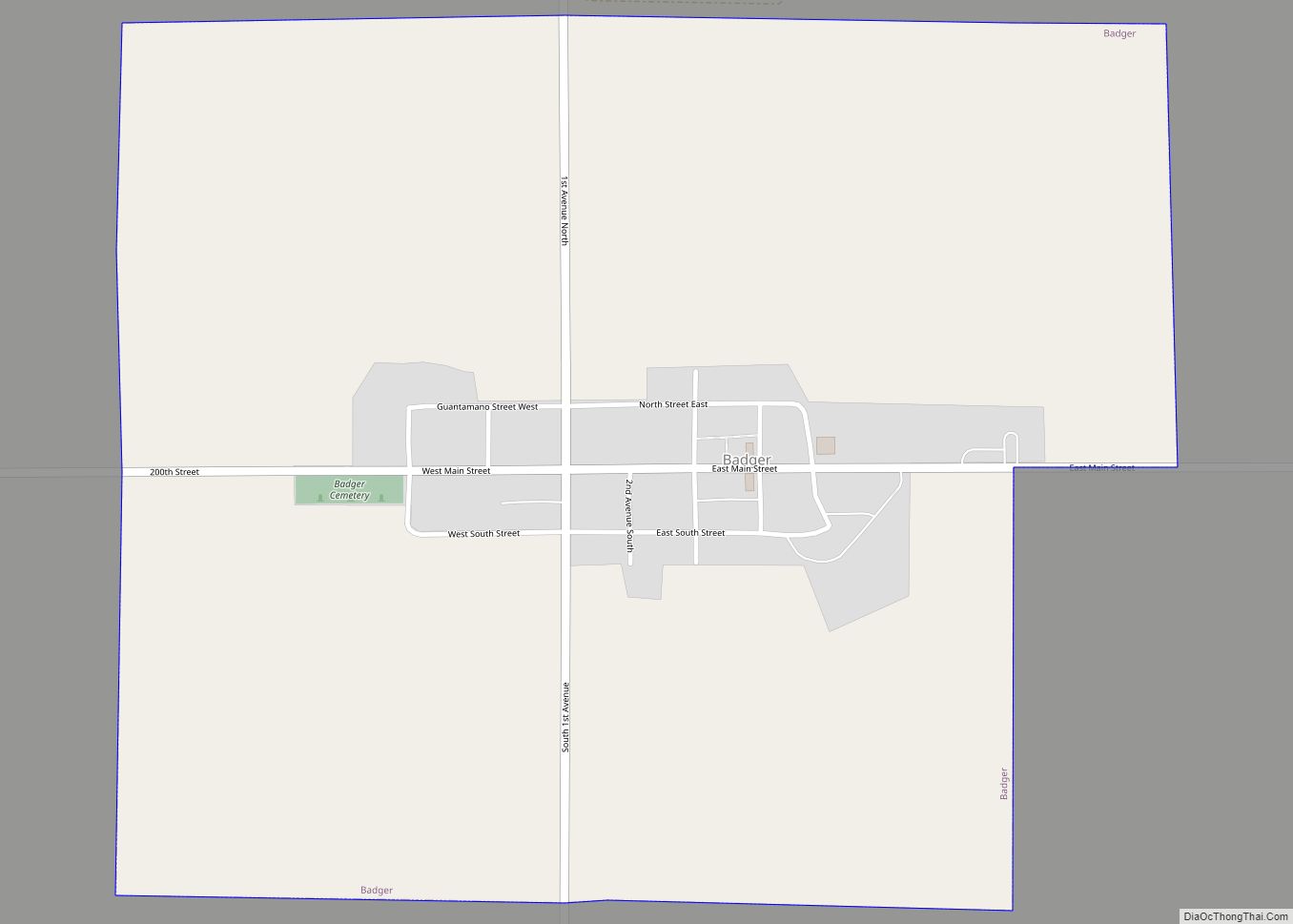
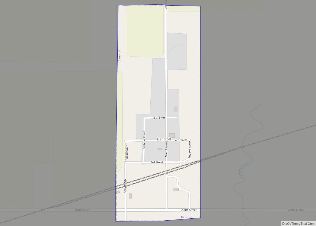
Iroquois Road Map
Iroquois city Satellite Map
Geography
Iroquois is located at 44°21′59″N 97°51′0″W / 44.36639°N 97.85000°W / 44.36639; -97.85000 (44.366437, -97.850095).
According to the United States Census Bureau, the city has a total area of 0.62 square miles (1.61 km), all land.
Iroquois has been assigned the ZIP code 57353 and the FIPS place code 32020.
See also
Map of South Dakota State and its subdivision:- Aurora
- Beadle
- Bennett
- Bon Homme
- Brookings
- Brown
- Brule
- Buffalo
- Butte
- Campbell
- Charles Mix
- Clark
- Clay
- Codington
- Corson
- Custer
- Davison
- Day
- Deuel
- Dewey
- Douglas
- Edmunds
- Fall River
- Faulk
- Grant
- Gregory
- Haakon
- Hamlin
- Hand
- Hanson
- Harding
- Hughes
- Hutchinson
- Hyde
- Jackson
- Jerauld
- Jones
- Kingsbury
- Lake
- Lawrence
- Lincoln
- Lyman
- Marshall
- McCook
- McPherson
- Meade
- Mellette
- Miner
- Minnehaha
- Moody
- Pennington
- Perkins
- Potter
- Roberts
- Sanborn
- Shannon
- Spink
- Stanley
- Sully
- Todd
- Tripp
- Turner
- Union
- Walworth
- Yankton
- Ziebach
- Alabama
- Alaska
- Arizona
- Arkansas
- California
- Colorado
- Connecticut
- Delaware
- District of Columbia
- Florida
- Georgia
- Hawaii
- Idaho
- Illinois
- Indiana
- Iowa
- Kansas
- Kentucky
- Louisiana
- Maine
- Maryland
- Massachusetts
- Michigan
- Minnesota
- Mississippi
- Missouri
- Montana
- Nebraska
- Nevada
- New Hampshire
- New Jersey
- New Mexico
- New York
- North Carolina
- North Dakota
- Ohio
- Oklahoma
- Oregon
- Pennsylvania
- Rhode Island
- South Carolina
- South Dakota
- Tennessee
- Texas
- Utah
- Vermont
- Virginia
- Washington
- West Virginia
- Wisconsin
- Wyoming