Map of La Bolt town

Map of La Bolt town

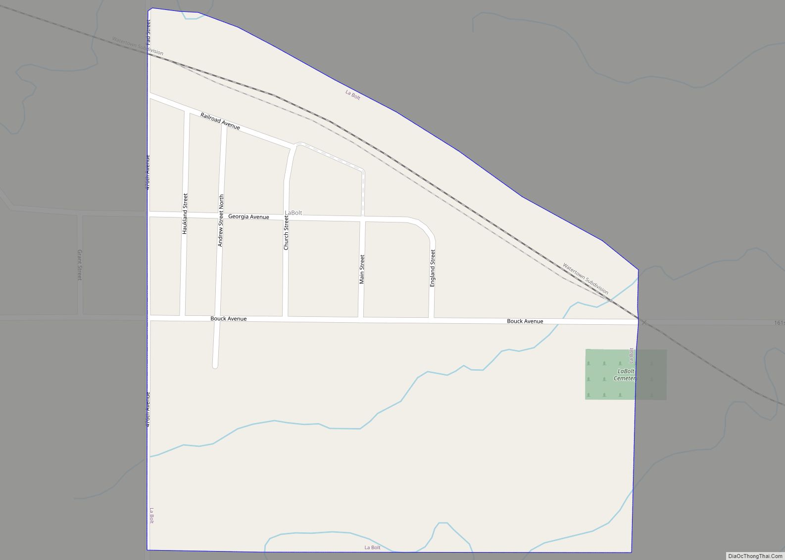
La Bolt is a town in Grant County, South Dakota, United States. The population was 66 at the 2020 census. The town has the name of Alfred Labolt, a pioneer settler. La Bolt town overview: Name: La Bolt town LSAD Code: 43 LSAD Description: town (suffix) State: South Dakota County: Grant County Incorporated: 1901 Total … Read more

Map of Lemmon city

Map of Lemmon city

Lemmon is a town in Perkins County, South Dakota, United States. The population was 1,160 at the 2020 census. Lemmon is named after George Ed Lemmon, a cattleman, who founded the town in 1906. The City of Lemmon received the South Dakota Community of the Year Award in 2012. Lemmon city overview: Name: Lemmon city … Read more

Map of Lebanon town, South Dakota

Map of Lebanon town, South Dakota

Lebanon is a town in Potter County, South Dakota, United States. The population was 33 at the 2020 census. Lebanon town overview: Name: Lebanon town LSAD Code: 43 LSAD Description: town (suffix) State: South Dakota County: Potter County Incorporated: 1917 Elevation: 1,952 ft (595 m) Total Area: 0.53 sq mi (1.37 km²) Land Area: 0.53 sq mi (1.37 km²) Water Area: 0.00 sq mi (0.00 km²) … Read more

Map of Lead city

Map of Lead city

Lead (/ˈliːd/ LEED) is a city in Lawrence County, South Dakota, United States. The population was 2,982 at the 2020 census. Lead is located in western South Dakota, in the Black Hills near the Wyoming state line. Lead city overview: Name: Lead city LSAD Code: 25 LSAD Description: city (suffix) State: South Dakota County: Lawrence … Read more

Map of Long Hollow CDP

Map of Long Hollow CDP

Long Hollow is an unincorporated community and census-designated place in Roberts County, South Dakota, United States. Its population was 265 as of the 2020 census. Long Hollow CDP overview: Name: Long Hollow CDP LSAD Code: 57 LSAD Description: CDP (suffix) State: South Dakota County: Roberts County Elevation: 1,696 ft (517 m) Total Area: 14.55 sq mi (37.69 km²) Land Area: … Read more

Map of Little Eagle CDP

Map of Little Eagle CDP

Little Eagle (Lakota: Waŋblí Čik’ala) is a census-designated place (CDP) in Corson County, South Dakota, United States. The population was 319 at the 2010 census. The community has the name of a Native American chieftain. Little Eagle CDP overview: Name: Little Eagle CDP LSAD Code: 57 LSAD Description: CDP (suffix) State: South Dakota County: Corson … Read more

Map of Lily town

Map of Lily town

Lily town overview: Name: Lily town LSAD Code: 43 LSAD Description: town (suffix) State: South Dakota County: Day County FIPS code: 4637140 Online Interactive Map Lily online map. Source: Basemap layers from Google Map, Open Street Map (OSM), Arcgisonline, Wmflabs. Boundary Data from Database of Global Administrative Areas. Lily location map. Where is Lily town? … Read more

Map of Letcher town

Map of Letcher town

Letcher is a town in Sanborn County, South Dakota, United States. The population was 159 at the 2020 census. Letcher has the name of O. T. Letcher, a local landowner. Letcher town overview: Name: Letcher town LSAD Code: 43 LSAD Description: town (suffix) State: South Dakota County: Sanborn County Elevation: 1,302 ft (397 m) Total Area: 0.65 sq mi … Read more

Map of Lesterville town

Map of Lesterville town

Lesterville is a town in Yankton County, South Dakota, United States. The population was 115 at the 2020 census. Lesterville town overview: Name: Lesterville town LSAD Code: 43 LSAD Description: town (suffix) State: South Dakota County: Yankton County Incorporated: 1883 Elevation: 1,388 ft (423 m) Total Area: 0.20 sq mi (0.52 km²) Land Area: 0.20 sq mi (0.52 km²) Water Area: 0.00 sq mi (0.00 km²) … Read more

Map of Leola city, South Dakota

Map of Leola city, South Dakota

Leola is a small city in, and the county seat of, McPherson County, South Dakota, United States. It was founded on May 1, 1884, and named for Leola Haynes, daughter of one of the town’s founders. The population was 434 as of the 2020 census. Leola city overview: Name: Leola city LSAD Code: 25 LSAD … Read more

Map of Lennox city, South Dakota

Map of Lennox city, South Dakota

Lennox is a city in Lincoln County, South Dakota, United States, located 20 miles (32 km) southwest of Sioux Falls. The population was 2,423 at the 2020 census. Lennox city overview: Name: Lennox city LSAD Code: 25 LSAD Description: city (suffix) State: South Dakota County: Lincoln County Incorporated: 1889 Elevation: 1,345 ft (410 m) Total Area: 1.75 sq mi (4.52 km²) … Read more

Map of Martin city, South Dakota

Map of Martin city, South Dakota

Martin (Lakota: pažóla otȟúŋwahe; “Knoll City”) is a city and the county seat of Bennett County, South Dakota, United States. The population was 938 at the 2020 census. Martin city overview: Name: Martin city LSAD Code: 25 LSAD Description: city (suffix) State: South Dakota County: Bennett County Founded: 1912 Elevation: 3,310 ft (1,009 m) Total Area: 0.56 sq mi … Read more