Map of Philip city
Philip is a town in and the county seat of rural Haakon County, South Dakota, United States. The population was 759 at the 2020 census. Philip city overview: Name: Philip city LSAD Code: 25 LSAD Description: city (suffix) State: South Dakota County: Haakon County Founded: 1907 Elevation: 2,165 ft (660 m) Total Area: 0.59 sq mi (1.54 km²) Land Area: ... Read more
Map of Philip city
Map of Pollock town, South Dakota
Pollock is a town in Campbell County, South Dakota, United States. The population was 224 at the time of the 2020 census. Pollock town overview: Name: Pollock town LSAD Code: 43 LSAD Description: town (suffix) State: South Dakota County: Campbell County Founded: 1901 Elevation: 1,654 ft (504 m) Total Area: 0.32 sq mi (0.83 km²) Land Area: 0.32 sq mi (0.83 km²) Water ... Read more
Map of Pollock town, South Dakota
Map of Platte city
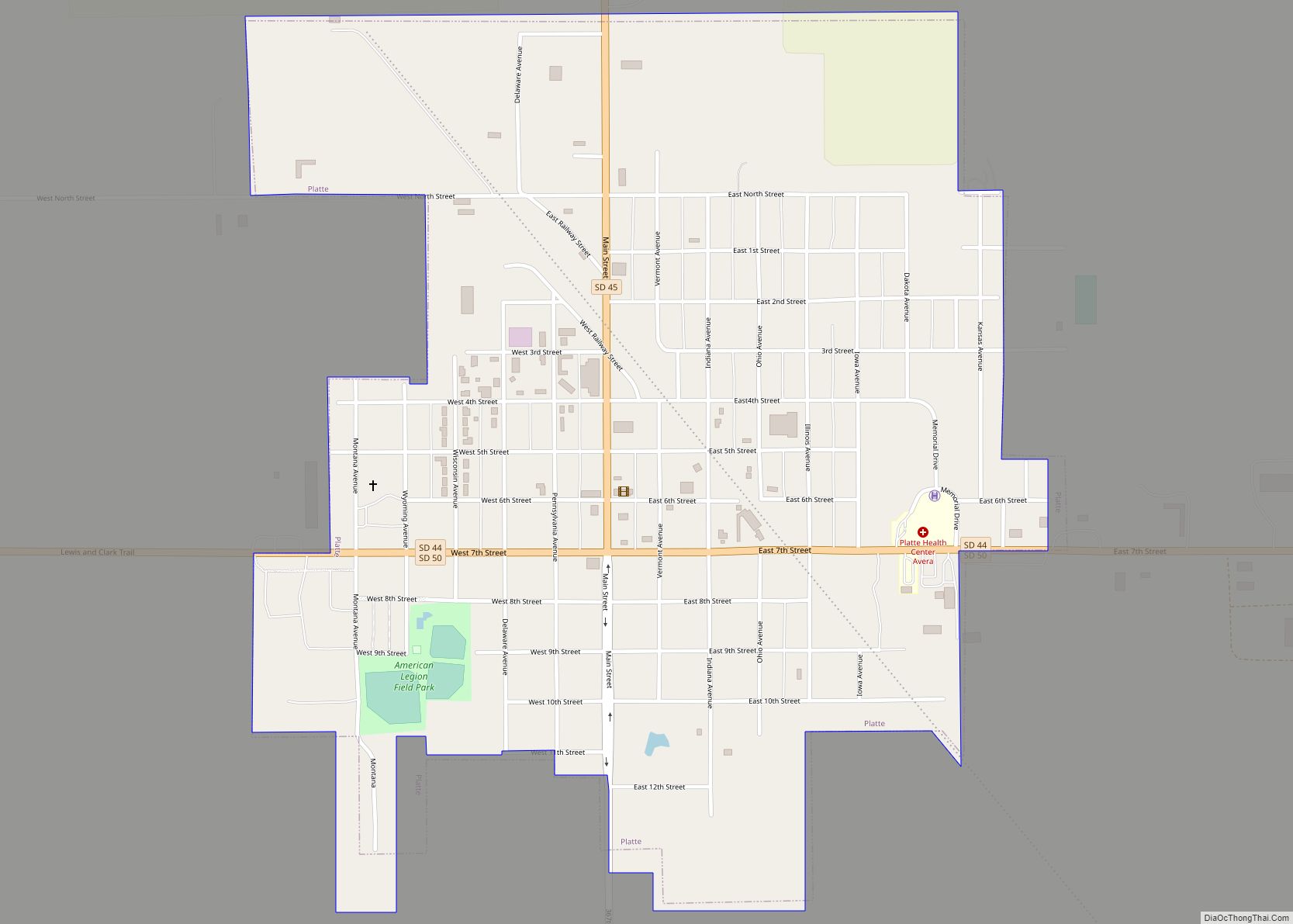
Platte is a city in Charles Mix County, South Dakota, United States. The population was 1,311 at the 2022 census. The community is named after the Platte Creek, a tributary of the Missouri River reservoir Lake Francis Case. Platte is located 15 miles east of Lake Francis Case on the Missouri River. Platte city overview: ... Read more
Map of Platte city
Map of Plankinton city
Plankinton is a city in and county seat of Aurora County, South Dakota, United States. The population was 781 at the 2020 census. Plankinton city overview: Name: Plankinton city LSAD Code: 25 LSAD Description: city (suffix) State: South Dakota County: Aurora County Incorporated: 1887 Elevation: 1,526 ft (465 m) Total Area: 0.76 sq mi (1.98 km²) Land Area: 0.76 sq mi (1.98 km²) ... Read more
Map of Plankinton city
Map of Pine Ridge CDP, South Dakota
Pine Ridge (Lakota: wazíbló) is a census-designated place (CDP) and the most populous community in Oglala Lakota County, South Dakota, United States. The population was 3,138 at the 2020 census. It is the tribal headquarters of the Oglala Sioux Tribe on the Pine Ridge Indian Reservation. Pine Ridge CDP overview: Name: Pine Ridge CDP LSAD ... Read more
Map of Pine Ridge CDP, South Dakota
Map of Pine Lakes Addition CDP
Pine Lakes Addition is an unincorporated community and census-designated place in Minnehaha County, South Dakota, United States. Its population was 306 as of the 2020 census. The community is east of Sioux Falls. Pine Lakes Addition CDP overview: Name: Pine Lakes Addition CDP LSAD Code: 57 LSAD Description: CDP (suffix) State: South Dakota County: Minnehaha ... Read more
Map of Pine Lakes Addition CDP
Map of Pierre city
Pierre city overview: Name: Pierre city LSAD Code: 25 LSAD Description: city (suffix) State: South Dakota County: Hughes County FIPS code: 4649600 Online Interactive Map Pierre online map. Source: Basemap layers from Google Map, Open Street Map (OSM), Arcgisonline, Wmflabs. Boundary Data from Database of Global Administrative Areas. Pierre location map. Where is Pierre city? ... Read more
Map of Pierre city
Map of Pierpont town, South Dakota
Pierpont is a town in northwestern Day County, South Dakota, United States. The population was 129 at the 2020 census. The town was founded in 1883 and takes its name from a railroad officer. Pierpont town overview: Name: Pierpont town LSAD Code: 43 LSAD Description: town (suffix) State: South Dakota County: Day County Elevation: 1,506 ft ... Read more
Map of Pierpont town, South Dakota
Map of Piedmont city, South Dakota
Piedmont is a city in Meade County, South Dakota, United States. According to the 2020 census, its population was 971. Piedmont lies along Interstate 90 between Rapid City and Sturgis. Piedmont has been assigned the ZIP Code of 57769. Piedmont city overview: Name: Piedmont city LSAD Code: 25 LSAD Description: city (suffix) State: South Dakota ... Read more
Map of Piedmont city, South Dakota
Map of Rapid Valley CDP
Rapid Valley is a census-designated place (CDP) and unincorporated community in Pennington County, South Dakota, United States, and a suburb of Rapid City. The population was 8,098 at the 2020 census. Rapid Valley has been a retreat for people living in Rapid City due to its low crime, cheap land, and views of the Black ... Read more
Map of Rapid Valley CDP
Map of Ramona town, South Dakota
Ramona is a town in Lake County, South Dakota, United States. The population was 159 at the 2020 census. Ramona was laid out in 1886, and named for the local Ramon family. Ramona town overview: Name: Ramona town LSAD Code: 43 LSAD Description: town (suffix) State: South Dakota County: Lake County Elevation: 1,818 ft (554 m) Total ... Read more
Map of Ramona town, South Dakota
Map of Quinn town
Quinn is a town in Pennington County, South Dakota, United States. The population was 63 at the 2020 census. The town is the home of the Badlands Observatory, located in the former community hospital, built in 1950. Quinn town overview: Name: Quinn town LSAD Code: 43 LSAD Description: town (suffix) State: South Dakota County: Pennington ... Read more
Map of Quinn town