Philip is a town in and the county seat of rural Haakon County, South Dakota, United States. The population was 759 at the 2020 census.
| Name: | Philip city |
|---|---|
| LSAD Code: | 25 |
| LSAD Description: | city (suffix) |
| State: | South Dakota |
| County: | Haakon County |
| Founded: | 1907 |
| Elevation: | 2,165 ft (660 m) |
| Total Area: | 0.59 sq mi (1.54 km²) |
| Land Area: | 0.59 sq mi (1.54 km²) |
| Water Area: | 0.00 sq mi (0.00 km²) |
| Total Population: | 759 |
| Population Density: | 1,277.78/sq mi (493.18/km²) |
| ZIP code: | 57567 |
| Area code: | 605 |
| FIPS code: | 4649300 |
| GNISfeature ID: | 1257034 |
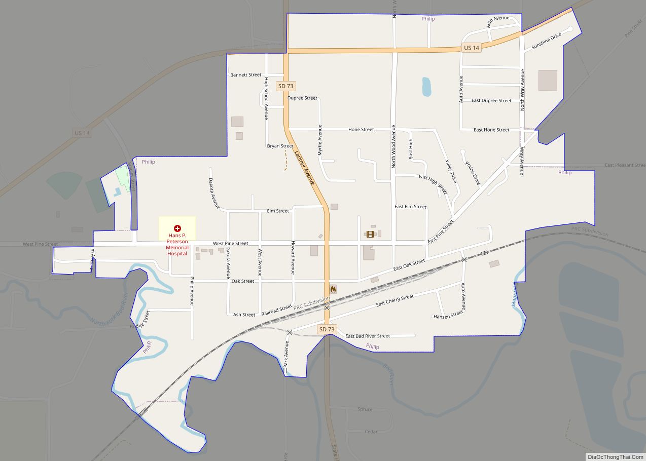
Online Interactive Map
Click on ![]() to view map in "full screen" mode.
to view map in "full screen" mode.
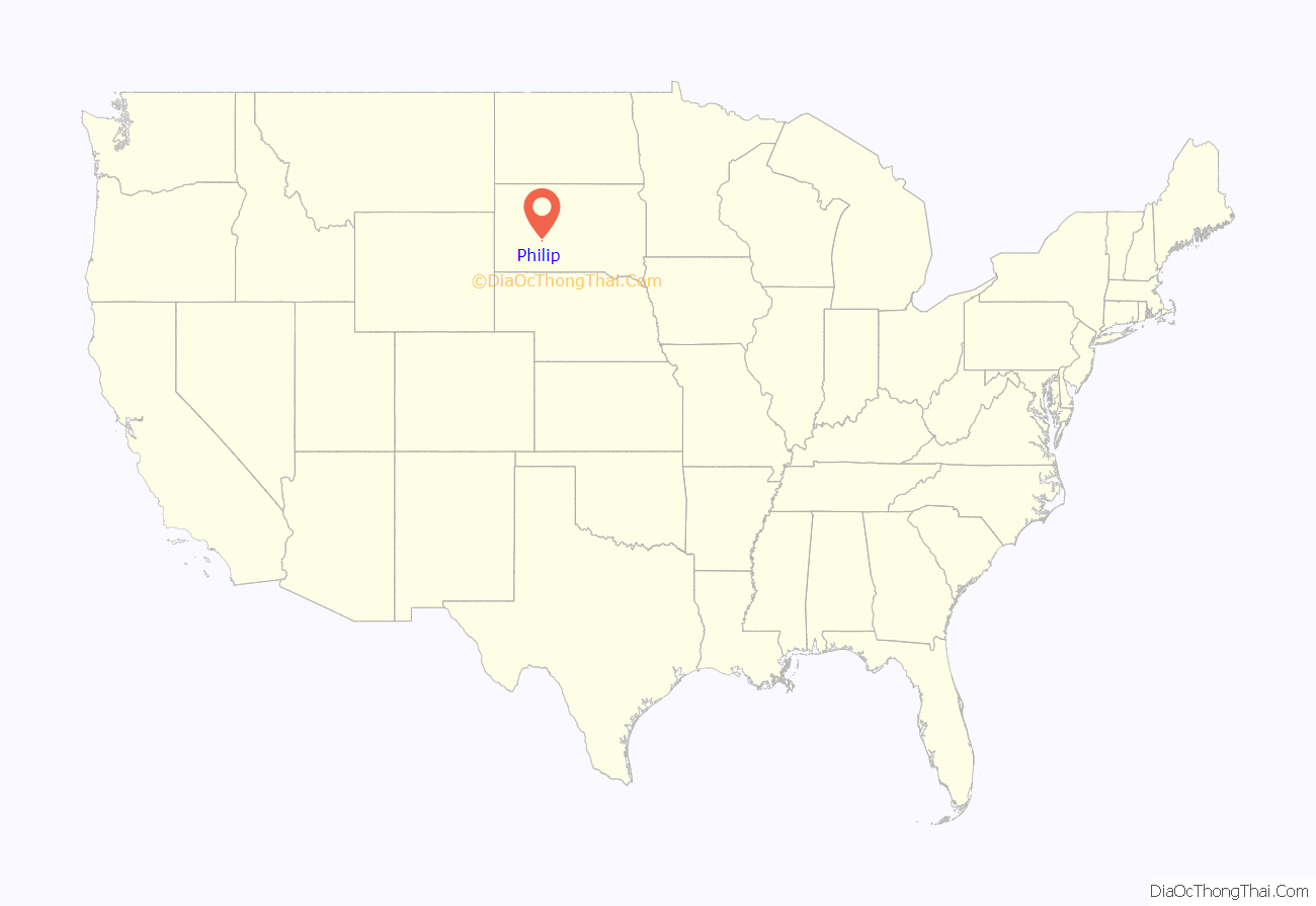
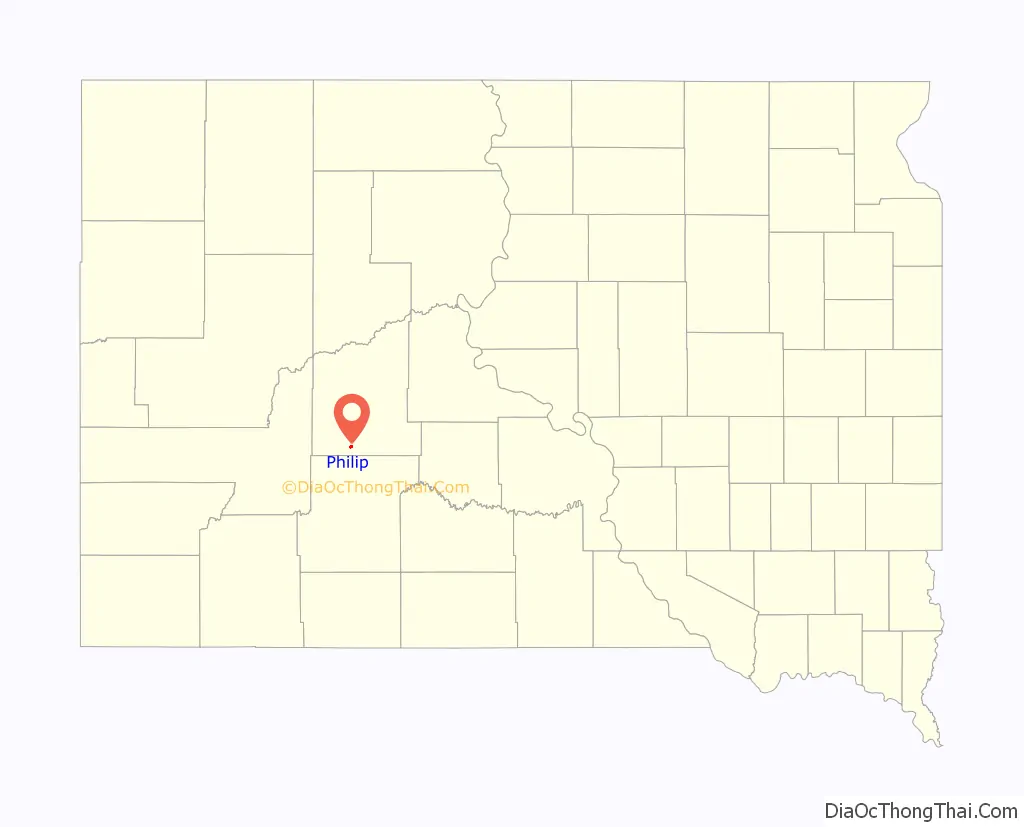
Philip location map. Where is Philip city?
History
Philip was laid out in 1907 when the Chicago and North Western Railway was extended to that point. It was incorporated in 1908. In 1914, Philip was designated seat of the newly formed Haakon County. The city was named for James “Scotty” Philip; the local high school mascot is the Scotch terrier, or “Scottie”, in his honor.
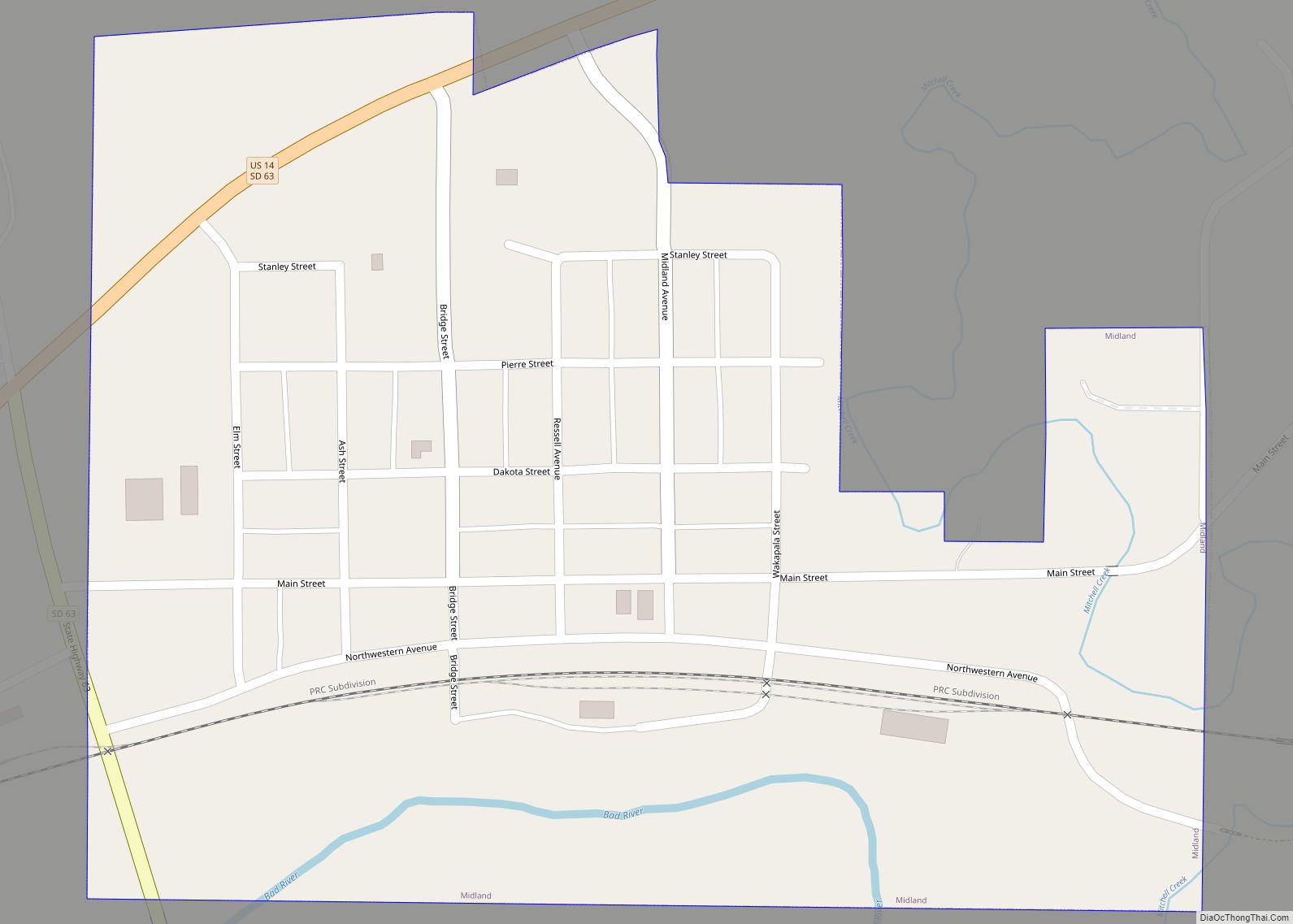
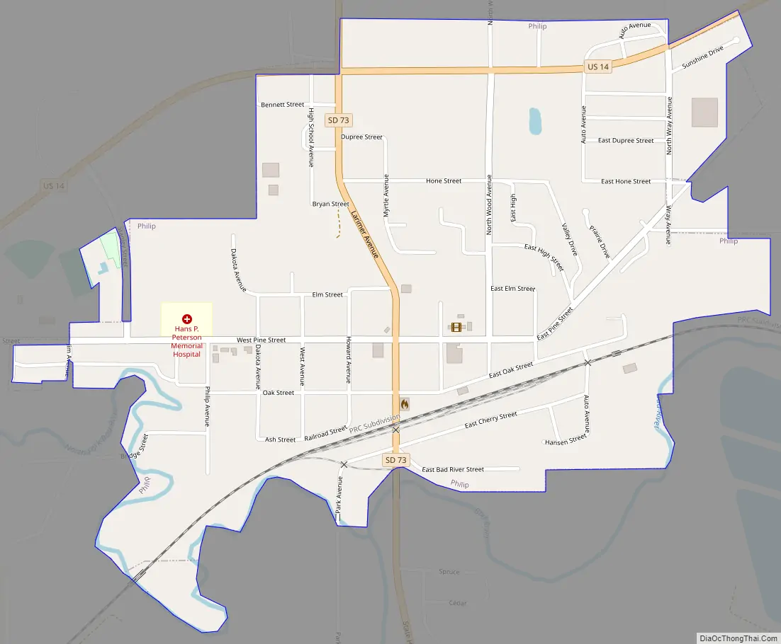
Philip Road Map
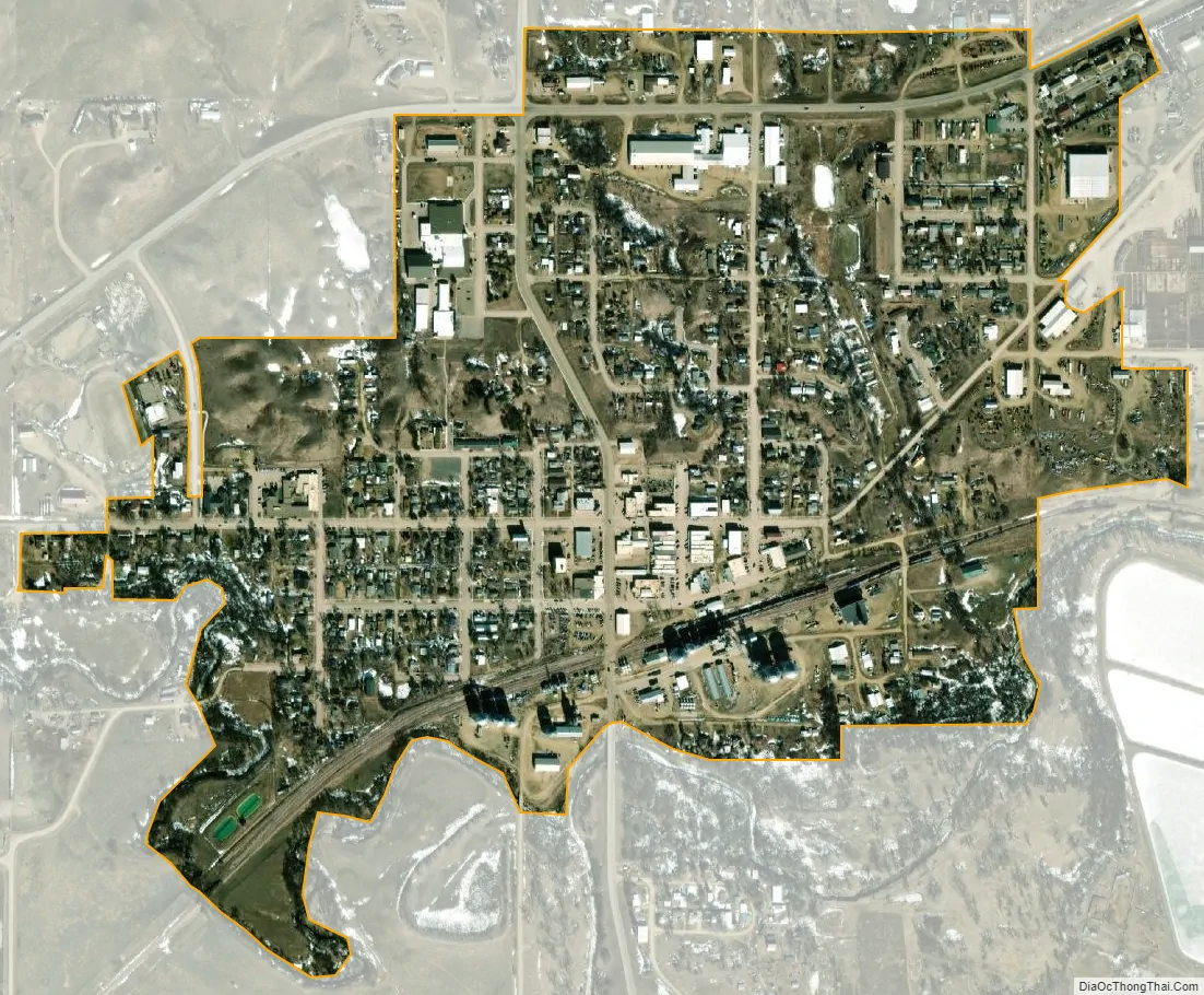
Philip city Satellite Map
Geography
Philip is located at 44°2′24″N 101°39′58″W / 44.04000°N 101.66611°W / 44.04000; -101.66611 (44.039949, −101.666208).
According to the United States Census Bureau, the city has a total area of 0.60 square miles (1.55 km), all land.
Philip has been assigned the ZIP code 57567 and the FIPS place code 49300.
Philip is located on the banks of the Bad River, which empties into the Missouri River at Fort Pierre.
Climate
Philip has a borderline humid continental (Köppen Dfa)/cool semi-arid (BSk) climate. Winters are generally freezing, although warm chinook winds bring temperatures above 50 °F or 10 °C on sixteen afternoons during an average December to February period. Aridity during this period limits snowfall to a mean of 27.0 inches or 0.69 metres and a median of 18.2 inches (0.46 m), with median snow depth never above 2 inches (0.051 m). Overall Philip has a USDA hardiness zone of 4b, with minimum temperatures ranging from −25 to −20 °F (−31.7 to −28.9 °C).
During spring temperatures warm steadily, although 2.7 mornings in May still expect subfreezing minima. Thunderstorm rains make this the wettest time of the year, with averages around 3 inches or 76 millimetres of rain falling in May and June. During settled dry spells in the summer, temperatures can become exceedingly hot: the record being 116 °F or 46.7 °C on July 15, 2006, while sustained spells of sweltering and extremely dry weather are not uncommon, for instance July 1974 averaged a maximum of 96.6 °F (35.9 °C) and July 2012 98.2 °F (36.8 °C). The whole calendar year of 2012 saw only 7.15 inches (181.6 mm) of precipitation, whereas the single month of May 1982 saw as much as 8.83 inches (224.3 mm).
See also
Map of South Dakota State and its subdivision:- Aurora
- Beadle
- Bennett
- Bon Homme
- Brookings
- Brown
- Brule
- Buffalo
- Butte
- Campbell
- Charles Mix
- Clark
- Clay
- Codington
- Corson
- Custer
- Davison
- Day
- Deuel
- Dewey
- Douglas
- Edmunds
- Fall River
- Faulk
- Grant
- Gregory
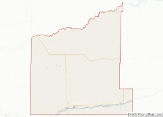
- Haakon
- Hamlin
- Hand
- Hanson
- Harding
- Hughes
- Hutchinson
- Hyde
- Jackson
- Jerauld
- Jones
- Kingsbury
- Lake
- Lawrence
- Lincoln
- Lyman
- Marshall
- McCook
- McPherson
- Meade
- Mellette
- Miner
- Minnehaha
- Moody
- Pennington
- Perkins
- Potter
- Roberts
- Sanborn
- Shannon
- Spink
- Stanley
- Sully
- Todd
- Tripp
- Turner
- Union
- Walworth
- Yankton
- Ziebach
- Alabama
- Alaska
- Arizona
- Arkansas
- California
- Colorado
- Connecticut
- Delaware
- District of Columbia
- Florida
- Georgia
- Hawaii
- Idaho
- Illinois
- Indiana
- Iowa
- Kansas
- Kentucky
- Louisiana
- Maine
- Maryland
- Massachusetts
- Michigan
- Minnesota
- Mississippi
- Missouri
- Montana
- Nebraska
- Nevada
- New Hampshire
- New Jersey
- New Mexico
- New York
- North Carolina
- North Dakota
- Ohio
- Oklahoma
- Oregon
- Pennsylvania
- Rhode Island
- South Carolina
- South Dakota
- Tennessee
- Texas
- Utah
- Vermont
- Virginia
- Washington
- West Virginia
- Wisconsin
- Wyoming