Map of Maury City town

Map of Maury City town

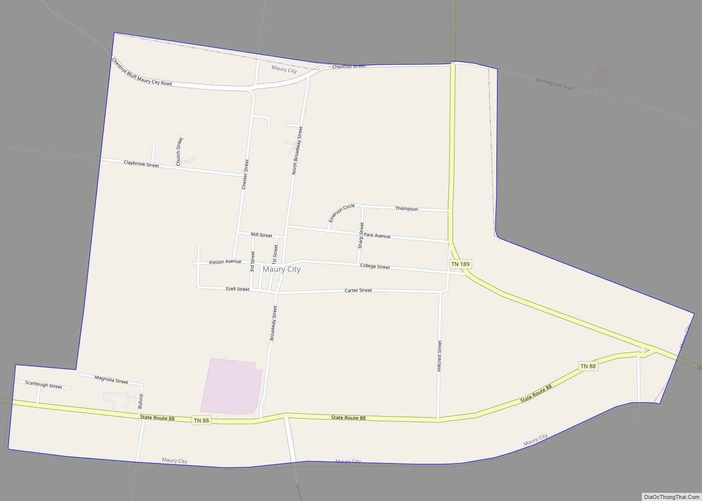
Maury City is a town in Crockett County, Tennessee. The population was 674 at the 2010 census. Locals pronounce the town’s name as “Murray City.” Maury City town overview: Name: Maury City town LSAD Code: 43 LSAD Description: town (suffix) State: Tennessee County: Crockett County Elevation: 351 ft (107 m) Total Area: 1.13 sq mi (2.92 km²) Land Area: 1.13 sq mi … Read more

Map of Mason town, Tennessee

Map of Mason town, Tennessee

Mason is a town in Tipton County, Tennessee. The population was 1,609 at the 2010 census. Mason is located along U.S. Route 70, and is home to a federal detention facility. Mason town overview: Name: Mason town LSAD Code: 43 LSAD Description: town (suffix) State: Tennessee County: Tipton County Elevation: 315 ft (96 m) Total Area: 1.98 sq mi … Read more

Map of Mascot CDP

Map of Mascot CDP

Mascot is a census-designated place (CDP) in Knox County, Tennessee, United States. The population was 2,760 at the 2020 census up from 2,411 at the 2010 census. Mascot CDP overview: Name: Mascot CDP LSAD Code: 57 LSAD Description: CDP (suffix) State: Tennessee County: Knox County Founded: 1796 Elevation: 1,037 ft (316 m) Total Area: 7.19 sq mi (18.61 km²) Land … Read more

Map of Maryville city, Tennessee

Map of Maryville city, Tennessee

Maryville is a city in and the county seat of Blount County, Tennessee, and is a suburb of Knoxville. Its population was 31,907 at the 2020 census. It is included in the Knoxville Metropolitan Area and is a short distance from popular tourist destinations such as the Great Smoky Mountains National Park, Dollywood, Gatlinburg, and … Read more

Map of Martin city, Tennessee

Map of Martin city, Tennessee

Martin is a city in Weakley County, Tennessee, United States. The population was 11,473 according to the 2010 census. The city is the home of the University of Tennessee at Martin. Martin city overview: Name: Martin city LSAD Code: 25 LSAD Description: city (suffix) State: Tennessee County: Weakley County Elevation: 407 ft (124 m) Total Area: 12.45 sq mi … Read more

Map of McMinnville city, Tennessee

Map of McMinnville city, Tennessee

McMinnville is the largest city in and the county seat of Warren County, Tennessee, United States. The population was 13,605 at the 2010 census. It was named for Governor Joseph McMinn. McMinnville city overview: Name: McMinnville city LSAD Code: 25 LSAD Description: city (suffix) State: Tennessee County: Warren County Founded: August 4, 1810 Incorporated: 1868 … Read more

Map of McLemoresville town

Map of McLemoresville town

McLemoresville is a town in Carroll County, Tennessee, United States. The population was 352 at the 2010 census. It is notable primarily as the birthplace, and final resting place, of television star Dixie Carter and her husband, actor Hal Holbrook. McLemoresville town overview: Name: McLemoresville town LSAD Code: 43 LSAD Description: town (suffix) State: Tennessee … Read more

Map of Millington city, Tennessee

Map of Millington city, Tennessee

Millington is a city in Shelby County, Tennessee, United States, and is a part of the Memphis metropolitan area. As of the 2010 census, it had a population of 10,176. Millington was granted the title “Flag City Tennessee” by the Tennessee State Legislature. The Naval Support Activity Mid-South is located at the former Memphis Naval … Read more

Map of Millersville city, Tennessee

Map of Millersville city, Tennessee

Millersville is a city in Robertson and Sumner counties, Tennessee. The population was 5,308 at the 2000 census and 6,440 in 2010. Millersville city overview: Name: Millersville city LSAD Code: 25 LSAD Description: city (suffix) State: Tennessee County: Robertson County, Sumner County Elevation: 502 ft (153 m) Total Area: 13.80 sq mi (35.75 km²) Land Area: 13.80 sq mi (35.75 km²) Water Area: … Read more

Map of Milledgeville town, Tennessee

Map of Milledgeville town, Tennessee

Milledgeville is a town in Chester, Hardin, and McNairy counties, Tennessee, United States. The population was 265 at the 2010 census. Milledgeville town overview: Name: Milledgeville town LSAD Code: 43 LSAD Description: town (suffix) State: Tennessee County: Chester County, Hardin County, McNairy County Incorporated: 1983 Elevation: 420 ft (128 m) Total Area: 1.61 sq mi (4.16 km²) Land Area: 1.61 sq mi … Read more

Map of Milan city, Tennessee

Map of Milan city, Tennessee

Milan (/ˈmaɪ.lən/) is the second largest city after Humboldt in Gibson County, Tennessee and the largest entirely within the county. It is home to the Milan Army Ammunition Plant, the West Tennessee Agricultural Museum and several historical sites listed on the National Register of Historic Places (NRHP). The city was the first in Tennessee to … Read more

Map of Midtown CDP

Map of Midtown CDP

Midtown is a census-designated place (CDP) in Roane County, Tennessee, United States. Its population was 1,360 as of the 2010 census. Twice in the 1990s residents voted to incorporate as a town, and for a time the community maintained a municipal government, but the incorporation was challenged in court and eventually overturned after the state … Read more