McMinnville is the largest city in and the county seat of Warren County, Tennessee, United States. The population was 13,605 at the 2010 census. It was named for Governor Joseph McMinn.
| Name: | McMinnville city |
|---|---|
| LSAD Code: | 25 |
| LSAD Description: | city (suffix) |
| State: | Tennessee |
| County: | Warren County |
| Founded: | August 4, 1810 |
| Incorporated: | 1868 |
| Elevation: | 961 ft (293 m) |
| Total Area: | 11.06 sq mi (28.65 km²) |
| Land Area: | 11.06 sq mi (28.65 km²) |
| Water Area: | 0.00 sq mi (0.00 km²) |
| Total Population: | 13,788 |
| Population Density: | 1,246.54/sq mi (481.28/km²) |
| ZIP code: | 37110, 37111 |
| Area code: | 931 |
| FIPS code: | 4745100 |
| GNISfeature ID: | 1652432 |
| Website: | McMinnvilleTn.gov |
Online Interactive Map
Click on ![]() to view map in "full screen" mode.
to view map in "full screen" mode.
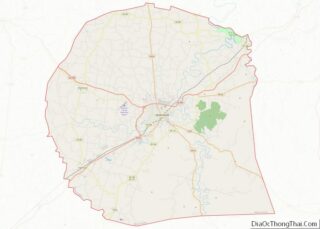
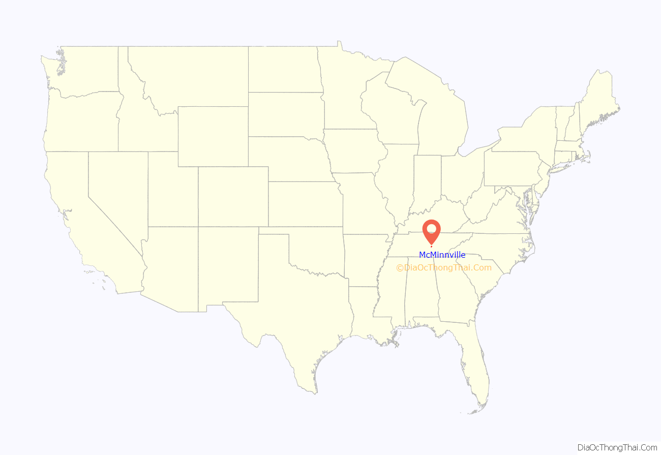
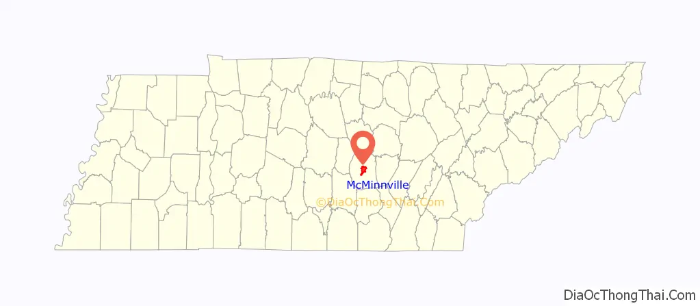
McMinnville location map. Where is McMinnville city?
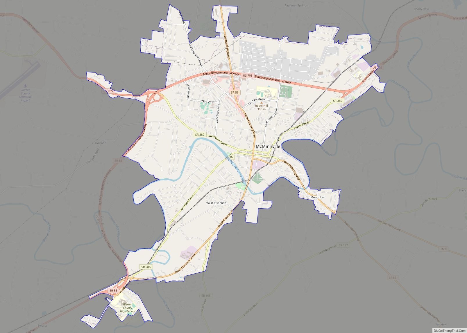
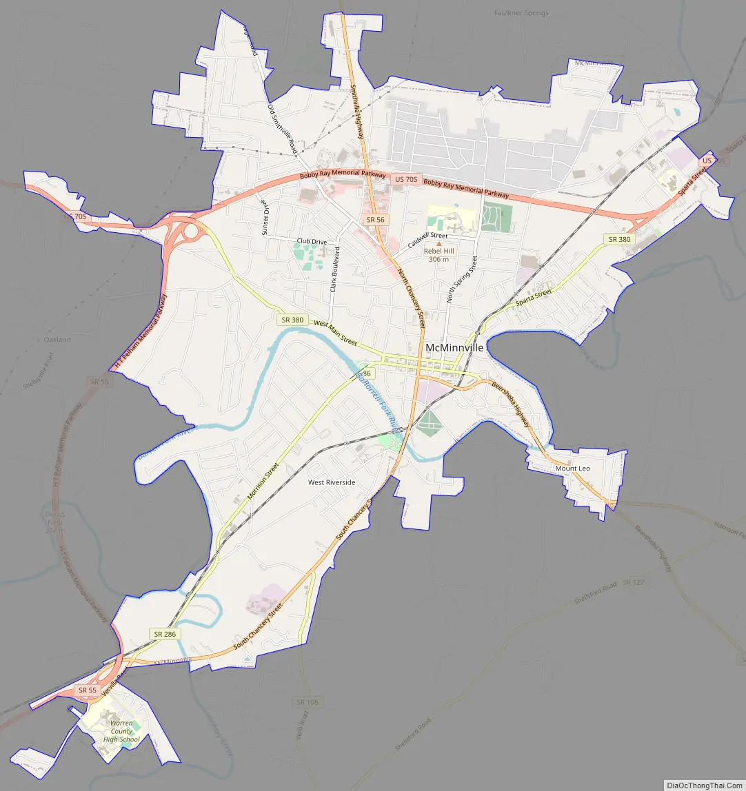
McMinnville Road Map
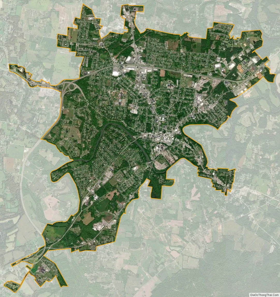
McMinnville city Satellite Map
Geography
McMinnville is located at 35°41′12″N 85°46′46″W / 35.68667°N 85.77944°W / 35.68667; -85.77944 (35.686708, -85.779309), approximately 35 miles (56 km) south of Cookeville and 70 miles (110 km) northwest of Chattanooga.
According to the United States Census Bureau, the city has a total area of 10.0 square miles (26 km), all land. McMinnville lies at an elevation of 968 feet (295 m), as it sits along the Eastern Highland Rim near the base of the Cumberland Plateau. The city is drained primarily by the Barren Fork, a tributary of the Collins River.
Nearby cities and towns
Climate
See also
Map of Tennessee State and its subdivision:- Anderson
- Bedford
- Benton
- Bledsoe
- Blount
- Bradley
- Campbell
- Cannon
- Carroll
- Carter
- Cheatham
- Chester
- Claiborne
- Clay
- Cocke
- Coffee
- Crockett
- Cumberland
- Davidson
- Decatur
- DeKalb
- Dickson
- Dyer
- Fayette
- Fentress
- Franklin
- Gibson
- Giles
- Grainger
- Greene
- Grundy
- Hamblen
- Hamilton
- Hancock
- Hardeman
- Hardin
- Hawkins
- Haywood
- Henderson
- Henry
- Hickman
- Houston
- Humphreys
- Jackson
- Jefferson
- Johnson
- Knox
- Lake
- Lauderdale
- Lawrence
- Lewis
- Lincoln
- Loudon
- Macon
- Madison
- Marion
- Marshall
- Maury
- McMinn
- McNairy
- Meigs
- Monroe
- Montgomery
- Moore
- Morgan
- Obion
- Overton
- Perry
- Pickett
- Polk
- Putnam
- Rhea
- Roane
- Robertson
- Rutherford
- Scott
- Sequatchie
- Sevier
- Shelby
- Smith
- Stewart
- Sullivan
- Sumner
- Tipton
- Trousdale
- Unicoi
- Union
- Van Buren
- Warren
- Washington
- Wayne
- Weakley
- White
- Williamson
- Wilson
- Alabama
- Alaska
- Arizona
- Arkansas
- California
- Colorado
- Connecticut
- Delaware
- District of Columbia
- Florida
- Georgia
- Hawaii
- Idaho
- Illinois
- Indiana
- Iowa
- Kansas
- Kentucky
- Louisiana
- Maine
- Maryland
- Massachusetts
- Michigan
- Minnesota
- Mississippi
- Missouri
- Montana
- Nebraska
- Nevada
- New Hampshire
- New Jersey
- New Mexico
- New York
- North Carolina
- North Dakota
- Ohio
- Oklahoma
- Oregon
- Pennsylvania
- Rhode Island
- South Carolina
- South Dakota
- Tennessee
- Texas
- Utah
- Vermont
- Virginia
- Washington
- West Virginia
- Wisconsin
- Wyoming