Map of Mount Juliet city

Map of Mount Juliet city

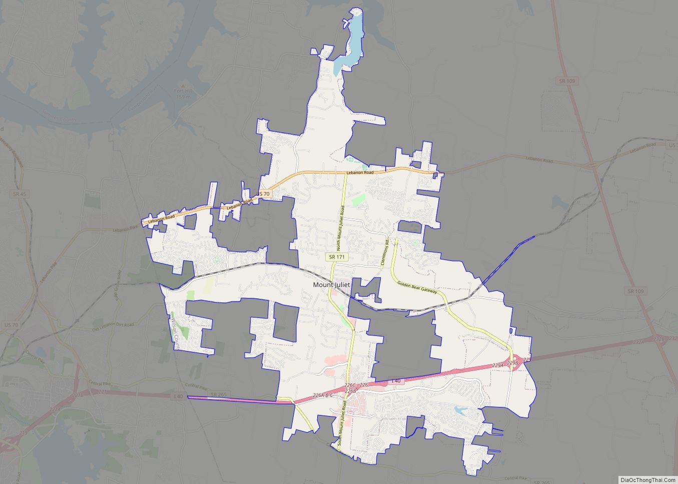
Mt. Juliet (also referred to as Mount Juliet) is a city located in western Wilson County, Tennessee. A suburb of Nashville, it is approximately 17 miles (27 km) east of downtown Nashville. Mt. Juliet is located mostly between two major national east-west routes, Interstate 40 and U.S. Route 70. As of the 2020 United States census, … Read more

Map of Nolensville town

Map of Nolensville town

Nolensville is a town in Williamson County, Tennessee. Its population was 13,829 at the 2020 census. It was established in 1797 by William Nolen, a veteran of the American Revolutionary War. Located in Middle Tennessee, it is about 22 miles southeast of Nashville. The town was reincorporated in 1996. Nolensville town overview: Name: Nolensville town … Read more

Map of Niota city

Map of Niota city

Niota is a city in McMinn County, Tennessee, United States. The population was estimated at 772 in 2020 by the U.S. Census Bureau. Niota city overview: Name: Niota city LSAD Code: 25 LSAD Description: city (suffix) State: Tennessee County: McMinn County Incorporated: 1911 Elevation: 1,007 ft (307 m) Total Area: 2.30 sq mi (5.95 km²) Land Area: 2.30 sq mi (5.95 km²) Water … Read more

Map of Newport city, Tennessee

Map of Newport city, Tennessee

Newport is a city in and the county seat of Cocke County, Tennessee, United States. The population was 6,945 at the 2010 census, down from 7,242 at the 2000 census. The estimated population in 2018 was 6,801. It is located along the Pigeon River. Newport city overview: Name: Newport city LSAD Code: 25 LSAD Description: … Read more

Map of Newbern town, Tennessee

Map of Newbern town, Tennessee

Newbern is a town in Dyer County, Tennessee. As of the 2010 census, the town population was 3,313. Newbern town overview: Name: Newbern town LSAD Code: 43 LSAD Description: town (suffix) State: Tennessee County: Dyer County Incorporated: 1857-1858 Elevation: 377 ft (115 m) Total Area: 4.53 sq mi (11.74 km²) Land Area: 4.53 sq mi (11.74 km²) Water Area: 0.00 sq mi (0.00 km²) Total Population: … Read more

Map of New Union CDP, Tennessee

Map of New Union CDP, Tennessee

New Union is an unincorporated community and Census-designated place in Coffee County, Tennessee. The population was 1,646 at the 2020 census, up from 1,431 at the 2010 census. New Union CDP overview: Name: New Union CDP LSAD Code: 57 LSAD Description: CDP (suffix) State: Tennessee County: Coffee County Elevation: 1,096 ft (334 m) Total Area: 3.84 sq mi (9.95 km²) … Read more

Map of Oak Ridge city, Tennessee

Map of Oak Ridge city, Tennessee

Oak Ridge is a city in Anderson and Roane counties in the eastern part of the U.S. state of Tennessee, about 25 miles (40 km) west of downtown Knoxville. Oak Ridge’s population was 31,402 at the 2020 census. It is part of the Knoxville Metropolitan Area. Oak Ridge’s nicknames include the Atomic City, the Secret City, … Read more

Map of Oak Hill city, Tennessee

Map of Oak Hill city, Tennessee

Oak Hill is a city in Davidson County, Tennessee. The population was 4,529 at the 2010 census. The Tennessee Governor’s Mansion is located in the city. Although the city is administered under the Metropolitan Government of Nashville and Davidson County, it retains its own municipal government. Oak Hill city overview: Name: Oak Hill city LSAD … Read more

Map of Oak Grove CDP, Tennessee

Map of Oak Grove CDP, Tennessee

Oak Grove is a census-designated place (CDP) in Washington County, Tennessee, United States. The population was 4,425 at the 2010 census. It is part of the Johnson City Metropolitan Statistical Area, which is a component of the Johnson City–Kingsport–Bristol, TN-VA Combined Statistical Area – commonly known as the “Tri-Cities” region. Oak Grove CDP overview: Name: … Read more

Map of Norris city, Tennessee

Map of Norris city, Tennessee

Norris is a city in Anderson County, Tennessee, United States. Its population was 1,599 at the 2020 census. It is included in the Knoxville, Tennessee Metropolitan Statistical Area. Norris was built as a model planned community by the Tennessee Valley Authority (TVA) in 1933 to house workers building Norris Dam on the Clinch River. It … Read more

Map of Normandy town, Tennessee

Map of Normandy town, Tennessee

Normandy is a town in Bedford County, Tennessee, United States. The population was 141 at the 2010 census. Normandy Dam is located just northeast of the town. The town is listed on the National Register of Historic Places as the Normandy Historic District. The historic Beech Hall is also located near Normandy. Normandy town overview: … Read more

Map of Palmer town, Tennessee

Map of Palmer town, Tennessee

Palmer is a town in Grundy County, Tennessee, United States. The population was 672 at the 2010 census. Palmer town overview: Name: Palmer town LSAD Code: 43 LSAD Description: town (suffix) State: Tennessee County: Grundy County Incorporated: 1925 Elevation: 1,805 ft (550 m) Total Area: 4.93 sq mi (12.77 km²) Land Area: 4.93 sq mi (12.77 km²) Water Area: 0.00 sq mi (0.00 km²) Total Population: … Read more