Oak Ridge is a city in Anderson and Roane counties in the eastern part of the U.S. state of Tennessee, about 25 miles (40 km) west of downtown Knoxville. Oak Ridge’s population was 31,402 at the 2020 census. It is part of the Knoxville Metropolitan Area. Oak Ridge’s nicknames include the Atomic City, the Secret City, the Ridge, the Town the Atomic Bomb Built, and the City Behind the Fence.
In 1942, the United States federal government purchased nearly 60,000 acres (240 km) of farmland in the Clinch River Valley for the development of a planned city supporting 75,000 residents. It was constructed with assistance from architectural and engineering firm Skidmore, Owings & Merrill, from 1942 to 1943. Oak Ridge was established in 1942 as a production site for the Manhattan Project—the massive American, British, and Canadian operation that developed the atomic bomb. Being the site of Oak Ridge National Laboratory and Y-12 National Security Complex, scientific and technological development still plays a crucial role in the city’s economy and culture in general.
| Name: | Oak Ridge city |
|---|---|
| LSAD Code: | 25 |
| LSAD Description: | city (suffix) |
| State: | Tennessee |
| County: | Anderson County, Roane County |
| Incorporated: | 1959 |
| Elevation: | 850 ft (260 m) |
| Total Area: | 89.95 sq mi (232.98 km²) |
| Land Area: | 85.25 sq mi (220.80 km²) |
| Water Area: | 4.70 sq mi (12.18 km²) |
| Total Population: | 31,402 |
| Population Density: | 368.35/sq mi (142.22/km²) |
| ZIP code: | 37830-37831 |
| Area code: | 865 |
| FIPS code: | 4755120 |
| Website: | www.oakridgetn.gov |
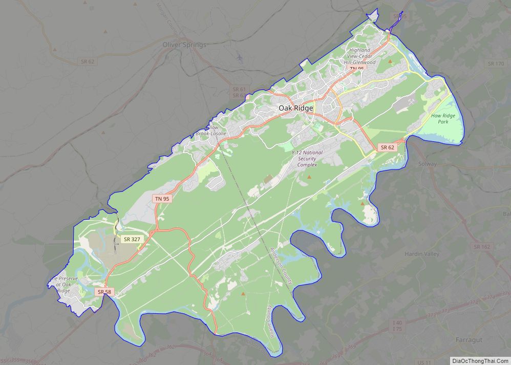
Online Interactive Map
Click on ![]() to view map in "full screen" mode.
to view map in "full screen" mode.
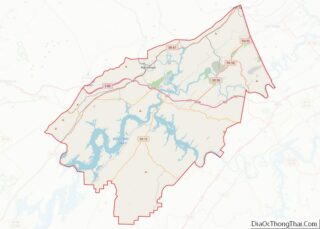
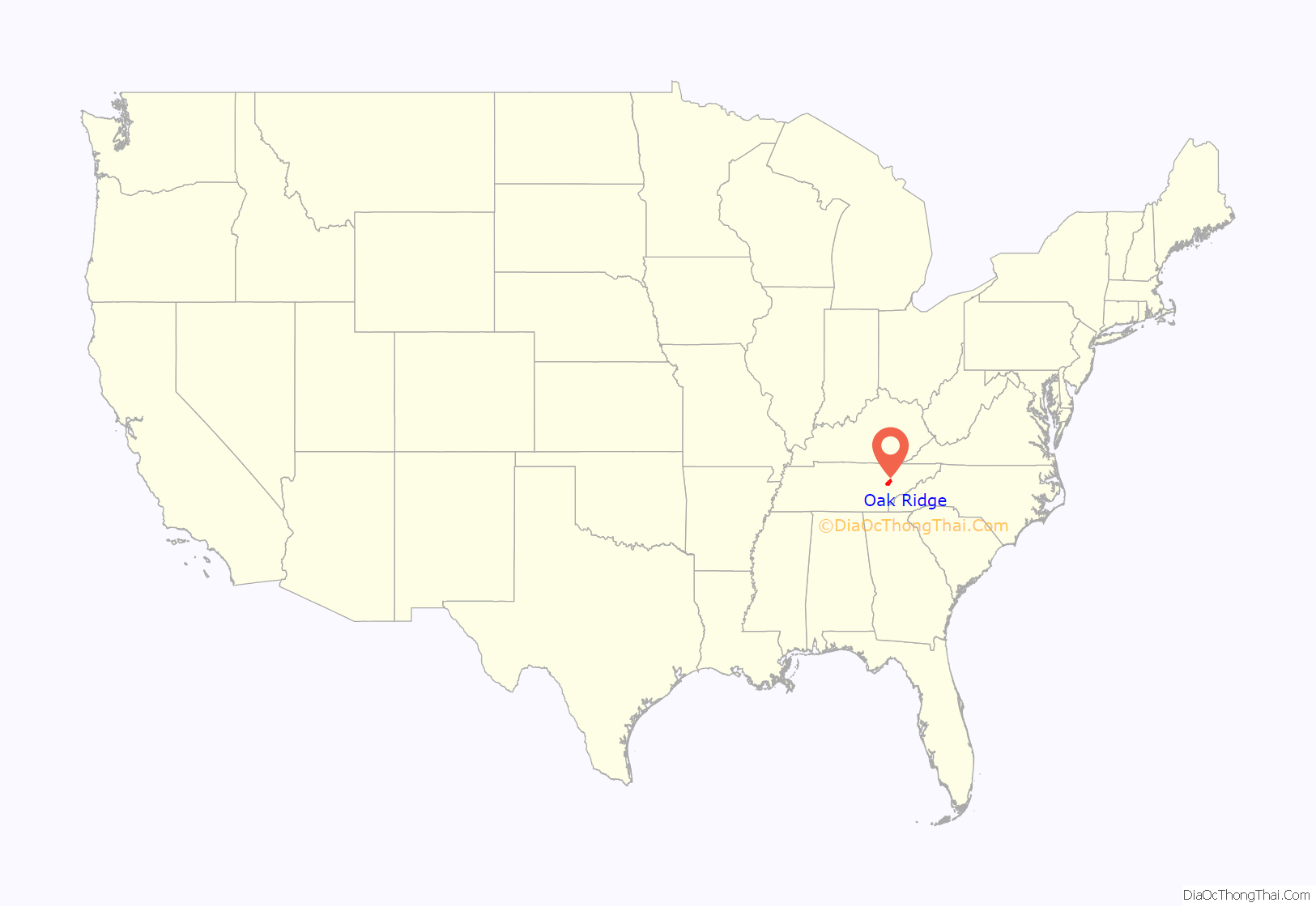
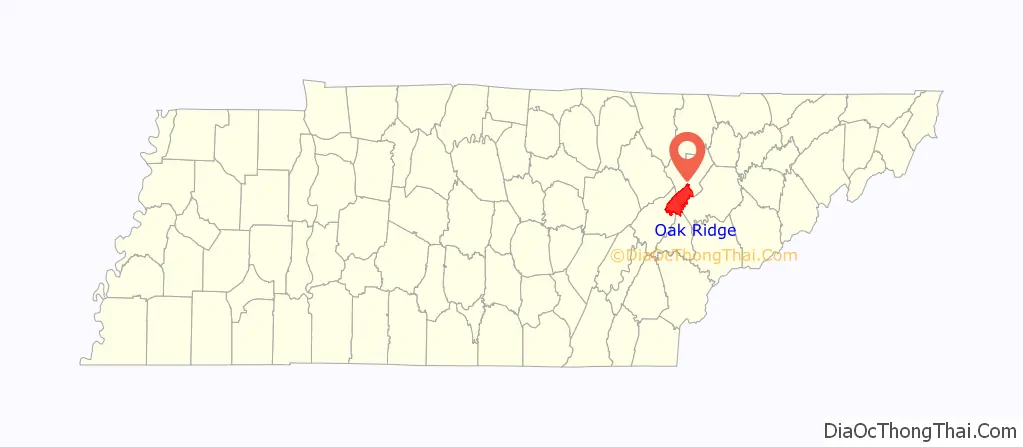
Oak Ridge location map. Where is Oak Ridge city?
History
The earliest substantial occupation of the Oak Ridge area occurred during the Woodland period (c. 1000 BC – 1000), although artifacts dating to the Paleo-Indian period have been found throughout the Clinch Valley. Two Woodland mound sites—the Crawford Farm Mounds and the Freels Farm Mounds—were uncovered in the 1930s as part of the Norris Basin salvage excavations. Both sites were just southeast of the former Scarboro community. The Bull Bluff site, which was occupied during the Woodland and Mississippian (c. 1000–1600) periods, was uncovered in the 1960s in anticipation of the construction of Melton Hill Dam. Bull Bluff is a cliff immediately southeast of Haw Ridge, opposite Melton Hill Park. The Oak Ridge area was largely uninhabited when Euro-American explorers and settlers arrived in the late 18th century, although the Cherokee claimed the land as part of their hunting grounds.
During the early 19th century, several rural farming communities developed in the Oak Ridge area, namely Edgemoor and Elza in the northeast, East Fork and Wheat in the southwest, Robertsville in the west, and Bethel and Scarboro in the southeast. The European-American settlers who founded these communities arrived in the late 1790s after the American Revolutionary War and after the Cherokee signed the Treaty of Holston, ceding what is now Anderson County to the United States.
A popular legend holds that John Hendrix (1865-1915), a largely unknown local man, predicted the creation of the city of Oak Ridge around 40 years before construction on the project began. Hendrix lacked any formal education, and was a simple logger for much of his life. Following the death of his youngest daughter, Ethel, to diphtheria, and the subsequent departure of his wife and three remaining children, Hendrix began hearing voices in his head. These voices urged him to stay in the woods and pray for guidance for 40 days and 40 nights, which Hendrix proceeded to do. As the story is told, following these 40 days spent in rugged isolation, Hendrix began seeing visions of the future, and sought to spread his prophetic message to any who would listen. According to published accounts, one vision that he described repeatedly was a description of the city and production facilities built 28 years after his death, during World War II.
The version recalled by neighbors and relatives reported:
Hendrix, in light of his tales of prophetic visions, was considered insane by most, and at one point was institutionalized. His grave lies in an area of Oak Ridge now known as the Hendrix Creek Subdivision. There are ongoing concerns over the preservation of his gravestone, as the man who owns the lot adjacent to the grave wishes to build a home there, while members of the Oak Ridge Heritage and Preservation Association are fighting to have a monument placed on the site of his grave.
Manhattan Project
In 1942, the United States federal government chose the area as a site for developing materials for the Manhattan Project. Major general Leslie Groves, military head of the Manhattan Project, liked the area for several reasons. Its relatively low population made acquisition affordable, yet the area was accessible by highway and rail, and utilities such as water and electricity were readily available due to the recent completion of Norris Dam. Finally, the project location was established within a 17-mile-long (27 km) valley. This feature was linear and partitioned by several ridges, providing natural protection against the spread of disasters at the four major industrial plants—so they wouldn’t blow up “like firecrackers on a string”.
When the Governor of Tennessee Prentice Cooper was officially handed by a junior officer (a lieutenant) the July 1943 presidential proclamation making Oak Ridge a military district not subject to state control, he tore it up and refused to see the MED engineer, Lieutenant colonel James C. Marshall. The new District Engineer Kenneth Nichols had to placate him. Cooper came to see the project (except for the production facilities under construction) on November 3, 1943; and he appreciated the bourbon-laced punch served (although Anderson County was “dry”). House and dormitory accommodations at the Clinton Engineer Works (CEW) in Oak Ridge and Hanford Engineer Works in Washington State were basic, with coal rather than oil or electric furnaces. But they were of a higher standard than Director Groves wanted, and were better than at Los Alamos. Medical care was provided by Army doctors and hospitals, with civilians paying $2.50 per month ($5 for families) to the medical insurance fund.
The location and low population helped keep the town a secret, though the settlement grew from 3,000 to 3,750 in 1942 to about 75,000 by 1945. The K-25 uranium separation facility covered 44 acres (18 ha), then the largest building in the world. The name “Oak Ridge” was chosen for the settlement in 1943 from suggestions submitted by project employees. The name evoked the settlement’s location along Black Oak Ridge, and officials thought the rural-sounding name “held outside curiosity to a minimum”. The name wasn’t formally adopted until 1949, and the site was referred to as the Clinton Engineer Works or CEW until then. All workers wore badges. The town was surrounded by guard towers and a fence with seven gates.
In October 1942, the United States Army Corps of Engineers began acquiring more than 60,000 acres (24,000 ha) in the Oak Ridge area for the United States’ Manhattan Project. Unlike the earlier land acquisitions by the Tennessee Valley Authority for Norris Dam—which were still fresh on the minds of many Anderson Countians—the Corps’ “declaration of taking” was much more swift and final. Many residents came home to find eviction notices tacked to their doors. Most were given six weeks to evacuate, although several had as little as two weeks. Some were forced out before they received compensation.
By March 1943, the COE had removed the area’s earlier communities and established fences and checkpoints. Anderson County lost one-seventh of its land and $391,000 in annual property tax revenue. The manner by which the Oak Ridge area was acquired by the government created a tense, uneasy relationship between the Oak Ridge complex and the surrounding towns that lasted throughout the Manhattan Project. Although the area’s original residents were allowed to be buried in existing cemeteries, every coffin was reportedly opened for inspection.
The Corps’ Manhattan Engineer District (MED) managed the acquisition and clearing. The K-25, S-50, and Y-12 plants were each built in Oak Ridge to separate the fissile isotope uranium-235 from natural uranium, which consists almost entirely of the isotope uranium-238. During construction of the electromagnets required for the uranium separation process at the Y-12 site, a shortage of copper forced the MED to borrow 14,700 tons of silver bullion from the United States Treasury as a copper substitute in wire for the electromagnet coils. The X-10 site, now the site of Oak Ridge National Laboratory, was established as a pilot plant for production of plutonium using the Graphite Reactor.
Because of the large number of workers recruited to the area for the Manhattan Project, the Army planned a town for project workers at the eastern end of the valley. The time required for the project’s completion caused the Army to opt for a relatively permanent establishment rather than an enormous camp.
The architecture firm Skidmore, Owings and Merrill (SOM) was contracted to provide the layout for the town and house designs. SOM Partner John O. Merrill moved to Tennessee to take charge of designing the secret buildings at Oak Ridge. He directed the creation of a town, which soon had 300 miles (480 km) of roads, 55 miles (89 km) of railroad track, ten schools, seven theaters, 17 restaurants and cafeterias, and 13 supermarkets. A library with 9,400 books, a symphony orchestra, sporting facilities, church services for 17 denominations, and a Fuller Brush Company salesman served the new city and its 75,000 residents. No airport was built, for security reasons. Prefabricated modular homes, apartments, and dormitories, many made from cemesto (bonded cement and asbestos) panels, were quickly erected. Streets were laid out in the manner of a “planned community”.
The original streets included several main east-to-west roads, namely the Oak Ridge Turnpike, Tennessee Avenue, Pennsylvania Avenue, Hillside Road, Robertsville Road, and Outer Drive. North-to-south oriented streets connecting these main roads were designated “Avenues”, and streets branching off from the avenues were designated “Roads”, “Places”, “Lanes”, or “Circles”. “Roads” connected two streets, while “Lanes” and “Places” were dead ends. The names of the main avenues generally progressed alphabetically from east to west (e.g., Alabama Avenue in the east, Vermont Avenue in the west), and the names of the smaller streets began with the same letter as the main avenue from which they started (e.g., streets connected to Florida Avenue began with “F”).
Construction personnel swelled the wartime population of Oak Ridge to as much as 70,000. The dramatic population increase, and the secret nature of the project, meant chronic shortages of housing and supplies during the war years. The town was administered by Turner Construction Company through a subsidiary named the Roane-Anderson Company. For most residents, however, their “landlord” was known as “MSI” (Management Services, Inc.).
The news of the use of the first atomic bomb against Japan on August 6, 1945, revealed to the people at Oak Ridge what they had been working on.
Oak Ridge was developed by the federal government as a segregated community, required by the Southern bloc of Democrats in Congress to authorize funding for the project. Due to generally holding lower-ranked jobs, their assigned dwellings were predominantly government-built “hutments” (one-room shacks) located very close to the Y-12 plant, in the one residential area designated as colored. Kenneth Nichols, the MED District Engineer, was told by the main construction contractor for the K-25 plant that the Negro construction labor force had a large turnover rate, so Nichols gave permission to set up a separate black women’s camp. When Leslie Groves visited the plant with K. T. Keller of Chrysler, Keller saw twelve Negro women sweeping the thirty-foot wide alley between the production units, and said “Nichols, don’t you know there is a machine made to sweep a concrete floor like this?” Nichols replied “Sure I do, but these gals can do more than one of those machines”. The men now had an opportunity to “fracas” on Saturday night, and labor turnover had reduced. During the war, plans were made for a colored neighborhood of houses equal in quality to those provided for whites, but it was not implemented due to limited resources. After the war, all hutments were dismantled, and a colored neighborhood of permanent houses was developed in the Gamble Valley area of Oak Ridge, which during wartime had been occupied by a white trailer community.
Oak Ridge elementary education prior to 1954 was totally segregated; it was legally part of the Anderson County system though built and operated primarily with federal funds. Black children could attend only the Scarboro Elementary School. Oak Ridge High School was closed to black students, who had to be bused to Knoxville for an education. Starting in 1950, Scarboro High School was established at Scarboro Elementary School to offer classes for African-American students. It operated until Oak Ridge High School was desegregated in the fall of 1955.
In 1953, the Oak Ridge Town Council encouraged desegregation of Oak Ridge High School; this resulted in an unsuccessful attempt by some residents to recall council member Waldo Cohn.
Following the U.S. Supreme Court decision in Brown v. Board of Education (1954) that the segregation of public schools was unconstitutional, Oak Ridge officials changed their policy and desegregated the schools. The nearby high school in Clinton was desegregated in the fall of 1956. It was later bombed and closed. Oak Ridge provided space at a recently vacated elementary school building (the original Linden Elementary School) for the education of high school students from Clinton for two years while Clinton High School was being rebuilt. Robertsville Junior High School, serving the west half of Oak Ridge, was desegregated at the same time as the high school. Elementary schools in other parts of the city and Jefferson Junior High School, serving the east half of the city, were desegregated slowly as African-American families moved into housing outside of Gamble Valley. In 1967, Scarboro Elementary School was closed, and African-American students from Gamble Valley were bused to other schools around the city.
Following the Brown decision, public accommodations in Oak Ridge were gradually integrated, which took a number of years. In 1955, the spring-fed Oak Ridge Municipal Outdoor Swimming Pool, which had been completed in June 1945, became integrated. In the early 1960s, Oak Ridge briefly experienced protest picketing against racial segregation in public accommodations, notably outside a local cafeteria and a laundromat.
Since World War II
Two years after World War II ended, Oak Ridge was shifted to civilian control, under the authority of the U.S. Atomic Energy Commission (AEC). The Roane Anderson Company administered community functions, including arranging housing and operating buses, under a government contract. In 1959 the town was incorporated. The community adopted a city manager and City Council form of government rather than direct federal control.
The S-50 liquid thermal diffusion plant was demolished soon after the war. K-25, where uranium was enriched by the gaseous diffusion process until 1985, was demolished in 2013–15. Two of the four major facilities created for the wartime bomb production remain standing:
- Y-12, originally used for electromagnetic separation of uranium, is used for nuclear weapons processing and materials storage.
- X-10, site of a graphite test reactor, is now Oak Ridge National Laboratory (ORNL).
In 1983, the Department of Energy declassified a report showing that significant amounts of mercury had been released from the Oak Ridge Reservation into the East Fork Poplar Creek between 1950 and 1977. A federal court ordered the DOE to bring the Oak Ridge Reservation into compliance with federal and state environmental regulations.
The Department of Energy runs Oak Ridge National Laboratory (ORNL), a nuclear and high-tech research establishment. In June 2018 IBM and the ORNL unveiled Summit, the “world’s fastest supercomputer”, claimed to be more than twice as powerful as the previous world leader, with a peak performance of 200,000 trillion calculations per second.
Tours of parts of the original facility are available to American citizens from March through November. The tour is so popular that there is a waiting list.
Oak Ridge’s scientific heritage is curated in the American Museum of Science and Energy. Its role in the Manhattan Project is preserved in the Manhattan Project National Historical Park (along with sites in Hanford, Washington and Los Alamos, New Mexico), run cooperatively by the National Park Service and the Department of Energy.
Economic development
In 2003, the city extended its borders west beyond the Clinch River boundary for the annexation of the master planned community, the Preserve at Oak Ridge, paving the way for economic growth into the 21st century.
In January 2020, the city council of Oak Ridge approved the “Wilson Street Corridor” project plan, intended to develop and construct a downtown area in the city situated along Wilson Street. The plan consists of a mixed-use development of retail, residential usage, and restaurants with a primary focus of multi-story residential space.
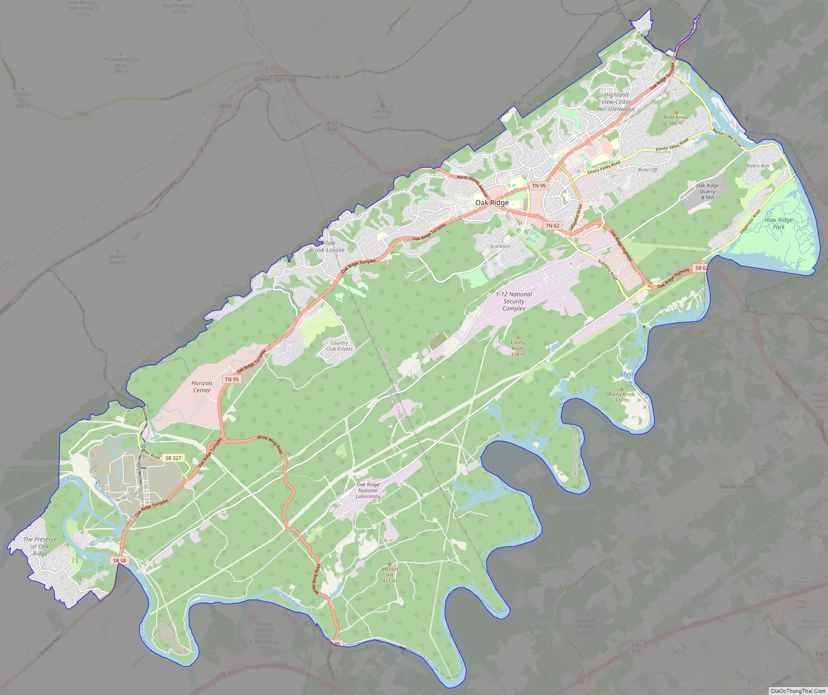
Oak Ridge Road Map
Oak Ridge city Satellite Map
Geography
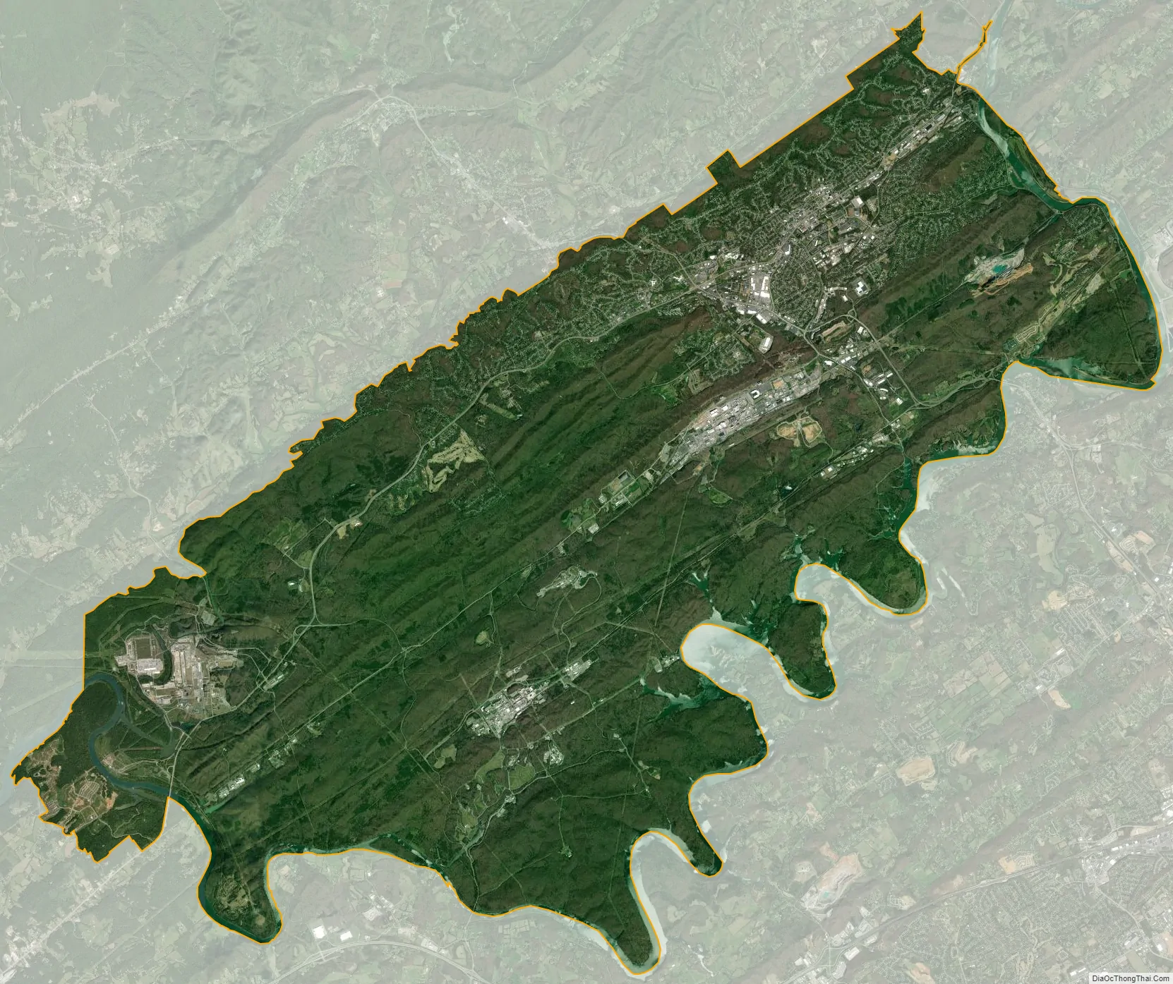
Immediately northeast of Oak Ridge, the southwestward-flowing Clinch River bends sharply to the southeast for roughly 6 miles (10 km) toward Solway, where it turns again to the southwest. After flowing for approximately 17 miles (27 km), the river bends sharply to the northwest at Copper Ridge, and continues in this direction for nearly 7 miles (11 km). At the K-25 plant, the Clinch turns southwest again and flows for another 11 miles (18 km) to its mouth along the Tennessee River at Kingston. This series of bends creates a half-rectangle formation—surrounded by water on the northeast, east, and southwest—in which Oak Ridge is situated.
The Oak Ridge area is striated by five elongated ridges that run roughly parallel to one another in a northeast-to-southwest direction. In order from west-to-east, the five ridges are Blackoak Ridge—which connects the Elza and K-25 bends of the Clinch and thus “walls off” the half-rectangle—East Fork Ridge, Pine Ridge, Chestnut Ridge, and Haw Ridge. The five ridges are divided by four valleys—East Fork Valley (between Blackoak and East Fork Ridge), Gamble Valley (between East Fork Ridge and Pine Ridge), Bear Creek Valley (between Pine Ridge and Chestnut), and Bethel Valley (between Chestnut and Haw). These ridges and valleys are part of the Ridge-and-Valley Appalachians physiographic province. The main section of the city is located in the northeast, where East Fork and Pine Ridge give way to low, scattered hills. Many of the city’s residences are located along the relatively steep northeastern slope of Blackoak Ridge.
The completion of Melton Hill Dam (along the Clinch near Copper Ridge) in 1963 created Melton Hill Lake, which borders the city on the northeast and east. The lakefront on the east side of the city is a popular recreation area, with bicycling trails and picnic areas lining the shore. The lake is also well known as a venue for rowing competitions. Watts Bar Lake, an impoundment of the Tennessee River which covers the lower 23 miles (37 km) of the Clinch, borders Oak Ridge to the south and southwest.
According to the United States Census Bureau, the city has a total area of 90.0 square miles (233.0 km), of which 85.3 square miles (220.8 km) is land and 4.7 square miles (12.2 km), or 5.25%, is water.
The highest point is Melton Hill (35°54′35″N 84°18′19″W / 35.90962°N 84.30525°W / 35.90962; -84.30525) on the DOE reservation, at elevation 1,356 feet (413 m).
Climate
Like much of the rest of the state, Oak Ridge has a humid subtropical climate (Cfa in the Köppen climate classification); it is part of USDA hardiness zone 7a. The normal monthly mean temperature ranges from 37.9 °F (3.3 °C) in January to 77.5 °F (25.3 °C) in July, while, on average, there are 4.3 days where the temperature stays at or below freezing and 39 days with a high at or above 90 °F (32 °C) per year. The all-time record low is −17 °F (−27 °C), set on January 21, 1985, while the all-time record high is 105 °F (41 °C), set on June 30, 2012, and July 28, 1952. However, temperatures reaching either 0 °F (−18 °C) or 100 °F (38 °C) are uncommon, having last occurred February 5, 1996 (the date of the all-time record low for February) and July 1, 2012.
Precipitation is high, averaging 59.70 inches (1,516 mm) annually, but reaches a low during late summer. The rainiest calendar day on record is August 10, 1960, when 7.45 inches (189 mm) of rain fell; monthly precipitation has ranged from trace amounts in October 1963 to 19.27 inches (489 mm) in July 1967.
See also
Map of Tennessee State and its subdivision:- Anderson
- Bedford
- Benton
- Bledsoe
- Blount
- Bradley
- Campbell
- Cannon
- Carroll
- Carter
- Cheatham
- Chester
- Claiborne
- Clay
- Cocke
- Coffee
- Crockett
- Cumberland
- Davidson
- Decatur
- DeKalb
- Dickson
- Dyer
- Fayette
- Fentress
- Franklin
- Gibson
- Giles
- Grainger
- Greene
- Grundy
- Hamblen
- Hamilton
- Hancock
- Hardeman
- Hardin
- Hawkins
- Haywood
- Henderson
- Henry
- Hickman
- Houston
- Humphreys
- Jackson
- Jefferson
- Johnson
- Knox
- Lake
- Lauderdale
- Lawrence
- Lewis
- Lincoln
- Loudon
- Macon
- Madison
- Marion
- Marshall
- Maury
- McMinn
- McNairy
- Meigs
- Monroe
- Montgomery
- Moore
- Morgan
- Obion
- Overton
- Perry
- Pickett
- Polk
- Putnam
- Rhea
- Roane
- Robertson
- Rutherford
- Scott
- Sequatchie
- Sevier
- Shelby
- Smith
- Stewart
- Sullivan
- Sumner
- Tipton
- Trousdale
- Unicoi
- Union
- Van Buren
- Warren
- Washington
- Wayne
- Weakley
- White
- Williamson
- Wilson
- Alabama
- Alaska
- Arizona
- Arkansas
- California
- Colorado
- Connecticut
- Delaware
- District of Columbia
- Florida
- Georgia
- Hawaii
- Idaho
- Illinois
- Indiana
- Iowa
- Kansas
- Kentucky
- Louisiana
- Maine
- Maryland
- Massachusetts
- Michigan
- Minnesota
- Mississippi
- Missouri
- Montana
- Nebraska
- Nevada
- New Hampshire
- New Jersey
- New Mexico
- New York
- North Carolina
- North Dakota
- Ohio
- Oklahoma
- Oregon
- Pennsylvania
- Rhode Island
- South Carolina
- South Dakota
- Tennessee
- Texas
- Utah
- Vermont
- Virginia
- Washington
- West Virginia
- Wisconsin
- Wyoming