Nolensville is a town in Williamson County, Tennessee. Its population was 13,829 at the 2020 census. It was established in 1797 by William Nolen, a veteran of the American Revolutionary War. Located in Middle Tennessee, it is about 22 miles southeast of Nashville. The town was reincorporated in 1996.
| Name: | Nolensville town |
|---|---|
| LSAD Code: | 43 |
| LSAD Description: | town (suffix) |
| State: | Tennessee |
| County: | Williamson County |
| Incorporated: | 1996 |
| Elevation: | 623 ft (190 m) |
| Total Area: | 10.44 sq mi (27.05 km²) |
| Land Area: | 10.44 sq mi (27.05 km²) |
| Water Area: | 0.00 sq mi (0.00 km²) |
| Total Population: | 13,829 |
| Population Density: | 1,324.11/sq mi (511.26/km²) |
| ZIP code: | 37135 |
| Area code: | 615 |
| FIPS code: | 4753460 |
| GNISfeature ID: | 1295807 |
| Website: | www.nolensvilletn.gov |
Online Interactive Map
Click on ![]() to view map in "full screen" mode.
to view map in "full screen" mode.
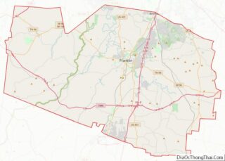
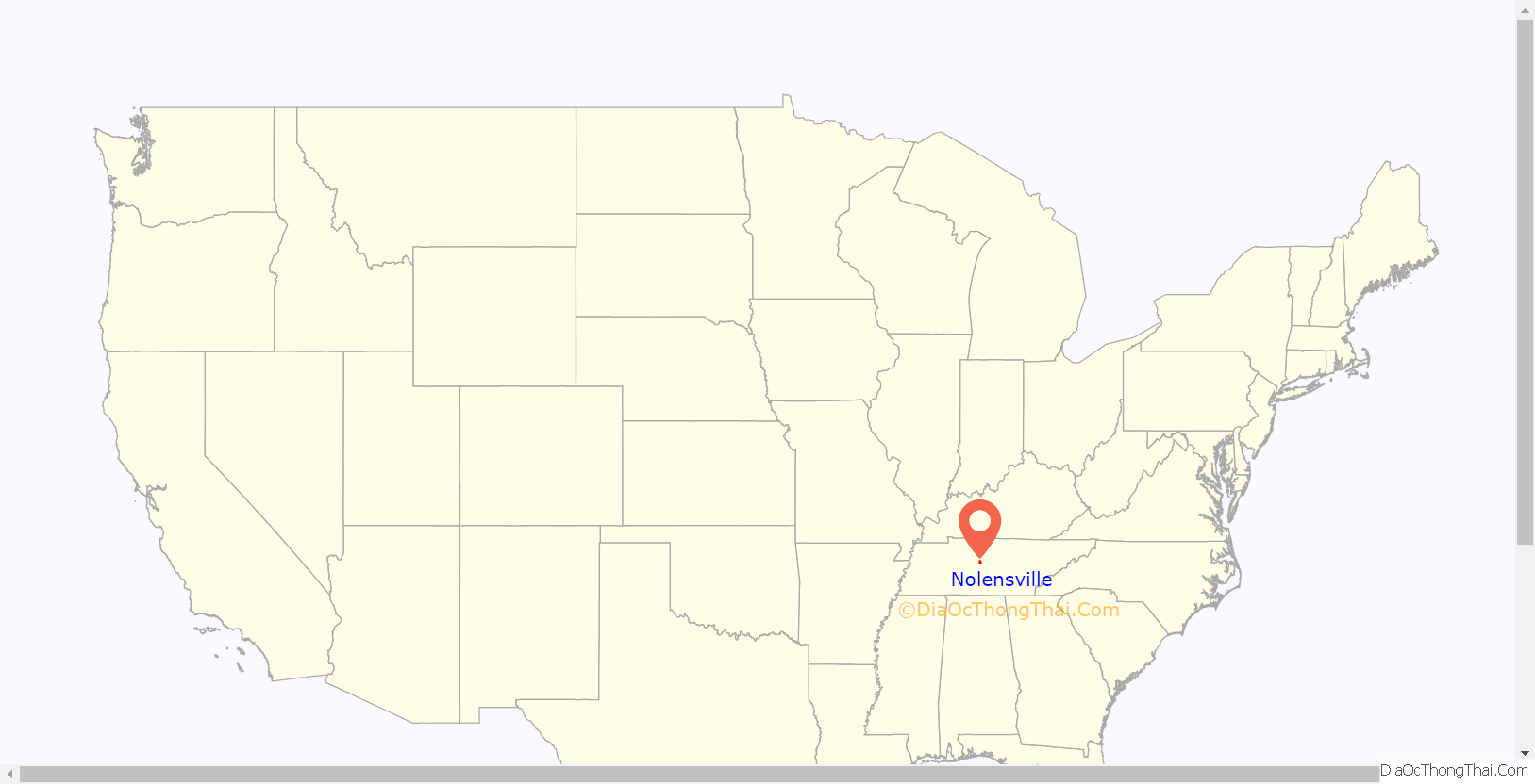
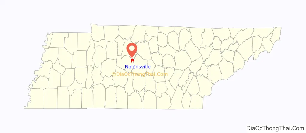
Nolensville location map. Where is Nolensville town?
History
This area was settled by European Americans after the American Revolutionary War, when pioneers began to move west of the Appalachian Mountains. William Nolen, a war veteran, his wife, Sarah, and their five children were passing through the area in 1797 when their wagon wheel broke. Surveying his surroundings, Nolen noted the rich soil and abundance of natural resources. He decided to settle here and the community was later named for him as Nolensville. William Nolen purchased a portion of a land grant made to Jason Thompson, on which Nolensville later developed. Nolen’s historic house was moved to a new location in 2009.
In the early 19th century, a large migration from Rockingham, North Carolina, brought the Adams, Allen, Barnes, Cyrus, Fields, Glenn, Irion, Johnson, Peay, Scales, Taylor, Vernon, Wisener, Williams, and other families to the area. Built along Mill Creek, the town was incorporated in 1839.
Foraging and skirmishing took place here during the Civil War. Gen. John Wharton’s Confederate cavalry unit was stationed in town briefly and Gen. Joseph Wheeler’s command captured a Union supply train here on December 30, 1862. A small group of soldiers from the 2nd Minnesota Volunteer Infantry successfully defended a Union wagon train against a much larger Confederate cavalry force in February 1863, with several of them earning the Medal of Honor for their actions.
From the post-Reconstruction period into the early 20th century, Whites lynched a total of five African Americans in Williamson County. They did not allow the legal system to prosecute these men, but conducted extrajudicial murder. Among the victims was 15-year-old Samuel Smith, an African American who was lynched in Nolensville in December 1924. He was arrested there for shooting and wounding Ike Eastwood at his house, after Eastwood shot Smith’s uncle; the grocer also shot and wounded Smith. Smith was taken for treatment to a hospital in Nashville. A group of masked men took him from the hospital, and with a larger mob, back 22 miles to Nolensville. There, the mob hanged the youth near Eastwood’s house and shot him multiple times. Although the Nashville Chamber of Commerce offered a $5000 reward in the case, no one was convicted of Smith’s murder. On June 5, 2017, a plaque was installed in his memory at St. Anselm Episcopal Church in Nashville; it memorialized two other local lynching victims, as well.
Post-World War II to present
On both sides of Nolensville Road, from north of Oldham Drive to the south as far as York/Williams Road, are many structures from the 19th century that are still in use as homes and/or stores. The Home Place Bed and Breakfast was built in 1820 as a private residence. Within the described area above is a historic section, which in the 19th century was the center of Nolensville. Of note are the Waller Funeral Home, built in 1876; the Nolensville Mill Company, which operated from 1890 to 1986 (today it houses a store featuring Amish goods); and the Nolensville Co-Op Creamery, which operated from 1921 to 1957. Now serving as an antique store, the creamery had produced butter known for its excellence throughout the area. The house north of the cemetery today serves as a veterinary clinic.
Nolensville voted by referendum to reincorporate in August 1996. In October 1996, the first election was held, electing the first three-member Nolensville board of mayor and aldermen. The first mayor of Nolensville was Charles F. Knapper, elected along with Aldermen Thomas “Tommy” Dugger, III, and Parman Henry. The town for the first time hired a town attorney, Robert J. Notestine, III.
Since 1996, Nolensville has had sustained growth. New home developments have been built around the town, including Bent Creek, Winterset Woods, Burkitt Place, Silver Stream, Ballenger Farms, Sunset Farms, and Summerlyn. Nolensville has had 290 residential building permits since the 2010 census; it boasts of having the lowest property tax rates in Williamson County. Other signs of growth are the new multimillion-dollar town hall, proposals for multiuse developments, and a high level of investment in commercial real estate.
To accommodate the many new students brought by families settling in the area, the Williamson County School Board purchased 95 acres (38 ha) on the south side of Nolensville for the construction of new elementary, middle, and high schools. These opened in the fall of 2016.
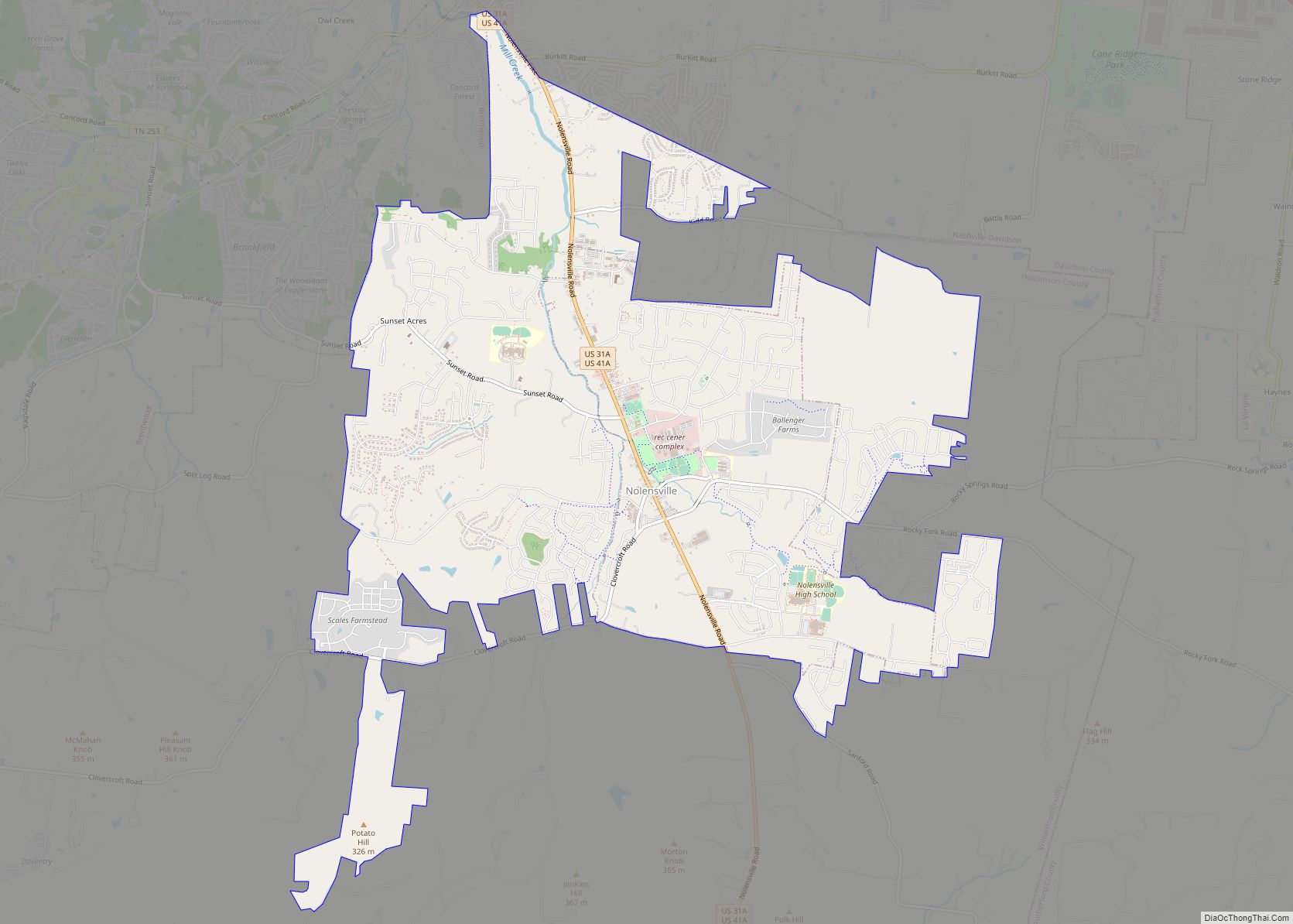
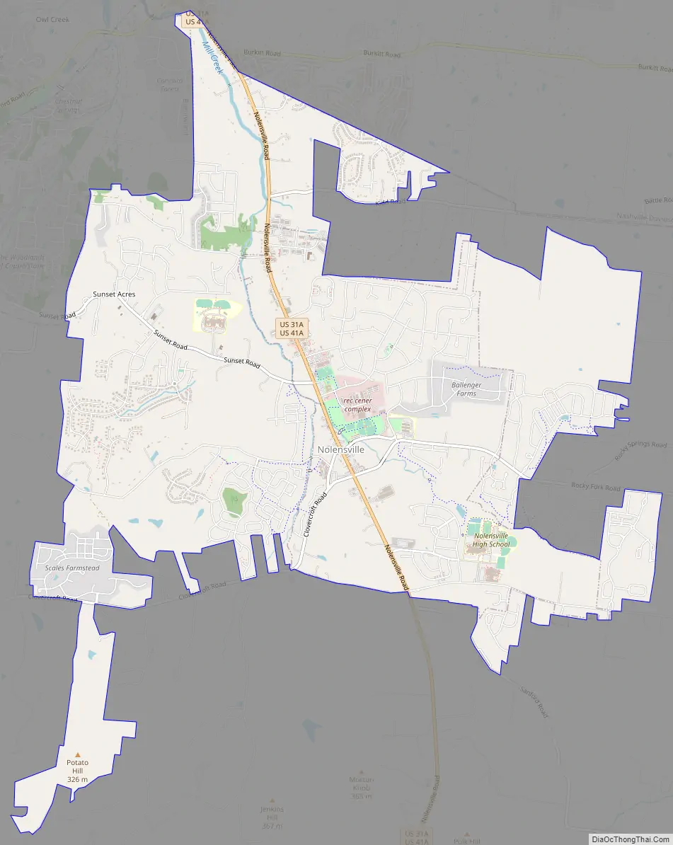
Nolensville Road Map
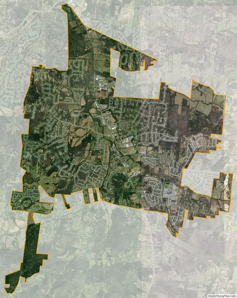
Nolensville city Satellite Map
Geography
Nolensville is located at 35°57′24″N 86°40′1″W / 35.95667°N 86.66694°W / 35.95667; -86.66694 (35.956786, -86.666967).
According to the United States Census Bureau, the town has a total area of 9.5 square miles (25 km), all land.
See also
Map of Tennessee State and its subdivision:- Anderson
- Bedford
- Benton
- Bledsoe
- Blount
- Bradley
- Campbell
- Cannon
- Carroll
- Carter
- Cheatham
- Chester
- Claiborne
- Clay
- Cocke
- Coffee
- Crockett
- Cumberland
- Davidson
- Decatur
- DeKalb
- Dickson
- Dyer
- Fayette
- Fentress
- Franklin
- Gibson
- Giles
- Grainger
- Greene
- Grundy
- Hamblen
- Hamilton
- Hancock
- Hardeman
- Hardin
- Hawkins
- Haywood
- Henderson
- Henry
- Hickman
- Houston
- Humphreys
- Jackson
- Jefferson
- Johnson
- Knox
- Lake
- Lauderdale
- Lawrence
- Lewis
- Lincoln
- Loudon
- Macon
- Madison
- Marion
- Marshall
- Maury
- McMinn
- McNairy
- Meigs
- Monroe
- Montgomery
- Moore
- Morgan
- Obion
- Overton
- Perry
- Pickett
- Polk
- Putnam
- Rhea
- Roane
- Robertson
- Rutherford
- Scott
- Sequatchie
- Sevier
- Shelby
- Smith
- Stewart
- Sullivan
- Sumner
- Tipton
- Trousdale
- Unicoi
- Union
- Van Buren
- Warren
- Washington
- Wayne
- Weakley
- White
- Williamson
- Wilson
- Alabama
- Alaska
- Arizona
- Arkansas
- California
- Colorado
- Connecticut
- Delaware
- District of Columbia
- Florida
- Georgia
- Hawaii
- Idaho
- Illinois
- Indiana
- Iowa
- Kansas
- Kentucky
- Louisiana
- Maine
- Maryland
- Massachusetts
- Michigan
- Minnesota
- Mississippi
- Missouri
- Montana
- Nebraska
- Nevada
- New Hampshire
- New Jersey
- New Mexico
- New York
- North Carolina
- North Dakota
- Ohio
- Oklahoma
- Oregon
- Pennsylvania
- Rhode Island
- South Carolina
- South Dakota
- Tennessee
- Texas
- Utah
- Vermont
- Virginia
- Washington
- West Virginia
- Wisconsin
- Wyoming