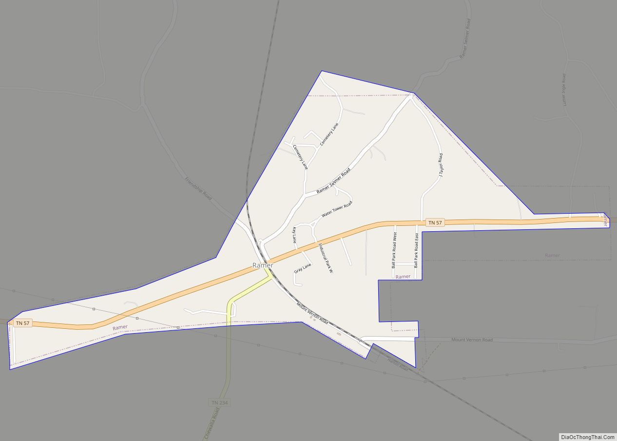
Map of Ridgeside city
Ridgeside is a city in Hamilton County, Tennessee, United States. The population was 446 at the 2020 census and estimated to be 432 in 2018. Ridgeside is an enclave, as it is completely surrounded by the city limits of Chattanooga. It is part of the Chattanooga, TN–GA Metropolitan Statistical Area. Ridgeside’s name is derived from ... Read more
Map of Ridgeside city
Map of Ridgely town, Tennessee
Ridgely is a town in Lake County, Tennessee, United States. The population was 1,667 at the 2000 census and 1,795 at the 2010 census. Ridgely town overview: Name: Ridgely town LSAD Code: 43 LSAD Description: town (suffix) State: Tennessee County: Lake County Elevation: 282 ft (86 m) Total Area: 1.98 sq mi (5.14 km²) Land Area: 1.98 sq mi (5.14 km²) Water Area: ... Read more
Map of Ridgely town, Tennessee
Map of Riceville CDP, Tennessee
Riceville is an unincorporated community and census-designated place (CDP) in McMinn County, Tennessee, United States. It is located some 60 miles southwest of Knoxville, and midway between Knoxville and Chattanooga, and in closer proximity, between Athens and Calhoun. Its population was 688 as of the 2020 census. Riceville CDP overview: Name: Riceville CDP LSAD Code: ... Read more
Map of Riceville CDP, Tennessee
Map of Rutherford town, Tennessee
Rutherford is a town in Gibson County, Tennessee, United States. At the 2000 census, its population was at 1,272 and in 2010 the population was 1,151. Rutherford town overview: Name: Rutherford town LSAD Code: 43 LSAD Description: town (suffix) State: Tennessee County: Gibson County Elevation: 331 ft (101 m) Total Area: 2.32 sq mi (6.00 km²) Land Area: 2.30 sq mi (5.97 km²) ... Read more
Map of Rutherford town, Tennessee
Map of Rural Hill CDP
Rural Hill is a census-designated place (CDP) in Wilson County, Tennessee. The population was 2,132 at the 2010 census. Rural Hill CDP overview: Name: Rural Hill CDP LSAD Code: 57 LSAD Description: CDP (suffix) State: Tennessee County: Wilson County Elevation: 581 ft (177 m) Total Area: 4.07 sq mi (10.55 km²) Land Area: 4.06 sq mi (10.51 km²) Water Area: 0.01 sq mi (0.04 km²) Total ... Read more
Map of Rural Hill CDP
Map of Rossville town, Tennessee
Rossville is a town in Fayette County, Tennessee, United States. The population was 664 at the 2010 census, up from 380 at the 2000 census. Rossville town overview: Name: Rossville town LSAD Code: 43 LSAD Description: town (suffix) State: Tennessee County: Fayette County Elevation: 312 ft (95 m) Total Area: 5.51 sq mi (14.27 km²) Land Area: 5.45 sq mi (14.12 km²) Water ... Read more
Map of Rossville town, Tennessee
Map of Rogersville town, Tennessee
Rogersville is a town in, and the county seat of, Hawkins County, Tennessee, United States. It was settled in 1775 by the grandparents of Davy Crockett. It is named for its founder, Joseph Rogers. Tennessee’s second oldest courthouse, the Hawkins County Courthouse, first newspaper The Knoxville Gazette, and first post office are all located in ... Read more
Map of Rogersville town, Tennessee
Map of Rockwood city, Tennessee
Rockwood is a city in Roane County, Tennessee, United States. Its population was 5,562 at the time of the 2010 census. It is included in the Harriman, Tennessee Micropolitan Statistical Area. Rockwood city overview: Name: Rockwood city LSAD Code: 25 LSAD Description: city (suffix) State: Tennessee County: Roane County Founded: 1868 Incorporated: 1890 Elevation: 892 ft ... Read more
Map of Rockwood city, Tennessee
Map of Rockvale CDP, Tennessee
Rockvale CDP overview: Name: Rockvale CDP LSAD Code: 57 LSAD Description: CDP (suffix) State: Tennessee FIPS code: 4764400 Online Interactive Map Rockvale online map. Source: Basemap layers from Google Map, Open Street Map (OSM), Arcgisonline, Wmflabs. Boundary Data from Database of Global Administrative Areas. Rockvale location map. Where is Rockvale CDP? Rockvale Road Map Rockvale ... Read more
Map of Rockvale CDP, Tennessee
Map of Rockford city, Tennessee
Rockford is a city in Blount County, Tennessee, United States. Its population was 798 at the 2000 census and 856 at the 2010 census. It is included in the Knoxville, Tennessee Metropolitan Statistical Area. Rockford city overview: Name: Rockford city LSAD Code: 25 LSAD Description: city (suffix) State: Tennessee County: Blount County Incorporated: 1970 Elevation: ... Read more
Map of Rockford city, Tennessee
Map of Robbins CDP, Tennessee
Robbins is an unincorporated community and census-designated place (CDP) in Scott County, Tennessee. As of the 2010 census, its population is 287. It is concentrated along U.S. Route 27 between Huntsville and Elgin, in Tennessee’s Cumberland Plateau region. The community is served by Robbins Elementary School. It is also home to Barton Chapel, a 1920s-era ... Read more
Map of Robbins CDP, Tennessee
Map of Roan Mountain CDP
Roan Mountain is a census-designated place (CDP) in Carter County, Tennessee, United States. The population was 1,360 at the 2010 census. It is part of the Johnson City Metropolitan Statistical Area, which is a component of the Johnson City–Kingsport–Bristol, TN-VA Combined Statistical Area – commonly known as the Tri-Cities region. Roan Mountain CDP overview: Name: ... Read more
Map of Roan Mountain CDP