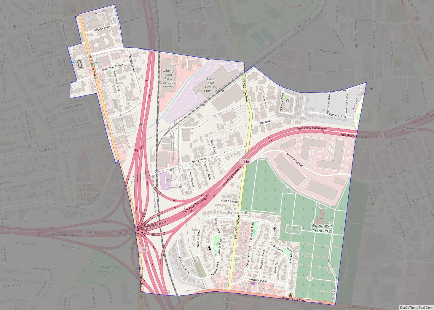
Map of Beersheba Springs town

Map of Beersheba Springs town

Beersheba Springs /ˈbɜːrʃəbə/ is a town in Grundy County, Tennessee, United States. The population was 477 at the 2010 census. A resort town in the 19th century, Beersheba Springs was the summer home of author Mary Noailles Murfree. It now serves as a major summer meeting center for the Tennessee United Methodist Church. Beersheba Springs … Read more

Map of Bean Station city

Map of Bean Station city

Bean Station is a town in Grainger and Hawkins counties in the state of Tennessee, United States. As of the 2020 census, the population was 2,967. Established in 1776 as a frontier outpost by William Bean, it is considered one of the earliest permanently settled communities in Tennessee. It would grow throughout the rest of … Read more

Map of Bloomingdale CDP, Tennessee

Map of Bloomingdale CDP, Tennessee

Bloomingdale is a census-designated place (CDP) in Sullivan County, Tennessee, United States. The population was 8,918 at the 2020 census down from 9,888 at the 2010 census, due to annexation by the City of Kingsport. It is part of the Kingsport–Bristol (TN)–Bristol (VA) Metropolitan Statistical Area, which is a component of the Johnson City–Kingsport–Bristol, TN-VA … Read more

Map of Blaine city, Tennessee

Map of Blaine city, Tennessee

Blaine, formerly known as Blaine’s Crossroads, is a city in Grainger County, Tennessee, United States, and a suburb of neighboring Knoxville. It is part of both the Knoxville Metropolitan Statistical Area and the Morristown Metropolitan Statistical Area. The population was 2,084 at the 2020 census, from 1,856 individuals since the 2010 census. Blaine city overview: … Read more

Map of Bransford CDP

Map of Bransford CDP

Bransford is a census-designated place and unincorporated community in Sumner County, Tennessee, United States. Its population was 170 as of the 2010 census. Bransford CDP overview: Name: Bransford CDP LSAD Code: 57 LSAD Description: CDP (suffix) State: Tennessee County: Sumner County Elevation: 571 ft (174 m) Total Area: 4.03 sq mi (10.44 km²) Land Area: 4.03 sq mi (10.44 km²) Water Area: 0.00 sq mi … Read more

Map of Bradford town, Tennessee

Map of Bradford town, Tennessee

Bradford is a town in Gibson County, Tennessee, United States. The population was 1,048 at the 2010 census. Bradford town overview: Name: Bradford town LSAD Code: 43 LSAD Description: town (suffix) State: Tennessee County: Gibson County Elevation: 364 ft (111 m) Total Area: 1.77 sq mi (4.58 km²) Land Area: 1.77 sq mi (4.58 km²) Water Area: 0.00 sq mi (0.00 km²) Total Population: 1,001 Population … Read more

Map of Braden town

Map of Braden town

Braden is a town in Fayette County, Tennessee. The population was 282 at the 2010 census. The town is named after Joseph P. Braden. Braden town overview: Name: Braden town LSAD Code: 43 LSAD Description: town (suffix) State: Tennessee County: Fayette County Elevation: 315 ft (96 m) Total Area: 3.67 sq mi (9.52 km²) Land Area: 3.67 sq mi (9.52 km²) Water Area: … Read more

Map of Bowman CDP, Tennessee

Map of Bowman CDP, Tennessee

Bowman is a census-designated place and unincorporated community in Cumberland County, Tennessee, United States. It is located off U.S. Route 127 north of Crossville, south of Clarkrange, and west of the Catoosa Wildlife Management Area. Its population was 302 as of the 2010 census. The community was named for Nathaniel Bowman, a pioneer settler. Bowman … Read more

Map of Bon Aqua Junction CDP

Map of Bon Aqua Junction CDP

Bon Aqua Junction is a census-designated place and unincorporated community in Hickman County, Tennessee, United States. Its population was 1,230 as of the 2010 census. Bon Aqua was located at a road junction outside of Bon Aqua, hence the name. Bon Aqua Junction CDP overview: Name: Bon Aqua Junction CDP LSAD Code: 57 LSAD Description: … Read more

Map of Bolivar city, Tennessee

Map of Bolivar city, Tennessee

Bolivar is a city in and the county seat of Hardeman County, Tennessee, United States. The town was named for South American revolutionary leader Simón Bolívar. As of the 2010 census, the city population was 5,417. Bolivar is served by William L. Whitehurst Field (airport). Bolivar city overview: Name: Bolivar city LSAD Code: 25 LSAD … Read more

Map of Bluff City, Tennessee

Map of Bluff City, Tennessee

Bluff City is a city in Sullivan County, Tennessee, United States. The population was 1,733 at the 2010 census. It is part of the Kingsport–Bristol (TN)–Bristol (VA) Metropolitan Statistical Area, which is a component of the Johnson City–Kingsport–Bristol, TN-VA Combined Statistical Area – commonly known as the “Tri-Cities” region. Bluff City overview: Name: Bluff City … Read more

Map of Blountville CDP

Map of Blountville CDP

Blountville is a census-designated place (CDP) in and the county seat of Sullivan County, Tennessee, United States. The population was 3,074 at the 2010 census. It is the only Tennessee county seat not to be an incorporated city or town. Blountville is part of the Kingsport–Bristol (TN)–Bristol (VA) Metropolitan Statistical Area, which is a component … Read more