Blaine, formerly known as Blaine’s Crossroads, is a city in Grainger County, Tennessee, United States, and a suburb of neighboring Knoxville. It is part of both the Knoxville Metropolitan Statistical Area and the Morristown Metropolitan Statistical Area. The population was 2,084 at the 2020 census, from 1,856 individuals since the 2010 census.
| Name: | Blaine city |
|---|---|
| LSAD Code: | 25 |
| LSAD Description: | city (suffix) |
| State: | Tennessee |
| County: | Grainger County |
| Incorporated: | 1978 |
| Elevation: | 1,037 ft (316 m) |
| Total Area: | 9.53 sq mi (24.69 km²) |
| Land Area: | 9.52 sq mi (24.65 km²) |
| Water Area: | 0.02 sq mi (0.05 km²) |
| Total Population: | 2,084 |
| Population Density: | 219.00/sq mi (84.55/km²) |
| ZIP code: | 37709 |
| Area code: | 865 |
| FIPS code: | 4706340 |
| GNISfeature ID: | 2403874 |
| Website: | https://www.blainetn.gov/ |
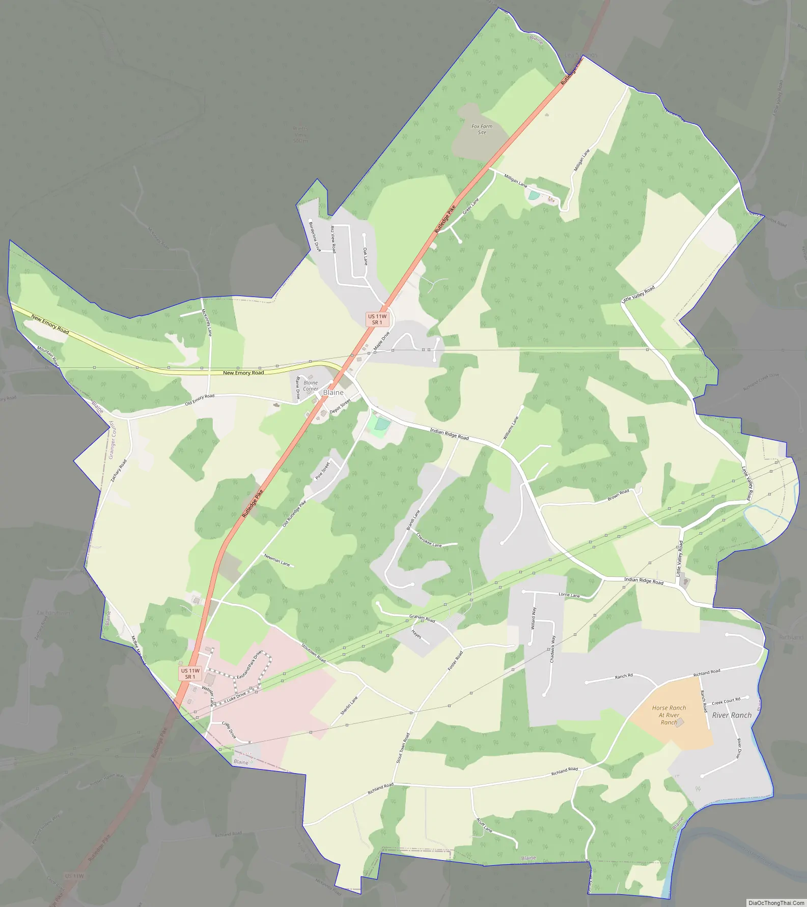
Online Interactive Map
Click on ![]() to view map in "full screen" mode.
to view map in "full screen" mode.
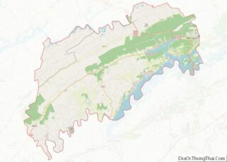
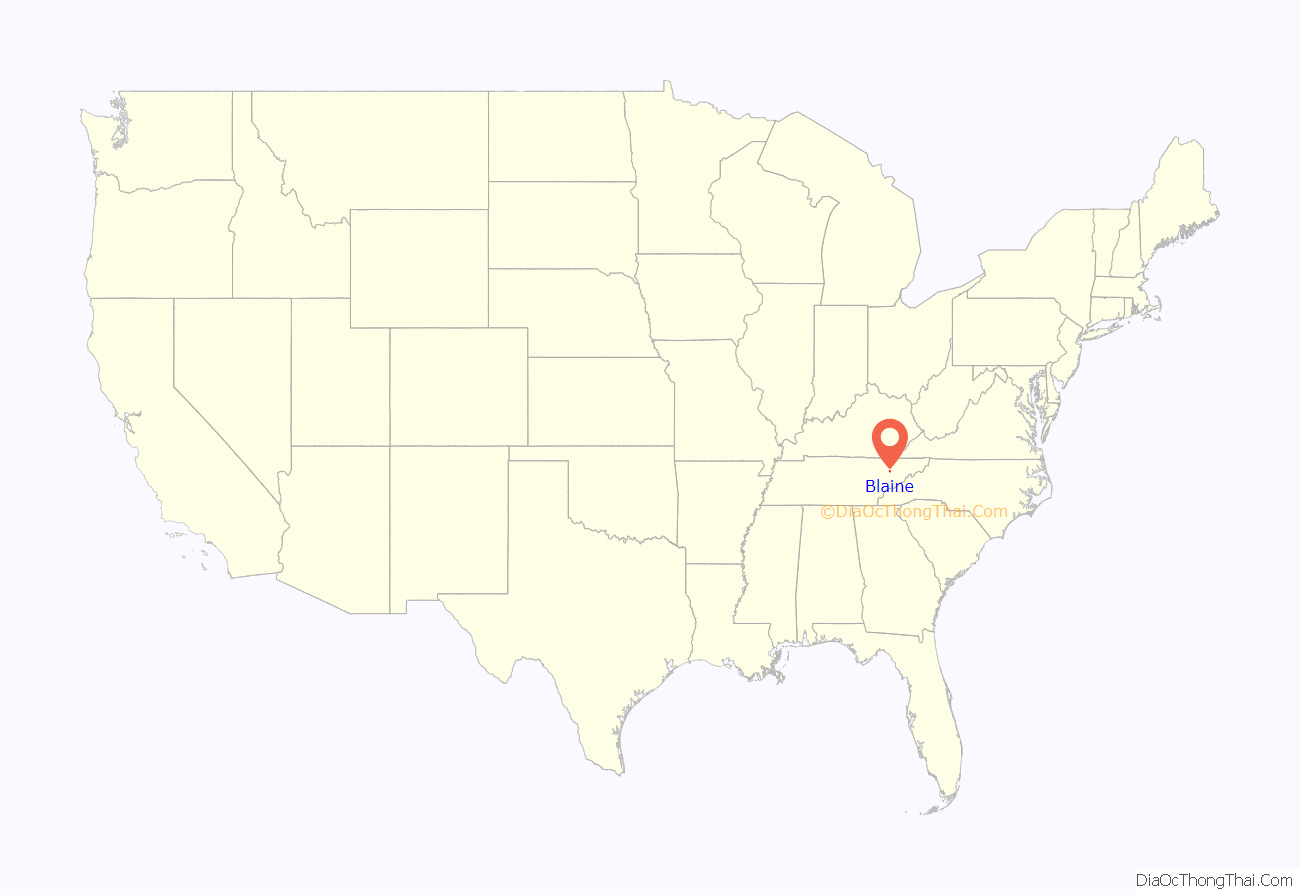
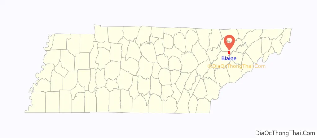
Blaine location map. Where is Blaine city?
History
Blaine was originally known as Blaine’s Crossroads (sometimes spelled “Blain”). During the early 19th century, it was located at the intersection of several important roads, including the eastern terminus of the Emory Road (present day SR 61), which traversed northern Knox County, the northern terminus of Indian Ridge Road, and the Great Indian Warpath, present-day U.S. Route 11W. Shields’ Station, a popular tavern and store, had been built in Blaine by the early 1830s. Blaine later served as a stop along the Knoxville and Bristol Railroad, also known as the Peavine Railroad, in the late 19th and early 20th centuries.
During the American Civil War, Blaine’s Crossroads served as the site of retreat of Confederate forces following General James Longstreet’s victory in the Battle of Bean’s Station. Longstreet and his forces attempted to siege westward into Blaine’s Crossroads, as part of the Knoxville campaign to capture the city of Knoxville. Union army forces retreating from Bean’s Station moved into Blaine’s Crossroads, making a stronger defense at the community for Union military forces. Overmatched by the strength of the Union Army, Longstreet and his forces retreated at Blaine’s Crossroads, ending the Confederacy’s attempt at controlling Knoxville.
Around 1890, a Pennsylvania native named Robert Blaine opened and operated a general store in the community. As the community grew, Blaine was chosen as the namesake of the city.
In the late 19th to the early 20th century, Blaine was a stop on the Knoxville and Bristol Railroad, commonly known by locals as the “Peavine Railroad.” The line ran from the City of Morristown in Hamblen County, through the Richland Valley to the bedroom community of Corryton, north of Blaine in unincorporated Knox County. With the creation of the railroad, Blaine saw a significant change from a small turnpike town, to a bustling railroad town.
On December 31, 1952, country music singer Hank Williams was spotted during his last ride in Blaine following his departure from the Andrew Johnson Hotel in downtown Knoxville. Falling severely ill after a dinner at the hotel, Williams asked his driver, Charles Carr, drive him from Knoxville to Charleston, West Virginia for a concert in the same day. Arriving in Blaine, Williams’ car was stopped by a Tennessee Highway Patrol trooper for speeding. The state trooper had seen Williams lying motionless in the back of the car during the stop and assumed that he was dead. Carr insisted that Williams was sedated from a Knoxville doctor’s order. The trooper fined Carr $25 for speeding, and later paid this fine at the Grainger County Courthouse in Rutledge.
In 1978, waste management company Browning-Ferris Industries announced plans for a large sanitary landfill to service the needs of Knoxville in Blaine. The proposal would prompt community members to petition and vote to incorporate Blaine into a city in the same year. Blaine residents would also use acts of vandalism (notably arson) and violence against Browning-Ferris and construction companies contracted to build the landfill to oppose the project. The largest of these acts resulted in the destruction of the Knoxville office of Browning-Ferris via bomb, costing the company $50,000.
In 2007, the city received $520,560 in funding from the Economic Development Administration, and $867,600 towards developing the city’s sewage treatment system for proposed commercial and industrial sites. The project created nearly 175 jobs in the city and the potential of $12.525 million in private investment. In 2010, the Blaine City Council moved forward with the sewer project despite previous hurdles with local opposition.
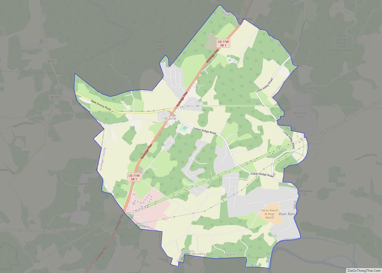
Blaine Road Map
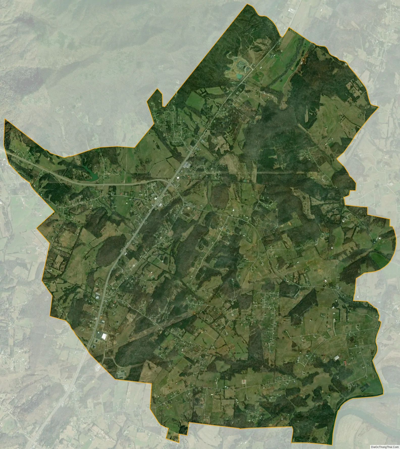
Blaine city Satellite Map
Geography
Blaine is located in the southwest corner of Grainger County at 36°9′3″N 83°42′2″W / 36.15083°N 83.70056°W / 36.15083; -83.70056 (36.150854, -83.700443). It is situated around the intersection of U.S. Route 11W (Rutledge Pike), Tennessee State Route 61, and Indian Ridge Road. The city is southeast of the point where Grainger, Knox, and Union counties meet. Clinch Mountain and adjacent ridges rise prominently to the north and northeast, and House Mountain is visible to the southwest.
It is 14 miles (23 km) southwest of Rutledge, the county seat, 12 miles (19 km) southeast of Maynardville, and 19 miles (31 km) northeast of Knoxville. Blaine is connected to Knoxville and Rutledge via U.S. Route 11W and Maynardville via TN-61.
According to the United States Census Bureau, the city has a total area of 9.4 square miles (24.3 km), all of it land.
See also
Map of Tennessee State and its subdivision:- Anderson
- Bedford
- Benton
- Bledsoe
- Blount
- Bradley
- Campbell
- Cannon
- Carroll
- Carter
- Cheatham
- Chester
- Claiborne
- Clay
- Cocke
- Coffee
- Crockett
- Cumberland
- Davidson
- Decatur
- DeKalb
- Dickson
- Dyer
- Fayette
- Fentress
- Franklin
- Gibson
- Giles
- Grainger
- Greene
- Grundy
- Hamblen
- Hamilton
- Hancock
- Hardeman
- Hardin
- Hawkins
- Haywood
- Henderson
- Henry
- Hickman
- Houston
- Humphreys
- Jackson
- Jefferson
- Johnson
- Knox
- Lake
- Lauderdale
- Lawrence
- Lewis
- Lincoln
- Loudon
- Macon
- Madison
- Marion
- Marshall
- Maury
- McMinn
- McNairy
- Meigs
- Monroe
- Montgomery
- Moore
- Morgan
- Obion
- Overton
- Perry
- Pickett
- Polk
- Putnam
- Rhea
- Roane
- Robertson
- Rutherford
- Scott
- Sequatchie
- Sevier
- Shelby
- Smith
- Stewart
- Sullivan
- Sumner
- Tipton
- Trousdale
- Unicoi
- Union
- Van Buren
- Warren
- Washington
- Wayne
- Weakley
- White
- Williamson
- Wilson
- Alabama
- Alaska
- Arizona
- Arkansas
- California
- Colorado
- Connecticut
- Delaware
- District of Columbia
- Florida
- Georgia
- Hawaii
- Idaho
- Illinois
- Indiana
- Iowa
- Kansas
- Kentucky
- Louisiana
- Maine
- Maryland
- Massachusetts
- Michigan
- Minnesota
- Mississippi
- Missouri
- Montana
- Nebraska
- Nevada
- New Hampshire
- New Jersey
- New Mexico
- New York
- North Carolina
- North Dakota
- Ohio
- Oklahoma
- Oregon
- Pennsylvania
- Rhode Island
- South Carolina
- South Dakota
- Tennessee
- Texas
- Utah
- Vermont
- Virginia
- Washington
- West Virginia
- Wisconsin
- Wyoming