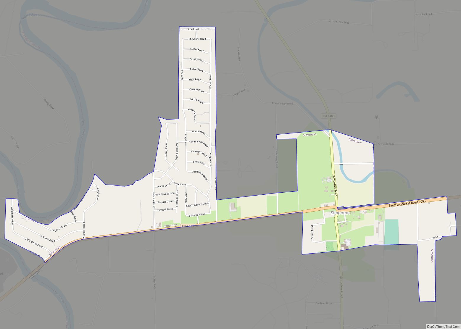
Map of Silverton city, Texas

Map of Silverton city, Texas

Silverton is a city in Briscoe County, Texas, United States. The population was 731 at the 2010 census. It is the county seat of Briscoe County. Silverton city overview: Name: Silverton city LSAD Code: 25 LSAD Description: city (suffix) State: Texas County: Briscoe County Elevation: 3,278 ft (999 m) Total Area: 1.00 sq mi (2.60 km²) Land Area: 1.00 sq mi (2.60 km²) … Read more

Map of Silsbee city

Map of Silsbee city

Silsbee is a town in Hardin County, Texas, United States. This town is 21 miles north of Beaumont. The population was 6,935 at the 2020 census. It is part of the Beaumont–Port Arthur metropolitan area. Silsbee city overview: Name: Silsbee city LSAD Code: 25 LSAD Description: city (suffix) State: Texas County: Hardin County Elevation: 82 ft … Read more

Map of Siesta Shores CDP

Map of Siesta Shores CDP

Siesta Shores is a census-designated place (CDP) in Zapata County, Texas, United States. The population was 1,382 at the 2010 census. Siesta Shores CDP overview: Name: Siesta Shores CDP LSAD Code: 57 LSAD Description: CDP (suffix) State: Texas County: Zapata County Elevation: 374 ft (114 m) Total Area: 1.6 sq mi (4 km²) Land Area: 0.73 sq mi (1.9 km²) Water Area: 0.85 sq mi … Read more

Map of Siesta Acres CDP

Map of Siesta Acres CDP

Siesta Acres is an unincorporated community and census-designated place in Maverick County, Texas, United States. Its population was 1,885 as of the 2010 census. U.S. Route 277 passes through the community. Siesta Acres CDP overview: Name: Siesta Acres CDP LSAD Code: 57 LSAD Description: CDP (suffix) State: Texas County: Maverick County Elevation: 768 ft (234 m) Total … Read more

Map of Sierra Blanca CDP

Map of Sierra Blanca CDP

Sierra Blanca is an unincorporated area in Hudspeth County, Texas, United States. It is also the county seat of the county and the namesake of a census-designated place (CDP) in which it is located. The town is part of the Trans-Pecos region of far West Texas, is located northeast of the Mexican border and is … Read more

Map of Sienna Plantation CDP

Map of Sienna Plantation CDP

Sienna Plantation CDP overview: Name: Sienna Plantation CDP LSAD Code: 57 LSAD Description: CDP (suffix) State: Texas County: Fort Bend County FIPS code: 4867766 Online Interactive Map Sienna Plantation online map. Source: Basemap layers from Google Map, Open Street Map (OSM), Arcgisonline, Wmflabs. Boundary Data from Database of Global Administrative Areas. Sienna Plantation location map. … Read more

Map of Slaton city

Map of Slaton city

Slaton is a city in Lubbock County, Texas, United States founded by German immigrants. Slaton was the westernmost German settlement in Texas. The population was 6,121 at the 2010 census. Slaton is part of the Lubbock Metropolitan Statistical Area. Slaton city overview: Name: Slaton city LSAD Code: 25 LSAD Description: city (suffix) State: Texas County: … Read more

Map of Somerville city, Texas

Map of Somerville city, Texas

Somerville (/ˈsʌmərvɪl/ SUM-ər-vil) is a city in Burleson County, Texas, United States. The population was 1,312 at the 2020 census. Somerville is named for Albert Somerville the first president of the Gulf, Colorado and Santa Fe Railway. Somerville city overview: Name: Somerville city LSAD Code: 25 LSAD Description: city (suffix) State: Texas County: Burleson County … Read more

Map of Somerset city, Texas

Map of Somerset city, Texas

Somerset is a city located in Bexar County, Texas, United States. It is located less than 20 miles south of Downtown San Antonio and is part of the San Antonio–New Braunfels metropolitan area. The population was 1,756 at the 2020 census. Somerset city overview: Name: Somerset city LSAD Code: 25 LSAD Description: city (suffix) State: … Read more

Map of Solis CDP

Map of Solis CDP

Solis is a census-designated place (CDP) in Cameron County, Texas, United States. The population was 512 at the 2010 census. It is part of the Brownsville–Harlingen Metropolitan Statistical Area. Solis CDP overview: Name: Solis CDP LSAD Code: 57 LSAD Description: CDP (suffix) State: Texas County: Cameron County Elevation: 59 ft (18 m) Total Area: 1.64 sq mi (4.24 km²) Land … Read more

Map of Socorro city, Texas

Map of Socorro city, Texas

Socorro is a city in El Paso County, Texas, United States. It is located on the north bank of the Rio Grande southeast of El Paso, and on the border of Mexico. El Paso adjoins it on the west and the smaller city of San Elizario on the southeast; small unincorporated areas of El Paso … Read more

Map of Snyder city, Texas

Map of Snyder city, Texas

Snyder is a town in, and the county seat of Scurry County, Texas, United States. The population was 11,202 at the 2010 census. The city is located in the lower part of the Southwestern Tablelands ecological region. Snyder city overview: Name: Snyder city LSAD Code: 25 LSAD Description: city (suffix) State: Texas County: Scurry County … Read more