Map of Falls City, Texas

Map of Falls City, Texas

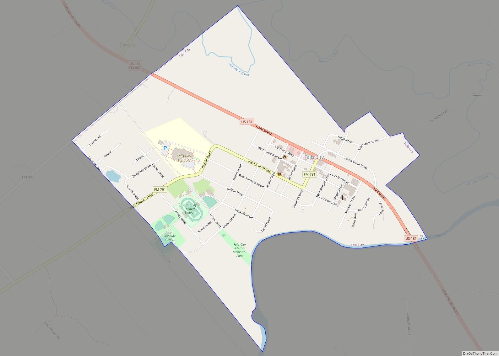
Falls City is a city in Karnes County, Texas, United States. The population was 514 at the 2020 census. Falls City is near the location of a uranium tailings disposal cell, completed in 1994 under the terms of the 1978 Uranium Mill Tailings Radiation Control Act. The early settlers, predominantly Polish Catholics, founded the Holy … Read more

Map of Falfurrias city

Map of Falfurrias city

Falfurrias (/fælˈfjʊəriəs/ fal-FYOOR-ee-əs) is a city in and the county seat of Brooks County, Texas. Its population was 4,981 at the 2010 census, in a county that in the same census was just over 7,000. The town is named for founder Edward Cunningham Lasater’s ranch, La Mota de Falfurrias. In 1893, the Falfurrias ranch was … Read more

Map of Florence city, Texas

Map of Florence city, Texas

Florence is a city in Williamson County, Texas, United States. The population was 1,171 at the 2020 census. Since 2000, the territorial limits of Florence has grown by 8%. Florence is located about 13 miles (21 km) north from Georgetown and 40 miles (64 km) north of Austin in northwestern Williamson County. Florence is part of the … Read more

Map of Flor del Rio CDP

Map of Flor del Rio CDP

Flor del Rio is a census-designated place (CDP) in Starr County, Texas, United States. It is a new CDP formed from part of the Los Alvarez CDP prior to the 2010 census with a population of 122. Flor del Rio CDP overview: Name: Flor del Rio CDP LSAD Code: 57 LSAD Description: CDP (suffix) State: … Read more

Map of Flatonia town

Map of Flatonia town

Flatonia is a town in southwestern Fayette County, Texas, United States. Located on Interstate 10 and the Union Pacific Railroad, 12 miles (19 km) west of Schulenburg, the population was 1,308 at the 2020 census. Flatonia town overview: Name: Flatonia town LSAD Code: 43 LSAD Description: town (suffix) State: Texas County: Fayette County Elevation: 456 ft (139 m) … Read more

Map of Fifth Street CDP

Map of Fifth Street CDP

Fifth Street is a census-designated place (CDP) located in the extraterritorial jurisdiction of Stafford within Fort Bend County, Texas, United States. The population was 2,486 at the 2010 census. Fifth Street is within the ZIP code 77477. Therefore, residents of Fifth Street have an address of Stafford, Texas. Fifth Street CDP overview: Name: Fifth Street … Read more

Map of Ferris city, Texas

Map of Ferris city, Texas

Ferris is a city in Dallas and Ellis counties in the U.S. state of Texas. It is 20 miles (32 km) south of downtown Dallas. The population was 2,788 in 2020. Ferris city overview: Name: Ferris city LSAD Code: 25 LSAD Description: city (suffix) State: Texas County: Dallas County, Ellis County Elevation: 466 ft (142 m) Total Area: … Read more

Map of Fernando Salinas CDP

Map of Fernando Salinas CDP

Fernando Salinas is a census-designated place (CDP) in Starr County, Texas, United States. This was a new CDP for the 2010 census with a population of 15. Fernando Salinas CDP overview: Name: Fernando Salinas CDP LSAD Code: 57 LSAD Description: CDP (suffix) State: Texas County: Starr County Total Area: 15 FIPS code: 4825744 Online Interactive … Read more

Map of Floydada city

Map of Floydada city

Floydada (/flɔɪˈdeɪdə/ floy-DAY-də) is a city in and the county seat of Floyd County, Texas, United States. This rural community lies on the high plains of the Llano Estacado in West Texas and is sometimes referred to as the Pumpkin Capital of Texas. The population was 3,038 at the 2010 census, down from 3,676 at … Read more

Map of Flower Mound town

Map of Flower Mound town

Flower Mound is an incorporated town located in Denton and Tarrant counties in the U.S. state of Texas. Located northwest of Dallas and northeast of Fort Worth adjacent to Grapevine Lake, the town derives its name from a prominent 12.5-acre (5.1 ha) mound located in the center of town. After settlers used the site for religious … Read more

Map of Flowella CDP

Map of Flowella CDP

Flowella also known as “La Parrita” is a census-designated place (CDP) in Brooks County, Texas, United States. The population was 118 at the 2010 census. Flowella CDP overview: Name: Flowella CDP LSAD Code: 57 LSAD Description: CDP (suffix) State: Texas County: Brooks County Elevation: 95 ft (29 m) Total Area: 1.0 sq mi (2.6 km²) Land Area: 1.0 sq mi (2.6 km²) Water … Read more

Map of Floresville city

Map of Floresville city

Floresville is a city in Wilson County, Texas, United States. According to the U.S. Census Bureau, its population was at 7,203 at the 2020 Census. It is the county seat of Wilson County. The city is also part of the San Antonio metropolitan statistical area. Floresville city overview: Name: Floresville city LSAD Code: 25 LSAD … Read more