Flower Mound is an incorporated town located in Denton and Tarrant counties in the U.S. state of Texas. Located northwest of Dallas and northeast of Fort Worth adjacent to Grapevine Lake, the town derives its name from a prominent 12.5-acre (5.1 ha) mound located in the center of town.
After settlers used the site for religious camps during the 1840s, the area around Flower Mound was first permanently inhabited in the 1850s; however, residents did not incorporate until 1961. Although an effort to create a planned community failed in the early 1970s, Flower Mound’s population increased substantially when Dallas/Fort Worth International Airport opened to the south in 1974. As of the 2020 United States census, the population was 75,956, reflecting a 17% increase over the 64,669 counted in the 2010 census. Of the Texas municipalities that label themselves “towns”, Flower Mound has the largest population. Flower Mound was the only town with a population greater than 20,000 in the 2020 census.
Flower Mound’s municipal government, operating under a council–manager system, has invested in a public park system highlighted by an extensive network of trails. Lewisville Independent School District, which operates public schools, covers the majority of Flower Mound. With its moderately affluent population and proximity to the Dallas–Fort Worth metroplex, Flower Mound has used a smart growth system for urban planning, and has recently experienced more rapid light industrial growth to match the growing needs of the primarily residential community.
| Name: | Flower Mound town |
|---|---|
| LSAD Code: | 43 |
| LSAD Description: | town (suffix) |
| State: | Texas |
| County: | Denton County, Tarrant County |
| Incorporated: | February 25, 1961 (1961-02-25) |
| Elevation: | 604 ft (184 m) |
| Land Area: | 41.96 sq mi (108.67 km²) |
| Water Area: | 2.52 sq mi (6.53 km²) |
| Population Density: | 1,810.20/sq mi (698.96/km²) |
| Area code: | 214, 469, 972, 682, 817 |
| FIPS code: | 4826232 |
| GNISfeature ID: | 1335983 |
| Website: | www.flower-mound.com |
Online Interactive Map
Click on ![]() to view map in "full screen" mode.
to view map in "full screen" mode.
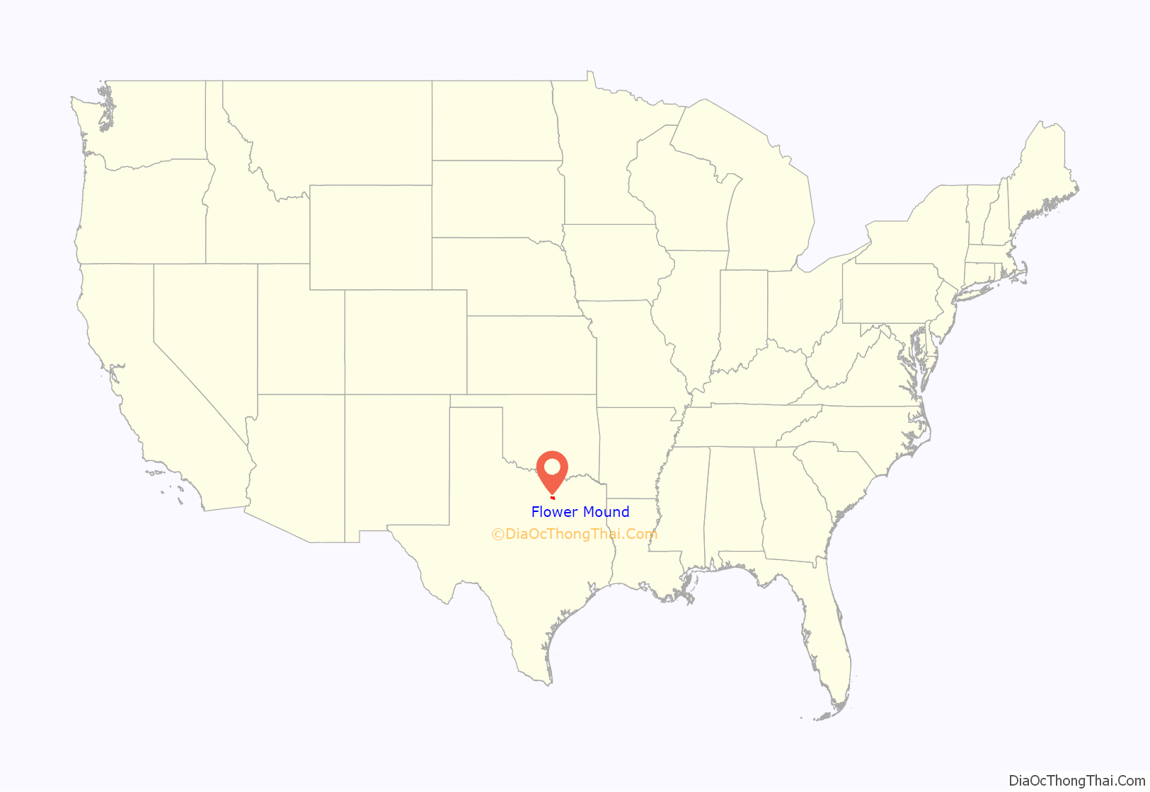
Flower Mound location map. Where is Flower Mound town?
History
Settlement in the area around Flower Mound began when the Presbyterians established a camp in the area in the 1840s. A log cabin, dated around 1850, was discovered preserved within the walls of a home near Liberty Elementary in 2016, providing further proof of settlement. At first, the group held religious camps for two to three weeks at a time. By 1854, residents had established the Flower Mound Presbyterian Church southwest of Lewisville in an area commonly referred to as “Long Prairie”. By 1920, the church had 126 members, and the pine-framed building was expanded in 1937. Early settlers such as Andrew Morriss and David Kirkpatrick are memorialized with street names in the town. The area remained sparsely populated for many decades after its initial settlement.
On February 25, 1961, the town voted to incorporate to avoid annexation by the City of Irving. William Wilkerson, who became the town’s second mayor, led the incorporation effort and helped improve the town’s phone service and water supply. In 1970, when Flower Mound had 1,685 residents, Edward S. Marcus and Raymond Nasher began a planned community project with $18 million in loan guarantees from the United States Department of Housing and Urban Development through their New Community program. Called “Flower Mound New Town”, the project included elements of the new towns movement, including collaboration with North Texas State University (now the University of North Texas) to move the school’s administrative offices to Flower Mound and conduct all research for the project. The project was featured in advertisements as late as 1974, but it was abandoned after residents threatened to disannex a portion of the town to thwart the development. The disannexation effort sharply divided the town, and led to a number of strongly contested elections between 1971 and 1976. In 1976, Texas Monthly awarded the project its “Bum Steer Award” after the project lost its federal loan guarantees.
The construction of Dallas/Fort Worth International Airport 4 miles (6.4 km) south of the town in 1974 sparked a period of rapid growth. Between 1980 and 1990, Flower Mound’s population increased from 4,402 to 15,896. It reached 50,702 in 2000, an average annual increase of nearly 13 percent per year during the 1990s, making it the nation’s tenth fastest-growing community. Between 2000 and 2002, Flower Mound was the ninth fastest-growing municipality in the United States with a population of more than 50,000, and its population continued to increase by approximately five percent each year between 2000 and 2005. Controlled growth continues in central and western Flower Mound.
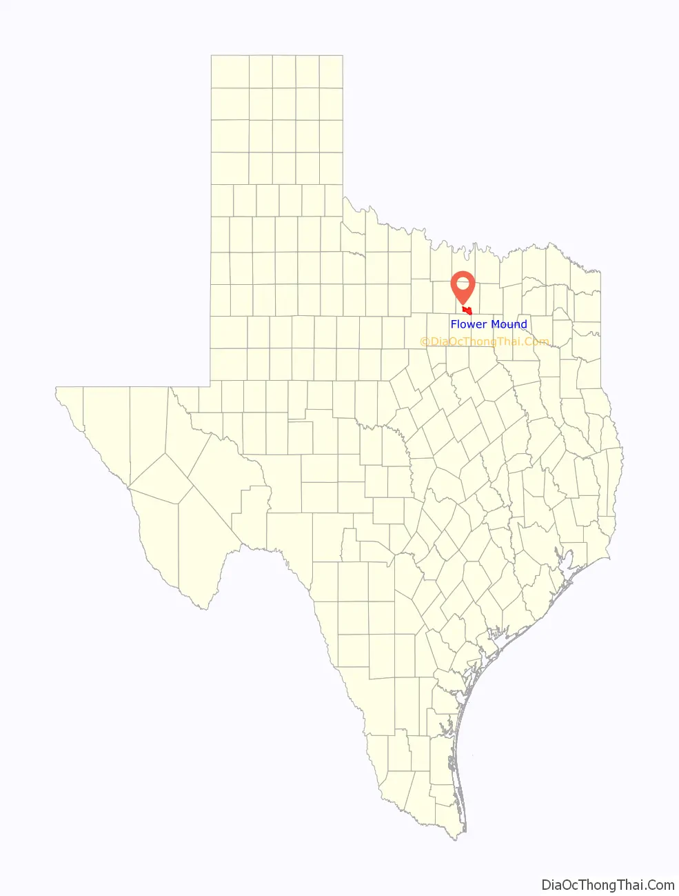
Flower Mound Road Map

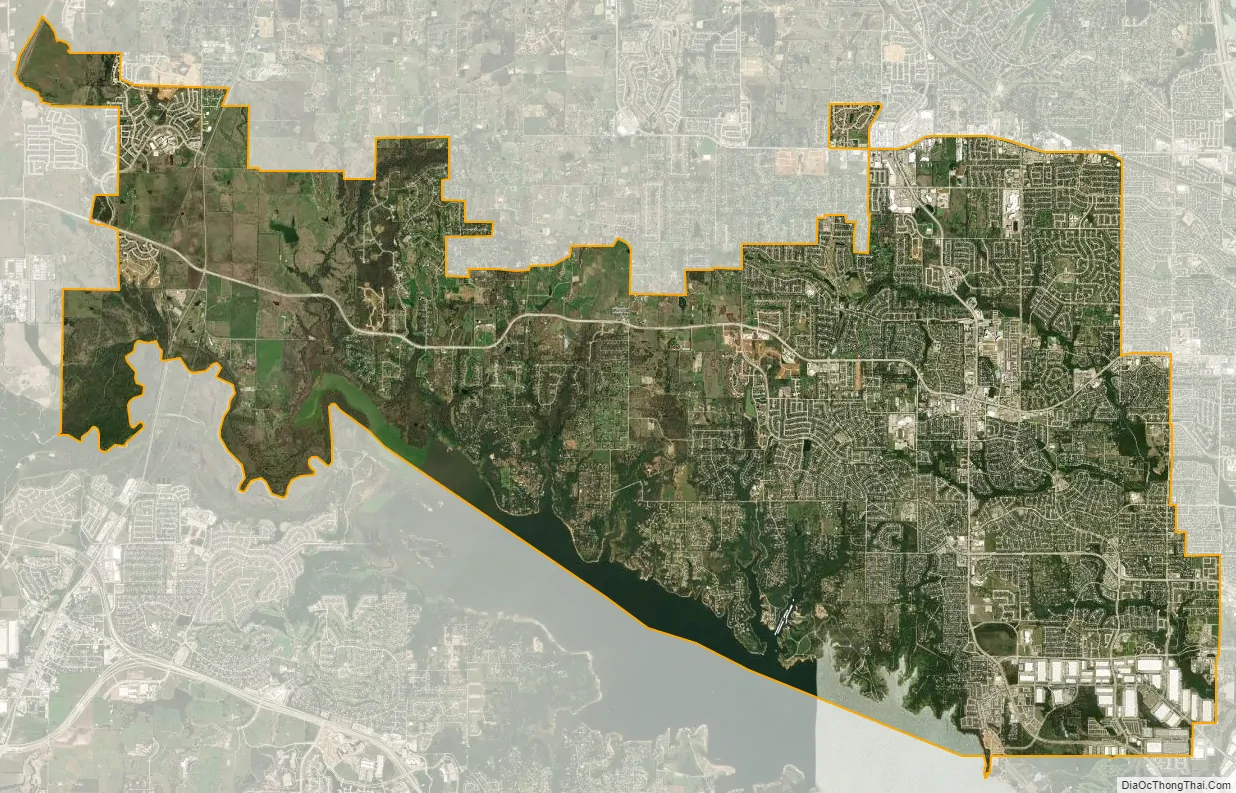
Flower Mound city Satellite Map
Geography
Flower Mound is located approximately 20 miles (32 km) northwest of Dallas and 25 miles (40 km) northeast of Fort Worth on the border between Denton and Tarrant counties. The town is located almost entirely in Denton County, however it has areas that extend into Tarrant County. It is situated on the basin of the Trinity River in the Eastern Cross Timbers subregion in Texas. The town borders Lewisville to the east and a number of cities and towns to the north, including Highland Village, Double Oak, and Bartonville. According to the United States Census Bureau, the town has a total area of 43.4 square miles (112 km). Land comprises 41.39 square miles (107.2 km) (95.37%) of the total area; Denton County soils include the Silawa, Nawo, Gasil series. Water comprises 2.5 square miles (6.5 km) (5.76%) of the total area; Grapevine Lake and Marshall Creek form much of the town’s southern boundary. Flower Mound’s climate is classified as humid subtropical; the town averages 233 sunny days per year and 79 days of precipitation.
The town encourages conservation development projects to protect and preserve existing open space, vistas, and natural habitats while allowing for controlled growth. Much of the town is located on the Barnett Shale, and drilling for shale gas in close proximity to residential neighborhoods has sharply divided parts of the community. In 1994, amateur fossil collector Gary Byrd discovered a fossilized example of a Hadrosaurid dinosaur among black shale rock formations in the southwest edge of the town near Grapevine Lake. The fossilized creature from the Cenomanian age was named “Protohadros byrdi” in Byrd’s honor.
“The Mound”
Flower Mound was named for a 12.5-acre (5.1 ha) hill approximately 50 feet (15 m) in height located close to the intersection of FM 3040 and FM 2499. The formation attracted the attention of early settlers to the area, and is often simply referred to as “The Mound”. Part of the Texas blackland prairies, The Mound is typically covered by big bluestem, little bluestem, and Indian grasses. During blooming seasons, dozens of varieties of flowers can grow on its slopes, often aided by the water retained by gilgai formations. Though surrounded by commercial and residential development, The Mound is owned and maintained by The Mound Foundation, a non-profit private–public partnership. The group has advocated for a controlled burn on The Mound for many years, and it expressed relief when an accidental New Year’s Eve fire in late 2011 spurred the growth of wildflowers for the first time in years.
Climate
See also
Map of Texas State and its subdivision:- Anderson
- Andrews
- Angelina
- Aransas
- Archer
- Armstrong
- Atascosa
- Austin
- Bailey
- Bandera
- Bastrop
- Baylor
- Bee
- Bell
- Bexar
- Blanco
- Borden
- Bosque
- Bowie
- Brazoria
- Brazos
- Brewster
- Briscoe
- Brooks
- Brown
- Burleson
- Burnet
- Caldwell
- Calhoun
- Callahan
- Cameron
- Camp
- Carson
- Cass
- Castro
- Chambers
- Cherokee
- Childress
- Clay
- Cochran
- Coke
- Coleman
- Collin
- Collingsworth
- Colorado
- Comal
- Comanche
- Concho
- Cooke
- Coryell
- Cottle
- Crane
- Crockett
- Crosby
- Culberson
- Dallam
- Dallas
- Dawson
- Deaf Smith
- Delta
- Denton
- Dewitt
- Dickens
- Dimmit
- Donley
- Duval
- Eastland
- Ector
- Edwards
- El Paso
- Ellis
- Erath
- Falls
- Fannin
- Fayette
- Fisher
- Floyd
- Foard
- Fort Bend
- Franklin
- Freestone
- Frio
- Gaines
- Galveston
- Garza
- Gillespie
- Glasscock
- Goliad
- Gonzales
- Gray
- Grayson
- Gregg
- Grimes
- Guadalupe
- Hale
- Hall
- Hamilton
- Hansford
- Hardeman
- Hardin
- Harris
- Harrison
- Hartley
- Haskell
- Hays
- Hemphill
- Henderson
- Hidalgo
- Hill
- Hockley
- Hood
- Hopkins
- Houston
- Howard
- Hudspeth
- Hunt
- Hutchinson
- Irion
- Jack
- Jackson
- Jasper
- Jeff Davis
- Jefferson
- Jim Hogg
- Jim Wells
- Johnson
- Jones
- Karnes
- Kaufman
- Kendall
- Kenedy
- Kent
- Kerr
- Kimble
- King
- Kinney
- Kleberg
- Knox
- La Salle
- Lamar
- Lamb
- Lampasas
- Lavaca
- Lee
- Leon
- Liberty
- Limestone
- Lipscomb
- Live Oak
- Llano
- Loving
- Lubbock
- Lynn
- Madison
- Marion
- Martin
- Mason
- Matagorda
- Maverick
- McCulloch
- McLennan
- McMullen
- Medina
- Menard
- Midland
- Milam
- Mills
- Mitchell
- Montague
- Montgomery
- Moore
- Morris
- Motley
- Nacogdoches
- Navarro
- Newton
- Nolan
- Nueces
- Ochiltree
- Oldham
- Orange
- Palo Pinto
- Panola
- Parker
- Parmer
- Pecos
- Polk
- Potter
- Presidio
- Rains
- Randall
- Reagan
- Real
- Red River
- Reeves
- Refugio
- Roberts
- Robertson
- Rockwall
- Runnels
- Rusk
- Sabine
- San Augustine
- San Jacinto
- San Patricio
- San Saba
- Schleicher
- Scurry
- Shackelford
- Shelby
- Sherman
- Smith
- Somervell
- Starr
- Stephens
- Sterling
- Stonewall
- Sutton
- Swisher
- Tarrant
- Taylor
- Terrell
- Terry
- Throckmorton
- Titus
- Tom Green
- Travis
- Trinity
- Tyler
- Upshur
- Upton
- Uvalde
- Val Verde
- Van Zandt
- Victoria
- Walker
- Waller
- Ward
- Washington
- Webb
- Wharton
- Wheeler
- Wichita
- Wilbarger
- Willacy
- Williamson
- Wilson
- Winkler
- Wise
- Wood
- Yoakum
- Young
- Zapata
- Zavala
- Alabama
- Alaska
- Arizona
- Arkansas
- California
- Colorado
- Connecticut
- Delaware
- District of Columbia
- Florida
- Georgia
- Hawaii
- Idaho
- Illinois
- Indiana
- Iowa
- Kansas
- Kentucky
- Louisiana
- Maine
- Maryland
- Massachusetts
- Michigan
- Minnesota
- Mississippi
- Missouri
- Montana
- Nebraska
- Nevada
- New Hampshire
- New Jersey
- New Mexico
- New York
- North Carolina
- North Dakota
- Ohio
- Oklahoma
- Oregon
- Pennsylvania
- Rhode Island
- South Carolina
- South Dakota
- Tennessee
- Texas
- Utah
- Vermont
- Virginia
- Washington
- West Virginia
- Wisconsin
- Wyoming


