Floresville is a city in Wilson County, Texas, United States. According to the U.S. Census Bureau, its population was at 7,203 at the 2020 Census. It is the county seat of Wilson County. The city is also part of the San Antonio metropolitan statistical area.
| Name: | Floresville city |
|---|---|
| LSAD Code: | 25 |
| LSAD Description: | city (suffix) |
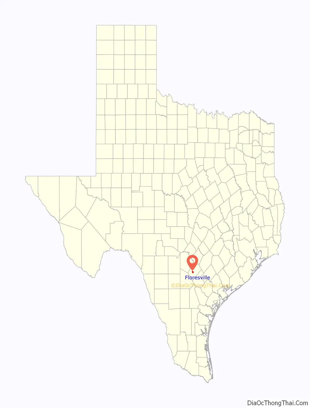
| State: | Texas |
| County: | Wilson County |
| Elevation: | 390 ft (119 m) |
| Total Area: | 7.72 sq mi (19.99 km²) |
| Land Area: | 7.69 sq mi (19.92 km²) |
| Water Area: | 0.03 sq mi (0.07 km²) |
| Total Population: | 7,203 |
| Population Density: | 1,046.03/sq mi (403.89/km²) |
| ZIP code: | 78114 |
| Area code: | 830 |
| FIPS code: | 4826160 |
| GNISfeature ID: | 1357499 |
| Website: | cityoffloresville.org |
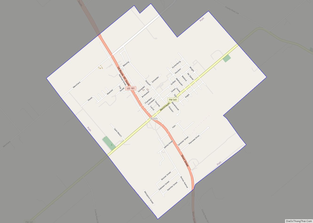
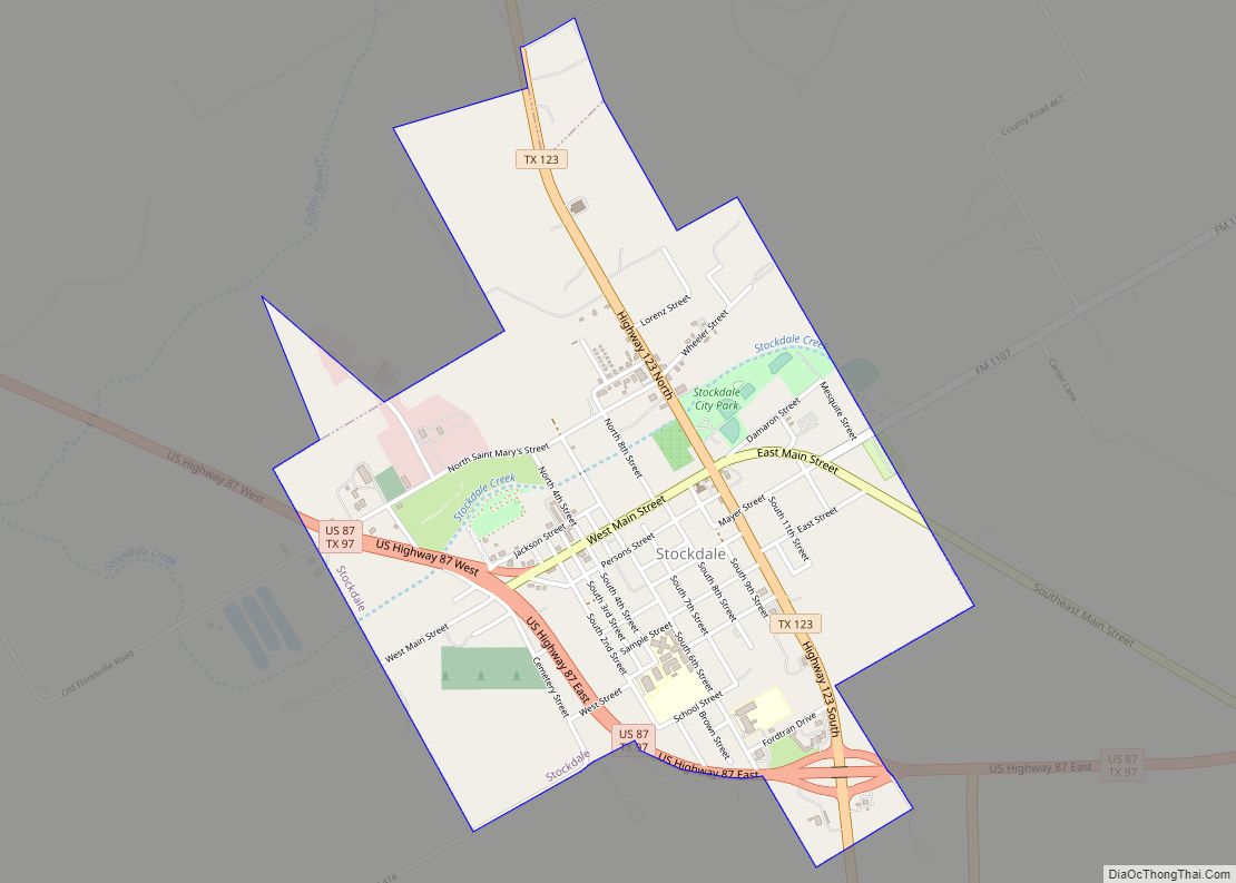
Online Interactive Map
Click on ![]() to view map in "full screen" mode.
to view map in "full screen" mode.
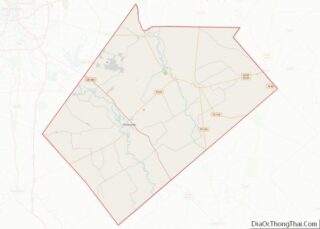
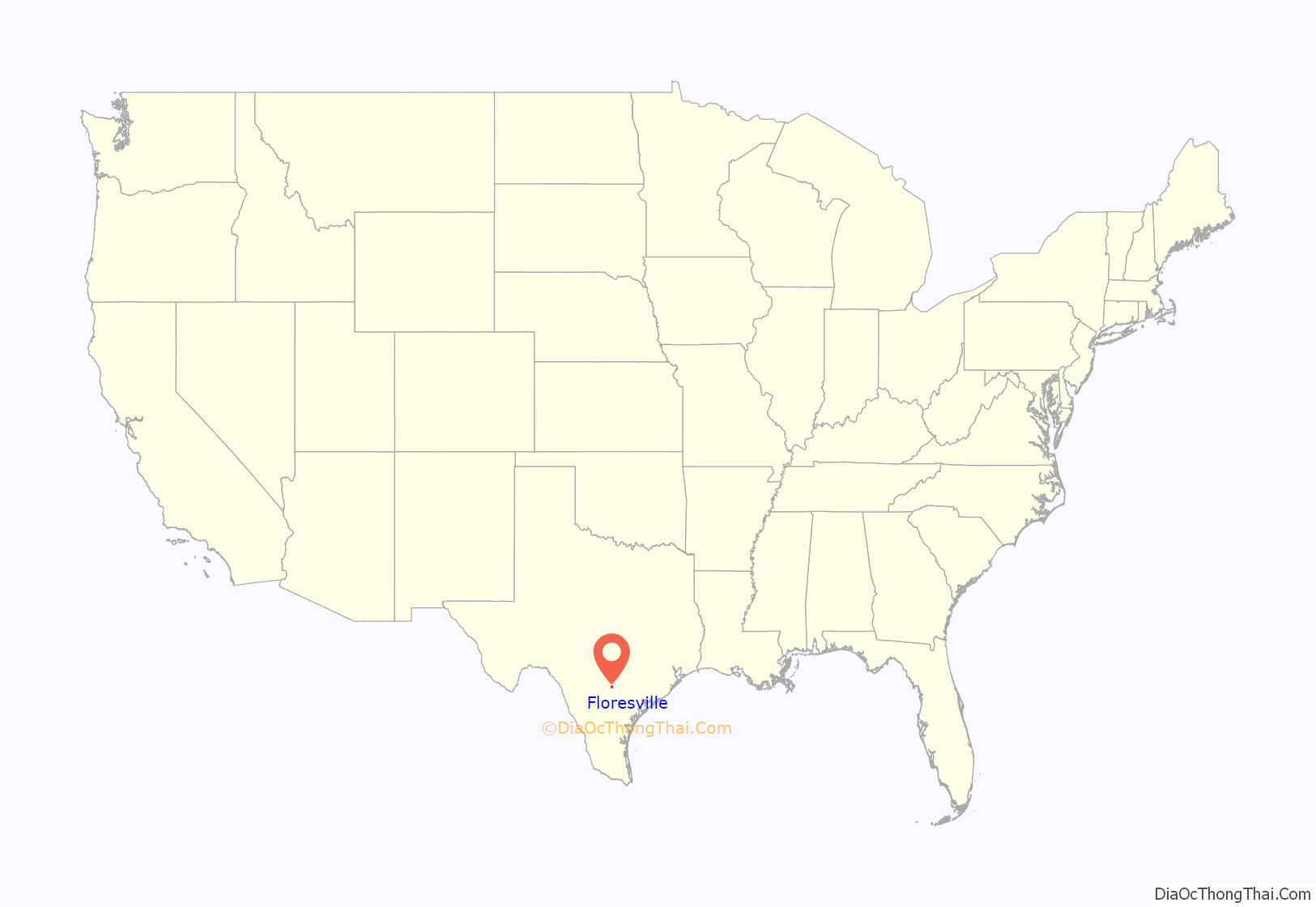
Floresville location map. Where is Floresville city?
History
Historic dwellers of the area were Lipan Apache tribes. After the Spanish discovery of the Americas, Western settlement came in the form of Christian missions. Thus, in the mid-18th century, Mision de las Cabras, “the goat ranch”, was established near Floresville as a mission ranching operation for Mission Espada. Indian and Spanish vaqueros lived and worshiped here, while caring for the herds of animals. This was the precursor of the Texas ranching industry.
The land and name for this town would be given to honor the Flores de Abrego family, who were descendants of the former Canary Islanders. Don Francisco Flores de Abrego was an early settler of this area, his ranch was six miles (10 km) northwest of the site of present Floresville. Four of his sons, Salvador, Manuel N., Nepomuceno, and Jose Maria served Texas in the 1835–1836 Revolution.
Don Erasmo Seguin (born 1782, in San Antonio) also settled in this area in late 1824, purchasing a ranch, and with his wife raised a family here. His ranch, “Casa Blanca”, began as a 9,000-acre (36 km) tract near present Floresville. The Erasmo Seguin family had previously lived in San Antonio de Bexar, and also owned a 22,000-acre (89 km) ranch further south (in present Karnes County), but now chose to build and live in Floresville.
Juan Seguín (born 1806, in San Antonio), one of Erasmo Seguin’s sons, was also a prominent Texas military and political figure. He returned with his family to again reside on his father’s Floresville ranch from 1848 to 1852. Juan then built a home in 1852 on a property adjacent to his father’s, 3 miles northwest of Floresville’s center, living there until about 1883. He had come back from a necessary self-imposed exile in Mexico, from 1842 to 1848.
As a Texian Army colonel, Juan Seguin, a true Texas Revolution (1835–1836) hero, had later been blamed by some Anglo Texans for the loss of San Antonio (then part of the Republic of Texas), from attacks by Gra. Rafael Vásquez under Gra. Santa Anna’s command in 1842, and his life was threatened. Santa Anna was trying to restore Texas to Mexican control. Though Col. Seguin had beat Gra. Vásquez’s forces back across the Rio Grande, he was disparaged as having Mexican sympathies and loyalties. In exile (from 1842), once in Mexico, he then agreed to serve under Santa Anna in the Mexican–American War of 1846–1848. Gra. Santa Anna had attempted to regain Texas from the United States in 1846, after Texas was willingly annexed by the US in 1845. After that war, Juan Seguin then left Mexico behind in 1848 and returned to the now US state of Texas, to his father’s Floresville ranch.
2015 tornado
In the early hours of October 30, an EF2 tornado touched down south of downtown. The tornado strengthened at a slow rate until it got to the city limits. The tornado threw a trailer on top of the Holiday Inn building. Floresville High School was severely damaged to the point where it almost collapsed. A store was pummeled by debris before the storm left the city limits. The tornado tracked into the oil fields toward Sutherland Springs. It lifted up before reaching Sutherland Springs.
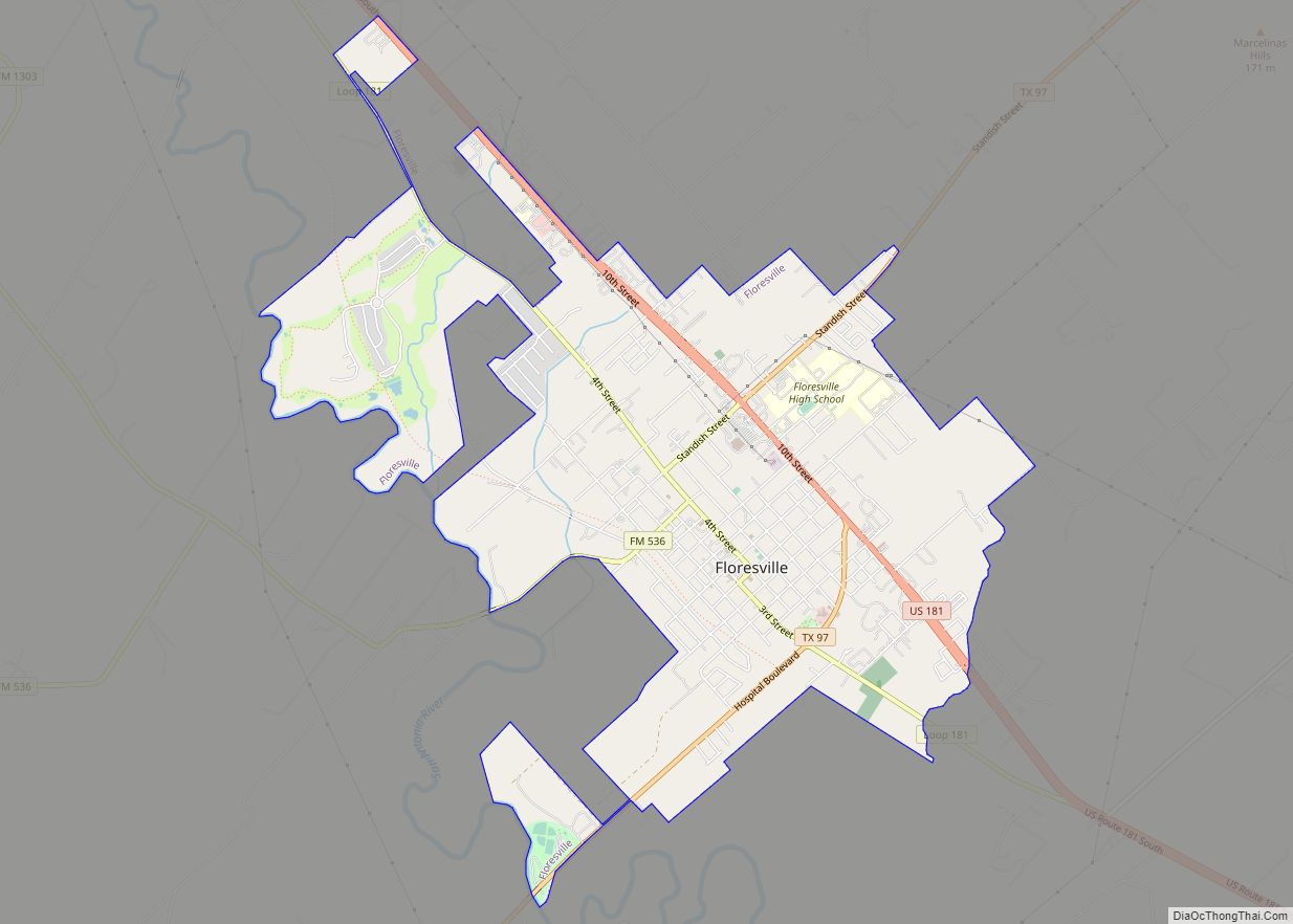
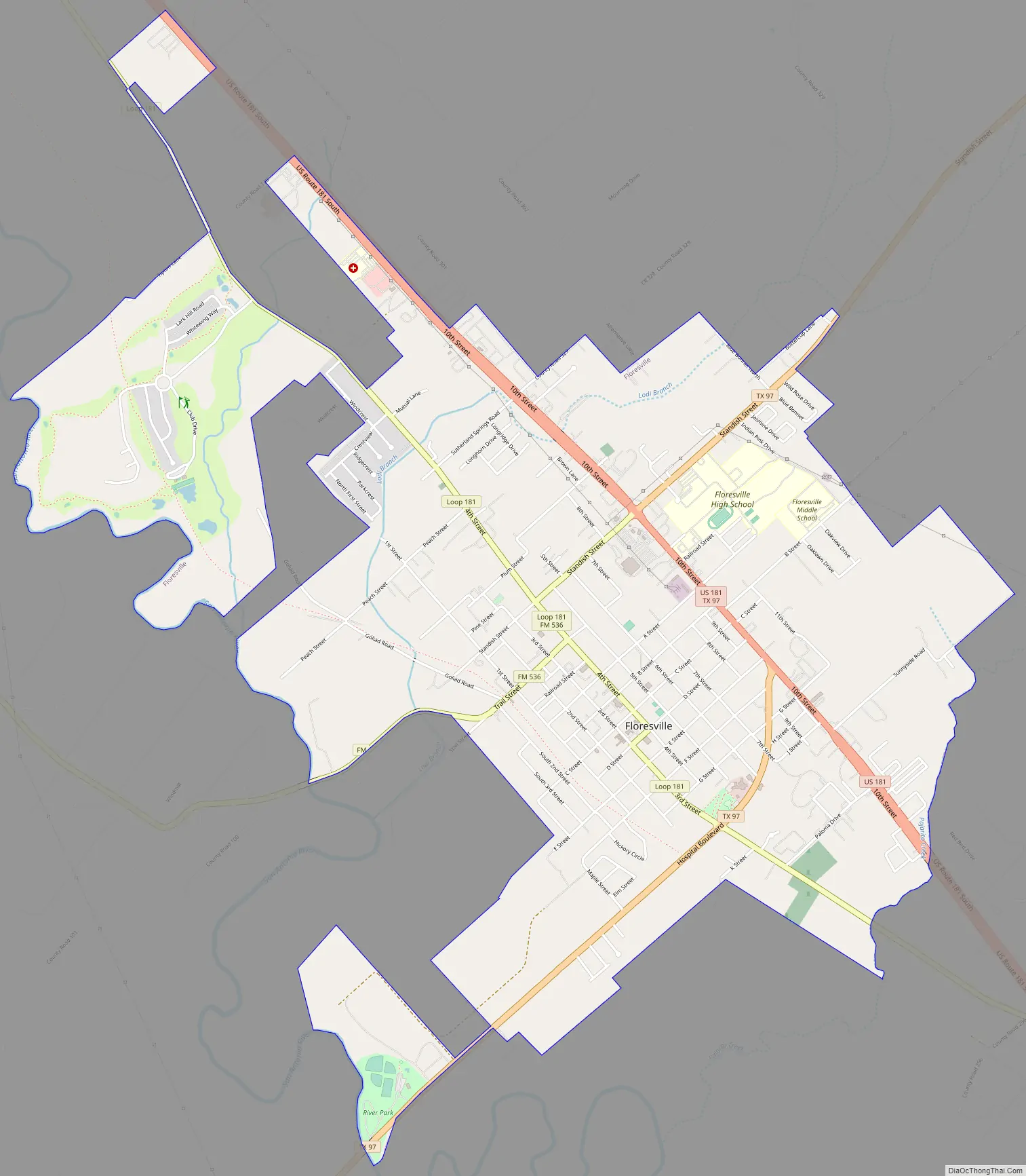
Floresville Road Map
Floresville city Satellite Map
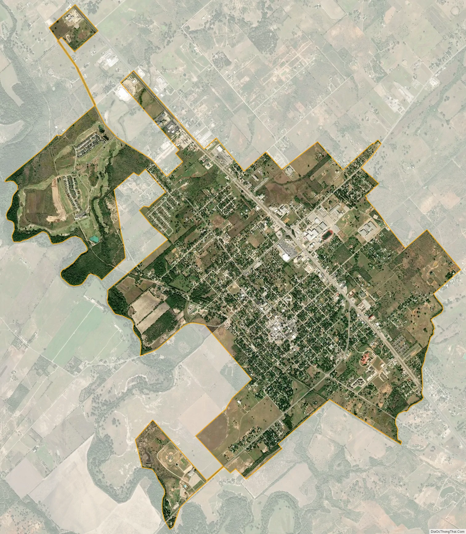
Geography
Floresville is located at 29°8′23″N 98°9′42″W / 29.13972°N 98.16167°W / 29.13972; -98.16167 (29.139805, −98.161692). The city has a total area of 5.7 square miles (15 km), all land.
The city is about 35 miles southeast of downtown San Antonio.
See also
Map of Texas State and its subdivision:- Anderson
- Andrews
- Angelina
- Aransas
- Archer
- Armstrong
- Atascosa
- Austin
- Bailey
- Bandera
- Bastrop
- Baylor
- Bee
- Bell
- Bexar
- Blanco
- Borden
- Bosque
- Bowie
- Brazoria
- Brazos
- Brewster
- Briscoe
- Brooks
- Brown
- Burleson
- Burnet
- Caldwell
- Calhoun
- Callahan
- Cameron
- Camp
- Carson
- Cass
- Castro
- Chambers
- Cherokee
- Childress
- Clay
- Cochran
- Coke
- Coleman
- Collin
- Collingsworth
- Colorado
- Comal
- Comanche
- Concho
- Cooke
- Coryell
- Cottle
- Crane
- Crockett
- Crosby
- Culberson
- Dallam
- Dallas
- Dawson
- Deaf Smith
- Delta
- Denton
- Dewitt
- Dickens
- Dimmit
- Donley
- Duval
- Eastland
- Ector
- Edwards
- El Paso
- Ellis
- Erath
- Falls
- Fannin
- Fayette
- Fisher
- Floyd
- Foard
- Fort Bend
- Franklin
- Freestone
- Frio
- Gaines
- Galveston
- Garza
- Gillespie
- Glasscock
- Goliad
- Gonzales
- Gray
- Grayson
- Gregg
- Grimes
- Guadalupe
- Hale
- Hall
- Hamilton
- Hansford
- Hardeman
- Hardin
- Harris
- Harrison
- Hartley
- Haskell
- Hays
- Hemphill
- Henderson
- Hidalgo
- Hill
- Hockley
- Hood
- Hopkins
- Houston
- Howard
- Hudspeth
- Hunt
- Hutchinson
- Irion
- Jack
- Jackson
- Jasper
- Jeff Davis
- Jefferson
- Jim Hogg
- Jim Wells
- Johnson
- Jones
- Karnes
- Kaufman
- Kendall
- Kenedy
- Kent
- Kerr
- Kimble
- King
- Kinney
- Kleberg
- Knox
- La Salle
- Lamar
- Lamb
- Lampasas
- Lavaca
- Lee
- Leon
- Liberty
- Limestone
- Lipscomb
- Live Oak
- Llano
- Loving
- Lubbock
- Lynn
- Madison
- Marion
- Martin
- Mason
- Matagorda
- Maverick
- McCulloch
- McLennan
- McMullen
- Medina
- Menard
- Midland
- Milam
- Mills
- Mitchell
- Montague
- Montgomery
- Moore
- Morris
- Motley
- Nacogdoches
- Navarro
- Newton
- Nolan
- Nueces
- Ochiltree
- Oldham
- Orange
- Palo Pinto
- Panola
- Parker
- Parmer
- Pecos
- Polk
- Potter
- Presidio
- Rains
- Randall
- Reagan
- Real
- Red River
- Reeves
- Refugio
- Roberts
- Robertson
- Rockwall
- Runnels
- Rusk
- Sabine
- San Augustine
- San Jacinto
- San Patricio
- San Saba
- Schleicher
- Scurry
- Shackelford
- Shelby
- Sherman
- Smith
- Somervell
- Starr
- Stephens
- Sterling
- Stonewall
- Sutton
- Swisher
- Tarrant
- Taylor
- Terrell
- Terry
- Throckmorton
- Titus
- Tom Green
- Travis
- Trinity
- Tyler
- Upshur
- Upton
- Uvalde
- Val Verde
- Van Zandt
- Victoria
- Walker
- Waller
- Ward
- Washington
- Webb
- Wharton
- Wheeler
- Wichita
- Wilbarger
- Willacy
- Williamson
- Wilson
- Winkler
- Wise
- Wood
- Yoakum
- Young
- Zapata
- Zavala
- Alabama
- Alaska
- Arizona
- Arkansas
- California
- Colorado
- Connecticut
- Delaware
- District of Columbia
- Florida
- Georgia
- Hawaii
- Idaho
- Illinois
- Indiana
- Iowa
- Kansas
- Kentucky
- Louisiana
- Maine
- Maryland
- Massachusetts
- Michigan
- Minnesota
- Mississippi
- Missouri
- Montana
- Nebraska
- Nevada
- New Hampshire
- New Jersey
- New Mexico
- New York
- North Carolina
- North Dakota
- Ohio
- Oklahoma
- Oregon
- Pennsylvania
- Rhode Island
- South Carolina
- South Dakota
- Tennessee
- Texas
- Utah
- Vermont
- Virginia
- Washington
- West Virginia
- Wisconsin
- Wyoming