Falfurrias (/fælˈfjʊəriəs/ fal-FYOOR-ee-əs) is a city in and the county seat of Brooks County, Texas. Its population was 4,981 at the 2010 census, in a county that in the same census was just over 7,000. The town is named for founder Edward Cunningham Lasater’s ranch, La Mota de Falfurrias. In 1893, the Falfurrias ranch was one of the largest in Texas at some 350,000 acres (140,000 ha).
The biggest industry in Falfurrias is the United States Border Patrol interior checkpoint south of the city. As an indirect consequence, many migrants seeking to bypass the checkpoint by setting off across the arid land die of exposure and dehydration.
The biggest issue in Falfurrias in the early 21st century is illegal immigration and the costs this imposes on Brooks County. The costs are for recovering, attempting to identify, and burying the dead migrants.
Falfurrias and Brooks County were featured in a 2014 Latino USA radio story on illegal immigration in South Texas. The 2021 movie Missing in Brooks County deals with the same topic.
| Name: | Falfurrias city |
|---|---|
| LSAD Code: | 25 |
| LSAD Description: | city (suffix) |
| State: | Texas |
| County: | Brooks County |
| Elevation: | 115 ft (35 m) |
| Total Area: | 2.86 sq mi (7.41 km²) |
| Land Area: | 2.86 sq mi (7.41 km²) |
| Water Area: | 0.00 sq mi (0.00 km²) |
| Total Population: | 4,981 |
| Population Density: | 1,681.93/sq mi (649.35/km²) |
| ZIP code: | 78355 |
| Area code: | 361 |
| FIPS code: | 4825368 |
| GNISfeature ID: | 1335669 |
| Website: | www.ci.falfurrias.tx.us |
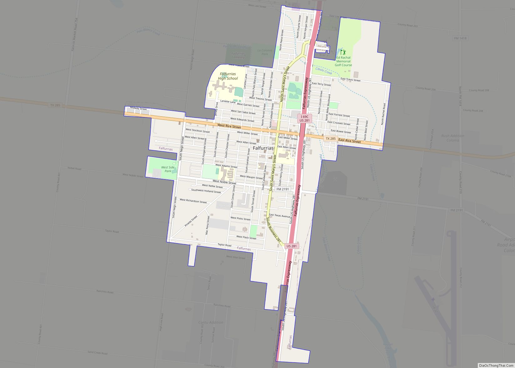
Online Interactive Map
Click on ![]() to view map in "full screen" mode.
to view map in "full screen" mode.
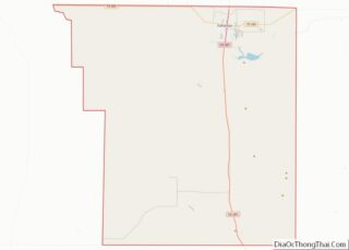
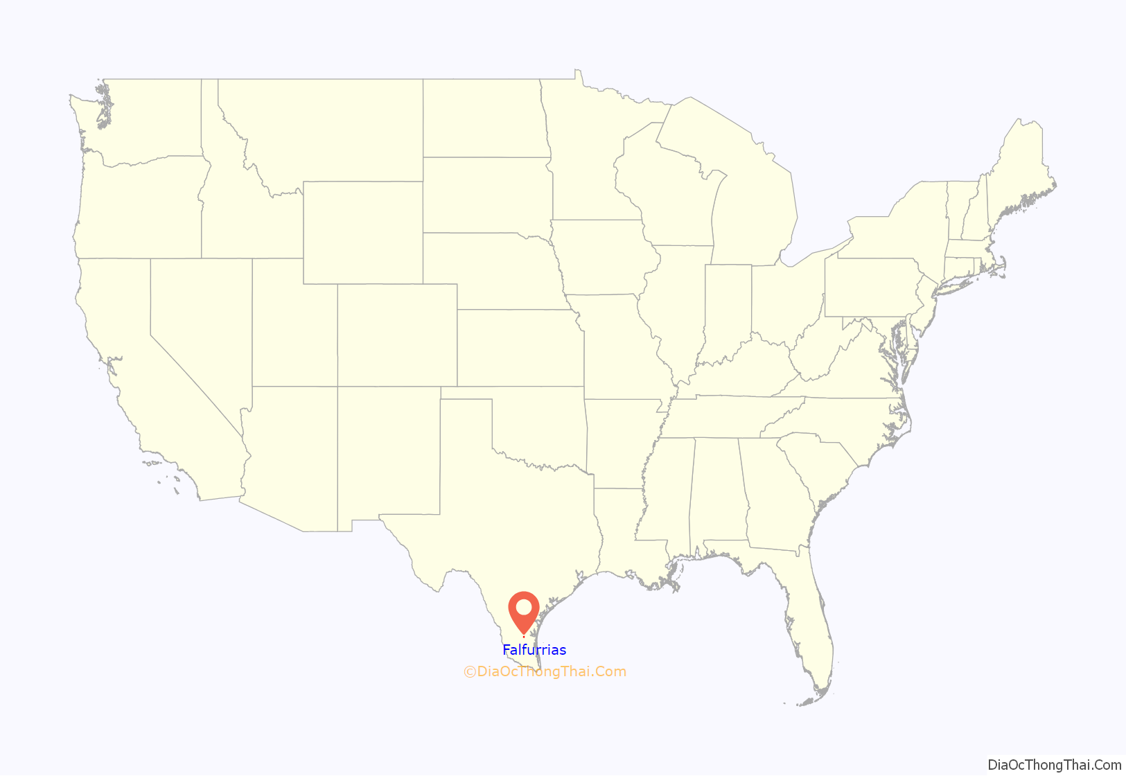
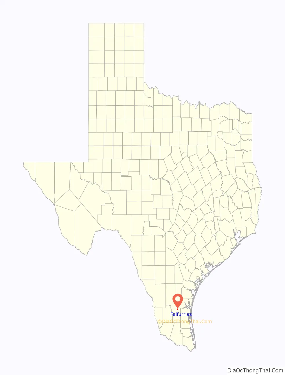
Falfurrias location map. Where is Falfurrias city?
History
Falfurrias’ founding and development were largely due to the efforts of Edward Cunningham Lasater, a pioneer Rio Grande Valley rancher and developer. In 1895, he started a cattle ranch in what was then northern Starr County. At one point, it was one of the largest ranches in Texas. With the extension of the San Antonio and Aransas Pass Railway south from Alice to his ranch in 1904, Lasater founded the town of Falfurrias and subdivided a sizable portion of his ranch land for sale to farmers. In 1898, a post office opened in the community. A local newspaper began publication in 1906. Lasater brought in his Jersey cows and established a creamery in 1909. Sweet-cream butter and other products from Edward Lasater’s creamery company made the town a familiar name across the state. That butter, though, is no longer made from milk produced in Falfurrias. Don Pedro Jaramillo, a Mexican-born curandero known as the “Healer of Los Olmos”, was buried in Falfurrias in 1907 and is venerated at a shrine there.
The state granted a petition by local residents to form a new county, Brooks, with Falfurrias as its county seat in 1911. Irrigation methods introduced to the area in the 1920s brought in truck farming and the citrus fruit industry. The city became a primary trade and shipping center for the surrounding region. The area received another economic boost in the 1930s and 1940s when extensive oil and gas reserves were discovered around Falfurrias.
The city had a population of 6,712 in 1950, which declined throughout the latter half of the 20th century; 5,297 people were living in Falfurrias in 2000, and 4,981 in 2010.
The U.S. Customs and Border Protection opened a station in Falfurrias in 1940; the present border checkpoint south of the city opened in 1994. It was renovated and enlarged in 2019, adding new cameras and X-ray machines. According to an NPR report, the station has been increasingly busy due to a surge of migrants coming from Central America. So many migrants die trying to hike around the checkpoint that there have been calls for it to be closed or moved.
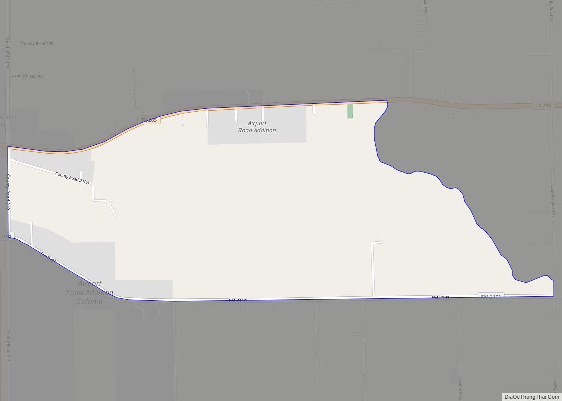
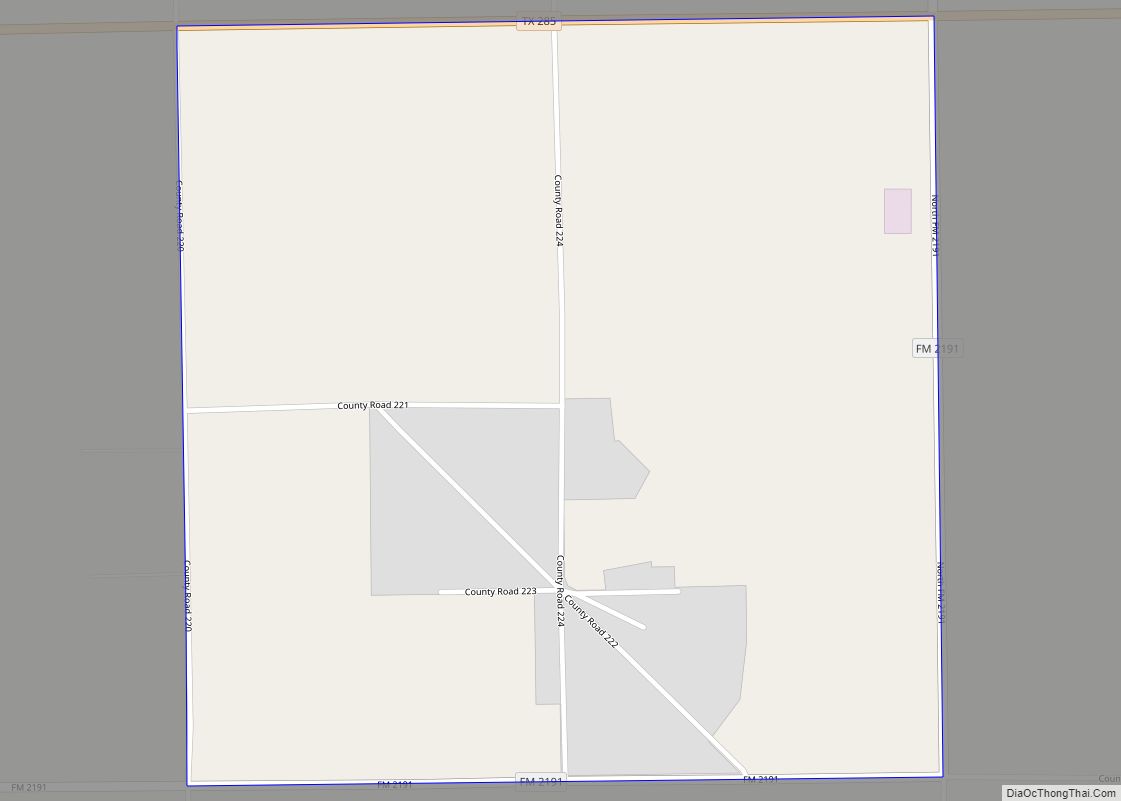
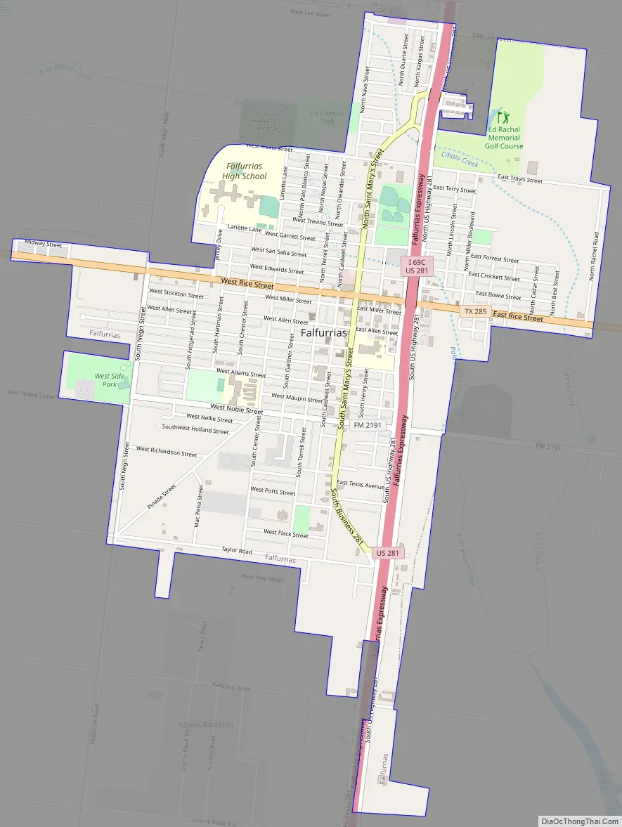
Falfurrias Road Map
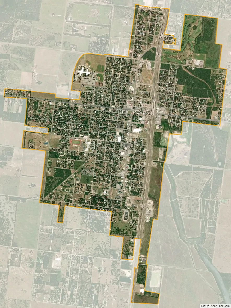
Falfurrias city Satellite Map
Geography
Falfurrias is located in northeastern Brooks County at 27°13′36″N 98°8′42″W / 27.22667°N 98.14500°W / 27.22667; -98.14500 (27.226529, –98.144922). The city is centered on the intersection of U.S. Highway 281 (Future Interstate 69C) and State Highway 285. Falfurrias is about 78 mi (126 km) southwest of Corpus Christi, 90 mi (140 km) east of Laredo, 67 mi (108 km) north of Edinburg, and 36 mi (58 km) south of Alice.
According to the United States Census Bureau, the city has a total area of 2.9 sq mi (7.4 km), all land.
See also
Map of Texas State and its subdivision:- Anderson
- Andrews
- Angelina
- Aransas
- Archer
- Armstrong
- Atascosa
- Austin
- Bailey
- Bandera
- Bastrop
- Baylor
- Bee
- Bell
- Bexar
- Blanco
- Borden
- Bosque
- Bowie
- Brazoria
- Brazos
- Brewster
- Briscoe
- Brooks
- Brown
- Burleson
- Burnet
- Caldwell
- Calhoun
- Callahan
- Cameron
- Camp
- Carson
- Cass
- Castro
- Chambers
- Cherokee
- Childress
- Clay
- Cochran
- Coke
- Coleman
- Collin
- Collingsworth
- Colorado
- Comal
- Comanche
- Concho
- Cooke
- Coryell
- Cottle
- Crane
- Crockett
- Crosby
- Culberson
- Dallam
- Dallas
- Dawson
- Deaf Smith
- Delta
- Denton
- Dewitt
- Dickens
- Dimmit
- Donley
- Duval
- Eastland
- Ector
- Edwards
- El Paso
- Ellis
- Erath
- Falls
- Fannin
- Fayette
- Fisher
- Floyd
- Foard
- Fort Bend
- Franklin
- Freestone
- Frio
- Gaines
- Galveston
- Garza
- Gillespie
- Glasscock
- Goliad
- Gonzales
- Gray
- Grayson
- Gregg
- Grimes
- Guadalupe
- Hale
- Hall
- Hamilton
- Hansford
- Hardeman
- Hardin
- Harris
- Harrison
- Hartley
- Haskell
- Hays
- Hemphill
- Henderson
- Hidalgo
- Hill
- Hockley
- Hood
- Hopkins
- Houston
- Howard
- Hudspeth
- Hunt
- Hutchinson
- Irion
- Jack
- Jackson
- Jasper
- Jeff Davis
- Jefferson
- Jim Hogg
- Jim Wells
- Johnson
- Jones
- Karnes
- Kaufman
- Kendall
- Kenedy
- Kent
- Kerr
- Kimble
- King
- Kinney
- Kleberg
- Knox
- La Salle
- Lamar
- Lamb
- Lampasas
- Lavaca
- Lee
- Leon
- Liberty
- Limestone
- Lipscomb
- Live Oak
- Llano
- Loving
- Lubbock
- Lynn
- Madison
- Marion
- Martin
- Mason
- Matagorda
- Maverick
- McCulloch
- McLennan
- McMullen
- Medina
- Menard
- Midland
- Milam
- Mills
- Mitchell
- Montague
- Montgomery
- Moore
- Morris
- Motley
- Nacogdoches
- Navarro
- Newton
- Nolan
- Nueces
- Ochiltree
- Oldham
- Orange
- Palo Pinto
- Panola
- Parker
- Parmer
- Pecos
- Polk
- Potter
- Presidio
- Rains
- Randall
- Reagan
- Real
- Red River
- Reeves
- Refugio
- Roberts
- Robertson
- Rockwall
- Runnels
- Rusk
- Sabine
- San Augustine
- San Jacinto
- San Patricio
- San Saba
- Schleicher
- Scurry
- Shackelford
- Shelby
- Sherman
- Smith
- Somervell
- Starr
- Stephens
- Sterling
- Stonewall
- Sutton
- Swisher
- Tarrant
- Taylor
- Terrell
- Terry
- Throckmorton
- Titus
- Tom Green
- Travis
- Trinity
- Tyler
- Upshur
- Upton
- Uvalde
- Val Verde
- Van Zandt
- Victoria
- Walker
- Waller
- Ward
- Washington
- Webb
- Wharton
- Wheeler
- Wichita
- Wilbarger
- Willacy
- Williamson
- Wilson
- Winkler
- Wise
- Wood
- Yoakum
- Young
- Zapata
- Zavala
- Alabama
- Alaska
- Arizona
- Arkansas
- California
- Colorado
- Connecticut
- Delaware
- District of Columbia
- Florida
- Georgia
- Hawaii
- Idaho
- Illinois
- Indiana
- Iowa
- Kansas
- Kentucky
- Louisiana
- Maine
- Maryland
- Massachusetts
- Michigan
- Minnesota
- Mississippi
- Missouri
- Montana
- Nebraska
- Nevada
- New Hampshire
- New Jersey
- New Mexico
- New York
- North Carolina
- North Dakota
- Ohio
- Oklahoma
- Oregon
- Pennsylvania
- Rhode Island
- South Carolina
- South Dakota
- Tennessee
- Texas
- Utah
- Vermont
- Virginia
- Washington
- West Virginia
- Wisconsin
- Wyoming