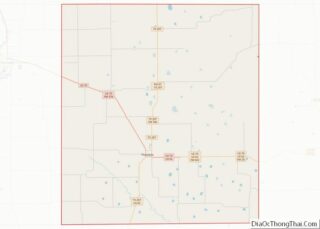
Floydada (/flɔɪˈdeɪdə/ floy-DAY-də) is a city in and the county seat of Floyd County, Texas, United States. This rural community lies on the high plains of the Llano Estacado in West Texas and is sometimes referred to as the Pumpkin Capital of Texas. The population was 3,038 at the 2010 census, down from 3,676 at the 2000 census.
| Name: | Floydada city |
|---|---|
| LSAD Code: | 25 |
| LSAD Description: | city (suffix) |
| State: | Texas |
| County: | Floyd County |
| Elevation: | 3,182 ft (970 m) |
| Total Area: | 2.04 sq mi (5.27 km²) |
| Land Area: | 2.04 sq mi (5.27 km²) |
| Water Area: | 0.00 sq mi (0.00 km²) |
| Total Population: | 3,038 |
| Population Density: | 1,314.99/sq mi (507.71/km²) |
| ZIP code: | 79235 |
| Area code: | 806 |
| FIPS code: | 4826268 |
| Website: | www.cityoffloydada.com |
Online Interactive Map
Click on ![]() to view map in "full screen" mode.
to view map in "full screen" mode.
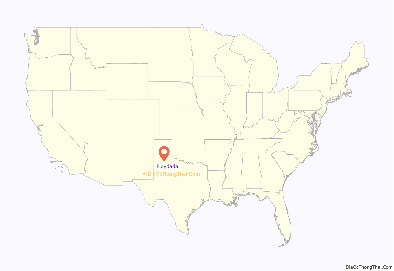
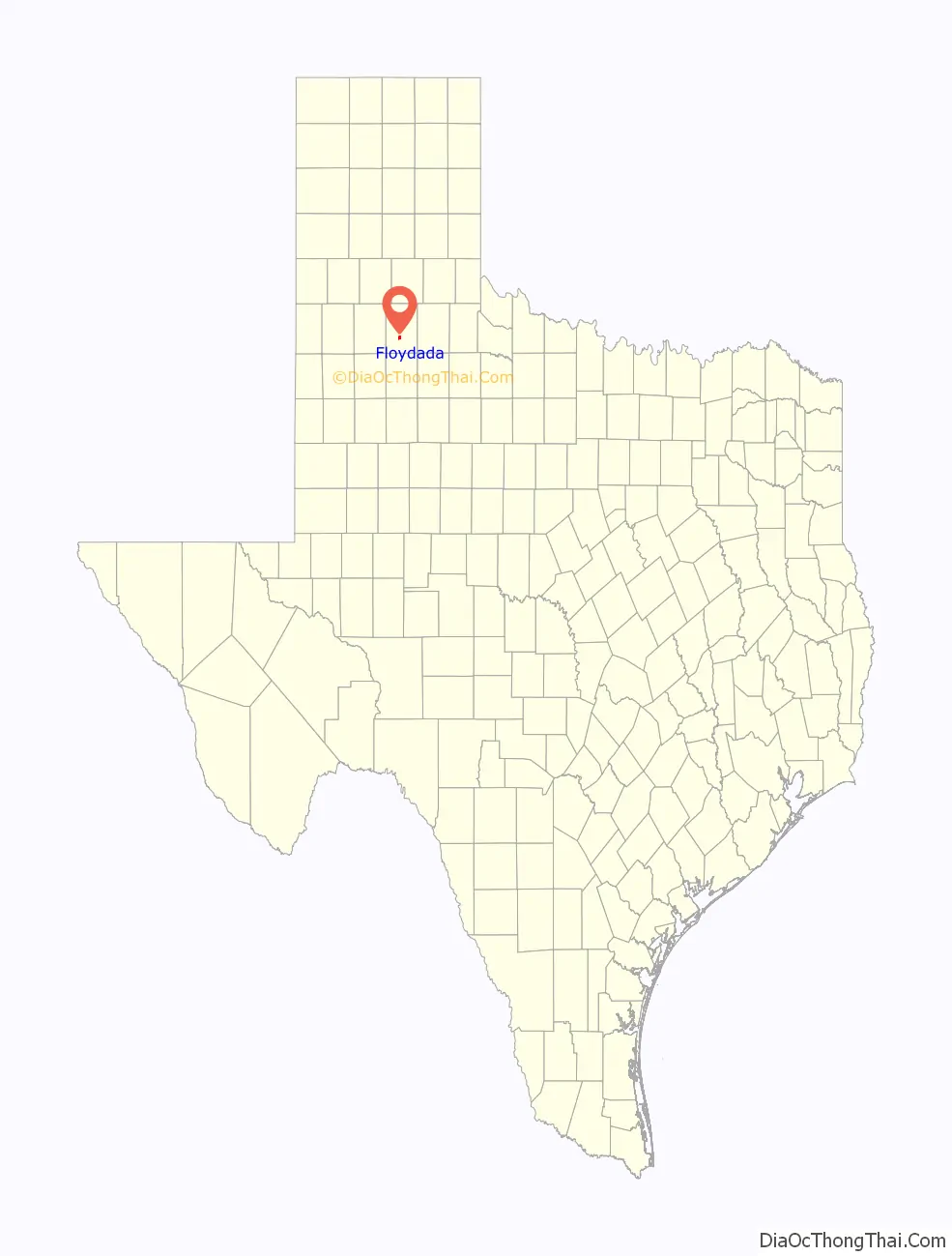
Floydada location map. Where is Floydada city?
History
According to the Texas State Historical Association, the community of Floydada was originally named “Floyd City”. It was established in 1890 on 640 acres (260 ha) of land donated by James B. and Caroline Price of Jefferson City, Missouri. Floydada won the election as county seat over Della Plain. When a post office opened, the name was changed to “Floydada”. The meaning of the name is disputed. Some claim it was meant to be “Floydalia” but was garbled in transmission to the U.S. Postal Service, while others insist it is a combination of the county’s name and that of James Price’s mother, Ada. A third view is that it was formed from Caroline Price’s parents, Floyd and Ada.
Floydada became an important railroad junction in 1928, when the Quanah, Acme and Pacific Railway reached the town.
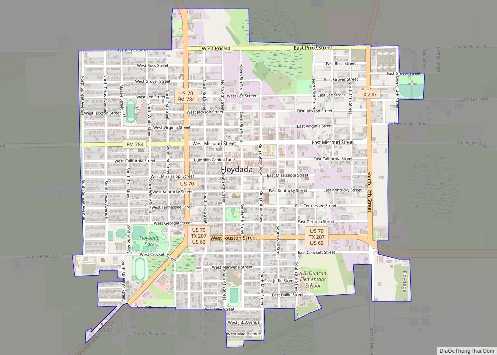
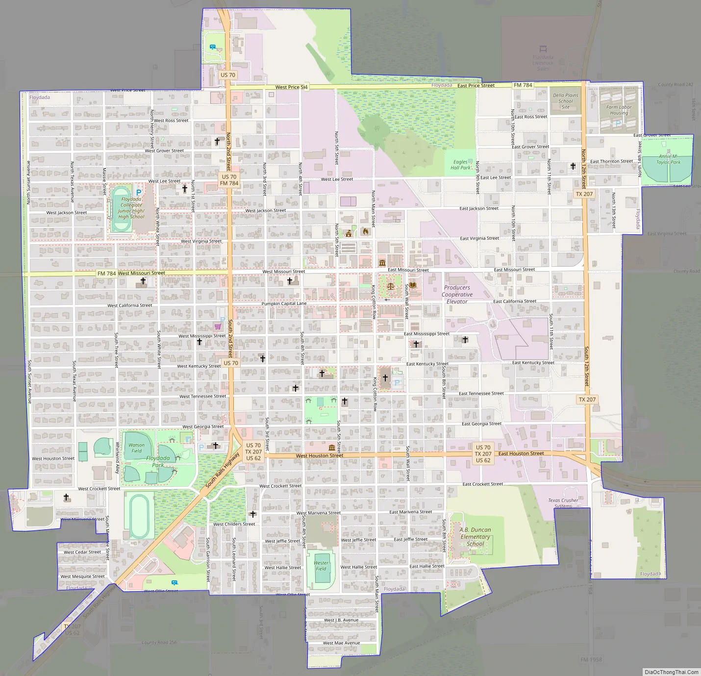
Floydada Road Map
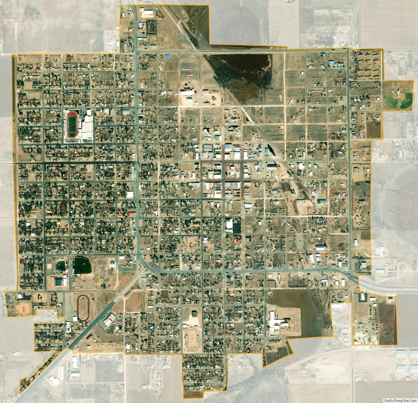
Floydada city Satellite Map
Geography
Floydada is located southwest of the center of Floyd County at 33°59′2″N 101°20′14″W / 33.98389°N 101.33722°W / 33.98389; -101.33722 (33.983771, –101.337259). U.S. Route 62 enters from the southwest as Ralls Highway and leads east out of town as Houston Street, while U.S. Route 70 enters from the north as Second Street and joins US 62 to exit town on Houston Street. Via US 62 it is 51 miles (82 km) southwest to Lubbock, while US 70 leads northwest 27 miles (43 km) to Plainview. The two highways lead east together 31 miles (50 km) to Matador. Texas State Highway 207 leads north from Floydada 35 miles (56 km) to Silverton.
According to the United States Census Bureau, Floydada has a total area of 2.0 square miles (5.3 km), all of it land.
Floydada lies on the High Plains of the Llano Estacado around 18 miles (29 km) west of the Caprock Escarpment. Blanco Canyon, a scenic canyon carved by the White River, is 6 miles (10 km) to the south. The terrain surrounding Floydada consists of level plains that at one time were covered with grassland vegetation and populated with bison. The bison were extirpated, and with the exception of Blanco Canyon, the shortgrass prairie has been replaced by plowed cropland, where cotton, grain sorghum, wheat, and pumpkins are grown.
See also
Map of Texas State and its subdivision:- Anderson
- Andrews
- Angelina
- Aransas
- Archer
- Armstrong
- Atascosa
- Austin
- Bailey
- Bandera
- Bastrop
- Baylor
- Bee
- Bell
- Bexar
- Blanco
- Borden
- Bosque
- Bowie
- Brazoria
- Brazos
- Brewster
- Briscoe
- Brooks
- Brown
- Burleson
- Burnet
- Caldwell
- Calhoun
- Callahan
- Cameron
- Camp
- Carson
- Cass
- Castro
- Chambers
- Cherokee
- Childress
- Clay
- Cochran
- Coke
- Coleman
- Collin
- Collingsworth
- Colorado
- Comal
- Comanche
- Concho
- Cooke
- Coryell
- Cottle
- Crane
- Crockett
- Crosby
- Culberson
- Dallam
- Dallas
- Dawson
- Deaf Smith
- Delta
- Denton
- Dewitt
- Dickens
- Dimmit
- Donley
- Duval
- Eastland
- Ector
- Edwards
- El Paso
- Ellis
- Erath
- Falls
- Fannin
- Fayette
- Fisher
- Floyd
- Foard
- Fort Bend
- Franklin
- Freestone
- Frio
- Gaines
- Galveston
- Garza
- Gillespie
- Glasscock
- Goliad
- Gonzales
- Gray
- Grayson
- Gregg
- Grimes
- Guadalupe
- Hale
- Hall
- Hamilton
- Hansford
- Hardeman
- Hardin
- Harris
- Harrison
- Hartley
- Haskell
- Hays
- Hemphill
- Henderson
- Hidalgo
- Hill
- Hockley
- Hood
- Hopkins
- Houston
- Howard
- Hudspeth
- Hunt
- Hutchinson
- Irion
- Jack
- Jackson
- Jasper
- Jeff Davis
- Jefferson
- Jim Hogg
- Jim Wells
- Johnson
- Jones
- Karnes
- Kaufman
- Kendall
- Kenedy
- Kent
- Kerr
- Kimble
- King
- Kinney
- Kleberg
- Knox
- La Salle
- Lamar
- Lamb
- Lampasas
- Lavaca
- Lee
- Leon
- Liberty
- Limestone
- Lipscomb
- Live Oak
- Llano
- Loving
- Lubbock
- Lynn
- Madison
- Marion
- Martin
- Mason
- Matagorda
- Maverick
- McCulloch
- McLennan
- McMullen
- Medina
- Menard
- Midland
- Milam
- Mills
- Mitchell
- Montague
- Montgomery
- Moore
- Morris
- Motley
- Nacogdoches
- Navarro
- Newton
- Nolan
- Nueces
- Ochiltree
- Oldham
- Orange
- Palo Pinto
- Panola
- Parker
- Parmer
- Pecos
- Polk
- Potter
- Presidio
- Rains
- Randall
- Reagan
- Real
- Red River
- Reeves
- Refugio
- Roberts
- Robertson
- Rockwall
- Runnels
- Rusk
- Sabine
- San Augustine
- San Jacinto
- San Patricio
- San Saba
- Schleicher
- Scurry
- Shackelford
- Shelby
- Sherman
- Smith
- Somervell
- Starr
- Stephens
- Sterling
- Stonewall
- Sutton
- Swisher
- Tarrant
- Taylor
- Terrell
- Terry
- Throckmorton
- Titus
- Tom Green
- Travis
- Trinity
- Tyler
- Upshur
- Upton
- Uvalde
- Val Verde
- Van Zandt
- Victoria
- Walker
- Waller
- Ward
- Washington
- Webb
- Wharton
- Wheeler
- Wichita
- Wilbarger
- Willacy
- Williamson
- Wilson
- Winkler
- Wise
- Wood
- Yoakum
- Young
- Zapata
- Zavala
- Alabama
- Alaska
- Arizona
- Arkansas
- California
- Colorado
- Connecticut
- Delaware
- District of Columbia
- Florida
- Georgia
- Hawaii
- Idaho
- Illinois
- Indiana
- Iowa
- Kansas
- Kentucky
- Louisiana
- Maine
- Maryland
- Massachusetts
- Michigan
- Minnesota
- Mississippi
- Missouri
- Montana
- Nebraska
- Nevada
- New Hampshire
- New Jersey
- New Mexico
- New York
- North Carolina
- North Dakota
- Ohio
- Oklahoma
- Oregon
- Pennsylvania
- Rhode Island
- South Carolina
- South Dakota
- Tennessee
- Texas
- Utah
- Vermont
- Virginia
- Washington
- West Virginia
- Wisconsin
- Wyoming