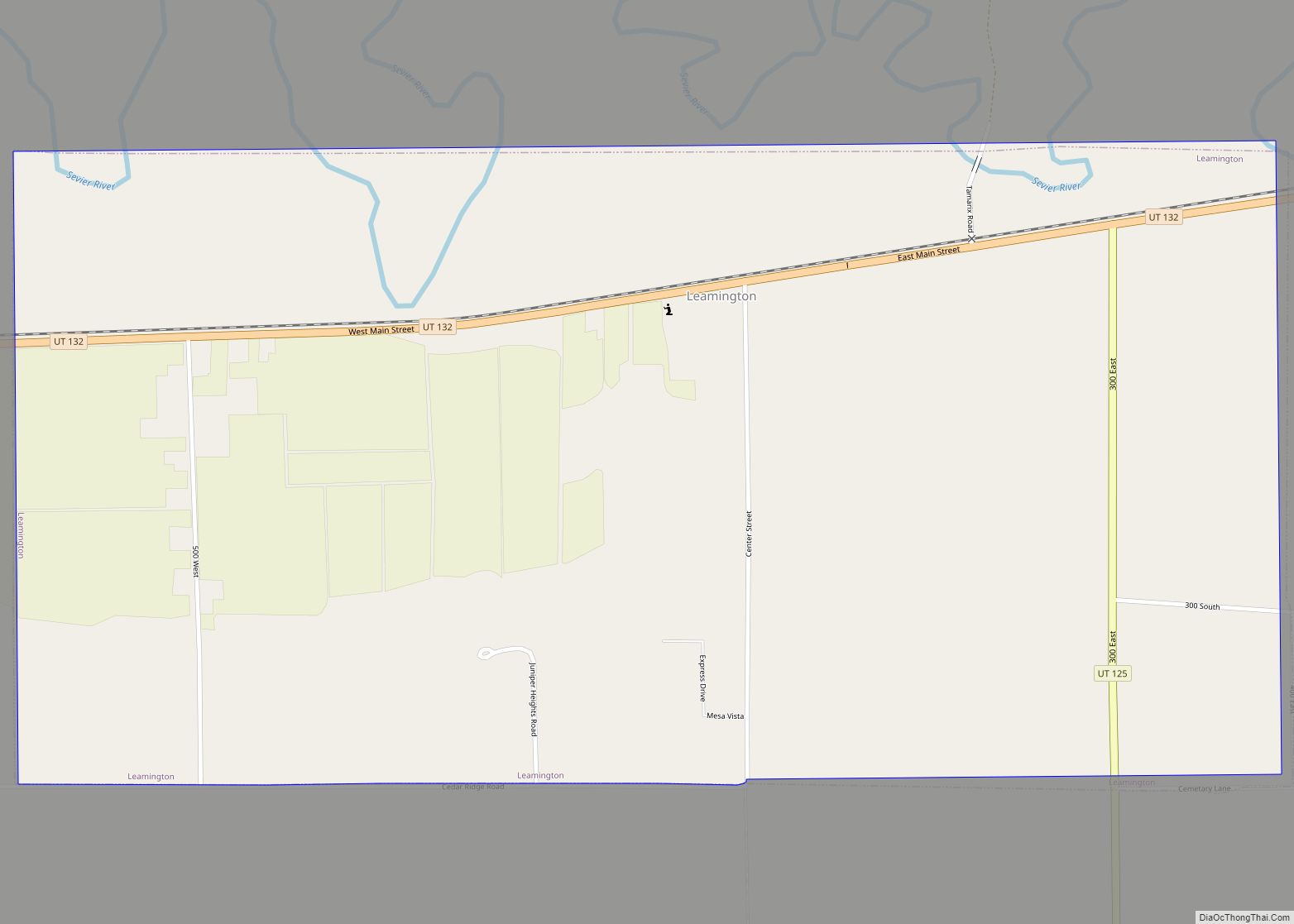
Map of West Haven city, Utah

Map of West Haven city, Utah

West Haven is a city in Weber County, Utah, United States. The population was 10,272 at the 2010 census. It was incorporated on July 1, 1991, combining the unincorporated communities of Kanesville and Wilson. West Haven is located approximately 35 miles (56 km) north of Salt Lake City, west of the Wasatch Mountains in northern Utah. … Read more

Map of West Bountiful city

Map of West Bountiful city

West Bountiful is a city in Davis County, Utah, United States. It is part of the Ogden–Clearfield, Utah Metropolitan Statistical Area. The population was 5,265 at the 2010 census, with an estimated population of 5,731 in 2018. West Bountiful city overview: Name: West Bountiful city LSAD Code: 25 LSAD Description: city (suffix) State: Utah County: … Read more

Map of Wendover city

Map of Wendover city

Wendover is a city on the western edge of Tooele County, Utah, United States. The population was 1,115 at the 2020 census. Wendover city overview: Name: Wendover city LSAD Code: 25 LSAD Description: city (suffix) State: Utah County: Tooele County Founded: 1908 Elevation: 4,291 ft (1,308 m) Total Area: 8.93 sq mi (23.12 km²) Land Area: 8.93 sq mi (23.12 km²) Water Area: … Read more

Map of Wellsville city, Utah

Map of Wellsville city, Utah

Wellsville is a city in Cache County, Utah, United States. The population was 3,432 at the 2010 census, with an estimated population of 3,849 in 2018. It is included in the Logan, Utah-Idaho Metropolitan Statistical Area. Wellsville was laid out in 1856, and named after Daniel H. Wells, a Mormon leader. Wellsville city overview: Name: … Read more

Map of Wellington city, Utah

Map of Wellington city, Utah

Wellington is a city in Carbon County, Utah, United States. The population was 1,676 at the 2010 census. The community was settled in 1878 by a band of thirteen Mormons led by Jefferson Tidwell. The town was named for Justus Wellington Seeley, Jr., of the Emery County Court. Many residents commute to nearby Price for … Read more

Map of Washington city, Utah

Map of Washington city, Utah

Washington is a city in south central Washington County, Utah, United States and is a part of the St. George Metropolitan Area. The area is also known as Utah’s Dixie because the Mormon pioneers who settled the St. George area came to the area to raise cotton, which was milled at the cotton mill in … Read more

Map of White Mesa CDP

Map of White Mesa CDP

White Mesa is a census-designated place (CDP) in San Juan County, Utah, United States. The population was 277 at the 2000 census. It is located within a section of the Ute Mountain Ute Tribe reservation along U.S. Route 191, south of Blanding and north of Bluff. White Mesa CDP overview: Name: White Mesa CDP LSAD … Read more

Map of Woods Cross city

Map of Woods Cross city

Woods Cross is a city in Davis County, Utah, United States. It is part of the Ogden–Clearfield, Utah Metropolitan Statistical Area. The population was 9,761 as of the 2010 census, with an estimated population in 2019 of 11,431. Woods Cross city overview: Name: Woods Cross city LSAD Code: 25 LSAD Description: city (suffix) State: Utah … Read more

Map of Woodruff town, Utah

Map of Woodruff town, Utah

Woodruff is a town in Rich County, Utah, United States. The population was 180 at the 2010 census. Woodruff town overview: Name: Woodruff town LSAD Code: 43 LSAD Description: town (suffix) State: Utah County: Rich County Incorporated: 1933 Elevation: 6,339 ft (1,932 m) Total Area: 0.72 sq mi (1.87 km²) Land Area: 0.72 sq mi (1.87 km²) Water Area: 0.00 sq mi (0.00 km²) Total Population: … Read more

Map of Woodland CDP, Utah

Map of Woodland CDP, Utah

Woodland is a census-designated place (CDP) in Summit County, Utah, United States. The population was 335 at the 2000 census. Woodland was first settled in 1874. Woodland CDP overview: Name: Woodland CDP LSAD Code: 57 LSAD Description: CDP (suffix) State: Utah County: Summit County Elevation: 6,722 ft (2,049 m) Total Area: 2.3 sq mi (6.0 km²) Land Area: 2.3 sq mi (6.0 km²) … Read more

Map of Woodland Hills city, Utah

Map of Woodland Hills city, Utah

Woodland Hills is a city in Utah County, Utah, United States. It is part of the Provo–Orem Metropolitan Statistical Area. The population was 1,521 at the 2020 census. Woodland Hills became a city at the end of 2000. As of the 2000 census, Woodland Hills had the highest median income in the state of Utah. … Read more

Map of Wolf Creek CDP

Map of Wolf Creek CDP

Wolf Creek is a census-designated place in Weber County, Utah, United States. Its population was 1,336 as of the 2010 census. Wolf Creek CDP overview: Name: Wolf Creek CDP LSAD Code: 57 LSAD Description: CDP (suffix) State: Utah County: Weber County Elevation: 5,331 ft (1,625 m) Total Area: 3.158 sq mi (8.18 km²) Land Area: 3.158 sq mi (8.18 km²) Water Area: 0 sq mi … Read more