Map of Brian Head town
Brian Head is a town in Iron County, Utah, United States. The population was 83 at the 2010 census, a significant decrease from the 2000 figure of 118. Brian Head is also the location of the Brian Head Ski Resort. Brian Head town overview: Name: Brian Head town LSAD Code: 43 LSAD Description: town (suffix) ... Read more
Map of Brian Head town
Map of Bountiful city
Bountiful is a city in Davis County, Utah. As of the 2010 census, the city population was 42,552, a three percent increase over the 2000 figure of 41,301. The city grew rapidly during the suburb growth of the late 1940s, 1950s, and 1960s and was Davis County’s largest city until 1985, when it was surpassed ... Read more
Map of Bountiful city
Map of Boulder town, Utah
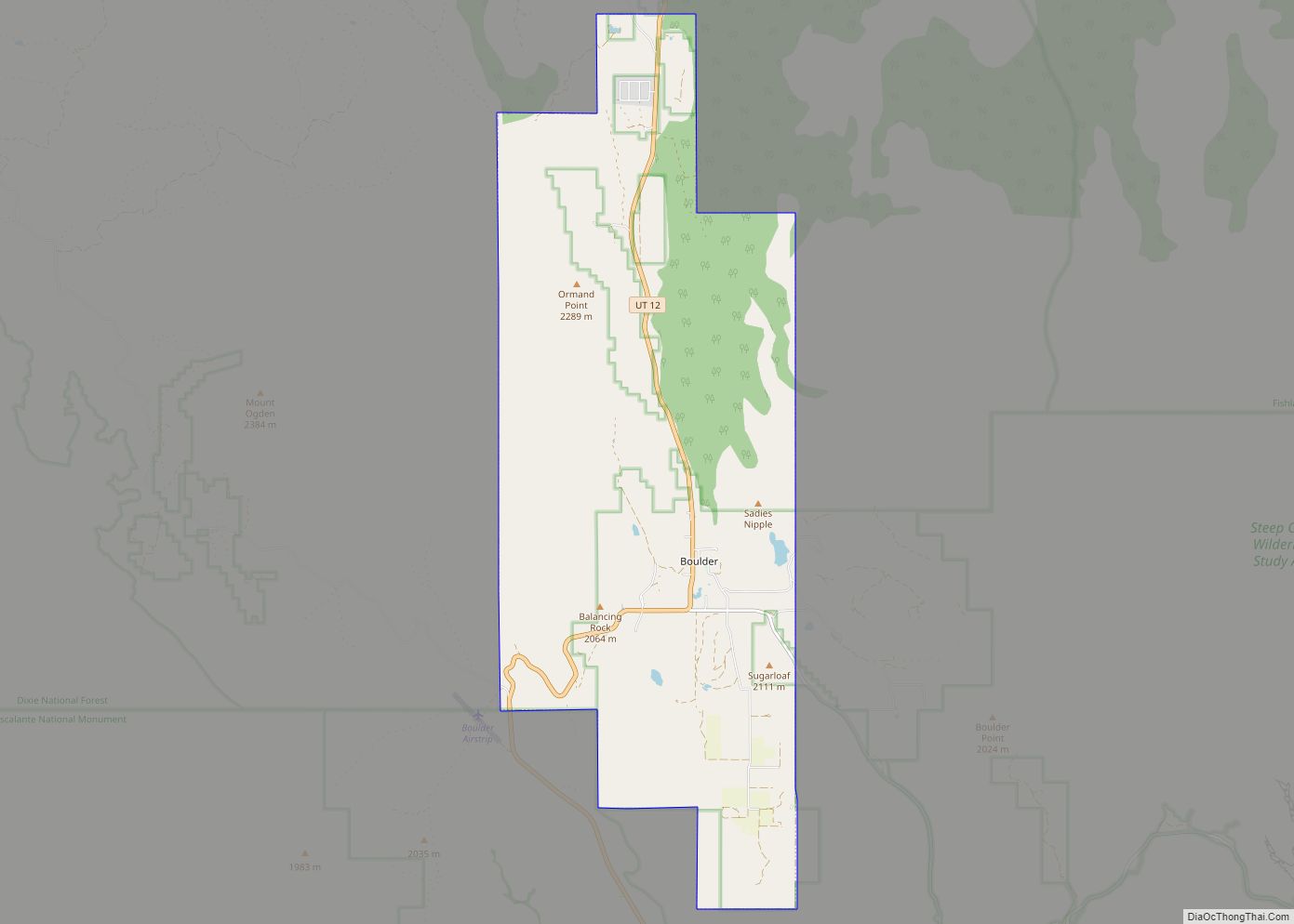
Boulder is a town in Garfield County, Utah, United States, 27 miles (44 km) northeast of Escalante on Utah Scenic Byway 12 at its intersection with the Burr Trail. As of the 2010 census, the town population was 226, an increase of nearly 26% over the 2000 figure of 180. Boulder, quite isolated until the Civilian ... Read more
Map of Boulder town, Utah
Map of Bonanza CDP, Utah
Bonanza is a census-designated place in eastern Uintah County, Utah, United States. The name refers to a rich mineral strike. Near the community is a coal-fired power plant owned by Deseret Power Electric Cooperative. Bonanza is also in the area of the Colorado Plateau where oil drilling and extraction takes place from oil shale and ... Read more
Map of Bonanza CDP, Utah
Map of Bluffdale city
Bluffdale is a city in Salt Lake and Utah counties in the U.S. state of Utah, located about 20 miles (32 km) south of Salt Lake City. As of the 2020 census, the city population was 17,014. From 2011 to 2013, the National Security Agency’s (NSA) data storage center, the Utah Data Center, was constructed at ... Read more
Map of Bluffdale city
Map of Carbonville CDP
Carbonville is a census-designated place in Carbon County, Utah, United States. The population was 1,567 at the 2010 census. Carbonville CDP overview: Name: Carbonville CDP LSAD Code: 57 LSAD Description: CDP (suffix) State: Utah County: Carbon County Elevation: 5,670 ft (1,730 m) Total Area: 5.6 sq mi (14.4 km²) Land Area: 5.6 sq mi (14.4 km²) Water Area: 0.0 sq mi (0.0 km²) Total Population: 1,567 ... Read more
Map of Carbonville CDP
Map of Central Valley town
Central Valley is a town in Sevier County, Utah, United States. The population was 528 at the 2010 census. Known for years simply as Central, the town was named Central Valley at its incorporation in 2005. Central Valley town overview: Name: Central Valley town LSAD Code: 43 LSAD Description: town (suffix) State: Utah County: Sevier ... Read more
Map of Central Valley town
Map of Centerfield town
Centerfield is a city in southwestern Sanpete County, Utah, United States. The population was 1,367 at the 2010 census. Although Centerfield was a town in 2000, it has since been classified as a fifth-class city by state law. The community was so named because of its location in the center of a wide valley. Centerfield ... Read more
Map of Centerfield town
Map of Cedar Highlands town
Cedar Highlands town overview: Name: Cedar Highlands town LSAD Code: 43 LSAD Description: town (suffix) State: Utah FIPS code: 4911435 Online Interactive Map Cedar Highlands online map. Source: Basemap layers from Google Map, Open Street Map (OSM), Arcgisonline, Wmflabs. Boundary Data from Database of Global Administrative Areas. Cedar Highlands location map. Where is Cedar Highlands ... Read more
Map of Cedar Highlands town
Map of Cedar City
Cedar City is the largest city in Iron County, Utah, United States. It is located 250 miles (400 km) south of Salt Lake City, and 170 miles (270 km) north of Las Vegas on Interstate 15. It is the home of Southern Utah University, the Utah Shakespeare Festival, the Utah Summer Games, the Simon Fest Theatre Co., ... Read more
Map of Cedar City
Map of Castle Valley town
Castle Valley is a town in Grand County, Utah, United States. The population was 319 at the 2010 census. The town is approximately 16 miles northeast of Moab, near State Route 128. The community was named for castle-like rock formations near the town site. Castle Valley town overview: Name: Castle Valley town LSAD Code: 43 ... Read more
Map of Castle Valley town
Map of Clear Creek CDP, Utah
Clear Creek is a census-designated place on the western edge of Carbon County, Utah, United States. It is located at the south end of State Route 96 and the Pleasant Valley Branch of the Union Pacific Railroad (previously the Denver and Rio Grande Western Railroad). Clear Creek CDP overview: Name: Clear Creek CDP LSAD Code: ... Read more
Map of Clear Creek CDP, Utah