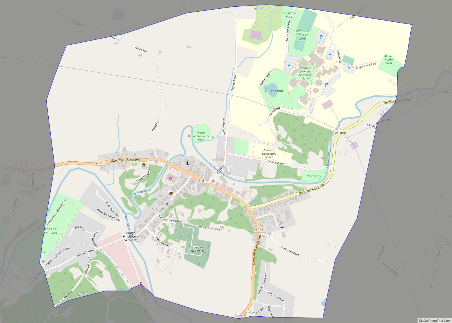
Jeffersonville village overview: Name: Jeffersonville village LSAD Code: 47 LSAD Description: village (suffix) State: Vermont County: Lamoille County FIPS code: 5036475 Online Interactive Map Jeffersonville online map. Source: Basemap layers from Google Map, Open Street Map (OSM), Arcgisonline, Wmflabs. Boundary Data from Database of Global Administrative Areas. Jeffersonville location map. Where is Jeffersonville village? Jeffersonville ... Read more
Vermont Cities and Places
Island Pond is a census-designated place (CDP) in the town of Brighton in Essex County, Vermont, United States. The population was 750 at the 2020 census. It is part of the Berlin, NH–VT Micropolitan Statistical Area. Island Pond CDP overview: Name: Island Pond CDP LSAD Code: 57 LSAD Description: CDP (suffix) State: Vermont County: Essex ... Read more
Irasburg is the primary village and a census-designated place (CDP) in the town of Irasburg, Orleans County, Vermont, United States. As of the 2020 census, it had a population of 159, out of 1,233 in the entire town of Irasburg. The CDP is in central Orleans County, south of the geographic center of the town. ... Read more
Hyde Park is a town in and the shire town (county seat) of Lamoille County, Vermont, United States. The town was named for Captain Jedediah Hyde, an early landowner who was a veteran of the American Revolutionary War. The population was 3,020 at the 2020 census. There is also a village of the same name ... Read more
Hinesburg is the primary village and a census-designated place (CDP) in the town of Hinesburg, Chittenden County, Vermont, United States. As of the 2020 census, it had a population of 872, out of 4,698 in the entire town of Hinesburg. The village is in southern Chittenden County, slightly northwest of the center of the town ... Read more
Hardwick is the primary village and a census-designated place (CDP) in the town of Hardwick, Caledonia County, Vermont, United States. As of the 2020 census, the CDP had a population of 1,269, out of 2,920 in the entire town of Hardwick. Hardwick village is in western Caledonia County, in the southern part of the town ... Read more
Manchester is a town in, and one of two shire towns (county seats) of, Bennington County, Vermont. The population was 4,484 at the 2020 census. Manchester Village, an incorporated village, and Manchester Center are settlement centers within the town. Manchester has become a tourist destination, especially for those from New York and Connecticut, offering visitors ... Read more
Manchester Center is a census-designated place (CDP) in the town of Manchester in Bennington County, Vermont, United States. As of the 2010 census, the CDP had a population of 2,120, out of 4,391 people in the entire town of Manchester. Manchester Center CDP overview: Name: Manchester Center CDP LSAD Code: 57 LSAD Description: CDP (suffix) ... Read more
Lyndonville village overview: Name: Lyndonville village LSAD Code: 47 LSAD Description: village (suffix) State: Vermont County: Caledonia County FIPS code: 5041950 Online Interactive Map Lyndonville online map. Source: Basemap layers from Google Map, Open Street Map (OSM), Arcgisonline, Wmflabs. Boundary Data from Database of Global Administrative Areas. Lyndonville location map. Where is Lyndonville village? Lyndonville ... Read more
Ludlow is a town in Windsor County, Vermont, United States. The population was 2,172 at the 2020 census. Ludlow is the home of Okemo Mountain, a popular ski resort. Before becoming a ski destination, Ludlow was originally a mill town, and was the home of a General Electric plant until 1977. It was named after ... Read more
Lowell is the primary village and a census-designated place (CDP) in the town of Lowell, Orleans County, Vermont, United States. As of the 2020 census, it had a population of 254, out of 887 in the entire town of Lowell. The CDP is in western Orleans County, at the geographic center of the town. It ... Read more
Morrisville village overview: Name: Morrisville village LSAD Code: 47 LSAD Description: village (suffix) State: Vermont County: Lamoille County FIPS code: 5046825 Online Interactive Map Morrisville online map. Source: Basemap layers from Google Map, Open Street Map (OSM), Arcgisonline, Wmflabs. Boundary Data from Database of Global Administrative Areas. Morrisville location map. Where is Morrisville village? Morrisville ... Read more