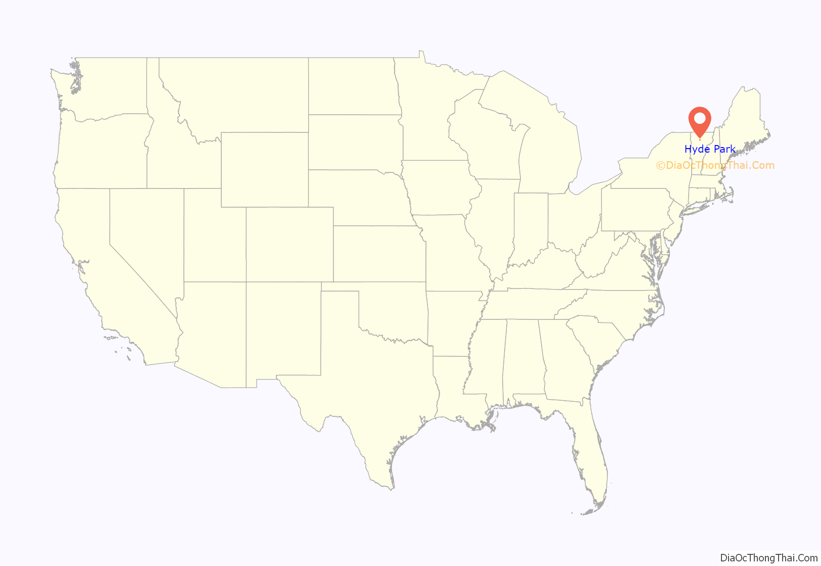
Hyde Park is a town in and the shire town (county seat) of Lamoille County, Vermont, United States. The town was named for Captain Jedediah Hyde, an early landowner who was a veteran of the American Revolutionary War. The population was 3,020 at the 2020 census. There is also a village of the same name within the town.
| Name: | Hyde Park village |
|---|---|
| LSAD Code: | 47 |
| LSAD Description: | village (suffix) |
| State: | Vermont |
| County: | Lamoille County |
| Total Area: | 38.9 sq mi (100.8 km²) |
| Land Area: | 37.6 sq mi (97.4 km²) |
| Water Area: | 1.4 sq mi (3.5 km²) 3.43% |
| Total Population: | 3,020 |
| Population Density: | 80/sq mi (31.0/km²) |
| ZIP code: | 05655 |
| Area code: | 802 |
| FIPS code: | 5034975 |
| GNISfeature ID: | 1462122 |
| Website: | hydeparkvt.com |
Online Interactive Map
Click on ![]() to view map in "full screen" mode.
to view map in "full screen" mode.
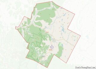
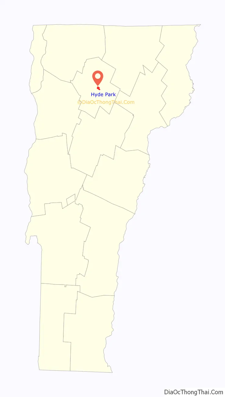
Hyde Park location map. Where is Hyde Park village?
Hyde Park Road Map
Hyde Park city Satellite Map

Geography
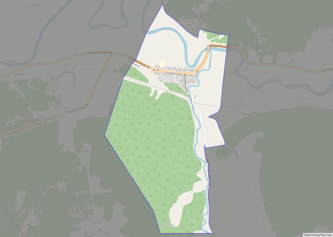
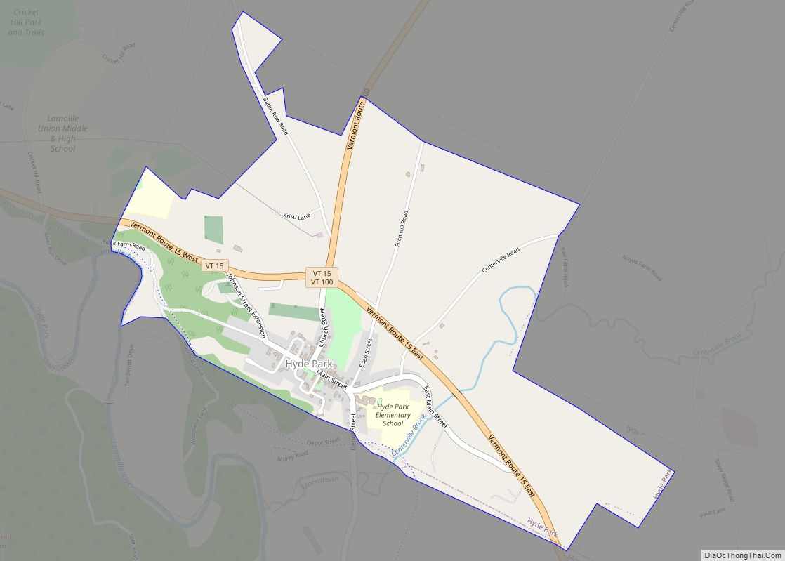
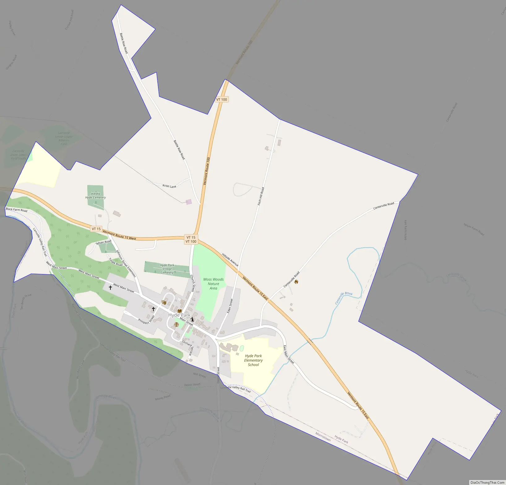
Hyde Park is in east-central Lamoille County, northeast of the Lamoille River valley. According to the United States Census Bureau, the town has a total area of 38.9 square miles (100.8 km), of which 37.6 square miles (97.4 km) are land and 1.4 square miles (3.5 km), or 3.43%, are water. The village of Hyde Park is in the southern part of the town.
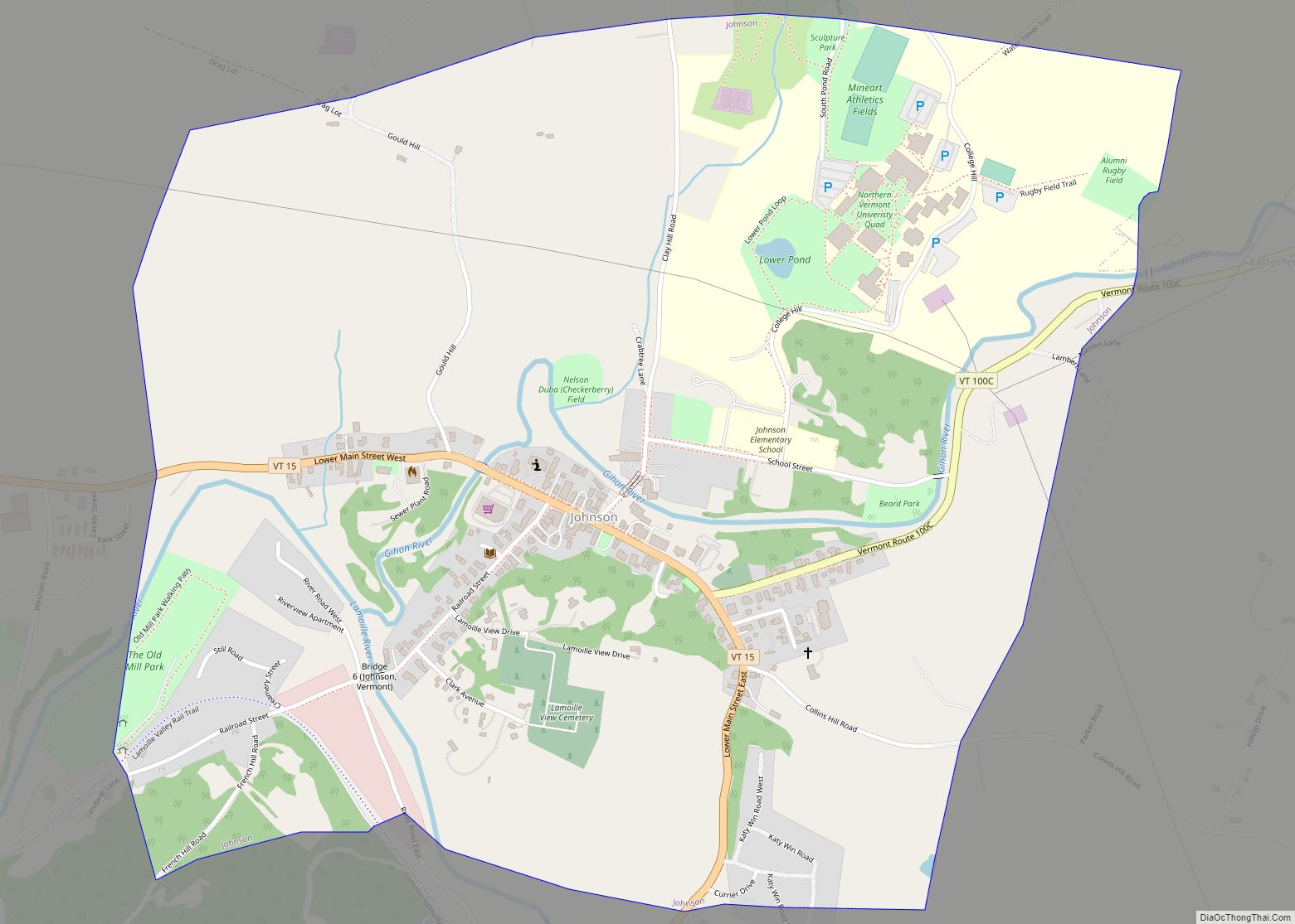
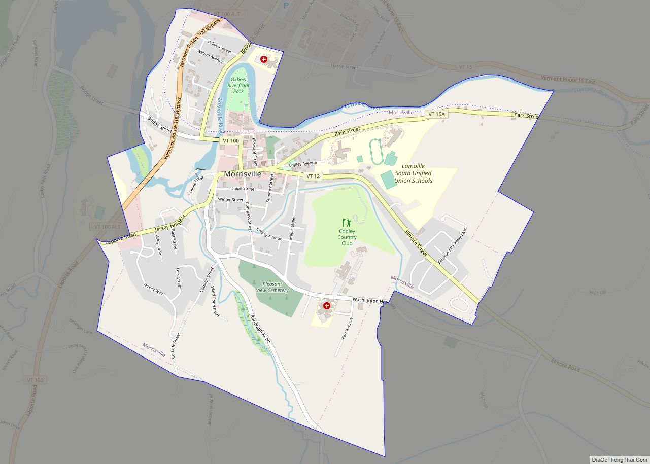
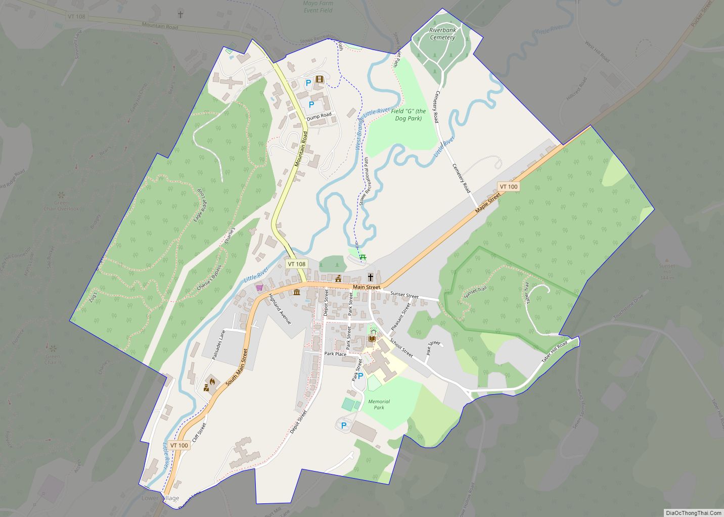
Vermont Route 15 crosses the southern part of the town, passing through Hyde Park village; it leads northwest 5 miles (8 km) to Johnson and southeast 15 miles (24 km) to Hardwick. Vermont Route 100 runs with Route 15 between Hyde Park village and Morrisville to the south. Route 100 leads north through North Hyde Park 33 miles (53 km) to the Newport area, while to the south it leads 11 miles (18 km) to Stowe.
See also
Map of Vermont State and its subdivision: Map of other states:- Alabama
- Alaska
- Arizona
- Arkansas
- California
- Colorado
- Connecticut
- Delaware
- District of Columbia
- Florida
- Georgia
- Hawaii
- Idaho
- Illinois
- Indiana
- Iowa
- Kansas
- Kentucky
- Louisiana
- Maine
- Maryland
- Massachusetts
- Michigan
- Minnesota
- Mississippi
- Missouri
- Montana
- Nebraska
- Nevada
- New Hampshire
- New Jersey
- New Mexico
- New York
- North Carolina
- North Dakota
- Ohio
- Oklahoma
- Oregon
- Pennsylvania
- Rhode Island
- South Carolina
- South Dakota
- Tennessee
- Texas
- Utah
- Vermont
- Virginia
- Washington
- West Virginia
- Wisconsin
- Wyoming