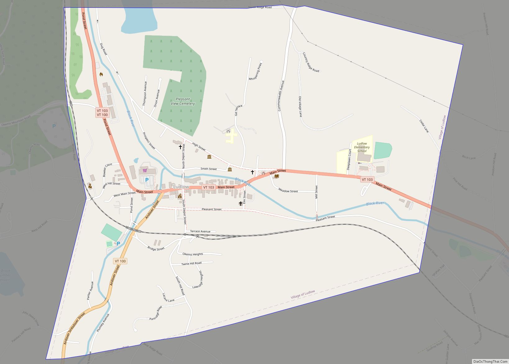
Ludlow is a town in Windsor County, Vermont, United States. The population was 2,172 at the 2020 census. Ludlow is the home of Okemo Mountain, a popular ski resort. Before becoming a ski destination, Ludlow was originally a mill town, and was the home of a General Electric plant until 1977. It was named after Ludlow, Massachusetts which is less than 100 miles away. There is also a village of Ludlow in the town.
| Name: | Ludlow village |
|---|---|
| LSAD Code: | 47 |
| LSAD Description: | village (suffix) |
| State: | Vermont |
| County: | Windsor County |
| Elevation: | 1,067 ft (325 m) |
| Total Area: | 35.7 sq mi (92.5 km²) |
| Land Area: | 35.2 sq mi (91.1 km²) |
| Water Area: | 0.5 sq mi (1.4 km²) |
| Total Population: | 2,172 |
| Population Density: | 61/sq mi (23/km²) |
| ZIP code: | 05149 |
| Area code: | 802 |
| FIPS code: | 5041200 |
| GNISfeature ID: | 1462138 |
| Website: | www.ludlow.vt.us |
Online Interactive Map
Click on ![]() to view map in "full screen" mode.
to view map in "full screen" mode.
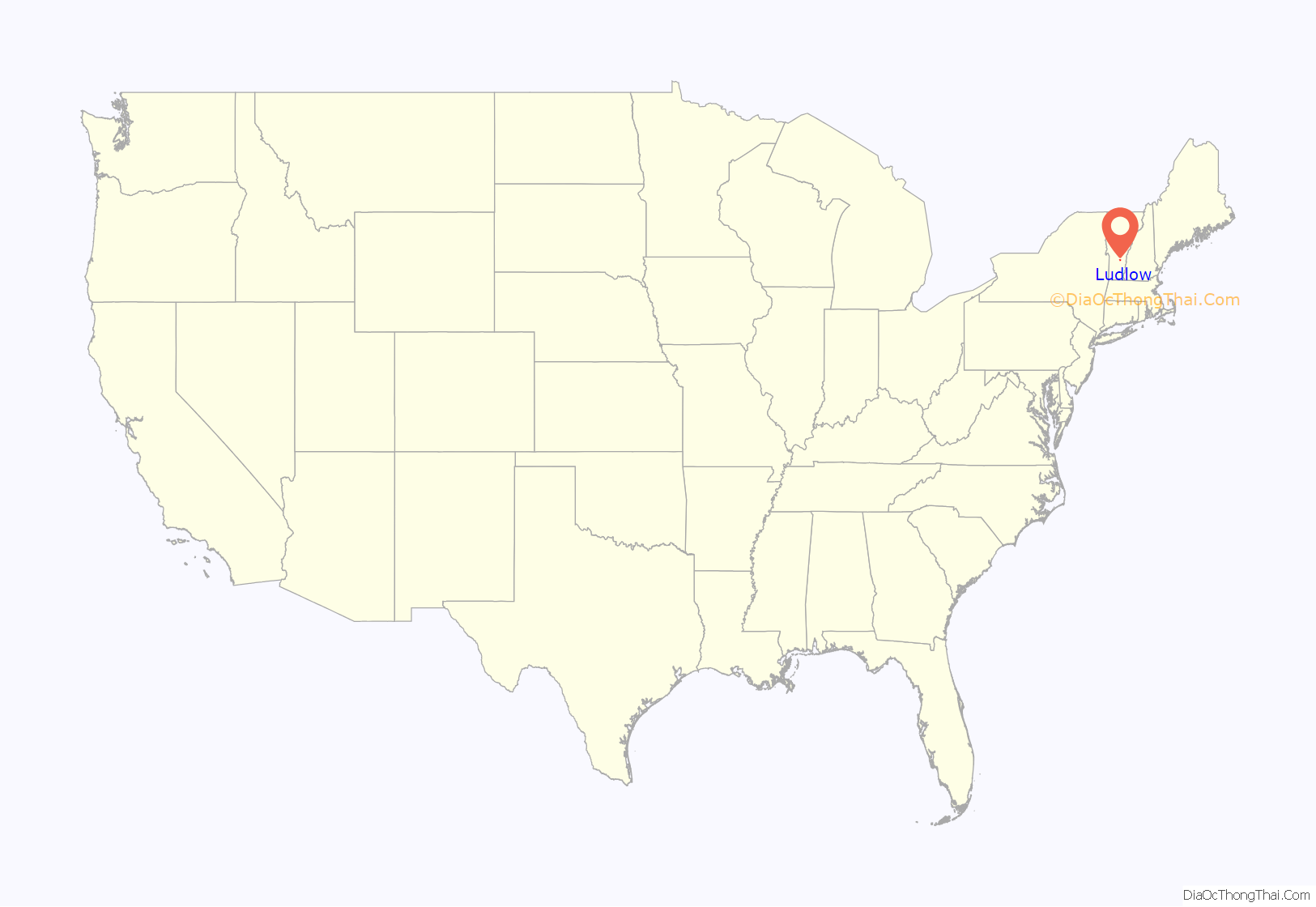
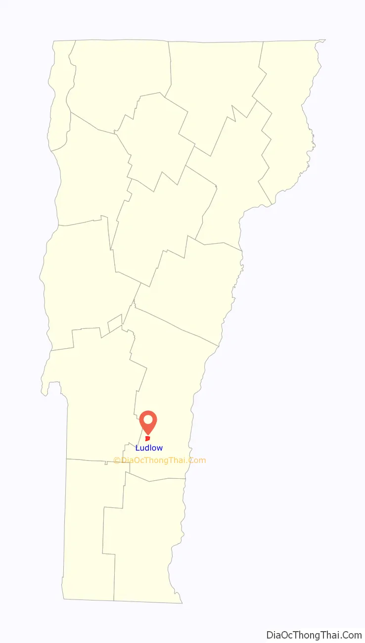
Ludlow location map. Where is Ludlow village?
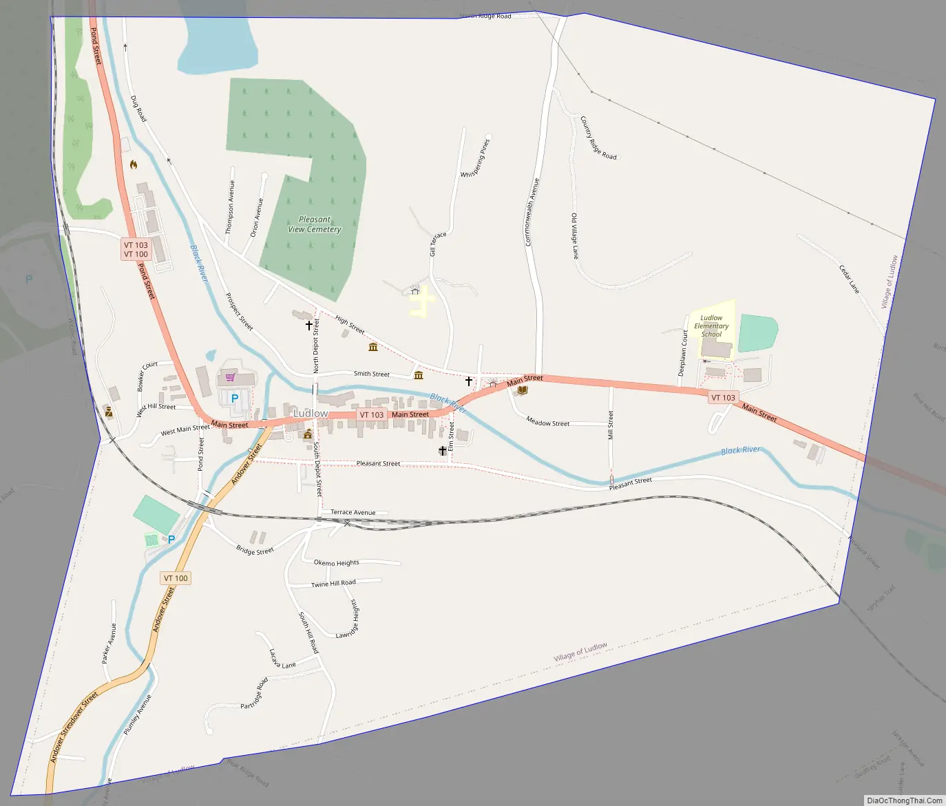
Ludlow Road Map
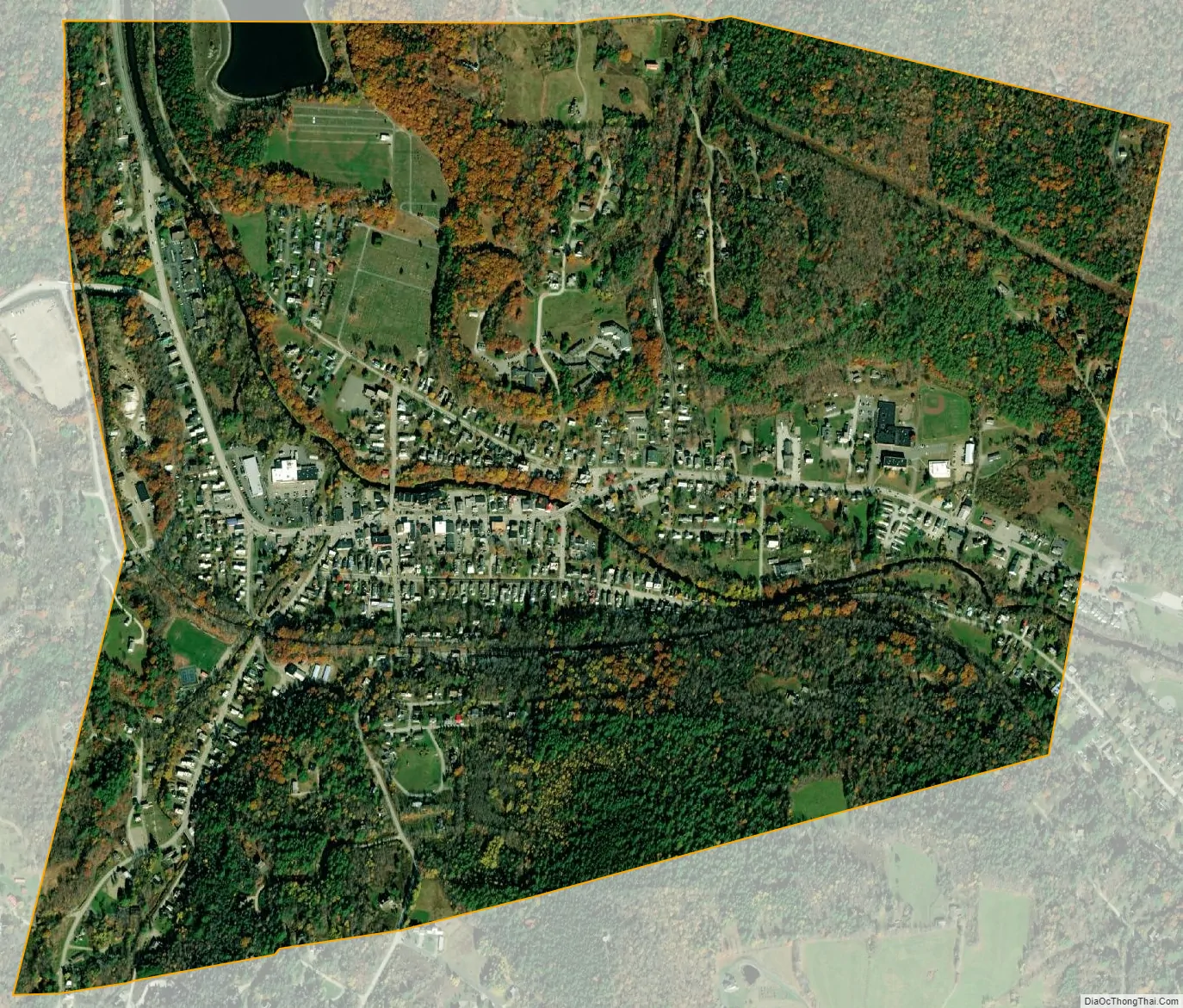
Ludlow city Satellite Map
Geography
According to the United States Census Bureau, the town has a total area of 35.7 square miles (92.5 km), of which 35.2 square miles (91.1 km) is land and 0.54 square miles (1.4 km), or 1.46%, is water. Within the town are located the incorporated village of Ludlow and the small hamlets of Grahamville and Smithville. Lake Rescue, a popular lake for recreational activities, is located about three miles north of the town center along Vermont Route 100. Vermont Route 103 passes east–west through the center of town. Interstate 91 does not pass through Ludlow, with the closest access points being Exit 6 in Rockingham and Exit 8 in Weathersfield.
See also
Map of Vermont State and its subdivision: Map of other states:- Alabama
- Alaska
- Arizona
- Arkansas
- California
- Colorado
- Connecticut
- Delaware
- District of Columbia
- Florida
- Georgia
- Hawaii
- Idaho
- Illinois
- Indiana
- Iowa
- Kansas
- Kentucky
- Louisiana
- Maine
- Maryland
- Massachusetts
- Michigan
- Minnesota
- Mississippi
- Missouri
- Montana
- Nebraska
- Nevada
- New Hampshire
- New Jersey
- New Mexico
- New York
- North Carolina
- North Dakota
- Ohio
- Oklahoma
- Oregon
- Pennsylvania
- Rhode Island
- South Carolina
- South Dakota
- Tennessee
- Texas
- Utah
- Vermont
- Virginia
- Washington
- West Virginia
- Wisconsin
- Wyoming