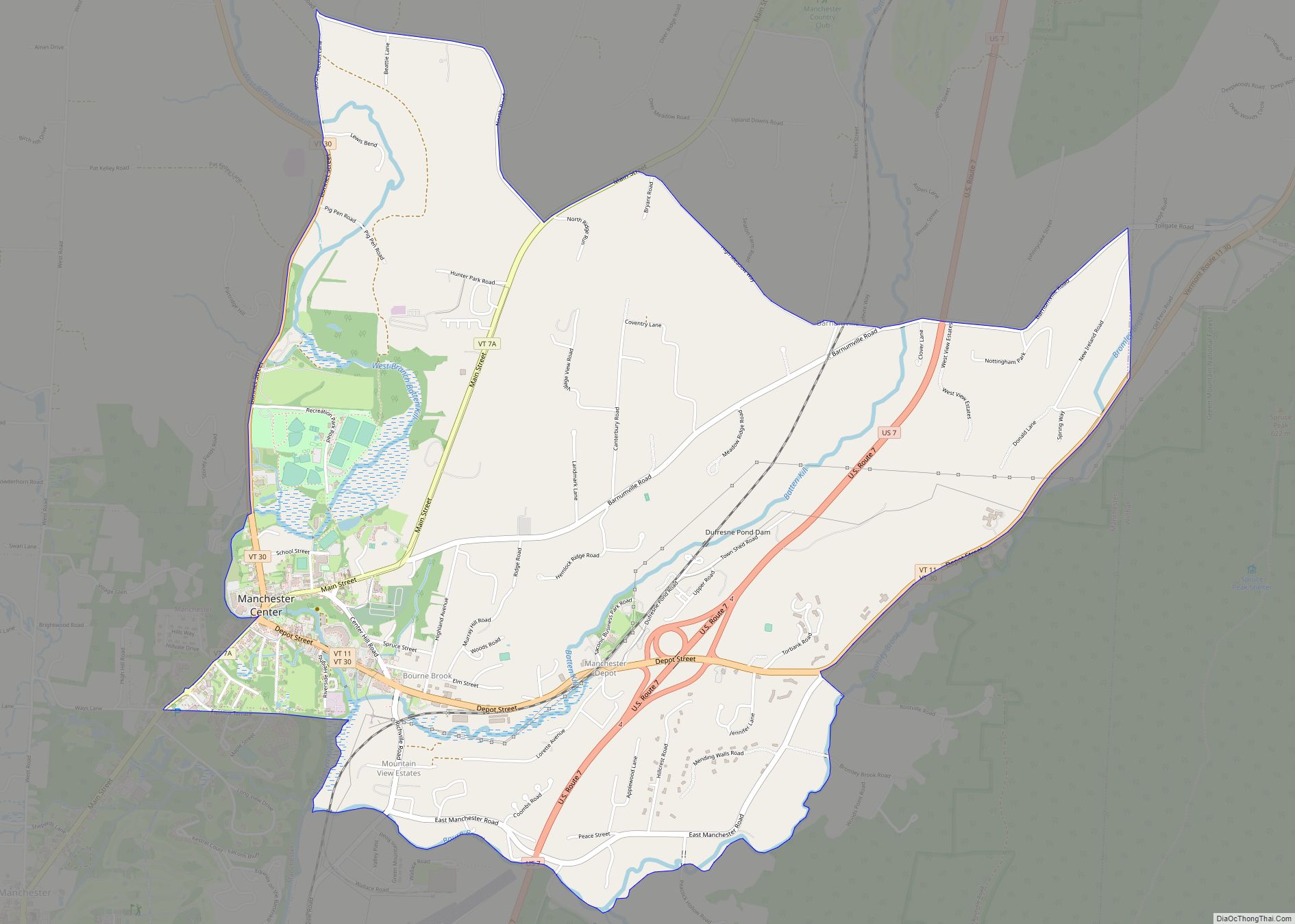
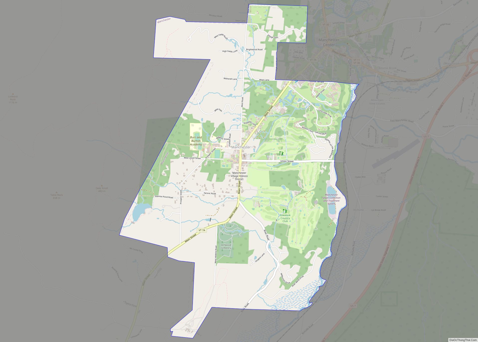
Manchester Center is a census-designated place (CDP) in the town of Manchester in Bennington County, Vermont, United States. As of the 2010 census, the CDP had a population of 2,120, out of 4,391 people in the entire town of Manchester.
| Name: | Manchester Center CDP |
|---|---|
| LSAD Code: | 57 |
| LSAD Description: | CDP (suffix) |
| State: | Vermont |
| County: | Bennington County |
| Elevation: | 745 ft (227 m) |
| Total Area: | 4.53 sq mi (11.74 km²) |
| Land Area: | 4.52 sq mi (11.70 km²) |
| Water Area: | 0.02 sq mi (0.04 km²) |
| Total Population: | 2,120 |
| Population Density: | 469/sq mi (181.2/km²) |
| ZIP code: | 05255 |
| Area code: | 802 |
| FIPS code: | 5042925 |
| GNISfeature ID: | 1461118 |
Online Interactive Map
Click on ![]() to view map in "full screen" mode.
to view map in "full screen" mode.
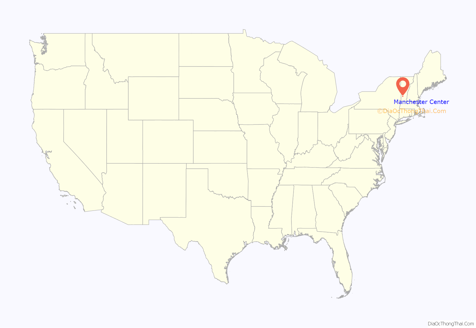
Manchester Center location map. Where is Manchester Center CDP?

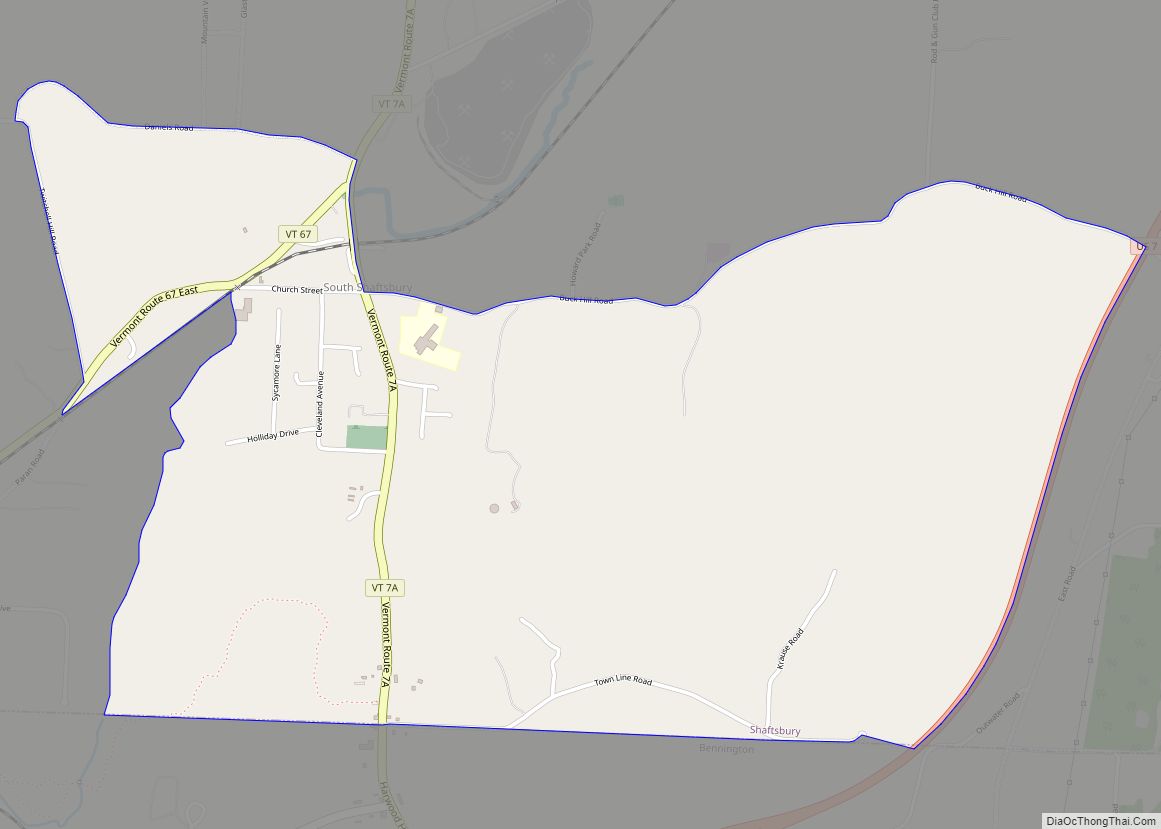
Manchester Center Road Map

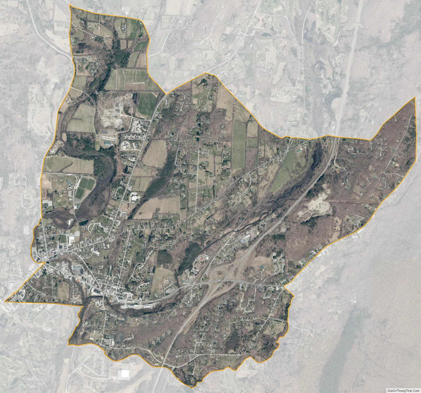
Manchester Center city Satellite Map
Geography
Manchester Center is located in the northeast part of the town of Manchester. The CDP encompasses the community of Manchester Center as well as the area known as Manchester Depot to the east. The CDP is bordered by the incorporated village of Manchester to the southwest.
According to the United States Census Bureau, the Manchester Center CDP has a total area of 4.53 square miles (11.74 km), of which 4.52 square miles (11.70 km) is land and 0.02 square miles (0.04 km), or 0.36%, is water.
See also
Map of Vermont State and its subdivision: Map of other states:- Alabama
- Alaska
- Arizona
- Arkansas
- California
- Colorado
- Connecticut
- Delaware
- District of Columbia
- Florida
- Georgia
- Hawaii
- Idaho
- Illinois
- Indiana
- Iowa
- Kansas
- Kentucky
- Louisiana
- Maine
- Maryland
- Massachusetts
- Michigan
- Minnesota
- Mississippi
- Missouri
- Montana
- Nebraska
- Nevada
- New Hampshire
- New Jersey
- New Mexico
- New York
- North Carolina
- North Dakota
- Ohio
- Oklahoma
- Oregon
- Pennsylvania
- Rhode Island
- South Carolina
- South Dakota
- Tennessee
- Texas
- Utah
- Vermont
- Virginia
- Washington
- West Virginia
- Wisconsin
- Wyoming