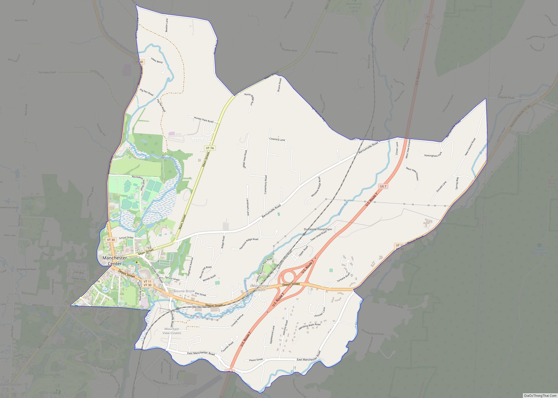
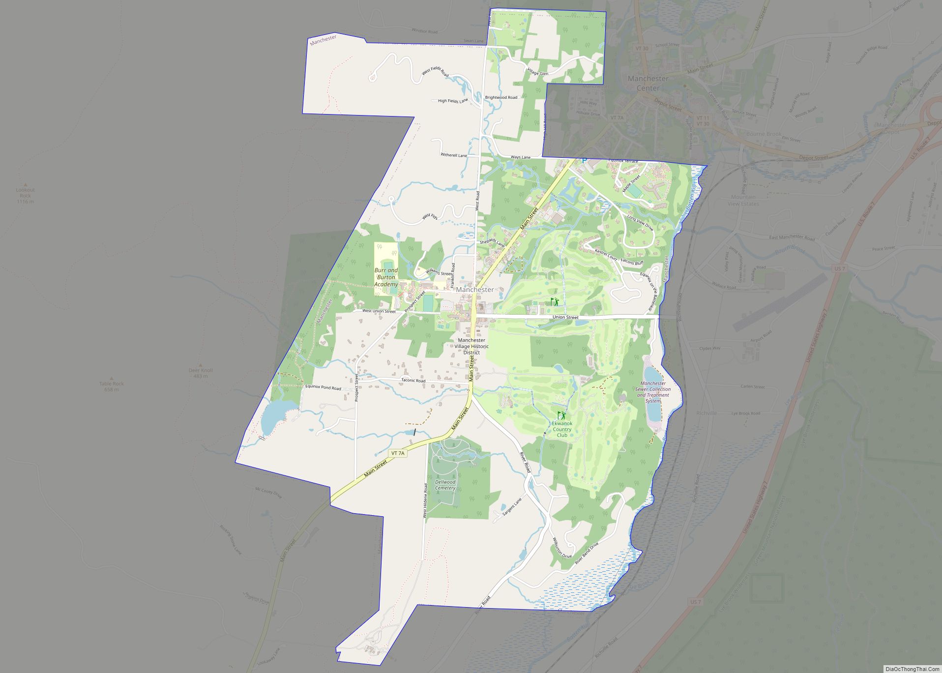
Manchester is a town in, and one of two shire towns (county seats) of, Bennington County, Vermont. The population was 4,484 at the 2020 census.
Manchester Village, an incorporated village, and Manchester Center are settlement centers within the town.
Manchester has become a tourist destination, especially for those from New York and Connecticut, offering visitors factory outlet stores of national chain retailers such as Brooks Brothers, Kate Spade and Ralph Lauren, as well as many locally owned businesses, including the Northshire Bookstore, an independent bookstore.
| Name: | Manchester village |
|---|---|
| LSAD Code: | 47 |
| LSAD Description: | village (suffix) |
| State: | Vermont |
| County: | Bennington County |
| Elevation: | 899 ft (281 m) |
| Total Area: | 42.2 sq mi (109.4 km²) |
| Land Area: | 42.1 sq mi (109.1 km²) |
| Water Area: | 0.1 sq mi (0.3 km²) |
| Total Population: | 4,484 |
| Population Density: | 106/sq mi (41.1/km²) |
| ZIP code: | 05254 |
| Area code: | 802 |
| FIPS code: | 5042700 |
| GNISfeature ID: | 1462142 |
| Website: | manchester-vt.gov |
Online Interactive Map
Click on ![]() to view map in "full screen" mode.
to view map in "full screen" mode.
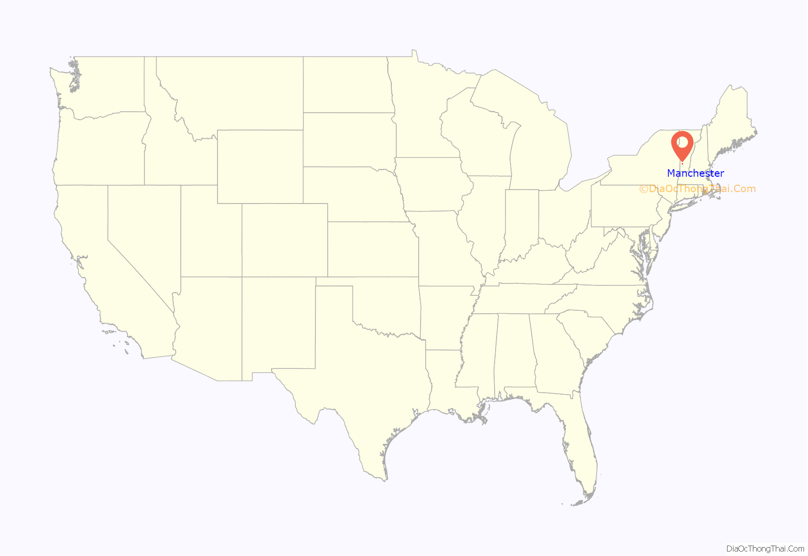
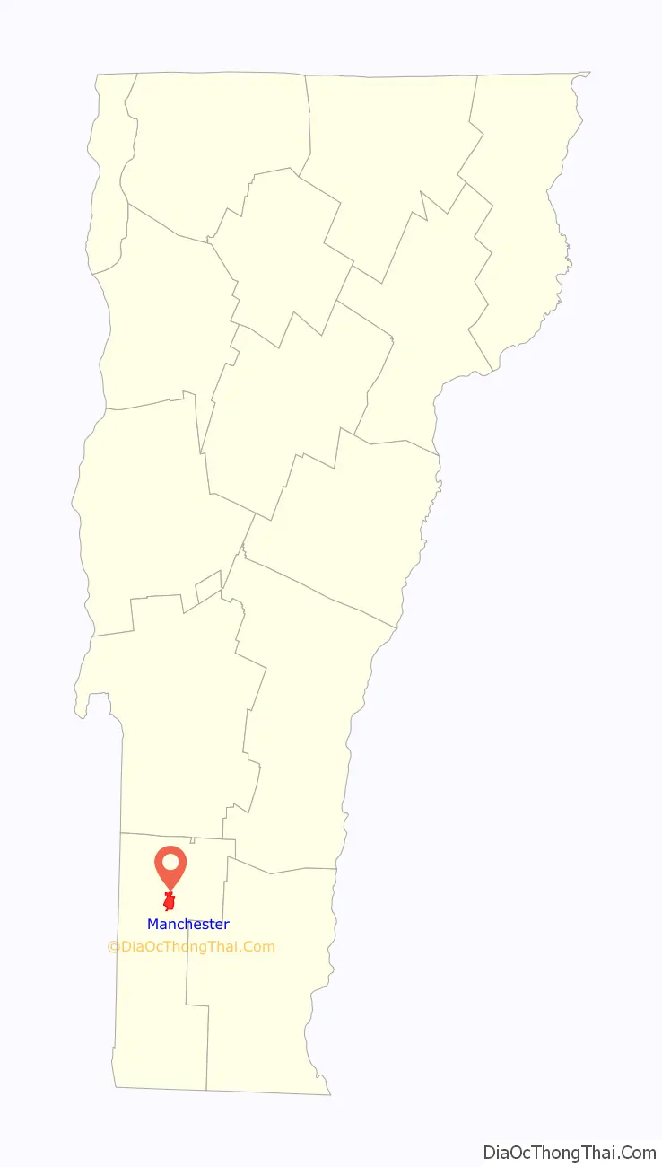
Manchester location map. Where is Manchester village?
History
The town was one of several chartered in 1761 by Benning Wentworth, colonial governor of New Hampshire. It was his custom to name new towns after prominent English aristocrats of the day, hoping they might adopt a patronly interest in their namesakes. Wentworth named Manchester for Robert Montagu, 3rd Duke of Manchester. First settled in 1764, the town was laid out in 1784. The land was better suited for grazing than tillage, so by 1839 about 6,000 sheep roamed the pastures and hillsides.
Other industries came to include iron mines, marble quarries and mills, and lumber companies. The arrival of the railroad from industrialized centers like New York City brought tourists, drawn by Manchester’s historic architecture and beautiful setting among mountains. Following the Civil War, the town developed into an affluent resort area, which it remains today.
Between 1812 and 1819, Manchester was made famous by the Boorn–Colvin case, called “America’s first wrongful conviction murder case”, the subject of several books and still studied today.
Orvis is a family-owned retail and mail-order business specializing in high-end fly fishing, hunting and sporting goods. Founded in Manchester in 1856 by Charles F. Orvis to sell fishing tackle, it is the oldest mail-order retailer in the United States.
Jake Burton Carpenter, founder of Burton Snowboards, perfected snowboard design in his garage in Manchester. The company operated out of Manchester until 1992, when it relocated to Burlington, Vermont. Stratton Mountain was among the first ski resorts to allow snowboarding.
The town has three distinct state-recognized historic districts—the Depot district located on Highland Avenue and Elm Street, Bonnet Street, just north of Main Street, and Main Street itself.
Manchester Road Map
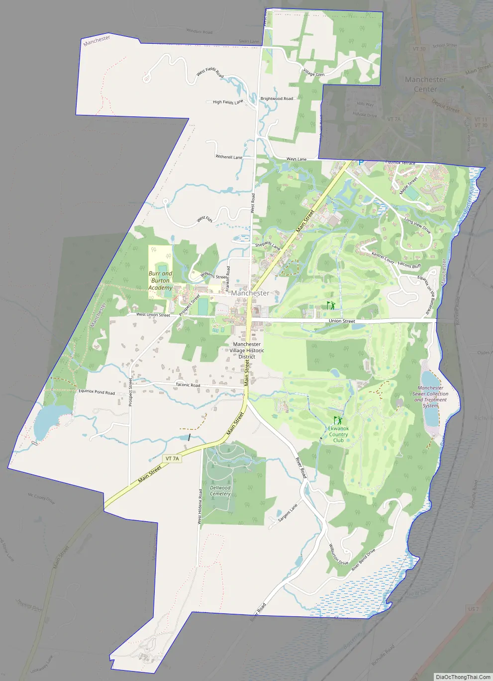
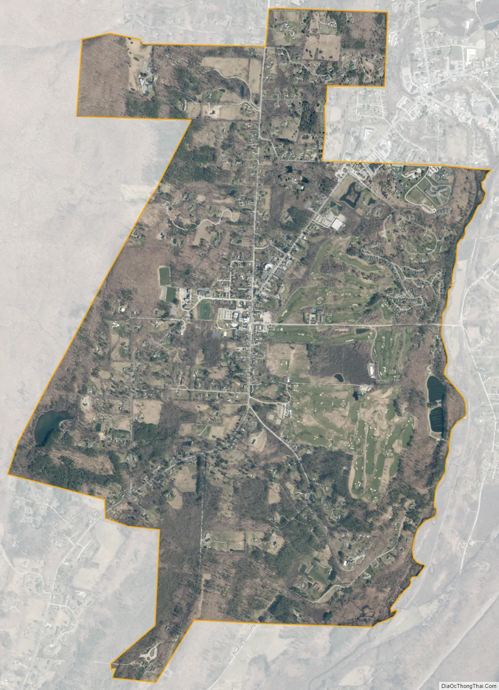
Manchester city Satellite Map
Geography
Manchester is located in north-central Bennington County, lying between the Green Mountains to the east and the Taconic Range to the west. Equinox Mountain, the highest summit in the Taconics, with an elevation of 3,850 feet (1,170 m), is in the western part of the town. Manchester is drained by the Batten Kill, Lye Brook, Munson Brook, Bromley Brook, and Bourn Brook. The Lye Brook Falls Hiking Trail which leads to one of the highest waterfalls in Vermont is a popular local attraction.
According to the U.S. Census Bureau, the town has a total area of 42.2 square miles (109.4 km), of which 42.1 square miles (109.1 km) is land and 0.1 square miles (0.3 km), or 0.29%, is water.
See also
Map of Vermont State and its subdivision: Map of other states:- Alabama
- Alaska
- Arizona
- Arkansas
- California
- Colorado
- Connecticut
- Delaware
- District of Columbia
- Florida
- Georgia
- Hawaii
- Idaho
- Illinois
- Indiana
- Iowa
- Kansas
- Kentucky
- Louisiana
- Maine
- Maryland
- Massachusetts
- Michigan
- Minnesota
- Mississippi
- Missouri
- Montana
- Nebraska
- Nevada
- New Hampshire
- New Jersey
- New Mexico
- New York
- North Carolina
- North Dakota
- Ohio
- Oklahoma
- Oregon
- Pennsylvania
- Rhode Island
- South Carolina
- South Dakota
- Tennessee
- Texas
- Utah
- Vermont
- Virginia
- Washington
- West Virginia
- Wisconsin
- Wyoming